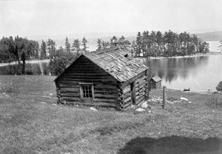
The Arctic Archipelago, also known as the Canadian Arctic Archipelago, is an archipelago lying to the north of the Canadian continental mainland, excluding Greenland.

Gloucester is a suburb in the City of Ottawa. Gloucester Township was established in 1792 and originally included lands east of the Rideau River from the Ottawa River south to Manotick. It was incorporated as a township in 1850 and became a city in 1981. Gloucester was one of the 11 municipalities that merged in 2001 to form the new city of Ottawa. As of the Canada 2016 Census, the former city of Gloucester had a population of 133,280.

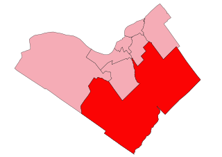
Ottawa West—Nepean is a federal electoral district in Ontario, Canada, that has been represented in the House of Commons of Canada since 1997.

Orléans is a federal electoral district in Ottawa, Ontario, Canada, that has been represented in the House of Commons of Canada since 1988.

Carleton County is the name of a former county in Ontario, Canada. In 1969, it was superseded by the Regional Municipality of Ottawa–Carleton. In 2001, the Regional Municipality and its eleven local municipalities were replaced by the current City of Ottawa.

The Regional Municipality of Ottawa–Carleton was a regional government area and census division in Ontario, Canada, which existed from 1969 until 2001. It was created in 1969 from the former Carleton County plus Cumberland Township, previously part of Russell County.
Russell County is a historic county in the Canadian province of Ontario.

Glengarry—Prescott—Russell is a federal electoral district in Ontario, Canada, that has been represented in the House of Commons of Canada since 1953.

Stittsville is a suburban community, part of the Canadian capital of Ottawa, Ontario. It is within the former Goulbourn Township. A part of the National Capital Region, Stittsville is immediately to the southwest of Kanata, and about 31 km (19 mi) west of Downtown Ottawa. The urban part of the community corresponds to Stittsville Ward on Ottawa City Council. Three school boards are represented in the area: Ottawa Catholic School Board, Ottawa-Carleton District School Board and Centre-East French Catholic School Board; Sacred Heart Catholic High School, Frederick Banting Secondary Alternate Program and École secondaire catholique Paul-Desmarais are the high schools.

Nepean—Carleton was a federal electoral district in Ontario, Canada that was represented in the House of Commons from 1979 to 1988, and again from 1997 to 2015.

Osgoode Township is a former township that is now a part of the city of Ottawa, Ontario, Canada. The township along the Rideau River was established in 1798 and incorporated in 1850. It was an independent township in Carleton County until its amalgamation with the city in 2001. It remains a largely rural area with only some 23,285 inhabitants as of the 2016 census. On Ottawa city council it is represented by George Darouze.

Carleton is a federal electoral district in Ontario, Canada, represented in the House of Commons of Canada from 1867 to 1968 and since 2015. It was represented in the Legislative Assembly of Upper Canada from 1821 to 1840 and in the Legislative Assembly of the Province of Canada from 1841 until 1866.
Nepean Township is a former incorporated and now geographic township in Eastern Ontario, Canada, now part of the City of Ottawa.

March Township is a geographic township and former municipality originally part of Carleton County in eastern Ontario, Canada. It is currently part of the City of Ottawa. It is located in the western part of the county, bordered to the northwest by Torbolton Township, to the southwest by Huntley Township, to the east by Nepean, to the south by Goulbourn Township and to the north by the Ottawa River. According to the Canada 2001 Census, the Township had a population of approximately 26,650.

The Johnstown District was a historic district in Upper Canada which existed until 1849.

The Ottawa District was a historic district in Upper Canada which existed until 1849. It was created in 1816 by splitting the counties of Prescott and Russell from the Eastern District. The district town was L'Orignal.

The Bathurst District was a historic district in Upper Canada. It was created in 1822 from the Johnstown District. Containing Carleton County, it existed until 1849. The district town was Perth.

Orléans is a provincial electoral district in eastern Ontario, Canada. It elects one member to the Legislative Assembly of Ontario. Before the 2018 election, it was known as Ottawa—Orléans.

Nepean-Carleton was a provincial electoral district in eastern Ontario, Canada. It elected one member to the Legislative Assembly of Ontario from 1999 to 2014.

The Ottawa Catholic School Board is a publicly funded separate school board in Ottawa, Ontario, Canada. Its headquarters are in the Nepean area of Ottawa.


