Huron County | |
---|---|
County of Huron | |
Coordinates: 43°40′N81°24′W / 43.667°N 81.400°W | |
Country | Canada |
Province | Ontario |
County seat | Goderich |
Municipalities | |
Area | |
• Land | 3,398.28 km2 (1,312.08 sq mi) |
Population (2021) [1] | |
• Total | 61,366 |
• Density | 18.1/km2 (47/sq mi) |
Time zone | UTC-5 (EST) |
• Summer (DST) | UTC-4 (EDT) |
Postal code span | N0G, N0M, N7A |
Website | www |
Huron County is a county of the province of Ontario, Canada. It is located on the southeast shore of its namesake, Lake Huron, in the southwest part of the province. The county seat is Goderich, also the county's largest community.
The population reported in the 2021 Census for this predominantly agricultural area with many villages and small towns was 61,366 in a land area of 3,398 square kilometres. [1] Of the total population, 7,881 reside in Goderich. [2]
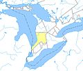
The portion of the Huron Tract ceded to the Canada Company was established as the "County of Huron" in 1835, with the exception of certain townships that were transferred to other counties: [3]
In 1835, the county was declared to consist of the following townships: [4]
They have since devolved to the following counties (as outlined in red):
Legislation was passed by the Legislative Assembly of Upper Canada in 1838 to authorize the separation of the county from the London District and constitute it as the Huron District. [5] The county was extended northward in 1840, upon the survey of a new range of townships on its northern boundary, beginning with Ashfield Township, and later including Wawanosh, Morris, Grey and Elma. [6] The District itself came into being in October 1841. [7]
Huron County was continued for electoral purposes in 1845, [8] and the District was extended northwards as far as the Bruce Peninsula in 1846. [9]
The District (which existed for judicial and municipal purposes) was abolished at the beginning of 1850. [10] Legislation passed later in the same session of the Legislative Assembly of the Province of Canada provided for the county to be reconstituted as the United Counties of Huron, Perth and Bruce, with the territory of the Bruce Peninsula withdrawn and annexed to Waterloo County. [11] The townships were distributed as follows:
From | Perth County | Bruce County | Huron County |
---|---|---|---|
Huron County |
|
|
|
Waterloo County |
|
The Bruce Peninsula was later returned to Bruce in 1851. [13] The County of Perth was given its own Provisional Municipal Council at that time, [14] and was separated from the United Counties in 1853. [15]
Several townships were transferred to Middlesex County:
Legislation was passed in 1866 to provide for the dissolution of the United Counties on January 1, 1867, with Huron and Bruce County becoming separate counties for all purposes. [18]
The Huron County Council consists of fifteen members from the nine area municipalities to ensure that each is represented on this council. Each year, a Warden is elected from the group; this individual chairs meetings and represents the County at various functions. Elected to Ashfeild-Colborne-Wawanosh Council in 2014, and acclaimed as Mayor in 2018, the current Warden is Glen McNeil.
Most of the population of the county resides in the Huron—Bruce, formerly Huron and Huron—Middlesex, federal electoral district. The majority also reside in the Huron—Bruce (provincial electoral district) formerly known as Huron and Huron—Middlesex.
The county's Official Plan (2015) addresses the following issues: "agriculture, community services, the economy, natural environment, extractive resources, and settlement patterns." According to this document, agriculture is a particularly significant part of the economy since "Huron leads all counties and regions in Ontario in total value of production; and it also exceeds the production totals of several provinces". [19]
Huron County comprises nine lower-tier municipalities (in order of population):
The boundaries of the county's municipalities have been in effect since 2001, after the provincial government imposed mergers throughout the province.
As a census division in the 2021 Census of Population conducted by Statistics Canada, Huron County had a population of 61,366 living in 25,334 of its 29,455 total private dwellings, a change of 3.5% from its 2016 population of 59,297. With a land area of 3,398.28 km2 (1,312.08 sq mi), it had a population density of 18.1/km2 (46.8/sq mi) in 2021. [1]
2021 | 2016 | 2011 | |
---|---|---|---|
Population | 61,366 (+3.5% from 2016) | 59,297 (0.3% from 2011) | 59,100 (-0.4% from 2006) |
Land area | 3,398.28 km2 (1,312.08 sq mi) | 3,399.27 km2 (1,312.47 sq mi) | 3,399.63 km2 (1,312.60 sq mi) |
Population density | 18.1/km2 (47/sq mi) | 17.4/km2 (45/sq mi) | 17.4/km2 (45/sq mi) |
Median age | 46.8 (M: 45.6, F: 48.4) | 46.3 (M: 45.3, F: 47.4) | 45.1 (M: 44, F: 46) |
Private dwellings | 29,455 (total) 25,334 (occupied) | 28,369 (total) 24,194 (occupied) | 28,049 (total) |
Median household income | $78,500 | $65,944 |
|
|
| |||||||||||||||||||||||||||||||||||||||||||||||||||||||||||||||
Population counts are not adjusted for boundary changes. Source: Statistics Canada [1] [25] |
Middlesex County is a primarily rural county in Southwestern Ontario, Canada. Landlocked, the county is bordered by Huron and Perth counties on the north, Oxford County on the east, Elgin County on the south, and Chatham-Kent and Lambton County on the west.
Peterborough County is located in Southern Ontario, Canada. The county seat is The City of Peterborough, which is independent of the county.
Hastings County is a county and census division of the Canadian province of Ontario. Geographically, it is located on the border of Eastern Ontario and Central Ontario. Hastings County is the second-largest county in Ontario, after Renfrew County. Its county seat is Belleville, which is, along with Quinte West, independent of Hastings County.
Renfrew County is a county in the Canadian province of Ontario. It straddles the west bank of the Ottawa River. There are 17 municipalities in the county.
Simcoe County is a county located in the central region of Ontario, Canada. The county is located north of the Greater Toronto Area, and forms the north western edge of the Golden Horseshoe. The largest city in the county is Barrie, while the county seat is located in Midhurst.
Bruce County is a county in Southwestern Ontario, Canada. It has eight lower-tier municipalities with a total 2016 population of 66,491. It is named for James Bruce, 8th Earl of Elgin and 12th Earl of Kincardine, the sixth Governor General of the Province of Canada. The Bruce name is also linked to the Bruce Trail and the Bruce Peninsula.
Lanark County is a county located in the Canadian province of Ontario. Its county seat is Perth, which was first settled in 1816 and was known as a social and political capital before being over shadowed by what we now know as Ottawa.
Frontenac County is a county and census division of the Canadian province of Ontario. It is located in the eastern portion of Southern Ontario. The city of Kingston is in the Frontenac census division, but is separated from the County of Frontenac.
Grey County is a county in the province of Ontario. The county is located in the Southwestern Ontario region, and is a part of the Georgian Triangle. At the time of the 2021 Canadian census the population of the county was 100,905. Owen Sound is the county seat and the largest city in Grey County.
Lennox and Addington County is a county and census division of the Canadian province of Ontario. The county seat is Greater Napanee. It is located in the subregion of Southern Ontario named Eastern Ontario.
Perth County is a county in the Canadian province of Ontario in Southwestern Ontario, 100 kilometres (62 mi) west of Toronto. Its population centres are Listowel, Mitchell and Milverton. The City of Stratford and the Town of St. Marys are within the Perth census division, but are separate from Perth County. The 2016 population of Perth County was 38,066.
The Maitland River is a river in Huron County, Perth County and Wellington County in Southwestern Ontario, Canada. The river is in the Great Lakes Basin and empties into Lake Huron at the town of Goderich. It is 150 kilometres (93 mi) long, and is named after Sir Peregrine Maitland, Lieutenant-Governor of Upper Canada from 1818 to 1828. It was formerly known as the Menesetung River.
Huron—Bruce is a federal electoral district in Ontario, Canada, that has been represented in the House of Commons of Canada since 1953.
Huron North was a federal electoral district represented in the House of Commons of Canada from 1867 to 1882, and from 1917 to 1953. It was located in the province of Ontario. It was created by the British North America Act of 1867 which divided the County of Huron into two ridings: Huron North and Huron South.
Central Huron is a township in western Ontario, Canada, in Huron County. It is situated on Lake Huron between the Maitland River and the Bayfield River.
The London District was a historic district in Upper Canada. It was formed in 1798 from parts of the Home and Western Districts, and lasted until its abolition in 1850.
The Township of Ashfield–Colborne–Wawanosh is a municipality in Huron County, Ontario, Canada. It was formed as an amalgamation of the former Ashfield, Colborne and West Wawanosh townships in 2001, in an Ontario-wide local government restructuring imposed by the government of that time. The three former townships now comprise the wards of the amalgamated municipality.
The Township of North Huron is a municipality in Huron County, Ontario, Canada. It was formed in 2001 when the Ontario government imposed amalgamation on municipalities throughout the province. Specifically, the former township of East Wawanosh was merged with the village of Blyth and the town of Wingham.
The Huron Tract Purchase also known as the Huron Block, registered as Crown Treaty Number 29, is a large area of land in southwestern Ontario bordering on Lake Huron to the west and Lake Erie to the east. The area spans the counties of Huron, Perth, Middlesex and present day Lambton County, Ontario in the province of Ontario.
Huron was an electoral district of the Legislative Assembly of the Parliament of the Province of Canada, in Canada West. It was created in 1841, upon the establishment of the Province of Canada by the union of Upper Canada and Lower Canada, and was based on Huron County. Huron was represented by one member in the Legislative Assembly. It was abolished in 1867, upon the creation of Canada and the province of Ontario.