Howick, Ontario

Last updated

Howick
Township of Howick
Gorrie Conservation Area - Gorrie, ON.jpg
Gorrie Conservation Area
Canada Southern Ontario location map 2.png
Red pog.svg
Howick
Coordinates: 43°54′N81°04′W / 43.9°N 81.07°W / 43.9; -81.07
CountryFlag of Canada (Pantone).svg  Canada
ProvinceFlag of Ontario.svg  Ontario
County Huron
Settled1851
Government
  ReeveDoug Harding
  Deputy ReeveMegan Gibson
  Federal riding Huron—Bruce
  Prov. riding Huron—Bruce
Area
[1]
  Land287.18 km2 (110.88 sq mi)
Population
 (2016) [2]
  Total3,873
  Density13.4/km2 (35/sq mi)
Time zone UTC-5 (EST)
  Summer (DST) UTC-4 (EDT)
Postal Code
N0G
Area code(s) 519, 226, 548
Website www.howick.ca OOjs UI icon edit-ltr-progressive.svg

The Township of Howick is a municipality in Huron County, Ontario, Canada. It is located in the northeast corner of Huron County near the Bruce County border, east of Wingham.

Contents

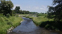
Its largest communities are Fordwich, Gorrie and Wroxeter. Smaller hamlets include Belmore and Lakelet. Rural areas comprise the remainder of the township. The township's municipal offices, road works facility, public school, arena and library are located between Fordwich and Gorrie on Huron Road 87 (formerly Ontario Highway 87).

History

Although Howick Township was one of the four Huron County Townships created out of the Queen's Bush by the Wilkinson survey of 1847, the first settler did not arrive until 1851, and the next in 1853. The township was named after George Grey who entered Parliament in 1829 as Lord Howick, taking the name from Howick Hall, his family's estate in England. [3]

In 1854, the lots in the township were put up for sale, resulting in a wave of settlement. During a series of municipal amalgamations in Ontario through the 1990s and ending in 2001, the Township of Howick boundaries remained unchanged. The Township celebrated its 150th anniversary in 2006. [3]

Demographics

Historical population
YearPop.±%
19913,461    
1996 3,685+6.5%
2001 3,779+2.6%
2006 3,882+2.7%
2011 3,856−0.7%
2016 3,873+0.4%
[4] [1] [2]

In the 2021 Census of Population conducted by Statistics Canada, Howick had a population of 4,045 living in 1,343 of its 1,414 total private dwellings, a change of

Transportation

A very small distance of Highway 9 travels through the extreme northeast corner of Howick Township. Otherwise, no provincial highways serve the township.

Huron Road 86 (formerly Highway 86) travels along the southern border of Howick.

Gorrie and Wroxeter are located on Huron Road 87 (formerly Highway 87), a significant east–west route through Howick. Fordwich is on Huron Road 30, a short distance from Huron Road 87.

Huron Road 12 on the western end of Howick serves Wroxeter and Belmore.

The remaining county roads in Howick are Huron Road 7 (east–west, through Lakelet) and Huron Road 28 (north–south, through Gorrie).

See also

Related Research Articles

<span class="mw-page-title-main">Adjala-Tosorontio</span> Township in Ontario, Canada

Adjala–Tosorontio is a township in south-central Ontario, Canada, in the County of Simcoe.

<span class="mw-page-title-main">Montague, Ontario</span> Township in Ontario, Canada

Montague is a township in eastern Ontario, Canada, in Lanark County on the Rideau River. The township administrative offices are located on Roger Stevens Drive east of Smiths Falls.

<span class="mw-page-title-main">Sables-Spanish Rivers</span> Township in Ontario, Canada

Sables-Spanish Rivers is a township in Ontario, Canada, on the north shore of Georgian Bay. It is located in the Sudbury District, approximately 70 kilometres (43 mi) west of Sudbury.

<span class="mw-page-title-main">Huron County, Ontario</span> County in Ontario, Canada

Huron County is a county of the province of Ontario, Canada. It is located on the southeast shore of its namesake, Lake Huron, in the southwest part of the province. The county seat is Goderich, also the county's largest community.

<span class="mw-page-title-main">Grey County</span> County in Ontario, Canada

Grey County is a county of the Canadian province of Ontario. The county seat is in Owen Sound. It is located in the subregion of Southern Ontario named Southwestern Ontario. Grey County is also a part of the Georgian Triangle. At the time of the Canada 2016 Census the population of the county was 93,830.

<span class="mw-page-title-main">Clearview, Ontario</span> Township in Ontario, Canada

Clearview is a rural incorporated township in Simcoe County in Central Ontario, Canada, west of Barrie and south of Collingwood and Wasaga Beach in Simcoe County.

<span class="mw-page-title-main">Maitland River</span> River in Ontario, Canada

The Maitland River is a river in Huron County, Perth County and Wellington County in Southwestern Ontario, Canada. The river is in the Great Lakes Basin and empties into Lake Huron at the town of Goderich. It is 150 kilometres (93 mi) long, and is named after Sir Peregrine Maitland, Lieutenant-Governor of Upper Canada from 1818 to 1828. It was formerly known as the Menesetung River.

<span class="mw-page-title-main">Laird, Ontario</span> Township in Ontario, Canada

Laird is a township and village in the Algoma District in Northern Ontario, Canada. The township had a population of 1,047 in the Canada 2016 Census, down from 1,057 in the 2011 census.

<span class="mw-page-title-main">Central Huron</span> Municipality in Ontario, Canada

Central Huron is a township in western Ontario, Canada, in Huron County. It is situated on Lake Huron between the Maitland River and the Bayfield River.

<span class="mw-page-title-main">South Huron</span> Municipality in Ontario, Canada

South Huron is a municipality in the Canadian province of Ontario, located in the southern part of Huron County. It was formed by amalgamation of the townships of Stephen and Usborne with the Town of Exeter in 2001, in an Ontario-wide municipal restructuring imposed by the provincial government.

<span class="mw-page-title-main">Lambton Shores</span> Municipality in Ontario, Canada

Lambton Shores is a municipality in Lambton County, Ontario, Canada, that is on the southern shores of Lake Huron.

<span class="mw-page-title-main">Ashfield–Colborne–Wawanosh</span> Township in Ontario, Canada

The Township of Ashfield–Colborne–Wawanosh is a municipality in Huron County, Ontario, Canada. It was formed as an amalgamation of the former Ashfield, Colborne and West Wawanosh townships in 2001, in an Ontario-wide local government restructuring imposed by the government of that time. The three former townships now comprise the wards of the amalgamated municipality. Mayor of Dungannon Robert Brindley Jr.

<span class="mw-page-title-main">Bluewater, Ontario</span> Municipality in Ontario, Canada

Bluewater is a municipality located in Huron County, Ontario, which is part of Southwestern Ontario, Ontario, Canada. As of 2016, the municipality has a population of 7,136.

<span class="mw-page-title-main">Huron East, Ontario</span> Municipality in Ontario, Canada

The Municipality of Huron East is a Canadian municipality located in Huron County, Ontario. It was formed in 2001 as an amalgamation of the former Grey, McKillop and Tuckersmith townships with the town of Seaforth and village of Brussels, due to an Ontario-wide local government restructuring imposed by the government of that time. The municipality is structured as five wards based on the former townships, town and village.

The Municipality of Morris-Turnberry is a municipality in Huron County, Ontario, Canada. It is located in the north portion of Huron County, near the Bruce County border, southeast of Wingham.

<span class="mw-page-title-main">North Huron, Ontario</span> Township in Ontario, Canada

The Township of North Huron is a municipality in Huron County, Ontario, Canada. It was formed in 2001 when the Ontario government imposed amalgamation on municipalities throughout the province. Specifically, the former township of East Wawanosh was merged with the village of Blyth and the town of Wingham.

<span class="mw-page-title-main">Huron Shores</span> Municipality in Ontario, Canada

Huron Shores is a municipality in the Canadian province of Ontario, located along the North Channel of Lake Huron in the Algoma District.

Malahide is a municipal township in Elgin County in southwestern Ontario, Canada.

<span class="mw-page-title-main">The North Shore, Ontario</span> Township in Ontario, Canada

The North Shore is a township in the Canadian province of Ontario, located in the Algoma District. The township had a population of 497 in the Canada 2016 Census. It is along the north shore of the North Channel of Lake Huron, with its main communities all along Highway 17.

<span class="mw-page-title-main">Tarbutt</span> Township in Ontario, Canada

Tarbutt is a township in the Canadian province of Ontario, located within the Algoma District. The township is about 40 kilometres (25 mi) east of Sault Ste. Marie.

References

  1. 1 2 "Howick, Ontario (Code 3540046) census profile". 2011 Census of Population . Statistics Canada. Retrieved 2012-08-10.
  2. 1 2 "Census Profile, 2016 Census Howick, Ontario". Statistics Canada. 8 February 2017. Retrieved April 30, 2019.
  3. 1 2 "Community Profile". Township of Howick. Archived from the original on July 6, 2011. Retrieved February 2, 2011.
  4. Statistics Canada: 1996, 2001, 2006 census
  5. "Population and dwelling counts: Canada, provinces and territories, census divisions and census subdivisions (municipalities), Ontario". Statistics Canada. February 9, 2022. Retrieved April 2, 2022.

Further reading