West Grey

Last updated

West Grey
Municipality of West Grey
Downtown Durham, ON.jpg
Durham, seat of and largest community in West Grey
Grey locator map 2021.svg
Red pog.svg
West Grey
Canada Southern Ontario location map 2.png
Red pog.svg
West Grey
Coordinates: 44°11′N80°49′W / 44.183°N 80.817°W / 44.183; -80.817
CountryCanada
Province Ontario
County Grey
FormedJanuary 1, 2001
Government
  MayorKevin Eccles
  Federal riding Bruce—Grey—Owen Sound
  Prov. riding Bruce—Grey—Owen Sound
Area
[1]
  Land876.16 km2 (338.29 sq mi)
Population
 (2016) [1]
  Total12,518
  Density14.3/km2 (37/sq mi)
Time zone UTC−05:00 (EST)
  Summer (DST) UTC−04:00 (EDT)
Postal Code
N0G 1R0
Area code(s) 519 and 226
Website www.westgrey.com

West Grey is a township in the northern area of Southwestern Ontario, Canada, in Grey County spanning across the River Styx, the Rocky Saugeen River, the Beatty Saugeen River, and the South Saugeen River.

Contents

The municipality was formed by order of the Province of Ontario on January 1, 2001 when the former Townships of Bentinck, Glenelg, and Normanby, the Village of Neustadt, and the Town of Durham were amalgamated in a county-wide reorganization.

Communities

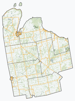
The Municipality of West Grey comprises the communities of Aberdeen, Allan Park, Alsfeldt, Ayton, Barrhead, Bentinck, Biemans Corners, Bunessan, Calderwood, Crawford, Durham, Edge Hill, Elmwood, Glen, Glenelg Centre, Habermehl, Hampden, Irish Lake, Lamlash, Lauderbach, Lauriston, Louise, Moltke, Mulock, Nenagh, Neustadt, Pomona, Priceville, Rocky Saugeen, Topcliff, Traverston, Vickers, Waudby and Welbeck.

Demographics

In the 2021 Census of Population conducted by Statistics Canada, West Grey had a population of 13,131 living in 5,284 of its 5,808 total private dwellings, a change of

Historical population
YearPop.±%
1996 11,499    
2001 11,741+2.1%
2006 12,193+3.8%
2011 12,286+0.8%
2016 12,518+1.9%
[3] [4] [1]

Populations prior to amalgamation (2001):

Education [5]

West Grey has three elementary schools: Normanby Community School, [6] Spruce Ridge Community School, [7] and St. Peter's and St. Paul's Catholic School. [8] Public school education is managed by the Bluewater and District School Board [9] and Catholic schools are managed by the Bruce-Grey Catholic School Board. [10]

Healthcare

West Grey has one hospital in the Town of Durham: South Bruce Grey Health Centre, [11] Durham. The 10-bed hospital has an Emergency Department available 24-7, laboratory, pharmacy, and diagnostic services. The West Grey Medical Clinic provides services by family doctors and allied health professionals. The Clinic is owned and managed by the Durham Hospital Foundation. [12]

Services

Fire

West Grey Fire Department has three stations: Durham, Ayton, and Neustadt.

Library [13]

West Grey Public Library has three branches: Durham, Ayton, and Neustadt.

Police [14]

Unlike most rural communities, West Grey maintains its own police force, the West Grey Police Service with headquarters in the Town of Durham.

Recreation [15]

West Grey has a variety of halls and recreation centres across the municipality including: Ayton Centennial Hall, Durham Community Centre, Durham Town Hall, Elmwood Community Centre, Glenel Hall, Lamlash Hall, Neustadt Arena, Neustadt Community Centre and Normanby Arena Complex. Enjoy swimming at the Durham Wading Pool [16] and the Middle Dam on the Saugeen River.

Transit

GOST [17] (Guelph Owen Sound Transportation) is a public transportation service connecting people from Owen Sound to Guelph along Hwy 10 with a stop in Durham.

Saugeen Mobility and Regional Transit [18] (SMART) provides accessible transportation for people who cannot travel by conventional transit or taxi.

See also

Related Research Articles

<span class="mw-page-title-main">Dundalk, Ontario</span> Village in Ontario, Canada

Dundalk, first called McDowell's Corners, was originally located on the Toronto-Sydenham Road, but moved about a mile to the west to be closer to the Toronto Grey and Bruce railway when it went through in the 1870s. Dundalk was incorporated as a village in 1887. On January 1, 2000, it was amalgamated with the Township of Proton and the Township of Egremont to form the Township of Southgate, in the southeast corner of Grey County. The mayor of Southgate is Briane Milne. Dundalk services the surrounding agricultural area and also has a few small manufacturing plants. Dundalk has the highest elevation of any populated place in southern Ontario at 526m. A rail line that used to pass through Dundalk is now removed, but its roadbed has become a multi-use trail sponsored by the federal government.

<span class="mw-page-title-main">Chatsworth, Ontario</span> Township in Ontario, Canada

Chatsworth is a township municipality in Grey County, in southwestern Ontario, Canada. The township is located at the headwaters of the Styx River, the Saugeen River, the Sauble River, the Bighead River, the Spey River, and the old Sydenham River.

<span class="mw-page-title-main">South Bruce Peninsula</span> Town in Ontario, Canada

South Bruce Peninsula is a town at the base of the Bruce Peninsula of Ontario, Canada, in Bruce County between Lake Huron and Georgian Bay. It was formed on January 1, 1999, when the town of Wiarton, the village of Hepworth, and the townships of Albemarle and Amabel were amalgamated. The new municipality was created to provide necessary political representation, administrative support, and necessary municipal services on behalf of the residents.

<span class="mw-page-title-main">Mount Forest, Ontario</span> Unincorporated community in Ontario, Canada

Mount Forest is an unincorporated community located at the junction of Highway 6 and Highway 89 in the township of Wellington North, Ontario, Canada. As of the 2011 Canadian census the population of Mount Forest was 4,757.

<span class="mw-page-title-main">Saugeen River</span> River in Ontario, Canada

The Saugeen River is located in southern Ontario, Canada. The river begins in the Osprey Wetland Conservation Lands and flows generally north-west about 160 kilometres (99 mi) before exiting into Lake Huron. The river is navigable for some distance, and was once an important barge route. Today the river is best known for its fishing and as a canoe route.

<span class="mw-page-title-main">Bruce County</span> County in Ontario, Canada

Bruce County is a county in Southwestern Ontario, Canada. It has eight lower-tier municipalities with a total 2016 population of 66,491. It is named for James Bruce, 8th Earl of Elgin and 12th Earl of Kincardine, the sixth Governor General of the Province of Canada. The Bruce name is also linked to the Bruce Trail and the Bruce Peninsula.

<span class="mw-page-title-main">Dufferin County</span> County in Ontario, Canada

Dufferin County is a county and census division located in Central Ontario, Canada. The county seat is Orangeville, and the current Warden is Wade Mills. The current chief administrative officer is Sonya Pritchard. Dufferin covers an area of 1,486.31 square kilometres (573.87 sq mi), and its population was 61,735 at the time of the 2016 Census.

<span class="mw-page-title-main">Grey County</span> County in Ontario, Canada

Grey County is a county of the Canadian province of Ontario. The county seat is in Owen Sound. It is located in the subregion of Southern Ontario named Southwestern Ontario. Grey County is also a part of the Georgian Triangle. At the time of the Canada 2016 Census the population of the county was 93,830.

<span class="mw-page-title-main">Southampton, Ontario</span> Community in Ontario, Canada

Southampton is a community on the shores of Lake Huron in Bruce County, Ontario, Canada. It is close to Port Elgin and is located at the mouth of the Saugeen River in the Saugeen Ojibway Nation Territory. The size of the town is 6.44 square kilometres. The permanent population in 2016 was 3,678, but the summer population is higher since cottagers and campers spend vacation time in the area.

Grey South was a federal electoral district represented in the House of Commons of Canada from 1876 to 1917. It was located in the province of Ontario. It was created by the British North America Act of 1867 which divided the County of Grey into two ridings: Grey South and Grey North.

Wellington—Grey, renamed Wellington—Grey—Dufferin—Waterloo in 1970, was a federal electoral district represented in the House of Commons of Canada from 1968 to 1979. It was located in the province of Ontario. This riding was created in 1966 from parts of Dufferin—Simcoe, Grey—Bruce, Waterloo North, Wellington South and Wellington—Huron ridings.

<span class="mw-page-title-main">Neustadt, Ontario</span> Unincorporated community in Ontario, Canada

Neustadt is a community in the municipality of West Grey in Grey County in southern Ontario, Canada. The village is located south of Hanover on Grey Road 10 and north of Guelph, Ontario and Kitchener, Ontario. Neustadt is a rural Ontario village with German roots and a village history associated with farming culture. In their April 2000 edition, Harrowsmith Magazine named Neustadt one of Canada's ten prettiest villages as evidenced by the historic 19th century Victorian farmhouses highlighting Gothic Revival architecture. Neustadt has also been featured in Country Living.

<span class="mw-page-title-main">Hanover, Ontario</span> Town in Ontario, Canada

Hanover is a town in the Canadian province of Ontario with a population of about 7,967 residents. It is located in southwestern Grey County, bordering on Bruce County, west of Durham and east of Walkerton on Grey/Bruce Road 4. Hanover has a city hall, police department and the Hanover and District Hospital.

<span class="mw-page-title-main">Saugeen Shores</span> Town in Ontario, Canada

Saugeen Shores is a town in Bruce County, Ontario, Canada, formed in 1998. In addition to the two main population centres of Southampton and Port Elgin, the town includes a portion of the village of Burgoyne and the North Bruce area, straddling the municipal eastern and southern boundary respectively. In 2016, the permanent population of Saugeen Shores was 13,715, in a land area of 171.05 square kilometres (66.04 sq mi).

<span class="mw-page-title-main">Port Elgin, Ontario</span> Community in Ontario, Canada

Port Elgin is a community in Bruce County, Ontario, Canada. Its location is in the traditional territory of the Saugeen Ojibway Nation. Originally named Normanton the town was renamed Port Elgin when it was incorporated in 1874, after James Bruce, 8th Earl of Elgin, a former Governor General of the Province of Canada.

<span class="mw-page-title-main">Wellington District, Upper Canada</span> Former district of Upper Canada

The Wellington District was a historic district in Upper Canada and its successor, Canada West, which existed until 1849. It was formed in June 1840 from townships transferred from certain other districts:

<span class="mw-page-title-main">Durham, Ontario</span> Unincorporated town in Ontario, Canada

Durham is a community in the municipality of West Grey, Grey County, Ontario, Canada. Durham is located near the base of the Bruce Peninsula.

<span class="mw-page-title-main">Clifford, Ontario</span> Unincorporated community in Ontario, Canada

Clifford is an unincorporated community in the Town of Minto in Wellington County in Southwestern Ontario, Canada. It is on Ontario Highway 9 and Coon Creek, a stream in the Saugeen River drainage basin.

<span class="mw-page-title-main">Ayton, Ontario</span>

Ayton is a community in the municipality of West Grey, Grey County, Ontario, Canada.

The West Grey Police are the police service for the Municipality of West Grey in southwestern Ontario. West Grey is an amalgamated municipality, consisting of the former townships of Bentinck, Glenelg and Normanby, the former villages of Neustadt,Ayton, Elmwood and the former town of Durham. West Grey is geographically the largest municipality in Grey County, with a population of approximately 12,000.

References

  1. 1 2 3 "Census Profile, 2016 Census: West Grey, Municipality". Statistics Canada . Retrieved June 14, 2019.
  2. "Population and dwelling counts: Canada, provinces and territories, census divisions and census subdivisions (municipalities), Ontario". Statistics Canada. February 9, 2022. Retrieved March 31, 2022.
  3. Statistics Canada: 1996, 2001, 2006 census
  4. "West Grey census profile". 2011 Census of Population . Statistics Canada. 8 February 2012. Retrieved 2012-08-09.
  5. "Schools and education". www.westgrey.com. 2020-09-28. Retrieved 2022-04-17.
  6. "Home". nor.bwdsb.on.ca. Retrieved 2022-04-17.
  7. "Home". spr.bwdsb.on.ca. Retrieved 2022-04-17.
  8. "St. Peter & St. Paul's School". stp.bgcdsb.org. Retrieved 2022-04-17.
  9. "Home". www.bwdsb.on.ca. Retrieved 2022-04-17.
  10. "Bruce-Grey Catholic District School Board". www.bgcdsb.org. Retrieved 2022-04-17.
  11. "South Bruce Grey Health Centre – Quality Health Care – Close to Home" . Retrieved 2022-04-17.
  12. "Our Clinic and Hospital | Durham Hospital Foundation". www.durhamfoundation.ca. Retrieved 2022-04-17.
  13. "About the Library | West Grey Public Library". www.westgreylibrary.com. Retrieved 2022-04-17.
  14. "West GreyPolice | Community Partners" . Retrieved 2022-04-17.
  15. "Facility and hall rentals". www.westgrey.com. 2021-12-14. Retrieved 2022-04-17.
  16. "Parks and recreation". www.westgrey.com. 2022-04-13. Retrieved 2022-04-17.
  17. "Guelph Owen Sound Transportation". www.owensound.ca. 2022-03-16. Retrieved 2022-04-17.
  18. "Eligibility Policy". Saugeen Mobility. Retrieved 2022-04-17.