Southgate, Ontario

Last updated

Southgate
Township of Southgate
Dundalk Ontario.jpg
Dundalk
Grey locator map 2021.svg
Red pog.svg
Southgate
Canada Southern Ontario location map 2.png
Red pog.svg
Southgate
Coordinates: 44°06′N80°35′W / 44.100°N 80.583°W / 44.100; -80.583
Country Flag of Canada (Pantone).svg  Canada
Province Flag of Ontario.svg  Ontario
County Grey
FormedJanuary 1, 2000
Government
  MayorBrian Milne
  Federal riding Bruce—Grey—Owen Sound
  Prov. riding Bruce—Grey—Owen Sound
Area
[1]
  Land644.38 km2 (248.80 sq mi)
Population
 (2016) [1]
  Total7,190
  Density11.4/km2 (30/sq mi)
Time zone UTC-5 (EST)
  Summer (DST) UTC-4 (EDT)
Postal Code
N0C 1B0
Area code(s) 519, 226, 548
Website www.southgate.ca

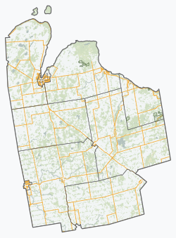
Southgate is a township in southwestern Ontario, Canada, in the southeast corner of Grey County. Southgate was formed on January 1, 2000, when the Village of Dundalk, the Township of Proton and the Township of Egremont were amalgamated. The headwaters of the South Saugeen, Beatty Saugeen and Grand Rivers are located in Southgate.

Contents

Communities

Dundalk welcome sign. Dundalksign.jpg
Dundalk welcome sign.

The township comprises the communities of Bethel, Birdell, Boothville, Cedarville, Conn, Dromore, Dundalk, Egerton, Gildale, Holstein, Hopeville, Keldon, Kingscote, Landerkin, Proton Station, Robbtown, Signet, Swinton Park, Tartan, Thistle, Varney, Ventry and Yeovil. The largest communities are Dundalk and Holstein.

Infrastructure

The former rail line roadbed has become a snowmobile and ATV trail which is owned by Grey County. Dundalk's three elementary schools are Egremont Community School, Dundalk & Proton Community School and Highpoint Community School. The high school is Grey Highlands Secondary School, which is located in the nearby town of Flesherton. The village of Dundalk is located on Hwy 10 and is serviced with municipal water and sewers, natural gas (Enbridge), electricity (Hydro One) and cable (Eastlink).

Economy

Agriculture is the dominant sector of the economy in Southgate. Many of the farms in Southgate have secondary businesses on the farm to service the rural farm community. For the last 20 years, Mennonites have been purchasing farmland in Southgate and have expanded the land base available for agriculture. The supply of agricultural land is expanding in Southgate.

The industrial sector is concentrated in the Dundalk area. There are 30 small manufacturers in the rural area around Dundalk, mostly in metal fabrication. A large portion are located on Mennonite farms on the eastern side of Southgate. These manufacturers use CNC equipment such a laser cutters to produce a wide variety of metal parts and products.

The Township of Southgate has developed a 220 acres (89 ha) Eco Park which is 90% sold out. The Park has 2 industries involved in the environment sector: Lystek which produces liquid fertilizer and Gro-Bark which produces soil from compost and wood chips. There have been 6 land sales in the last 2 years. The companies that have purchased properties are planning to build industrial facilities. Currently 18 acres are available for industrial development.

Most of the commercial retail businesses are located in downtown Dundalk. There are over 30 businesses in the downtown and another 10 outside the downtown or near Hwy. 10.

The Tourism economy is growing in Southgate, focused on the many events held in Holstein and Dundalk. A new tourism experience was developed in 2016 called Butter Tarts & Buggies: Explore the Simpler Life in partnership with Wellington North, Minto, Mapleton and West Grey. It includes the Mennonite culture of Southgate with butter tarts and the local food experience.<Township of Southgate Economic Development>

Culture and Tourism

Southgate was settled in the 1850s as a farming area spreading from the settlement roads of Hwy 10 and Hwy 6. The original settlers were from England, Scotland, Ireland, Wales and other European countries. Soon after 2 rail lines were built running north–south near Hwy 10 through Dundalk and Proton Station and Hwy 6 through Holstein. The most recent arrivals in Southgate are Mennonites mostly from the Kitchener-Waterloo area. Southgate has several churches representing Catholic, Anglican, Protestant and Mennonite denominations.

Dundalk is the starting point of the Grey County CP Rail Trail, a multi-purpose trail which runs through downtown Dundalk on the old railline to Owen Sound. Dundalk is the hub of the regional ATV and snowmobile networks in the region.

The Highpoint Campground is a municipally-owned campground in downtown Dundalk in Dundalk Memorial Park.

The village of Dundalk hosts many tourism events including the Dundalk Fair and Canadian Open Dance Competition, Horse Shows, Family Recreation Weekend, Automotive Swap-Meet & Flea Market and Santa Claus Parade.

The Dundalk Fair and Canadian Open Dance Competition is held the 2nd weekend of September. The Dance Competition includes step dancing, clogging, square dancing and group step dancing. The Fair is a traditional fall fair which has been held for over 160 years. It includes saddle horse shows, harness racing, demolition derby, tractor pulls, classic car show, garden tractor races, Ambassador of the Fair crowning, amusement rides and over a hundred competitions judging jam to livestock.

The village of Holstein hosts many events each year including: the Holstein Maplefest, a Canada Day Fireworks display, Holstein Santa Claus Parade and annual drama productions. Landmarks and businesses in Holstein are the Holstein General Store, Holstein Feed Mill, Holstein Park and Dam, Egremont Optimist's Community centre, Holstein Cenotaph, Knox Holstein Presbyterian Church and Egremont Community School. The Holstein Dam is on the Waterfalls of Grey County Tour.

Holstein's Maplefest is hosted at Love's Sugarbush the second weekend in April and has displays of pioneer activities, modern production of maple syrup, games, booths from local merchants, artists and local community groups and has live shows and children's entertainment.

Butter Tarts and Buggies is a new tourist attraction in Southgate, Wellington North, Minto, Mapleton and West Grey which features many of the Mennonite businesses in the Holstein area. A special feature of the Butter Tarts and Buggies is an authentic Mennonite horse drawn buggy ride through 2 Mennonite working farms and scenic backroads just outside Holstein.

Varney International Speedway is located in Varney on the western edge of Southgate. It is the only speedway in Ontario to feature a 33° high-bank asphalt racing surface. [2]

Demographics

In the 2021 Census of Population conducted by Statistics Canada, Southgate had a population of 8,716 living in 3,017 of its 3,257 total private dwellings, a change of 18.5% from its 2016 population of 7,354. With a land area of 643.08 km2 (248.29 sq mi), it had a population density of 13.6/km2 (35.1/sq mi) in 2021. [3]

Canada census – Southgate, Ontario community profile
2016 2011
Population7,354 (+2.3% from 2011)7,190 (+1.7% from 2006)
Land area644.38 km2 (248.80 sq mi)644.35 km2 (248.78 sq mi)
Population density11.4/km2 (30/sq mi)11.2/km2 (29/sq mi)
Median age41.0 (M: 40.4, F: 41.5)
Total private dwellings2,9872,921
Median household income$67,959
References: 2016 [4] 2011 [5] earlier [6] [7]
Historical population
YearPop.±%
1996 6,449    
2001 6,907+7.1%
2006 7,167+3.8%
2011 7,190+0.3%
2016 7,354+2.3%
[8] [5] [1]
2006 population would have been 7,072 using 2011 boundaries

Notable residents

See also

Related Research Articles

<span class="mw-page-title-main">Dundalk, Ontario</span> Village in Ontario, Canada

Dundalk, first called McDowell's Corners, was originally located on the Toronto-Sydenham Road, but moved about a mile to the west to be closer to the Toronto Grey and Bruce railway when it went through in the 1870s. Dundalk was incorporated as a village in 1887. On January 1, 2000, it was amalgamated with the Township of Proton and the Township of Egremont to form the Township of Southgate, in the southeast corner of Grey County. The mayor of Southgate is Briane Milne. Dundalk services the surrounding agricultural area and also has a few small manufacturing plants. Dundalk has the highest elevation of any populated place in southern Ontario at 526m. A rail line that used to pass through Dundalk is now removed, but its roadbed has become a multi-use trail sponsored by the federal government.

<span class="mw-page-title-main">Midland, Ontario</span> Town in Ontario, Canada

Midland is a town located on Georgian Bay in Simcoe County, Ontario, Canada. It is part of the Huronia/Wendat region of Central Ontario.

<span class="mw-page-title-main">West Grey</span> Municipality in Ontario, Canada

West Grey is a township in the northern area of Southwestern Ontario, Canada, in Grey County spanning across the River Styx, the Rocky Saugeen River, the Beatty Saugeen River, and the South Saugeen River.

<span class="mw-page-title-main">Cavan Monaghan</span> Township in Ontario, Canada

Cavan Monaghan is a township in Peterborough County in central-eastern Ontario, Canada, 20 kilometres (12 mi) southwest of the city of Peterborough.

<span class="mw-page-title-main">South Bruce Peninsula</span> Town in Ontario, Canada

South Bruce Peninsula is a town at the base of the Bruce Peninsula of Ontario, Canada, in Bruce County between Lake Huron and Georgian Bay. It was formed on January 1, 1999, when the town of Wiarton, the village of Hepworth, and the townships of Albemarle and Amabel were amalgamated. The new municipality was created to provide necessary political representation, administrative support, and necessary municipal services on behalf of the residents.

<span class="mw-page-title-main">Mount Forest, Ontario</span> Unincorporated community in Ontario, Canada

Mount Forest is an unincorporated community located at the junction of Highway 6 and Highway 89 in the township of Wellington North, Ontario, Canada. As of the 2011 Canadian census the population of Mount Forest was 4,757.

<span class="mw-page-title-main">West Montrose, Ontario</span> Unincorporated rural community in Ontario, Canada

West Montrose is an unincorporated rural community in Woolwich Township in the Regional Municipality of Waterloo, Ontario, Canada. As of the 2016 census, the population of the community was 257.

<span class="mw-page-title-main">Bruce County</span> County in Ontario, Canada

Bruce County is a county in Southwestern Ontario, Canada. It has eight lower-tier municipalities with a total 2016 population of 66,491. It is named for James Bruce, 8th Earl of Elgin and 12th Earl of Kincardine, the sixth Governor General of the Province of Canada. The Bruce name is also linked to the Bruce Trail and the Bruce Peninsula.

<span class="mw-page-title-main">Dufferin County</span> County in Ontario, Canada

Dufferin County is a county and census division located in Central Ontario, Canada. The county seat is Orangeville, and the current Warden is Wade Mills. The current chief administrative officer is Sonya Pritchard. Dufferin covers an area of 1,486.31 square kilometres (573.87 sq mi), and its population was 61,735 at the time of the 2016 Census.

<span class="mw-page-title-main">Grey County</span> County in Ontario, Canada

Grey County is a county of the Canadian province of Ontario. The county seat is in Owen Sound. It is located in the subregion of Southern Ontario named Southwestern Ontario. Grey County is also a part of the Georgian Triangle. At the time of the Canada 2016 Census the population of the county was 93,830.

<span class="mw-page-title-main">New Hamburg, Ontario</span> Unincorporated community in Ontario, Canada

New Hamburg is a community of approximately 11,953 in the township of Wilmot, Ontario, Canada. It is in the far western part of the Regional Municipality of Waterloo, near the regional border with Perth County. It is adjacent to the community of Baden, which sits to its east and is also a part of the township of Wilmot. The nearest cities are Kitchener, Waterloo, and Stratford.

Dufferin—Peel—Wellington—Grey was a federal electoral district in Ontario, Canada, that was represented in the House of Commons of Canada from 1997 to 2004.

<span class="mw-page-title-main">Huron—Bruce</span> Federal electoral district in Ontario, Canada

Huron—Bruce is a federal electoral district in Ontario, Canada, that has been represented in the House of Commons of Canada since 1953.

Wellington—Grey—Dufferin—Simcoe was a federal electoral district represented in the House of Commons of Canada from 1988 to 1997. It was located in the province of Ontario. This riding was created in 1987 from parts of Bruce—Grey, Grey—Simcoe and Wellington—Dufferin—Simcoe ridings.

<span class="mw-page-title-main">Saugeen Shores</span> Town in Ontario, Canada

Saugeen Shores is a town in Bruce County, Ontario, Canada, formed in 1998. In addition to the two main population centres of Southampton and Port Elgin, the town includes a portion of the village of Burgoyne and the North Bruce area, straddling the municipal eastern and southern boundary respectively. In 2016, the permanent population of Saugeen Shores was 13,715, in a land area of 171.05 square kilometres (66.04 sq mi).

<span class="mw-page-title-main">Port Elgin, Ontario</span> Community in Ontario, Canada

Port Elgin is a community in Bruce County, Ontario, Canada. Its location is in the traditional territory of the Saugeen Ojibway Nation. Originally named Normanton the town was renamed Port Elgin when it was incorporated in 1874, after James Bruce, 8th Earl of Elgin, a former Governor General of the Province of Canada.

<span class="mw-page-title-main">Durham, Ontario</span> Unincorporated town in Ontario, Canada

Durham is a community in the municipality of West Grey, Grey County, Ontario, Canada. Durham is located near the base of the Bruce Peninsula.

<span class="mw-page-title-main">Wellington North, Ontario</span> Township in Ontario, Canada

Wellington North is a township in the Canadian province of Ontario, located within Wellington County.

<span class="mw-page-title-main">Melancthon, Ontario</span> Township in Ontario, Canada

Melancthon is a rural Canadian township in the northwest corner of Dufferin County, Ontario, bordered on the east by Mulmur Township, Amaranth Township and East Luther Grand Valley to the south, Southgate Township to the west, and the Municipality of Grey Highlands to the north. The township does not include the town of Shelburne on its southern border. It has one of the lowest population densities in southwestern Ontario.

The Beatty Saugeen River is a river in the Saugeen River and Lake Huron drainage basins in Grey County, southwestern Ontario, Canada. It is a tributary of the South Saugeen River.

References

  1. 1 2 3 "Census Profile, 2016 Census: Southgate, Township". Statistics Canada . Retrieved June 14, 2019.
  2. "Full Throttle Motor Speedway" . Retrieved June 14, 2019.
  3. "Population and dwelling counts: Canada, provinces and territories, census divisions and census subdivisions (municipalities), Ontario". Statistics Canada. February 9, 2022. Retrieved April 2, 2022.
  4. "2016 Community Profiles". 2016 Canadian Census . Statistics Canada. August 12, 2021. Retrieved 2019-06-14.
  5. 1 2 "2011 Community Profiles". 2011 Canadian Census . Statistics Canada. March 21, 2019. Retrieved 2012-03-15.
  6. "2006 Community Profiles". 2006 Canadian Census . Statistics Canada. August 20, 2019.
  7. "2001 Community Profiles". 2001 Canadian Census . Statistics Canada. July 18, 2021.
  8. Statistics Canada: 1996, 2001, 2006 census