Grand Valley, Ontario

Last updated

Grand Valley
Town of Grand Valley
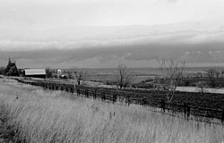
Storm Clouds - panoramio.jpg
Township of East Luther - Grand Valley.png
Motto: 
Nature's Playground
East Luther-Grand Valley within the Dufferin County.svg
Grand Valley within Dufferin County
Canada Southern Ontario location map 2.png
Red pog.svg
Grand Valley
Grand Valley in relation to southern Ontario
Coordinates: 43°57′N80°22′W / 43.950°N 80.367°W / 43.950; -80.367
CountryFlag of Canada (Pantone).svg  Canada
ProvinceFlag of Ontario.svg  Ontario
County Dufferin
FormedJanuary 1, 1995
Government
  MayorSteve Soloman
  Federal riding Dufferin—Caledon
  Prov. riding Dufferin—Caledon
Area
[1]
  Land158.23 km2 (61.09 sq mi)
Population
 (2016) [1]
  Total2,956
  Density18.7/km2 (48/sq mi)
Time zone UTC-5 (EST)
  Summer (DST) UTC-4 (EDT)
Postal code
L9W
Area code(s) 519 and 226
Website www.townofgrandvalley.ca

Grand Valley (formerly The Township of East Luther Grand Valley) is a town in the Canadian province of Ontario. It comprises the former Township of East Luther and the former Village of Grand Valley. The town is located within Dufferin County, and includes part of the Luther Marsh. The marsh covers over 10,000 acres (40 km²) including Luther Lake. The Grand River is one of the major sites in the town.

Contents

Geography

Communities

The Town of Grand Valley comprises a number of villages and hamlets, including the following communities such as Colbeck, Damascus, Grand Valley, Leggatt, Monticello, Peepabun, Tarbert; Erasmus, Hill Settlement, Keldon, Wesley; Chatter's Corners, Doyle's Settlement

History

The formation of the town under the name Township of East Luther Grand Valley was a result of an amalgamation effective January 1, 1995, of the Township of East Luther and the Village of Grand Valley. In September 2012, the name was changed to the Town of Grand Valley. [2] Grand Valley was hit by an F4 tornado on May 31, 1985, that destroyed much of the town's infrastructure, which has since been rebuilt.

Local government

Municipal Office

The Municipal Office for the Town of Grand Valley is located at:
5 Main Street North
Grand Valley, ON
L9W 5S6

Council

  1. Paul Latam
  2. Lorne Dart
  3. James Jonker

Grand Valley B.I.A.

The Grand Valley B.I.A. is encouraging commerce developments in the town. In an attempt to accommodate new development, the town is in the process of updating the By-laws.

The Grand Valley B.I.A., is the smallest Business Improvement Area in Ontario.

Demographics

Historical population
YearPop.±%
19912,501    
1996 2,773+10.9%
2001 2,842+2.5%
2006 2,844+0.1%
2011 2,726−4.1%
2016 2,956+8.4%
[3]

In the 2021 Census of Population conducted by Statistics Canada, Grand Valley had a population of 3,851 living in 1,397 of its 1,445 total private dwellings, a change of 30.3% from its 2016 population of 2,956. With a land area of 158.6 km2 (61.2 sq mi), it had a population density of 24.3/km2 (62.9/sq mi) in 2021. [4]

Canada census – Grand Valley community profile
2021 2016 2011
Population3,851 (+30.3% from 2016)2,956 (8.4% from 2011)2,726 (-4.1% from 2006)
Land area158.60 km2 (61.24 sq mi)158.23 km2 (61.09 sq mi)158.23 km2 (61.09 sq mi)
Population density24.3/km2 (63/sq mi)18.7/km2 (48/sq mi)17.2/km2 (45/sq mi)
Median age36.8 (M: 36.4, F: 37.2)40.9 (M: 40.1, F: 41.8)41.5 (M: 41.1, F: 41.8)
Private dwellings1,445 (total)  1,397 (occupied)1,145 (total) 1,048 (total) 
Median household income$101,000$80,691
References: 2021 [5] 2016 [1] 2011 [6] earlier [7] [8]

Movies filmed in Grand Valley

See also

Related Research Articles

<span class="mw-page-title-main">Brighton, Ontario</span> Municipality in Ontario, Canada

Brighton is a town in Northumberland County, Ontario, Canada, approximately 150 kilometres (93 mi) east of Toronto and 100 km (62 mi) west of Kingston. It is traversed by both Highway 401 and the former Highway 2. The west end of the Murray Canal that leads east to the Bay of Quinte is at the east end of the town.

<span class="mw-page-title-main">Erin, Ontario</span> Town in Ontario, Canada

Erin is a town in Wellington County, approximately 80 kilometres (50 mi) northwest of Toronto, Ontario, Canada. Erin is bordered by the Town of Caledon, Ontario to the east, the Town of Halton Hills to the south, the Township of Guelph/Eramosa to the west and the Township of East Garafraxa to the north.
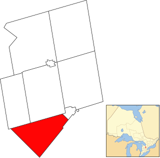
<span class="mw-page-title-main">East Garafraxa</span> Township in Ontario, Canada

East Garafraxa is a rural township located in Dufferin County, Ontario, Canada, to the west of Orangeville and within relative commuting distance of Toronto, Brampton, Guelph, and Kitchener.
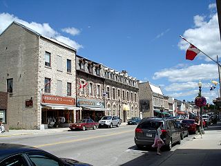
<span class="mw-page-title-main">Wellington County, Ontario</span> County in Ontario, Canada

Wellington County is a county located in Southwestern Ontario, Canada and is part of the Greater Golden Horseshoe. The county, made up of two towns and five townships, is predominantly rural in nature. However many of the residents in the southern part of the county commute to urban areas such as Guelph, Kitchener, Waterloo, Brampton, Mississauga, Toronto and Hamilton for employment. The northern part of the county is made up of mainly rural farming communities, except for a few larger towns such as Mount Forest and Arthur. According to the 2021 census, the population of the county was 241,026.
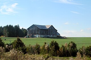
<span class="mw-page-title-main">Mono, Ontario</span> Town in Ontario, Canada

Mono is a town situated in south-central Ontario, Canada, at the south-east corner of Dufferin County. It stretches from Highway 9 along its southern border to Highway 89 along its northern border. Its border to the west is with the Township of Amaranth and in the east, it is bordered by the Township of Adjala-Tosorontio. It was previously known as the Township of Mono.

<span class="mw-page-title-main">Bradford West Gwillimbury</span> Town in Ontario, Canada

Bradford West Gwillimbury is a town in south-central Ontario, in the County of Simcoe in the Toronto Census Metropolitan Area on the Holland River. West Gwillimbury takes its name from the family of Elizabeth Simcoe, née Gwillim.

<span class="mw-page-title-main">Centre Wellington</span> Township in Ontario, Canada

Centre Wellington is a township in south-central Ontario, Canada, located in Wellington County. The primary communities are Elora and Fergus. The area is agricultural but also includes industries such as manufacturing. In the Canada 2016 Census, the population was stated as 28,191.

<span class="mw-page-title-main">Drummond/North Elmsley</span> Township in Ontario, Canada

Drummond/North Elmsley is a township in eastern Ontario, Canada in Lanark County. It is situated on the north shore of the Rideau River between the town of Perth and the town of Smiths Falls. It is a predominantly rural municipality. The township offices are located in the hamlet of Port Elmsley.
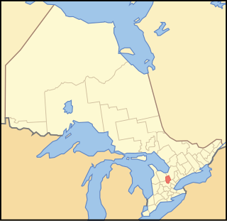
<span class="mw-page-title-main">Dufferin County</span> County in Ontario, Canada

Dufferin County is a county and census division located in Central Ontario, Canada. The county seat is Orangeville, and the current Warden is Wade Mills. The current chief administrative officer is Sonya Pritchard. Dufferin covers an area of 1,486.31 square kilometres (573.87 sq mi), and its population was 61,735 at the time of the 2016 Census.

<span class="mw-page-title-main">Grey County</span> County in Ontario, Canada

Grey County is a county of the Canadian province of Ontario. The county seat is in Owen Sound. It is located in the subregion of Southern Ontario named Southwestern Ontario. Grey County is also a part of the Georgian Triangle. At the time of the Canada 2016 Census the population of the county was 93,830.

<span class="mw-page-title-main">Mulmur</span> Township in Ontario, Canada

Mulmur is a township in Dufferin County in Southern Ontario, Canada. There are a number of original settlements such as Mulmur Corners, some of which can still be identified as to location, including Rosemont and Stanton.

<span class="mw-page-title-main">Bonfield, Ontario</span> Township in Ontario, Canada

Bonfield is a township in northeastern Ontario, Canada, on the Mattawa River in Nipissing District.
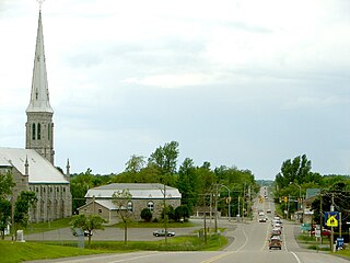
<span class="mw-page-title-main">South Stormont</span> Township in Ontario, Canada

South Stormont is a township in eastern Ontario, Canada, in the United Counties of Stormont, Dundas and Glengarry. It is located 53 kilometres (33 mi) southeast of Ottawa. South Stormont borders on, but does not include, the city of Cornwall.

<span class="mw-page-title-main">Amaranth, Ontario</span> Township in Ontario, Canada

Amaranth is a township located in Dufferin County, Ontario, Canada, with a 2021 population of 4,327. It is named after the plant which grows abundantly within its borders. It is bordered by Mono to the east and East Luther to the west.

<span class="mw-page-title-main">Wellington North, Ontario</span> Township in Ontario, Canada

Wellington North is a township in the Canadian province of Ontario, located within Wellington County.
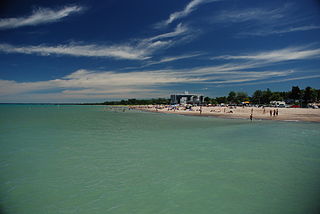
<span class="mw-page-title-main">Lambton Shores</span> Municipality in Ontario, Canada

Lambton Shores is a municipality in Lambton County, Ontario, Canada, that is on the southern shores of Lake Huron.

<span class="mw-page-title-main">The Blue Mountains, Ontario</span> Town in Ontario, Canada

The Blue Mountains is a town in Grey County, southwestern Ontario, Canada, located where the Beaver River flows into Nottawasaga Bay. It is named for the Blue Mountain, and hence the economy of the town is centred on tourism, particularly on the Blue Mountain ski resort and the private Georgian Peaks, Osler, Craigleith and Alpine Ski Clubs.
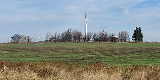
<span class="mw-page-title-main">Melancthon, Ontario</span> Township in Ontario, Canada

Melancthon is a rural Canadian township in the northwest corner of Dufferin County, Ontario, bordered on the east by Mulmur Township, Amaranth Township and East Luther Grand Valley to the south, Southgate Township to the west, and the Municipality of Grey Highlands to the north. The township does not include the town of Shelburne on its southern border. It has one of the lowest population densities in southwestern Ontario.
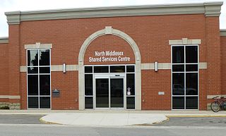
<span class="mw-page-title-main">North Middlesex, Ontario</span> Municipality in Middlesex County, Ontario, Canada

North Middlesex is a municipality in Middlesex County, Ontario, Canada.

<span class="mw-page-title-main">Bonnechere Valley</span> Township municipality in Ontario, Canada

Bonnechere Valley is a township municipality in Renfrew County, Ontario, Canada. It had a population of 3,674 in the Canada 2016 Census. It was established in 2001 by amalgamation of the village of Eganville and the townships of Grattan, Sebastapol and South Algona.
References

  1. 1 2 3 "2016 Community Profiles". 2016 Canadian Census . Statistics Canada. August 12, 2021. Retrieved 2017-02-14.
  2. "Archived copy" (PDF). Archived from the original (PDF) on 2016-03-03. Retrieved 2012-11-30.{{cite web}}: CS1 maint: archived copy as title (link)
  3. Statistics Canada: 1996, 2001, 2006 census, 2011, 2016
  4. "Population and dwelling counts: Canada, provinces and territories, census divisions and census subdivisions (municipalities), Ontario". Statistics Canada. February 9, 2022. Retrieved March 30, 2022.
  5. "2021 Community Profiles". 2021 Canadian Census . Statistics Canada. February 4, 2022. Retrieved 2023-10-19.
  6. "2011 Community Profiles". 2011 Canadian Census . Statistics Canada. March 21, 2019. Retrieved 2012-08-14.
  7. "2006 Community Profiles". 2006 Canadian Census . Statistics Canada. August 20, 2019.
  8. "2001 Community Profiles". 2001 Canadian Census . Statistics Canada. July 18, 2021.