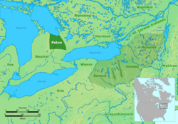
The house of Orangeville founder Orange Lawrence as it stands todayTerritory of the Petún (Tionontati) people.
The first patent of land was issued to Ezekiel Benson, a land surveyor, on August 7, 1820. That was followed by land issued to Alan Robinet in 1822.
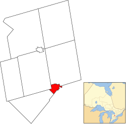
History and Naming
In 1863, Orangeville was named after Orange Lawrence, a businessman born in Connecticut in 1796 who owned several mills in the village. As a young man, he moved to Canada and settled in Halton County. During Mackenzie's rebellion in 1837, he was a captain in the militia. Lawrence purchased the land that became Orangeville from Robert Hughson.[3] He settled in the area in 1844 and established a mille.[4] The post office dates from 1851.[5] Orange Lawrence died by suicide December 15, 1861.[6][7] In 1873, the Act of Incorporation was passed and Orangeville was given town status on January 1, 1874. The public library, located at Broadway and Mill Street, was completed in 1908. Andrew Carnegie, well-known businessman and philanthropist, provided financial assistance for its construction.
Economy
Businesses on Broadway through downtown Orangeville
Orangeville serves as an administrative and commercial hub for Dufferin County, which sits to the north of the Region of Peel. Orangeville's downtown core is home to a substantial number of retail stores, and there is a cluster of big-box stores in the Fairgrounds Shopping Centre. Many residents in and around Orangeville also commute to different areas of the Greater Toronto Area and Southwestern Ontario for work.
There are a number of manufacturing plants located in the town. Major commercial and industrial employers include: the Resolve Corporation, a provider of computer outsourcing services; Allied Threaded Products, a fastener manufacturer; Greening Donald, a maker of automotive airbag components; Clorox Company of Canada, Glad garbage bags; Relizon Canada, pressure-sensitive labels; Rochling Engineering Plastics, formerly Symplastics Limited, plastic sheets; and Sanoh Canada, automotive components. Orangeville is also the main banking centre for residents in the area.
Transportation
Orangeville Town Hall.
The main intersection in the heart of the town is Broadway (formerly Highway 9) and First Street. Highway 10 runs through Orangeville on its east side.
Beginning in 2005, a major roadwork project was initiated to resurface Broadway through Orangeville. The downtown section was completed in early 2006, with extensive work still to be done on the west end in late 2006. In conjunction with this project, there was another one completed in late 2006 that involved building large planters in the middle of Broadway through the downtown section between First and Third Streets (West - East). The project was controversial, as safety concerns had been raised by the fire department because the new concrete planters in the middle of the road have made the rights of way too narrow for fire trucks to properly set up in case of a fire in a downtown building.[citation needed]
A section of County Road 109, often referred to as the "Orangeville bypass", is a bypass opened in 2005,[8] running east–west connecting Highway 10 with a pre-existing section of County Road 109 that was formerly Highway 9 running west out of town. Much of the eastern stretch runs through the Town of Caledon, but officially enters Orangeville at the Townline Road intersection, where it is named Riddell Road.
Orangeville Transit is the town's public transit system, and there is a commuter GO Transit bus service to Brampton. In 2023, Orangeville Transit introduced a two-year pilot program of free public transport under which no fares were collected on any of its routes within the town. In 2024 the town announced the pilot program would continue until at least 2027. Orangeville became the largest town or city in Canada with free public transport.[9]
In the early 1990s, preliminary plans were drawn up for GO Transit passenger rail service to Orangeville. However, it never got past the drawing board.[citation needed] Industries in Orangeville were served by the Orangeville Brampton Railway, which purchased 55 kilometres (34mi) of surplus track from the Canadian Pacific Railway. The railway connected with the CPR in Mississauga, and also serviced customers in Brampton to the south. From 2004 to 2018, a tourist train was operated on weekends in summer months. The last train out of Orangeville was December 17, 2021.[10][11]
In 1906, survey work was underway for an electric railway line which would serve Orangeville, to be called the Huron and Ontario Electric Railway.[12] The planned 150 kilometres (93mi) line would have connected Orangeville with Goderich, Ontario. The line was proposed during a period where electric railways was popular in Ontario but many would end up in the hands of Ontario Hydro in the 1930s or fail. Like the 1902 Ontario West Shore Railway this line was never built.
In the 2021 Census of Population conducted by Statistics Canada, Orangeville had a population of 30,167 living in 11,059 of its 11,308 total private dwellings, a change of 4.4% from its 2016 population of 28,900. With a land area of 15.16km2 (5.85sqmi), it had a population density of 1,989.9/km2 (5,153.8/sqmi) in 2021.[13]
The median age was 38.8 years, lower than the national median age of 41.6 years. The median value of a dwelling in Orangeville was $750,000, higher than the national average at $472,000, and the median household income (after-taxes) was $89,000, higher than the national median of $73,000.[1][14]
There are currently eleven public and separate elementary schools in Orangeville: Credit Meadows, Mono Amaranth, Montgomery Village, Parkinson Centennial, Princess Elizabeth, Princess Margaret, St. Andrew's RC, St. Benedict's RC, St. Peter's RC, Island Lake Public School and Spencer Avenue Elementary. Along with these publicly funded schools, there are several private schools in the area: Headwater Hills Montessori School, Dufferin Area Christian School, Hillcrest Private School, The Maples Academy (IB World School), Orangeville Christian School.
A French elementary school named L'École élémentaire de Quatre-rivièrs (translated as "Four Rivers Elementary School") currently resides in the old Springbrook Elementary building despite the reason for closing the school being 'structural' problems.[citation needed] Most of these problems are said to be the result of 'improper foundation for the area' as the school was built upon a swamp.[a] It had been used as a holding school for other schools including Island Lake, Montgomery Village, and Princess Margaret, while repairs, renovations, rebuilds and construction were completed.
Humber College had offered full-time programs at the Alder Street arena beginning in 2007. After 15 years of operation, the campus closed on June 15, 2021.[15]
Georgian College currently owns and operates a campus located at 22 Centennial Road, offering full-time and part-time courses. It is also delivering employment programs and services out of a location on 51 Townline.
Culture
Built c.1871, the town hall contains the opera hall
Orangeville hosts the annual Orangeville Blues and Jazz Festival, typically the first full weekend in June.[16]
The Town Hall building contains the historic Orangeville Opera House on the second floor. The building was restored in 1993–1994. This facility is the home base of professional theatre company Theatre Orangeville, and hosts plays and concerts throughout the year.[17]
Begun in 2003, Orangeville's Art Walk of Tree Sculptures features more than 50 detailed works by local artists. The sculptures are carved from old maple trees that have died from natural causes. The largest tree sculpture is a tribute to Canadiana and the centrepiece of a small newly developed park. It is a story totem entitled Nature's Unity, and celebrates Canada's 150th birthday.[18]
Orangeville is also host to the annual Dufferin Film Festival which began in August, 2024. The event features Canadian short films, parties, networking, workshops and an industry speaker event.[19]
There are two local newspapers based in Orangeville, the Orangeville Citizen and the Orangeville Banner.
Two radio stations are licensed to Orangeville, adult contemporaryCKMO-FM (FM 101 Orangeville) and rhythmic contemporaryCIDC-FM (Z103.5). CKMO launched in 2015 and broadcasts from studios in downtown Orangeville.[21] CIDC has historically targeted the broader Greater Toronto Area as a rimshot, and has usually marketed itself as a Toronto station (having moved its tower closer to the city, and operating from studios in Etobicoke) rather than operate as an Orangeville-specific outlet. It faced reprimands from the CRTC in 2016 for not regularly broadcasting news and information content of specific relevance to Orangeville.[22][23]
Until June 2005, Rogers TV maintained its Peel North studio and production facility at 98 C-Line. The facility was closed to allow for expansion of the Peel North headend. Today, Rogers TV has a studio and production facility located at 70 C-line.
Dillon Ward, 2017 NLL Goaltender of the Year, MVP of 2014 World Lacrosse Championships, 2022 NLL Finals MVP
Notes
↑Because of this the intermediate (grade 7-8) yard area is known to gain a large pond in the spring, about 1+1⁄2 feet (45.7cm) deep at the deepest point. This pond is referred to as Springbrook Lake by students and staff. A second smaller pond, only about 1 foot (30.5cm) at its very deepest, appears in the primary (grades 1-3) yard. This is referred to as Springbrook Pond.
This page is based on this Wikipedia article Text is available under the CC BY-SA 4.0 license; additional terms may apply. Images, videos and audio are available under their respective licenses.