Minto | |
|---|---|
| Town of Minto | |
 Main Street, Harriston | |
| Motto: "Where Your Family Belongs" | |
 Minto  Minto | |
| Coordinates: 43°55′N80°52′W / 43.917°N 80.867°W | |
| Country | |
| Province | |
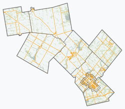
| County | Wellington |
| Formed | 1999 |
| Government | |
| • Mayor | Dave Turton |
| • Deputy Mayor | Jean Anderson |
| • Federal riding | Perth Wellington |
| • Prov. riding | Perth—Wellington |
| Area | |
| • Land | 300.69 km2 (116.10 sq mi) |
| Elevation | 334 m (1,096 ft) |
| Population (2021) | |
• Total | 9,300 |
| • Density | 30.3/km2 (78/sq mi) |
| [1] | |
| Time zone | UTC-5 (EST) |
| • Summer (DST) | UTC-4 (EDT) |
| Postal code | N0G 2P0 N0G 1Z0 N0G 1M0 |
| Area codes | 519 and 226 |
| Website | www.town.minto.on.ca |
Minto is a town in midwestern Ontario, Canada, on the Maitland River in Wellington County. Minto is the western terminus of Highway 9. It is named for Gilbert Elliot-Murray-Kynynmound, 4th Earl of Minto; 8th Governor General of Canada.
Contents
The Town of Minto was formed in 1999 through the amalgamation of the Township of Minto, the Towns of Harriston and Palmerston along with the Village of Clifford.