Petherton, Ontario

Last updated

Petherton
Unincorporated rural community
Petherton, Ontario.jpg
Looking southwest over Four Mile Creek towards Highway 6 in Petherton
Canada location map 2.svg
Red pog.svg
Petherton
Canada Ontario location map 2.svg
Red pog.svg
Petherton
Coordinates: 43°52′07″N80°35′43″W / 43.86861°N 80.59528°W / 43.86861; -80.59528
Country Canada
Province Ontario
County Wellington
Township Wellington North
Government
Time zone UTC-5 (Eastern (EST))
  Summer (DST) UTC-4 (EDT)
GNBC CodeFDOWL [1]

Petherton is an unincorporated rural community in Wellington North Township, Wellington County, Ontario, Canada. [1] [2] Petherton was located in Arthur Township until 1999. [3] [4]

Contents

The settlement is located along Highway 6, 6.4 km (4.0 mi) northwest of Arthur.

Little remains of the once thriving community.

History

When several Baptist families in the area constructed a log church and cemetery there, Petherton was founded in 1860. Known as the South Arthur Baptist Church and the Petherton Pioneer Cemetery, they were built on land donated by the Spark family. The church was dismantled in 1892 after a new church was built in nearby Kenilworth. [5] [6]

A post office was established in 1869, and by the 1870s Petherton was a thriving agricultural centre, with two stores, two carriage makers, two hotels, two blacksmith shops, a carpenter, a chopping mill, a kiln for making bricks, and several houses. [7] [5] The population was 155. [5]

The Toronto, Grey and Bruce Railway established a line through Petherton in 1872, and a station was erected there. The railway has since been abandoned and the tracks removed. [8]

Decline

The post office closed in 1915. [7]

The cemetery fell into neglect, and was restored in 1977 by descendants of the pioneers buried there. Surviving grave markers were cemented into a cairn, and a historic plaque was placed there. [6]

Related Research Articles

<span class="mw-page-title-main">Oro-Medonte</span> Township in Simcoe County, Ontario

Oro-Medonte is a township in south-central Ontario, Canada, on the northwestern shores of Lake Simcoe in Simcoe County.

<span class="mw-page-title-main">Tara, Ontario</span> Community in Ontario, Canada

Tara is an unincorporated community in the municipality of Arran–Elderslie, Bruce County, in southwestern Ontario, Canada. It is a designated place and had 1,037 residents and 458 dwellings as of the 2011 census. Tara is in geographic Arran Township and is located on the Sauble River. It has an area of 2.39 square kilometres (0.92 sq mi) and an urban area that covers 63.5 square kilometres (24.5 sq mi).

<span class="mw-page-title-main">Augusta, Ontario</span> Township in Ontario, Canada

Augusta Township is a township in the United Counties of Leeds and Grenville, located in eastern Ontario, Canada. Augusta is situated along the Saint Lawrence River, and extends back into rural hamlets. The township is located between the city of Brockville to the west, and the town of Prescott to the east.

<span class="mw-page-title-main">Alma, Ontario</span> Unincorporated rural community in Ontario, Canada

Alma is an unincorporated rural community in Mapleton Township, Wellington County, Ontario, Canada.

<span class="mw-page-title-main">Priceville, Ontario</span> Village in Ontario, Canada

Priceville is a village in the southwest corner of the Municipality of Grey Highlands, Grey County, Ontario, Canada. It is on the Saugeen River on Grey Road 4, east of Durham and southwest of Flesherton.

<span class="mw-page-title-main">Wellington North, Ontario</span> Township in Ontario, Canada

Wellington North is a township in the Canadian province of Ontario, located within Wellington County.

<span class="mw-page-title-main">Norwich, Ontario</span> Township in Ontario, Canada

The Township of Norwich is a municipality located in Oxford County in Southwestern Ontario, Canada. At the centre of the Township of Norwich is the Town of Norwich. The preferred pronunciation of the town name is NOR-witch, which differs from the pronunciation NORR-ij used for the city of Norwich, England. The origin of Norwich, Ontario, is more likely Norwich in upper New York State, the area from which the pioneering families emigrated in the early 19th century, where the community was known as Norwichville.

<span class="mw-page-title-main">Perth East, Ontario</span> Township in Ontario, Canada

The Township of Perth East is a municipality in Perth County, Ontario, Canada and situated north of Stratford. It was created in 1998 when the Ontario government amalgamated the village of Milverton with the surrounding former townships of Ellice, Mornington, North Easthope and South Easthope.

<span class="mw-page-title-main">Little Britain, Ontario</span> Compact rural community in Ontario, Canada

Little Britain is a compact rural community in the City of Kawartha Lakes, Ontario, Canada. It is located 15 kilometres (9.3 mi) southwest of Lindsay. Formerly a part of Mariposa Township and Victoria County, Little Britain is now part of Ward 4, City of Kawartha Lakes.

<span class="mw-page-title-main">West Perth, Ontario</span> Municipality in Ontario, Canada

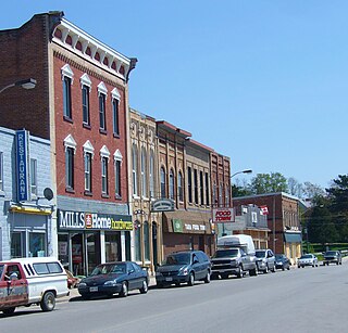
West Perth is a municipality in Ontario, Canada, situated in Western Perth County, just west of the city of Stratford. In 2016, its population was 8,865 in a land area of 579.36 square kilometers. The former town of Mitchell and townships of Logan, Hibbert, and Fullarton all amalgamated into this single large municipality on January 1, 1998. Municipal offices, administration, and services are based in Mitchell. Its mayor is Walter McKenzie.

<span class="mw-page-title-main">Haltonville, Ontario</span> Unincorporated community in Ontario, Canada

Haltonville is an unincorporated community in Milton, Ontario, Canada.

<span class="mw-page-title-main">Living Springs, Ontario</span> Unincorporated rural community in Ontario, Canada

Living Springs is an unincorporated rural community in Centre Wellington Township, Wellington County, Ontario, Canada. The settlement was part of West Garafraxa Township until 1999.

<span class="mw-page-title-main">Spier, Ontario</span> Unincorporated rural community in Ontario, Canada

Spier is an unincorporated rural community in Centre Wellington Township, Wellington County, Ontario, Canada. The settlement was part of West Garafraxa Township until 1999.

<span class="mw-page-title-main">Kenilworth, Ontario</span> Unincorporated rural community in Ontario, Canada

Kenilworth is an unincorporated rural community in Wellington North Township, Wellington County, Ontario, Canada. Kenilworth was located in Arthur Township until 1999.

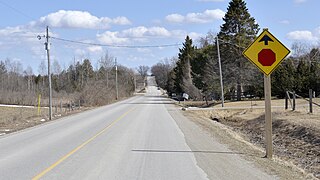
Olivet is an unincorporated rural community in Wellington North Township, Wellington County, Ontario, Canada.

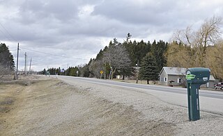
Riverstown is an unincorporated rural community in Wellington North township, Wellington County, Ontario, Canada. Prior to 1999, Riverstown was located in Arthur Township.

<span class="mw-page-title-main">Communities in Norfolk County, Ontario</span>

Norfolk County in the Canadian province of Ontario consists of a long list of communities. Its four designated population centres are Simcoe, Port Dover, Delhi, and Waterford.

<span class="mw-page-title-main">Creek Bank, Ontario</span> Unincorporated rural community in Ontario, Canada

Creek Bank is an unincorporated rural community in Centre Wellington Township, Wellington County, Ontario, Canada.

<span class="mw-page-title-main">Riverbank, Ontario</span> Unincorporated rural community in Ontario, Canada

Riverbank is an unincorporated rural community in Mapleton Township, Wellington County, Ontario, Canada. Prior to 1999, Riverbank was located in Maryborough Township.

<span class="mw-page-title-main">Cumnock, Ontario</span> Unincorporated rural community in Ontario, Canada

Cumnock is an unincorporated rural community in Centre Wellington Township, Wellington County, Ontario, Canada. Cumnock was part of Nichol Township until 1999.

References

  1. 1 2 "Petherton". Natural Resources Canada. October 6, 2016.
  2. "Wellington North". Statistics Canada. November 2, 2016.
  3. "Restructuring Flashnews Municipal Restructuring Summary Table". Ontario Ministry of Municipal Affairs. Retrieved April 18, 2017.
  4. Province of Ontario Gazetteer and Directory, 1910 - 1911. Union Publishing. 1911. p. 833.
  5. 1 2 3 "Petherton Pioneer Baptist Cemetery". Simply Explore Culture. Retrieved April 6, 2017.
  6. 1 2 "Petherton Pioneer Baptist Cemetery" (PDF). Ontario Genealogical Society. Retrieved April 6, 2017.
  7. 1 2 "Petherton". Library and Archives Canada. May 27, 2014.
  8. Brown, Ron (2011). In Search of the Grand Trunk: Ghost Rail Lines in Ontario. Dundurn. p. 138. ISBN   9781459717787.