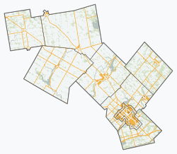
Mapleton, Ontario

Last updated

Mapleton
Township of Mapleton
Drayton Festival Theatre - Drayton, ON.jpg
Drayton
Wellington locator map 2021.svg
Red pog.svg
Mapleton
Canada Southern Ontario location map 2.png
Red pog.svg
Mapleton
Coordinates: 43°45′00″N80°40′00″W / 43.75°N 80.6667°W / 43.75; -80.6667
Country Flag of Canada (Pantone).svg  Canada
Province Flag of Ontario.svg  Ontario
County Wellington
Established1999
Government
  TypeTownship
  MayorGregg Davidson
  Governing BodyMapleton Township Council
  Federal riding Perth Wellington
  Prov. riding Perth—Wellington
Area
[1]
  Land534.87 km2 (206.51 sq mi)
Population
 (2016) [1]
  Total10,527
  Density19.7/km2 (51/sq mi)
Time zone UTC-5 (EST)
  Summer (DST) UTC-4 (EDT)
Postal Code FSA
N0B
Area code(s) 519, 226, 548
Website www.mapleton.ca

Mapleton is a rural township in the Canadian province of Ontario, located within Wellington County.

Contents

Communities

The largest and central community in Mapleton is the village of Drayton, which contains the township offices and has the largest retail presence.

The township also contains the smaller communities of Alma, Bosworth, Dobbenville, Glen Allan, Goldstone, Hollen, Lebanon, Moorefield, Parker, Quarindale, Riverbank, Rothsay, Spruce Green, Stirton, Wyandot, and Yatton. [2]

History

The township was formed by the amalgamation of the townships of Maryborough and Peel, and the village of Drayton on January 1, 1999.

Demographics

Mapleton, Ontario
Historical populations
YearPop.±%
1996 8,827    
2001 9,303+5.4%
2006 9,851+5.9%
2011 9,989+1.4%
2016 10,527+5.4%
[3] [4] [1]

In the 2021 Census of Population conducted by Statistics Canada, Mapleton had a population of 10,839 living in 3,245 of its 3,633 total private dwellings, a change of

Education

Mapleton is served by four public schools, administered by the Upper Grand District School Board. These are:

Secondary education is served by Norwell District Secondary School in Palmerston, in the adjacent township of Minto.

Mapleton is also served by one independent school

Recreation

Conestogo Lake is home to a reservoir and conservation area. It is part of the Conestogo River watershed.

See also

Related Research Articles

<span class="mw-page-title-main">Caledon, Ontario</span> Town in Ontario, Canada

Caledon is a town in the Regional Municipality of Peel in the Greater Toronto Area of Ontario, Canada. The name comes from a shortened form of Caledonia, the Roman name for what is now Scotland. Caledon is primarily rural with a number of hamlets and small villages, but also contains the larger community of Bolton in its southeastern quadrant, adjacent to York Region. Some spillover urbanization also occurs in the south bordering the City of Brampton.

<span class="mw-page-title-main">Timiskaming District</span> District in Ontario, Canada

Timiskaming is a district and census division in Northeastern Ontario in the Canadian province of Ontario. The district was created in 1912 from parts of Algoma, Nipissing, and Sudbury districts. In 1921, Cochrane District was created from parts of this district and parts of Thunder Bay District.

<span class="mw-page-title-main">Wellington County, Ontario</span> County in Ontario, Canada

Wellington County is a county located in Southwestern Ontario, Canada and is part of the Greater Golden Horseshoe. The county, made up of two towns and five townships, is predominantly rural in nature. However many of the residents in the southern part of the county commute to urban areas such as Guelph, Kitchener, Waterloo, Brampton, Mississauga, Toronto and Hamilton for employment. The northern part of the county is made up of mainly rural farming communities, except for a few larger towns such as Mount Forest and Arthur. According to the 2021 census, the population of the county was 241,026.

<span class="mw-page-title-main">Essa, Ontario</span> Township in Ontario, Canada

Essa is a township in Ontario, Canada, west and south of the city of Barrie in Simcoe County. It is bounded by County Road 90 to its north, County Road 27 to its east, and Ontario Highway 89 to its south. The township is about 100 kilometres (62 mi) from Toronto. The township is well known for its agriculture industry, particularly potato farming. Nearby CFB Borden brings a strong military presence to the area as well, including a high number of Francophone families.

<span class="mw-page-title-main">Woolwich, Ontario</span> Township in Ontario, Canada

The Township of Woolwich is a rural township in Southwestern Ontario, Canada, considered as a municipality. The Township is located in the northeast part of Waterloo Region and is made up of 10 small communities, with Elmira, Ontario the largest and St. Jacobs, Ontario the second largest. The population at the time of the 2021 Census was 26,999, up from the 2016 population of 25,006. Waterloo Region is still home to the largest population of Old Order Mennonites in Canada, particularly in the areas around St Jacobs and Elmira. They are often seen on the local roads using their traditional horse and buggy transportation; many also use horses to pull the implements in their farm fields.

<span class="mw-page-title-main">Perth South, Ontario</span> Township in Ontario, Canada

The Township of Perth South is a lower-tier municipality in southwestern Ontario, Canada. It is in Perth County at the confluence of the Thames and Avon rivers. The township was created on January 1, 1998, from the amalgamation of the former Township of Blanshard and the former Township of Downie. The land area of Perth South is 393.14 square kilometers. The population in 2016 was 3,810.

<span class="mw-page-title-main">Cochrane District</span> District in Ontario, Canada

Cochrane District is a district and census division in Northeastern Ontario in the Canadian province of Ontario. It was created in 1921 from parts of Timiskaming and Thunder Bay districts.

<span class="mw-page-title-main">Perth County, Ontario</span> County in Ontario, Canada

Perth County is a county in the Canadian province of Ontario in Southwestern Ontario, 100 kilometres (62 mi) west of Toronto. Its population centres are Listowel, Mitchell and Milverton. The City of Stratford and the Town of St. Marys are within the Perth census division, but are separate from Perth County. The 2016 population of Perth County was 38,066.

<span class="mw-page-title-main">Quinte West</span> City in Ontario, Canada

Quinte West is a city, geographically located in but administratively separated from Hastings County, in Southern Ontario, Canada. It is on the western end of the Bay of Quinte on Lake Ontario. The Lake Ontario terminus of the Trent–Severn Waterway is in the municipality.

<span class="mw-page-title-main">Oliver Paipoonge</span> Municipality in Ontario, Canada

Oliver Paipoonge is a township in the Canadian province of Ontario, located directly west of the city of Thunder Bay. The municipality was formed on January 1, 1998, with the amalgamation of the former Township of Oliver and Township of Paipoonge. It contains several communities within its boundaries, including Baird, Carters Corners, Harstone, Kakabeka Falls, Lee, McCluskeys Corners, Millar, Murillo, Rosslyn, Slate River Valley, Stanley and Twin City. The remainder of the municipality is agricultural or rural.

<span class="mw-page-title-main">Central Elgin</span> Municipality in Ontario, Canada

Central Elgin is a township located in Southwestern Ontario, Canada in Elgin County on Lake Erie. It is part of the London census metropolitan area.

<span class="mw-page-title-main">Drayton Valley</span> Town in Alberta, Canada

Drayton Valley is a town in central Alberta, Canada. It is located on Highway 22, approximately 133 kilometres (83 mi) southwest of Edmonton. It is surrounded by Brazeau County, known for its vast oil fields. The town is located between the North Saskatchewan River and the Pembina River.

<span class="mw-page-title-main">Southgate, Ontario</span> Township in Ontario, Canada

Southgate is a township in southwestern Ontario, Canada, in the southeast corner of Grey County. Southgate was formed on January 1, 2000, when the Village of Dundalk, the Township of Proton and the Township of Egremont were amalgamated. The headwaters of the South Saugeen, Beatty Saugeen and Grand Rivers are located in Southgate.

<span class="mw-page-title-main">Minto, Ontario</span> Town in Ontario, Canada

Minto is a town in midwestern Ontario, Canada, on the Maitland River in Wellington County. Minto is the western terminus of Highway 9. It is named for Gilbert Elliot-Murray-Kynynmound, 4th Earl of Minto; 8th Governor General of Canada.

<span class="mw-page-title-main">Drayton, Ontario</span> Unincorporated community in Ontario, Canada

Drayton is a community in Wellington County, Ontario, Canada. It is a part of the township of Mapleton. The village is on the corner of Wellington Road 8 and Wellington Road 11, geographically northwest of Fergus and southwest of Arthur.

<span class="mw-page-title-main">Wellington North, Ontario</span> Township in Ontario, Canada

Wellington North is a township in the Canadian province of Ontario, located within Wellington County.

<span class="mw-page-title-main">Perth East, Ontario</span> Township in Ontario, Canada

The Township of Perth East is a municipality in Perth County, Ontario, Canada and situated north of Stratford. It was created in 1998 when the Ontario government amalgamated the village of Milverton with the surrounding former townships of Ellice, Mornington, North Easthope and South Easthope.

<span class="mw-page-title-main">West Perth, Ontario</span> Municipality in Ontario, Canada

West Perth is a municipality in Ontario, Canada, situated in Western Perth County, just west of the city of Stratford. In 2016, its population was 8,865 in a land area of 579.36 square kilometers. The former town of Mitchell and townships of Logan, Hibbert, and Fullarton all amalgamated into this single large municipality on January 1, 1998. Municipal offices, administration, and services are based in Mitchell. Its mayor is Walter McKenzie.

<span class="mw-page-title-main">Conestogo, Ontario</span> Unincorporated community in Ontario, Canada

Conestogo is a community in the Canadian province of Ontario, located in the township of Woolwich in Waterloo Region. The population in 2016 was 1,270.

<span class="mw-page-title-main">Riverbank, Ontario</span> Unincorporated rural community in Ontario, Canada

Riverbank is an unincorporated rural community in Mapleton Township, Wellington County, Ontario, Canada. Prior to 1999, Riverbank was located in Maryborough Township.

References

  1. 1 2 3 "Census Profile, 2016 Census: Mapleton, Township". Statistics Canada. 8 February 2017. Retrieved July 22, 2019.
  2. "Mapleton". Statistics Canada. November 2, 2016.
  3. Statistics Canada: 1996, 2001, 2006 census
  4. "Mapleton, Ontario (Code 3523033) census profile". 2011 Census of Population . Statistics Canada. Retrieved 2012-08-16.
  5. "Population and dwelling counts: Canada, provinces and territories, census divisions and census subdivisions (municipalities), Ontario". Statistics Canada. February 9, 2022. Retrieved April 2, 2022.