Perth East, Ontario

Last updated

Perth East
Township of Perth East
WelcomeToPerthEast.jpg
Perth locator map 2021.svg
Red pog.svg
Perth East
Canada Southern Ontario location map 2.png
Red pog.svg
Perth East
Coordinates: 43°28′N80°57′W / 43.47°N 80.95°W / 43.47; -80.95
CountryFlag of Canada (Pantone).svg  Canada
ProvinceFlag of Ontario.svg  Ontario
County Perth
FormedJanuary 1, 1998
Government
  MayorRhonda Ehgoetz
  Federal riding Perth Wellington
  Prov. riding Perth—Wellington
Area
[1]
  Land712.14 km2 (274.96 sq mi)
Population
 (2016) [2]
  Total12,261
  Density17.2/km2 (45/sq mi)
Time zone UTC-5 (EST)
  Summer (DST) UTC-4 (EDT)
Postal Code
N0K
Area code(s) 519, 226, 548
Website www.pertheast.on.ca OOjs UI icon edit-ltr-progressive.svg
[3]

The Township of Perth East is a municipality in Perth County, Ontario, Canada and situated north of Stratford. It was created in 1998 when the Ontario government amalgamated the village of Milverton with the surrounding former townships of Ellice, Mornington, North Easthope and South Easthope.

Contents

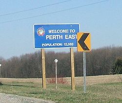
Milverton is the largest community of the township, where the municipal administration is based. The mayor is Rhonda Ehgoetz. The population in 2016 was 12,595, with 4,266 occupied private dwellings, in a land area of 711.93 km² (275 sq. mi.). [4]

History

Ellice Township

In 1829, the first concession in the Township of Ellice was surveyed and opened for settlement. A cairn still stands marking the site of the first home, at Lot 31, Concession 1, owned by Andrew Seebach from Bavaria. (A cairn has been erected to mark the location.) The township was named after Edward Ellice, a director of the Canada Company. The local municipal history began in 1842 when John Sebring was appointed to the position of District Councillor (later classified as a Reeve). The first separate school in the township was opened at Millbrook in 1857 and closed in 1907 when it merged with another local school. In 1908 the Ellice Council purchased the abandoned school and moved it to a site on the County Road where it served as the seat of municipal government until 1960. The building was replaced by the present hall which was built in 1961. [5]

Village of Milverton

The first settler was Andrew West, a shoemaker who settled on a farm and opened a hotel in 1851. Other businesses soon followed and the hamlet of West's Corners in Mornington Township began to expand. The first Post Office was established in 1854 and the first schoolhouse in 1856. By 1864, the settlement contained a sawmill, a tannery, two churches and some 200 residents. In about 1871 the name of the village was changed to Milverton, named after Milverton, Somerset in England. [6]

The Stratford and Huron Railway reached this area in 1877, making it easy to market the area's agricultural products; the population increased afterwards. Effective January 1, 1881, Milverton was incorporated into a village; its population at the time was 550. [7] [8]

Village of Shakespeare

According to Stratford Heritage, Perth County's first settler was Sebastian Fryfogel from Bavaria, Germany. He first built a log shelter in 1827 while the Canada Company's Huron Road was being surveyed. Still standing, it is part of what is now the village of Shakespeare. In 1844 or 1845, he replaced it with a larger building which served as an inn and stagecoach stop, the Fryfogel Tavern. It maintained this role until about 1856, when the railway became the primary method of transportation. [9] According to Canada's Register of Historic Places, "graves and markers of Sebastian Fryfogel and other Fryfogel family members are located on the property's western portion, as well as a cairn (1928) marking the site's century of occupation". [10]

Mornington Township

The first Township Council meeting was held in 1854. This, and subsequent meetings were held at taverns throughout the municipality. In 1857, only four years after the township was established, the township clerk was fired - council minutes explain that "the collections roll contained contradicting statements that... money had been collected, the expenditure of which could not be ascertained by the Auditors in a satisfactory manner". In 1876, the Stratford and Huron Railway Company and the township entered into an agreement to bring the railway into the municipality with two stations. [11]

North Easthope Township

North Easthope Township was named after Sir John Easthope, a Canada Company director. The area was settled around 1832 by two main ethnic groups - Highland Scots and Hessen Darmstadt Deutsch due to the Canada Company's advertisement of the local land in Scottish and German newspapers. [12]

South Easthope Township

The first settler to Southeast Township moved in on Christmas Day in 1828. In 1863, South Easthope was the smallest township in the area with a population of 2,322 and an areas of 9,759 hectares. Council meetings were held in a room leased at a hotel until 1954 when a township hall was opened. In 1959, a Fire Hall was opened housing a volunteer department of 17 men, two fire trucks and a pumper. This department still exists and serves the communities in North and South Easthope. [13]

Municipal Restructuring

As part of provincial initiatives in the late 1990s, the Government of Ontario pursued a policy of municipal amalgamations to rationalize municipal levels of government services and "reduc[e] government entanglement and bureaucracy with an eye to eliminating waste and duplication as well as unfair downloading by the province". [14] On June 26, 1997, an order from the Ontario Minister of Municipal Affairs for the amalgamation of the former Townships of Ellice, Mornington, North Easthope, South Easthope and the Village of Milverton into Perth East Township received Royal assent. The amalgamation came into effect on January 1, 1998. [15]

Geography

Communities

The township comprises the communities of Amulree, Brocksden, Brunner, Burns, Carthage, Dorking, Fernbank, Gads Hill, Hesson, Kinkora, Kuhryville, Mennonite Corner, Millbank, Milverton, Moserville, Newton, Nithburg, Peffers, Poole, Ratzburg, Rostock, Sebastopol, Shakespeare, Topping, Tralee and Wartburg. It also includes a portion of the hamlet of Punkeydoodles Corners, which straddles the municipal boundaries of Perth East, East Zorra – Tavistock and Wilmot.

Milverton was mentioned in the Season 4 episode Old King Clancy of How I Met Your Mother . [16] [ better source needed ]

Ellice Swamp

Ellice Swamp is a large woodlot in Perth County, Ontario. [17] The swamp covers approximately 856 hectares (2,115 acres). It is located between Stratford and Milverton in the northeastern portion of the Thames River Watershed, between the North Branch of the Thames and the Nith River. [18] Historically, it was known as Ellice Huckleberry Swamp and was part of the Huron Tract administered by the Canada Company. It is primarily owned by the Upper Thames River Conservation Authority. [18]

Demographics

Historical population
YearPop.±%
200611,986    
201112,028+0.4%
201612,261+1.9%
202112,595+2.7%
Source: 2006 Census of Canada 2011 Census of Canada

In the 2021 Census of Population conducted by Statistics Canada, Perth East had a population of 12,595 living in 4,112 of its 4,266 total private dwellings, a change of

In 2011, children aged 9 and under accounted for approximately 15.4% of the population, while the percentage at retirement age (65 and over) is approximately 12.8%. The median age was 36.1 years of age. [20] The average income was $37,303 with an average after-tax income of $32,356. [21]

In 2011, 6.2% of the population had immigrant status. The most common countries immigrants come from are Mexico (28.5%), followed by the Netherlands (16.3%) and Germany (10.8%). [21]

The majority of residents of Perth East are members of a Christian faith and account for 87.5% of the population. Less than 1% of the population is Sikh or "Other religion" with the remaining population (11.8%) reporting no religious affiliation. Of the Christian population, the largest religious affiliation is Roman Catholic (18.5%) followed by Lutheran (15.2%), United Church (11.8%), Presbyterian (1.6%), Anglican (2.4%), Pentecostal (1.4%), Baptist (1.3%) and other Christian (42%). [21]

Economy

The township indicates that economic categories include agriculture, farm-related businesses, millwrighting, metal fabrication, and tourism. [22]

Industrial companies in this area include Iron Bridge Fabrication, Quality Fertilizers, Mornington Communications and Nuhn Industries. [23] Nuhn Industries is a third generation, family owned business founded in 1902. In 2014, the company was planning a 30,000 square foot addition to their 66,000 square foot facility to better serve its customers throughout North America, Latin America, Japan and Africa. [23]

According to the 2011 National Household Survey, the largest economic sectors by number of workers employed are manufacturing (910 workers); construction (710 workers); health care and social assistance (645 workers) and retail trade (600 workers). Other industries in the region employing more than 200 workers are wholesale trade; transportation and warehousing; administrative and support, waste management and remediation services; accommodation and food services; and public administration. [21]

Local government

Perth East Township is governed by a Township Council composed of seven members including a Mayor, Deputy Mayor and five Councillors. Councillors represent the wards of Ellice, Milverton, Mornington, North Easthope and South Easthope. [24]

Township operations are overseen by the Chief Administrator's Office and municipal departments include Building, Clerk's Office, Finance, Fire Services, Library Services, Planning, Public Works, and Recreation. [25]

Township Council 2018-2022

Source: [24]

PositionName
MayorRhonda Ehgoetz
Deputy MayorHugh McDermid
Councillor - ElliceAmanda Brodhagen
Councillor - MilvertonJerry Smith
Councillor - MorningtonJeremy Matheson
Councillor - North EasthopeDaryl Herlick
Councillor - South EasthopeAndrew B. MacAlpine

County government

Because the Perth East is part of the upper-tier municipality Perth County, Ontario, it has representation on the County Council. The Perth County Council is determined by a restructuring order that came into force on January 1, 1998. [26] That Council is made up of representatives from the four Perth Townships. [27] The head of County Council is elected from among the council members annually, by a vote at council and is known as the Warden. In 2018-2019, the Perth County Warden is Walter McKenzie from West Perth. [26]

Perth East Mayor Rhonda Ehgoetz, Deputy Mayor Hugh McDermid, and Councillor Daryl Herlick serve as Perth East's representatives on County Council. [26]

Provincial Government

Perth—Wellington is a provincial electoral district in Ontario, Canada, that has been represented in the Legislative Assembly of Ontario since the 2007 provincial election. It was created in 2003 from parts of Dufferin—Peel—Wellington—Grey, Perth—Middlesex and Waterloo—Wellington ridings.

It consists of the County of Perth, and the Town of Minto and the townships of Mapleton and Wellington North in the County of Wellington. [28] As of June 2, 2022, the MPP for the riding is Matthew Rae. [29]

Perth—Wellington
AssemblyYearsMemberParty
Riding created from Dufferin—Peel—Wellington—Grey, Perth—Middlesex and Waterloo—Wellington
39th  2007–2011   John Wilkinson Liberal
40th  2011–2014   Randy Pettapiece Progressive Conservative
41st  2014–2018
42nd  2018–2022
43rd  2022–Present   Matthew Rae Progressive Conservative

Federal government

Perth—Wellington is a federal electoral district in Ontario, Canada, that has been represented in the House of Commons of Canada since 2004. The riding was created in 2003 from parts of Perth—Middlesex (76%), Waterloo—Wellington (17%) and Dufferin—Peel—Wellington—Grey (7%) ridings. It did not undergo any boundary changes in the 2012 electoral redistribution. [30]

It consists of the County of Perth, the City of Stratford, the Town of St. Mary's and the Town of Minto and the townships of Mapleton and Wellington North in the County of Wellington. [31]

Since 2015, the MP for this riding has been John Nater (PC).

See also

Related Research Articles

<span class="mw-page-title-main">Middlesex County, Ontario</span> County in Ontario, Canada

Middlesex County is a primarily rural county in Southwestern Ontario, Canada. Landlocked, the county is bordered by Huron and Perth counties on the north, Oxford County on the east, Elgin County on the south, and Chatham-Kent and Lambton County on the west.

<span class="mw-page-title-main">Stratford, Ontario</span> City in Ontario, Canada

Stratford is a city on the Avon River within Perth County in southwestern Ontario, Canada, with a 2021 population of 33,232 in a land area of 30.02 square kilometres (11.59 sq mi). Stratford is the seat of Perth County, which was settled by English, Irish, Scottish and German immigrants, in almost equal numbers, starting in the 1820s but primarily in the 1830s and 1840s. Most became farmers; even today, the area around Stratford is known for mixed farming, dairying and hog production.

<span class="mw-page-title-main">Wellington County, Ontario</span> County in Ontario, Canada

Wellington County is a county located in Southwestern Ontario, Canada and is part of the Greater Golden Horseshoe. The county, made up of two towns and five townships, is predominantly rural in nature. However many of the residents in the southern part of the county commute to urban areas such as Guelph, Kitchener, Waterloo, Brampton, Mississauga, Toronto and Hamilton for employment. The northern part of the county is made up of mainly rural farming communities, except for a few larger towns such as Mount Forest and Arthur. According to the 2021 census, the population of the county was 241,026.

<span class="mw-page-title-main">Bruce County</span> County in Ontario, Canada

Bruce County is a county in Southwestern Ontario, Canada. It has eight lower-tier municipalities with a total 2016 population of 66,491. It is named for James Bruce, 8th Earl of Elgin and 12th Earl of Kincardine, the sixth Governor General of the Province of Canada. The Bruce name is also linked to the Bruce Trail and the Bruce Peninsula.

<span class="mw-page-title-main">Perth South, Ontario</span> Township in Ontario, Canada

The Township of Perth South is a lower-tier municipality in southwestern Ontario, Canada. It is in Perth County at the confluence of the Thames and Avon rivers. The township was created on January 1, 1998, from the amalgamation of the former Township of Blanshard and the former Township of Downie. The land area of Perth South is 393.14 square kilometers. The population in 2016 was 3,810.

<span class="mw-page-title-main">Dufferin County</span> County in Ontario, Canada

Dufferin County is a county and census division located in Central Ontario, Canada. The county seat is Orangeville, and the current Warden is Wade Mills. The current chief administrative officer is Sonya Pritchard. Dufferin covers an area of 1,486.31 square kilometres (573.87 sq mi), and its population was 61,735 at the time of the 2016 Census.

<span class="mw-page-title-main">Huron County, Ontario</span> County in Ontario, Canada

Huron County is a county of the province of Ontario, Canada. It is located on the southeast shore of its namesake, Lake Huron, in the southwest part of the province. The county seat is Goderich, also the county's largest community.

<span class="mw-page-title-main">Perth County, Ontario</span> County in Ontario, Canada

Perth County is a county in the Canadian province of Ontario in Southwestern Ontario, 100 kilometres (62 mi) west of Toronto. Its population centres are Listowel, Mitchell and Milverton. The City of Stratford and the Town of St. Marys are within the Perth census division, but are separate from Perth County. The 2016 population of Perth County was 38,066.

<span class="mw-page-title-main">Southwestern Ontario</span> Secondary region in Ontario, Canada

Southwestern Ontario is a secondary region of Southern Ontario in the Canadian province of Ontario. It occupies most of the Ontario Peninsula bounded by Lake Huron, including Georgian Bay, to the north and northwest; the St. Clair River, Lake St. Clair, and Detroit River, to the west; and Lake Erie to the south. To the east, on land, Southwestern Ontario is bounded by Central Ontario and the Golden Horseshoe. The region had a population of 2,583,544 in 2016. It is sometimes further divided into "Midwestern Ontario" covering the eastern half of the area and the heart of Southwestern Ontario encompassing the western half of the region.

Perth North was a federal electoral district represented in the House of Commons of Canada from 1867 to 1935. It was located in the province of Ontario. It was created by the British North America Act of 1867 which divided the County of Perth into two ridings.

Perth South was a federal electoral district represented in the House of Commons of Canada from 1867 to 1935. It was located in the province of Ontario. It was created by the British North America Act of 1867, which divided the County of Perth into two ridings. The South Riding of the County of Perth initially consisted of the Townships of Blanchard, Downie, South Easthope, Fullarton, Hibbert, and the Villages of Mitchell and St. Marys.

Perth was a federal electoral district in Ontario, Canada, that was represented in the House of Commons of Canada from 1935 to 1988. This riding was created in 1933 from Perth North and parts of Perth South ridings.

<span class="mw-page-title-main">East Zorra-Tavistock</span> Township in Ontario, Canada

East Zorra-Tavistock is a township in southwestern Ontario, Canada, formed on 1 January 1975 through the amalgamation of the Township of East Zorra and the Village of Tavistock. It is part of Oxford County. The township had a population of 7,129 in the Canada 2016 Census.

<span class="mw-page-title-main">North Perth, Ontario</span> Municipality in Ontario, Canada

North Perth is a lower-tier municipality in Ontario, Canada. Its name is based on its location in the northern portion of Perth County. The main community in North Perth is Listowel. Other communities include Atwood, Monkton, Elma and Wallace township. The municipality was incorporated in 1998 and is heavily agricultural.

<span class="mw-page-title-main">Ashfield–Colborne–Wawanosh</span> Township in Ontario, Canada

The Township of Ashfield–Colborne–Wawanosh is a municipality in Huron County, Ontario, Canada. It was formed as an amalgamation of the former Ashfield, Colborne and West Wawanosh townships in 2001, in an Ontario-wide local government restructuring imposed by the government of that time. The three former townships now comprise the wards of the amalgamated municipality. Mayor of Dungannon Robert Brindley Jr.

<span class="mw-page-title-main">Plympton–Wyoming</span> Town in Ontario, Canada

Plympton–Wyoming is a town in the Canadian province of Ontario, located in Lambton County immediately east of Sarnia. It is the seat of the Lambton County Council.

Brunner is a community in the Township of Perth East, Perth County, Ontario, Canada. It lies 17 kilometres (11 mi) north of Stratford on Perth County Road 119. Topping is the nearest community, 4 kilometres (2 mi) east, and Milverton is 5 kilometres (3 mi) north. The Stratford and Huron Railway, later part of Canadian National Railway, passes through the community.

<span class="mw-page-title-main">West Perth, Ontario</span> Municipality in Ontario, Canada

West Perth is a municipality in Ontario, Canada, situated in Western Perth County, just west of the city of Stratford. In 2016, its population was 8,865 in a land area of 579.36 square kilometers. The former town of Mitchell and townships of Logan, Hibbert, and Fullarton all amalgamated into this single large municipality on January 1, 1998. Municipal offices, administration, and services are based in Mitchell. Its mayor is Walter McKenzie.

<span class="mw-page-title-main">Huron Tract</span> Area of land in Ontario, Canada

The Huron Tract Purchase also known as the Huron Block, registered as Crown Treaty Number 29, is a large area of land in southwestern Ontario bordering on Lake Huron to the west and Lake Erie to the east. The area spans the counties of Huron, Perth, Middlesex and present day Lambton County, Ontario in the province of Ontario.

Ellice Swamp is a large woodlot in Perth County, Ontario. The swamp covers approximately 856 hectares. It is located between Stratford and Milverton in the northeastern portion of the Thames River Watershed, between the North Branch of the Thames and the Nith River.

References

  1. "Perth East, Ontario (Code 3531030) census profile". 2011 Census of Population . Statistics Canada. Retrieved 2012-08-10.
  2. "Perth East, Ontario". 2016 Census of Population . Statistics Canada. Retrieved 7 March 2017.
  3. "Perth East". StatsCan. 2016. Retrieved 8 March 2017.
  4. "Perth East". StatsCan. 26 October 2022. Retrieved 23 November 2022.
  5. "Ellice - Perth East Township". www.pertheast.ca. Retrieved 2017-03-06.
  6. Rayburn, Alan (1997). Place names of Ontario. Toronto: University of Toronto Press. p. 222. ISBN   0-8020-7207-0 . Retrieved 20 October 2017.
  7. Cook, Wayne (2015). "Historical Plaques of Perth County". Historical Plaques. Wayne Cook. Retrieved 5 March 2017.
  8. "Milverton - Perth East Township". www.pertheast.ca. Retrieved 2015-08-21.
  9. "Fryfogel Tavern". Stratford Perth Heritage. Retrieved 6 March 2017. The three stones are those of Sebastian Fryfogel, his father Jakob and a son who died at an early age. Sebastian's wife is buried elsewhere. The stone cairn was erected in 1928 when the Huron Road (Hwy. 8) to Goderich was paved 100 years after its survey.
  10. "Fryfogel's Tavern". Register of Historic Places. Parks Canada. 1990. Retrieved June 29, 2019. 1931, Hwy. No. 7/8, Shakespeare, Ontario, N0B, Canada
  11. "Mornington - Perth East Township". www.pertheast.ca. Retrieved 2015-08-21.
  12. "North Easthope - Perth East Township". www.pertheast.ca. Retrieved 2015-08-21.
  13. "South Easthope - Perth East Township". www.pertheast.ca. Retrieved 2015-08-21.
  14. Progressive Conservative Party of Ontario. 1994. The Common Sense Revolution. Toronto: Progressive Conservative Party of Ontario.
  15. "Municipal Restructuring Activity Summary Table". www.mah.gov.on.ca. Retrieved 2015-08-16.
  16. http://how-i-met-your-mother.hypnoweb.net/episodes-/saison-4/resume-l-episode-418/script-vo-418.63.1027/
  17. "Swamp Friends" . Retrieved November 22, 2010.
  18. 1 2 "Ellice Swamp | UTRCA: Inspiring A Healthy Environment". thamesriver.on.ca. Retrieved 2015-08-20.
  19. "Population and dwelling counts: Canada, provinces and territories, census divisions and census subdivisions (municipalities), Ontario". Statistics Canada. February 9, 2022. Retrieved April 2, 2022.
  20. "Census Profile". www12.statcan.gc.ca. 8 February 2012. Retrieved 2015-08-17.
  21. 1 2 3 4 "National Household Survey (NHS) Profile, 2011". www12.statcan.gc.ca. 8 May 2013. Retrieved 2015-08-17.
  22. "About Our Community". Perth East. Township of Perth East. 2016. Retrieved 7 March 2017.
  23. 1 2 "Investor Community Profile" (PDF). Perth County, Ontario. p. 20. Archived from the original (PDF) on March 8, 2017.
  24. 1 2 "Council". Perth East Township. Retrieved June 28, 2019.
  25. "Departments". Township of Perth East. Retrieved June 29, 2019.
  26. 1 2 3 "County Council". Perth County, Ontario. Retrieved June 28, 2019.
  27. "Consolidated Official Plan" (PDF). County of Perth. The Corporation of the County of Perth. February 2016. Retrieved 7 March 2017.
  28. "Perth-Wellington". www.elections.on.ca. Archived from the original on 2015-04-10. Retrieved 2015-08-17.
  29. "Matthew Rae | Legislative Assembly of Ontario". www.ola.org. Retrieved 2022-11-24.
  30. "Perth - Wellington". CBC News. CBC. 2008. Retrieved 8 March 2017.
  31. "Perth–Wellington | Maps Corner | Elections Canada Online". elections.ca. Retrieved 2015-08-17.