
Caledon is a town in the Regional Municipality of Peel in the Greater Toronto Area of Ontario, Canada. The name comes from a shortened form of Caledonia, the Roman name for what is now Scotland. Caledon is primarily rural with a number of hamlets and small villages, but also contains the larger community of Bolton in its southeastern quadrant, adjacent to York Region. Some spillover urbanization also occurs in the south bordering the City of Brampton.
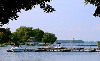
Orillia is a city in Ontario, Canada, about 30 km north-east of Barrie in Simcoe County. It is located at the confluence of Lake Couchiching and Lake Simcoe. Although it is geographically located within Simcoe County, the city is a single-tier municipality. It is part of the Huronia region of Central Ontario. The population in 2021 was 33,411.

Whitby is a town in Durham Region. Whitby is located in Southern Ontario east of Ajax and west of Oshawa, on the north shore of Lake Ontario and is home to the headquarters of Durham Region. It had a population of 138,501 at the 2021 census. It is approximately 45 km (28 mi) east of Toronto, and it is known as a commuter suburb in the Durham Region, a part of the Greater Toronto Area. While the southern portion of Whitby is predominantly urban and an economic hub, the northern part of the municipality is more rural and includes the communities of Ashburn, Brooklin, Myrtle, Myrtle Station, and Macedonian Village.

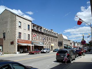
Paris is a community located in the County of Brant, Ontario, Canada. It lies just northwest from the city of Brantford at the spot where the Nith River empties into the Grand River. Paris was voted "the Prettiest Little Town in Canada" by Harrowsmith Magazine. The town was established in 1850. In 1999, its town government was amalgamated into that of the County of Brant, ending 149 years as a separate incorporated municipality, with Paris as the largest population centre in the county.
Wellington County is a county located in Southwestern Ontario, Canada and is part of the Greater Golden Horseshoe. The county, made up of two towns and five townships, is predominantly rural in nature. However many of the residents in the southern part of the county commute to urban areas such as Guelph, Kitchener, Waterloo, Brampton, Mississauga, Toronto and Hamilton for employment. The northern part of the county is made up of mainly rural farming communities, except for a few larger towns such as Mount Forest and Arthur. According to the 2021 census, the population of the county was 241,026.

The Ontario Provincial Police (OPP) is the provincial police service of Ontario, Canada. The OPP patrols provincial highways and waterways; protects provincial government buildings and officials, with the exception of the legislative precinct; patrols unincorporated areas in northern Ontario; provides training, operational support, and funding to some Indigenous police forces; and investigates complex or multi-jurisdictional crimes across the province. The OPP also has a number of local mandates through contracts with municipal governments and First Nations, where it acts as the local police force and provides front-line services.

Simcoe County is a county located in the central region of Ontario, Canada. The county is located north of the Greater Toronto Area, and forms the north western edge of the Golden Horseshoe. The largest city in the county is Barrie, while the county seat is located in Midhurst.

Russell is a police village that is part of Russell Township in the United Counties of Prescott and Russell in Eastern Ontario, Canada. It is located immediately east of Ottawa, the city limits of which are just over 2km west of Russell. Ottawa's downtown core is about 40km (25mi) northwest of Russell.

The Township of Perth South is a lower-tier municipality in southwestern Ontario, Canada. It is in Perth County at the confluence of the Thames and Avon rivers. The township was created on January 1, 1998, from the amalgamation of the former Township of Blanshard and the former Township of Downie. The land area of Perth South is 393.14 square kilometers. The population in 2016 was 3,810.

The United Counties of Prescott and Russell is a county located in the Canadian province of Ontario. Its county seat is L'Orignal. The county was created as a result of a merger between Russell County and Prescott County in 1820. It is located in Eastern Ontario, in the wedge-shaped area between the Ottawa River and St. Lawrence River, approximately 55 kilometres (34 mi) east of the City of Ottawa. Under Ontario law, the county is an Upper-tier Municipality.

Oxford County is a regional municipality in the Canadian province of Ontario. Highway 401 runs east–west through the centre of the county, creating an urban industrial corridor with more than half the county's population, spanning 25 km between the Toyota auto assembly plant in Woodstock and the CAMI General Motors auto assembly plant in Ingersoll. The local economy is otherwise dominated by agriculture, especially the dairy industry.

Perth County is a county in the Canadian province of Ontario in Southwestern Ontario, 100 kilometres (62 mi) west of Toronto. Its population centres are Listowel, Mitchell and Milverton. The City of Stratford and the Town of St. Marys are within the Perth census division, but are separate from Perth County. The 2016 population of Perth County was 38,066.
Middlesex Centre is a township in Middlesex County, in southwestern Ontario, Canada, north and west of London. The Corporation of the Township of Middlesex Centre formed on January 1, 1998, with the amalgamation of the former Townships of Delaware, Lobo, and London. It is part of the London census metropolitan area.

Clearview is a rural incorporated township in Simcoe County in Central Ontario, Canada, west of Barrie and south of Collingwood and Wasaga Beach in Simcoe County.
Minto is a town in midwestern Ontario, Canada, on the Maitland River in Wellington County. Minto is the western terminus of Highway 9. It is named for Gilbert Elliot-Murray-Kynynmound, 4th Earl of Minto; 8th Governor General of Canada.

North Perth is a lower-tier municipality in Ontario, Canada. Its name is based on its location in the northern portion of Perth County. The main community in North Perth is the former town of Listowel. Other communities include the former towns of Atwood and Monkton, and the former townships of Elma and Wallace. The municipality was incorporated in 1998 and is heavily agricultural.

The Township of Perth East is a municipality in Perth County, Ontario, Canada and situated north of Stratford. It was created in 1998 when the Ontario government amalgamated the village of Milverton with the surrounding former townships of Ellice, Mornington, North Easthope and South Easthope.

The Treaty Three Police Service (T3PS) is a self-administered First Nation Police service in Ontario, serving all Treaty 3 First Nations.
Auxiliary constables or reserve constables are unpaid citizens in Canada who volunteer their time and skills to a police force. They are uniformed, unarmed members who perform a similar role to their UK counterparts in the Special Constabulary. Their main function is to supplement the police force with additional manpower, with duties varying by appointment, geographical location and the needs of the specific detachment/department.
King's Highway 23, commonly referred to as Highway 23, is a provincially maintained highway in the Canadian province of Ontario. The route travels from Highway 7 east of Elginfield north to Highway 9 and Highway 89 in Harriston. The total length of Highway 23 is 97.7 kilometres. The highway was first established in 1927 between Highway 8 in Mitchell and Highway 9 in Teviotdale, via Monkton, Listowel and Palmerston. As part of a depression relief program, it was extended south to Highway 7 in 1934. It remained relatively unchanged until 2003, when it was rerouted northward from Palmerston to Harriston.

