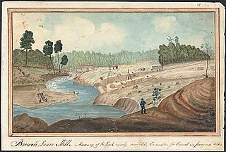
The Cataraqui River forms the lower portion of the Rideau Canal and drains into Lake Ontario at Kingston, Ontario. The name is taken from the original name for Kingston, Ontario; its exact meaning, however, is undetermined. Early maps showed several name variations including the Great Cataraqui River and Grand River Cataraquay. The river was once called Riviere de Frontenac, or Frontenac River. The alternate spelling "Cadaraqui" also appears in some historic texts.

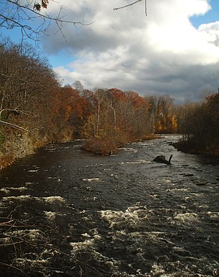
The Don River is a watercourse in southern Ontario that empties into Lake Ontario, at Toronto Harbour. Its mouth was just east of the street grid of the town of York, Upper Canada, the municipality that evolved into Toronto, Ontario. The Don is one of the major watercourses draining Toronto that have headwaters in the Oak Ridges Moraine.

The Township of Woolwich is a rural township in Southwestern Ontario, Canada, considered as a municipality. The Township is located in the northeast part of Waterloo Region and is made up of 10 small communities, with Elmira, Ontario the largest and St. Jacobs, Ontario the second largest. The population at the time of the 2021 Census was 26,999, up from the 2016 population of 25,006. Waterloo Region is still home to the largest population of Old Order Mennonites in Canada, particularly in the areas around St Jacobs and Elmira. They are often seen on the local roads using their traditional horse and buggy transportation; many also use horses to pull the implements in their farm fields.

The Grand River, formerly known as the River Ouse, is a large river in Ontario, Canada. It lies along the western fringe of the Greater Golden Horseshoe region of Ontario which overlaps the eastern portion of southwestern Ontario, sometimes referred to as Midwestern Ontario, along the length of this river. From its source near Wareham, Ontario, it flows south through Grand Valley, Fergus, Elora, Waterloo, Kitchener, Cambridge, Paris, Brantford, Ohsweken, Six Nations of the Grand River, Caledonia, and Cayuga before emptying into the north shore of Lake Erie south of Dunnville at Port Maitland. One of the scenic and spectacular features of the river is the falls and Gorge at Elora.
The Upper Thames River Conservation Authority is a body based in London, Ontario, Canada. It was created in 1947. It was responsible for the construction of the Fanshawe Dam, completed in the 1950s, to control flooding from the Thames River, which runs through London. During the last ice age, the site of London was the terminus of a large glacier. When the region warmed at the end of the ice age, the glacier melted and receded North, leaving behind a drainage ditch and features such as Sifton Bog. As such, the Thames is a watershed for most of Western Ontario, and is therefore highly susceptible to seasonal flooding. In 1937, such flooding had devastating consequences, destroying over 1,000 homes, and causing millions of dollars in damage.

The Salmon River is a small river north of Syracuse in Upstate New York, the United States. It is a popular and economically important sportfishing destination, and the most heavily fished of New York's Lake Ontario tributaries. From its headwaters in the Tug Hill region of New York, it flows 44 miles (71 km) westward through two hydroelectric dams and over the 110-foot (34 m) Salmon River Falls before it empties into eastern Lake Ontario at Port Ontario in Oswego County. The Salmon River watershed drains approximately 280 square miles (730 km2).

The Conestogo River is a river in Waterloo Region and Wellington County in Southwestern Ontario, Canada. The river was named by Mennonite settlers after the Conestoga River in Pennsylvania. In the 1800s there were several different spellings of the name of the river and of the nearby settlement of Conestogo, Ontario but the name ending in "o" became official.

The Eramosa River is a river in Wellington County in southwestern Ontario which rises near Erin, Ontario, and flows southwest through the city of Guelph, where it joins the Speed River, which then enters the Grand River in Cambridge. The river is believed to derive its name from the Mississauga word um-ne-mo-sah, meaning "black dog" or "dead dog".

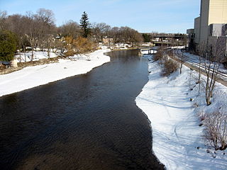
The Speed River is a river that flows through Wellington County and the Region of Waterloo in southwestern Ontario, Canada. It flows south from its source near Orton, through Guelph, where it is joined by the Eramosa River, then through the towns of Hespeler and Preston, finally uniting with the Grand River in north-west Cambridge.

Lake Allatoona is a U.S. Army Corps of Engineers reservoir on the Etowah River in northwestern part of the State of Georgia. This reservoir is mostly in southeastern Bartow County and southwestern Cherokee County. A small portion is located in Cobb County near Acworth.

Stirton is an unincorporated rural community in Mapleton Township, Wellington County, Ontario, Canada.

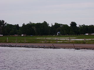
Canyon Lake is a reservoir on the Guadalupe River in the Texas Hill Country in the United States. Canyon Lake is a U.S. Army Corps of Engineers reservoir formed on the Guadalupe River in Comal County by Canyon Dam, which is located about sixteen miles northwest of New Braunfels. The dam, lake, and all adjacent property are managed by the U.S. Army Corps Of Engineers. Water rights, waste water treatment, and hydroelectric generating facilities are managed by the Guadalupe-Blanco River Authority. Construction of the dam began in 1958 and was completed in 1964. The reservoir serves to provide flood control and water supply for the communities downstream from the dam. The lake is also a popular recreational destination.
King's Highway 40, commonly referred to as Highway 40, is a provincially maintained highway in the southwestern portion of the Canadian province of Ontario. The 91.4-kilometre (56.8 mi) route links Chatham and Sarnia via Wallaceburg, following close to the St. Clair River. The southern terminus is at Highway 401 south of Chatham, while the northern terminus is at Highway 402 in Sarnia. The portion of Highway 40 between Highway 401 and north of Wallaceburg is within the municipality of Chatham-Kent, while the portion north of there is within Lambton County.

The Lake Simcoe Region Conservation Authority is a conservation authority established in 1951, and is among the oldest in the Canadian province of Ontario.

Guelph Lake is a man-made reservoir on the Speed River, in the Township of Guelph/Eramosa. It is located upriver and slightly northeast of the city of Guelph, Ontario. The reservoir was created in 1974, with the construction of the Guelph Lake dam. The site is part of a 1,608 hectares conservation area maintained by the Grand River Conservation Authority.

Douglas Dam is a hydroelectric dam on the French Broad River in Sevier County, Tennessee, in the southeastern United States. The dam is operated by the Tennessee Valley Authority (TVA), which built the dam in record time in the early 1940s to meet emergency energy demands at the height of World War II. Douglas Dam is a straight reinforced concrete gravity-type dam 1705 feet long and 202 feet high, impounding the 28,420-acre (11,500 ha) Douglas Lake. The dam was named for Douglas Bluff, a cliff overlooking the dam site prior to construction.

Mapleton is a rural township in the Canadian province of Ontario, located within Wellington County.

Lake Belwood is a reservoir in East Garafraxa, Dufferin County and Centre Wellington, Wellington County, Ontario, Canada. It is on the Grand River, whose waters were impounded in 1942 by the erection of the Shand Dam for flood control and the generation of hydroelectricity. The community of Belwood is on the north shore of the lake, and only the easternmost portion of the lake is in Dufferin County. Belwood Lake Conservation Area, operated by the Grand River Conservation Authority, surrounds almost the whole lake.

Mitchell Lake is a small, artificial lake in the Great Lakes Basin and located in the city of Kawartha Lakes in Central Ontario, Canada. The lake was formed sometime in the first decade of the twentieth century alongside the construction of the Kirkfield Lift Lock, which was completed and operational by the end of 1907. It is part of the summit of the Trent–Severn Waterway, the middle of a connection via canals of Balsam Lake on the Gull River system, which flows eventually to Lake Ontario, and the Kirkfield Lift Lock and Canal Lake on the Talbot River system, which flows to Lake Simcoe and eventually to Lake Huron.
The Old Ausable Channel is a self-contained waterway in Lambton County, Ontario, Canada that runs through the Pinery Provincial Park and the community of Grand Bend. It is a 14 kilometre long river channel that was isolated from the Ausable River by the digging of canals for drainage in the late nineteenth century. Part of the Pinery Provincial Park's rare oak savanna, the channel is an important part of the region's ecosystem.


