South Huron | |
|---|---|
| Municipality of South Huron | |
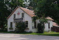 Dashwood | |
 South Huron | |
| Coordinates: 43°19′N81°30′W / 43.32°N 81.5°W | |
| Country | |
| Province | |
| County | Huron |
| Settled | 1842 |
| Formed | 2001 |
| Government | |
| • Mayor | George Finch |
| • Deputy Mayor | Jim Dietrich |
| • Federal riding | Huron—Bruce |
| • Prov. riding | Huron—Bruce |
| Area | |
| • Land | 425.36 km2 (164.23 sq mi) |
| Population (2016) [1] | |
• Total | 10,096 |
| • Density | 23.4/km2 (61/sq mi) |
| Time zone | UTC-5 (EST) |
| • Summer (DST) | UTC-4 (EDT) |
| Postal Code | N0M |
| Area codes | 519 and 226 |
| Website | www |
South Huron is a municipality in the Canadian province of Ontario, located in the southern part of Huron County. It was formed by amalgamation of the townships of Stephen and Usborne with the Town of Exeter in 2001, in an Ontario-wide municipal restructuring imposed by the provincial government.