
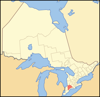
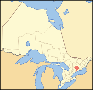
The Newcastle District was a historic district in Upper Canada which existed until 1849. It was formed in 1802 from the Home District, consisting of the counties of Durham and Northumberland.
The Newcastle District was a historic district in Upper Canada which existed until 1849. It was formed in 1802 from the Home District, consisting of the counties of Durham and Northumberland.
The legislature had enacted in 1798 that "as soon as there are one thousand souls within the said counties, and that six of the townships therein do hold town meetings according to law," the government shall constitute them as a separate district; [1] which was done in 1802. [2]
| Northumberland County | Durham County |
|---|---|
The townships of
together with the peninsula of Newcastle | The townships of
with all the tract of land ... which lies to the southward of the small lakes above the Rice Lake, and the communication between them and the communication between the eastern boundary of the township of Hope, and the western boundary of the township of Darlington, produced north fifteen degrees west, until they intersect either of the said lakes, or the communication between them... |
The district town was originally Newcastle, located near the current town of Brighton, and then Amherst, later renamed Cobourg.
In 1841, the northern part of the District was detached to form the Colborne District, consisting of Peterborough County. [4] It consisted of the following territory:
| Peterborough County |
|---|
The townships of
and
|
In 1850, the district was dissolved, and replaced with the United Counties of Northumberland and Durham that was established for municipal purposes. [6]
Middlesex County is a primarily rural county in Southwestern Ontario, Canada. Landlocked, the county is bordered by Huron and Perth counties on the north, Oxford County on the east, Elgin County on the south, and Chatham-Kent and Lambton County on the west.

The County of Victoria, or Victoria County, was a county in the Canadian province of Ontario. It was formed in 1854 as The United Counties of Peterborough and Victoria, and separated from Peterborough in 1863. In 2001, the county was dissolved and reformed as the city of Kawartha Lakes. Though first opened to settlement in 1821, the area that was encompassed by Victoria County has a history of Indian occupation, first by the Hurons.
Peterborough County is located in Southern Ontario, Canada. The county seat is Peterborough, which is independent of the county.

Hastings County is located in the province of Ontario, Canada. Geographically, it is located on the border of Eastern Ontario and Central Ontario. Hastings County is the second-largest county in Ontario, after Renfrew County, and its county seat is Belleville, which is independent of Hastings County. Hastings County has trademarked the moniker "Cheese Capital of Canada".

Simcoe County is located in the central portion of Southern Ontario, Canada. The county is just north of the Greater Toronto Area, stretching from the shores of Lake Simcoe in the east to Georgian Bay in the west. Simcoe County forms part of the Greater Golden Horseshoe area, a densely populated and industrialized region, centred on the Greater Toronto Area.
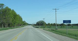
Huron County is a county of the province of Ontario, Canada. It is located on the southeast shore of its namesake, Lake Huron, in the southwest part of the province. The county seat is Goderich, also the county's largest community.
Grey County is a county of the Canadian province of Ontario. The county seat is in Owen Sound. It is located in the subregion of Southern Ontario named Southwestern Ontario. Grey County is also a part of the Georgian Triangle. At the time of the Canada 2016 Census the population of the county was 93,830.
Lennox County is a historic county in the Canadian province of Ontario which now forms part of Lennox and Addington County. It was named after Charles Lennox, 3rd Duke of Richmond.
Ontario County was the name of two historic counties in the Canadian province of Ontario.
Durham County is a historic county in Ontario, Canada. It was named for the English County Durham and city of Durham. It was created in 1792 but was later merged Northumberland County to form the United Counties of Northumberland and Durham. In 1974, the two counties were split and reorganized, with the former portions of Durham County reorganized into the Regional Municipality of Durham.

Grenville County is a former county in the Canadian province of Ontario. It fronted on the north shore of the Saint Lawrence River, between the towns of Kingston and Cornwall. The county was created in 1792, and named in honour of William Grenville, 1st Baron Grenville, who was the British Secretary of State responsible for the colonies in 1790. It consisted of five townships, which were settled primarily by United Empire Loyalists in the late 1700s after the Revolutionary War. Prior to being settled by Europeans, the area was home to many generations of native cultures. Grenville County merged with Leeds County in 1850 to create Leeds and Grenville County. The county covered an area of 272,261 acres (110,180 ha).

Durham is a federal electoral district in Ontario, Canada, that has been represented in the House of Commons of Canada from 1904 to 1968 and since 1988.

The Home District was one of four districts of the Province of Quebec created in 1788 in the western reaches of the Montreal District and detached in 1791 to create the new colony of Upper Canada. It was abolished with the adoption of the county system in 1849.
Midland District was one of four districts of the Province of Quebec created in 1788 in the western reaches of the Montreal District and partitioned in 1791 to create the new colony of Upper Canada.
The Johnstown District was a historic district in Upper Canada which existed until 1849.
The London District was a historic district in Upper Canada. It was formed in 1798 from parts of the Home and Western Districts, and lasted until its abolition in 1850.
The Niagara District was a historic district in Upper Canada. Created in 1798 from the Home District, it existed until 1849.
Alexander McDonell, Esq. was an immigration agent, military officer and member of the Legislative Assembly of Upper Canada. After immigrating from Scotland to Upper Canada he fought in the War of 1812 with the Canadian fencibles. He later served as a Colonel and assembled a militia to help quell the Upper Canada Rebellion, although they were never called to action. He spent most of his professional life as a Crown agent in the area surrounding Peterborough, Ontario assigning plots of land to settlers, advocating for projects to improve the infrastructure, and settling disputes as a Justice of the Peace. He was elected to the Legislative Assembly of Upper Canada in 1834 and reelected in 1836 by relying on his reputation after helping settlers and running on a pro-British platform. He lost his election to the Legislative Assembly of the Province of Canada in 1841 and became a lumberjack after his retirement in 1843.
Durham was an electoral district of the Legislative Assembly of the Parliament of the Province of Canada, in Canada West, on the north shore of Lake Ontario. It was created in 1841, upon the establishment of the Province of Canada by the union of Upper Canada and Lower Canada. Durham was represented by one member in the Legislative Assembly. It was abolished in 1867, upon the creation of Canada and the province of Ontario.
Northumberland North was an electoral district of the Legislative Assembly of the Parliament of the Province of Canada, in Canada West. It was created in 1841, upon the establishment of the Province of Canada by the union of Upper Canada and Lower Canada. Northumberland North was represented by one member in the Legislative Assembly. It was abolished in 1867, upon the creation of Canada and the province of Ontario.