Stretching over 3600 km (2236 miles) from Prince Township, west of Sault Ste. Marie, to the Quebec border, the Great Lakes Waterfront Trail is a signed route of interconnecting roads and off-road trails joining over 150 communities and First Nations along the Canadian shores of the Great Lakes and St. Lawrence River. The Great Lakes Waterfront Trail is part of a strategy to protect and connect people to the largest group of freshwater lakes on earth. It is a legacy project of the Waterfront Regeneration Trust, a charity, and its community partners. Through Toronto, the trail is called the Martin Goodman Trail. The Waterfront Trail is also used by commuters in parts of Southern Ontario.[1]
In October 2013, Premier of Ontario Kathleen Wynne announced government support for expansion of the trail system to better connect the 2015 Pan Am Games venues and community.
I want to ensure that all of the people of this province benefit from our investments in the Pan Am and Parapan Am Games, because that is how we can grow as One Ontario. Extending our trails system and connecting more communities is a great way for the excitement of the Games to live on well beyond 2015.
— Kathleen Wynne, Premier of Ontario, October 3, 2013[2]
The announcement ensures that "the province will work with First Nation and Métis communities and organizations to incorporate Aboriginal markers along the trails to honour the history and culture of Aboriginal communities in Ontario."
Trails will connect to four major Pan Am and Parapan Am Games venues – CIBC Pan Am/Parapan Am Athletes' Village, CIBC Pan Am Park, CIBC Hamilton Soccer Stadium and Pan Am/Parapan Am Fields.
In November 2013, two waterfront-design firms were selected to reimagine the space at the former Ontario Place grounds in Toronto to incorporate a broader mandate for greenspace and parkland.[3]
Since 2013, the Trail has been growing radically, with expansions along the shores of Lake Erie, Lake Huron, Georgian Bay and Lake Huron's north channel, adding over 2000 km to its length.
Uses
The rising cost of automobiles and gasoline mean a heavier burden on the trail system from multiple uses.
The rise of social travel and photography have parallelled with the rise of smaller wearable technological advancements that permits travelers along the trail a variety of activities and destinations.
The jewel of the Waterfront Trail lies at the Toronto Islands Ferry Terminal where trail users can catch a ferry to the expansive Toronto Islands including Centre Island and Hanlon's Point Beach. In 2015, the Waterfront Trail is expected to connect to the huge underground Toronto PATH system. Cyclists and skaters are encouraged on the peaceful island where only utility vehicles are permitted.
Among the artistic touches of this portion of the trail include the architecturally renowned Wave Decks, designed by West8.[5]
The Beaches community in eastern Toronto is an important location on the trail, being one of the only neighbourhoods in Toronto with residential homes next to the lakeshore. The Beach itself is a popular destination, hosting games of beach volleyball, and attracting many cyclists and rollerbladers. North of the waterfront are many small stores and restaurants along Queen Street and The Danforth. From the Beaches, the trail, called the Martin Goodman Trail, runs west along the Toronto waterfront for its entire length, with only a few sections on city streets. Currently, there isn't any path running east along the waterfront from the Beaches.
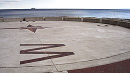
Sugar Beach
Sugar Beach is a former parking lot located at Lower Jarvis Street and Queen's Quay—the park is now a non-swimming beach on the south-eastern edge of South Core, Toronto.
Port Credit straddles the Credit River with a mix of residential and commercial development along the trail. Most of the trail is separated from traffic with the exception of some residential streets at the east end near the Adamson Estate.
The 1000 Islands Bikepath is a 37 kilometre trail running parallel to the Parkway between Gananoque and Brockville, forming a section of the Waterfront Trail.[6]
Ontario Place
In July 2014, the provincial government of Ontario announced a $100 million renovation plan that will see the transformation of Ontario Place from an entertainment venue into a huge mixed-use park that will anchor the trail in this section.[7]
Cycling on the trail
Old Soo Road in Lively, one of a number of mixed-traffic sections of the trail.
Not all sections of the Great Lakes Waterfront Trail are off-road. The route is designated with existing infrastructure in place with the goal of future improvements, including a legacy goal of a completely off-road trail, as close to the water's edge as ecologically feasible. There is an effort by the Waterfront Regeneration Trust, the charity leading the partnership of communities the Trail connects, to expand and improve the route. Their partnership with local, regional, and Provincial governments has yielded several successes, including the Ministry of Transportation's addition of paved shoulders on roughly 50km of Highway 17 between Sault Ste Marie and Greater Sudbury, where the route could use no other roads.
The Waterfront Regeneration Trail is focused on creating a cycling route around the Great Lakes, and has big expansion plans and dreams for the coming years to increase significantly its mileage. Some of the biggest deterrents for cycle tourists are poor road conditions that force cyclists into traffic and a lack of good signage.[8]
Harbourfront is a neighbourhood on the northern shore of Lake Ontario within downtown Toronto, Ontario, Canada. Part of the Toronto waterfront, Harbourfront extends from Bathurst Street in the west, along Queens Quay, with its ill-defined eastern boundary being either Yonge Street or York Street. Its northern boundary is the Gardiner Expressway. Much of the district was former water lots filled in during the early 1900s to create a larger harbour district. After shipping patterns changed and the use of the Toronto Harbour declined, the area was converted from industrial uses to a mixed-use district that is mostly residential and leisure.
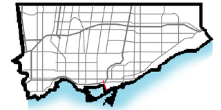
The Toronto waterfront is the lakeshore of Lake Ontario in the city of Toronto, Ontario, Canada. It spans 46 kilometres between the mouth of Etobicoke Creek in the west and the Rouge River in the east.
Clarkson, also called Clarkson Village, is a neighbourhood in the city of Mississauga, Ontario, Canada, situated in the southwest corner of the city, along the shore of Lake Ontario. It is bordered by Lake Ontario to the south, Oakville to the west, Erindale and Erin Mills to the north, and Lorne Park to the east.
The Scarborough Bluffs, also known as The Bluffs, is an escarpment in the Scarborough district of Toronto, Ontario, Canada. There are nine parks along the bluffs, with Bluffers Park being the only one with a beach. Forming much of the eastern portion of Toronto's waterfront, the Scarborough Bluffs stands above the shoreline of Lake Ontario. At its highest point, the escarpment rises 90 metres (300 ft) above the coastline and spans a length of 15 kilometres (9.3 mi).
Bronte is the community that makes up much of the west end of Oakville, in Ontario, Canada. Twelve Mile Creek flows through the middle of town and empties into Lake Ontario. Main roads include Bronte Road (north-south), Lakeshore Road West and Rebecca Street (east-west). Streets in the business section include Lakeshore, Jones, Marine, and Ontario Street. Bronte is also accessed via a superhighway located to the north of the former village. Other main roads include Third Line, Speers Road and Burloak Drive to the west
Sunnyside is a lakefront district in Toronto, Ontario, Canada. It includes a beach and park area along Lake Ontario's Humber Bay, from west of Exhibition Place to the mouth of the Humber River. The area has several recreation uses, including rowing clubs, sports clubs, picnic areas, playgrounds, a nightclub, a bathing pavilion and public pool. The area is a 3 kilometres (1.9 mi) long strip along the lakeshore, bounded by the Gardiner Expressway and rail lines, which separate it from the Parkdale, Roncesvalles and Swansea neighbourhoods to the north. The name originates in a local farm owned by John Howard, which was situated just to the north, on the location of the current St. Joseph's Health Centre hospital.
Rattlesnake Point is an eco-tourism area located in Milton, Ontario, Canada and is owned and operated by Conservation Halton. Spanning roughly one hundred square kilometres across and near the Niagara Escarpment in Halton Region, the Rattlesnake Point area is home to many golf courses, country markets and equestrian training and boarding facilities. It is a popular scouting area.
Bay Street is a lower city arterial road in Hamilton, Ontario, Canada. It starts at Inglewood Drive, just South of Aberdeen Avenue, as a collector road with only two lanes, then eventually becomes a six lane thoroughfare at its peak. Bay Street also passes through downtown Hamilton, where many high-rise buildings are found. Bay Street is a one-way street from Aberdeen Avenue to Cannon Street West. Bay Street continues as an arterial route to Strachan Street, where it is downgraded to a neighbourhood collector and eventually ends at a curb at Pier 4 Park at Burlington Street in the city's North End.
Toronto, Ontario, like many North American cities, has slowly been expanding its purpose-built cycling infrastructure. The number of cyclists in Toronto has been increasing progressively, particularly in the city's downtown core. As cycling conditions improve, a cycling culture has grown and alternatives such as automobiles are seen as less attractive. The politics of providing resources for cyclists, particularly dedicated bike lanes, has been contentious, particularly since the 2010s.
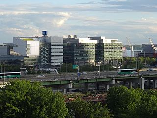
East Bayfront, or the East Bayfront Precinct, is an emerging neighbourhood in Toronto, Ontario, Canada. It is currently undergoing a transformation from industrial use to mixed-use as part of Waterfront Toronto's plans to create a residential and commercial district urban core near the lake.
The 2015 Pan and Parapan American Games venues were mostly located in the host city of Toronto, Ontario, though some events required facilities located elsewhere. Besides Toronto, fourteen other municipalities in Southern Ontario hosted competitions: Ajax, Hamilton, Innisfil, Markham, Milton, Minden, Mississauga, Mono, Oro-Medonte, Oshawa, Palgrave, St. Catharines, Welland and Whitby.
Cherry Street is a north-south arterial roadway in the eastern downtown of Toronto, Ontario, Canada. It is situated in a former industrial area, that is now the site of redevelopment. It connects Eastern Avenue south to Lake Shore Boulevard, then to the Toronto Port Lands district, and terminates at Lake Ontario at Cherry Beach.
The Markham Pan Am Centre is a multi-purpose community and aquatics centre located in the new downtown area of Markham, Ontario, Canada.
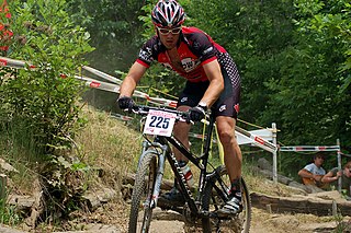
Hardwood Ski and Bike is located in Oro-Medonte Township in Ontario’s Lake Country region about one hour north of Toronto, Ontario. The facility is a family oriented cross country skiing, snowshoeing, mountain biking and outdoor recreation area.
York Lions Stadium is an outdoor sports stadium on the Keele Campus of Toronto's York University in the former city of North York. It is home to the York Lions, the varsity teams of York University, the Toronto Arrows of Major League Rugby and York United of the Canadian Premier League. The facility was primarily built for the 2015 Pan American and Parapan American Games, where it hosted track and field events and the opening ceremony. In 2021, the stadium's running track was removed to expand the playing surface used for football and soccer.
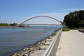
The Martin Goodman Trail is a 56 km (35 mi) multi-use path along the waterfront in Toronto, Ontario, Canada. It traverses the entire lake shore from one end of the city to the other, from Humber Bay Arch Bridge in the west to the Rouge River in the east. The Martin Goodman Trail is part of the 730 km Waterfront Trail around Lake Ontario.
The Pan Am Path is a multi-use path that connects trails in the Greater Toronto Area as part of the legacy of the 2015 Pan American Games and the 2015 Parapan American Games. The path is over 80 kilometres (50 mi) in length, connecting Toronto neighbourhoods.
Lake Ontario's Woodbine Beach is the largest of the four beaches in the Beaches in Toronto, Ontario, Canada. Located along Lake Shore Boulevard at the foot of Woodbine Avenue, it is next to Ashbridge's Bay and Kew-Balmy Beach. Woodbine beach is the westernmost beach in the Beaches, and the series of beaches extend east until the RC Harris Water Treatment Plant. The beach runs parallel to the boardwalk and the Martin Goodman Trail and is part of Woodbine Beach Park.
Ashbridges Bay is a bay and park in Toronto, Ontario, Canada. It is located along Lake Shore Boulevard next to Woodbine Beach in the Beaches. The Martin Goodman Trail and boardwalk run through the park along the bay. The boardwalk runs 3 kilometres (1.9 mi) from Ashbridges Bay in the west to the R. C. Harris Water Treatment Plant in the east along Lake Ontario. It was once part of the marsh that lay east of Toronto Islands and Toronto Harbour.
The Ontario Place West Channel, also known as the Toronto Western Beaches Watercourse is a "flat water" training and competition centre for rowing, paddling, and water sports located on the shoreline of Lake Ontario in Toronto, Ontario, Canada.
This page is based on this Wikipedia article Text is available under the CC BY-SA 4.0 license; additional terms may apply. Images, videos and audio are available under their respective licenses.