Greenlink Rotary Park Trail System

Last updated

Greenlink Rotary Park Trail System
42-20131022 Rotary Park GreenLink Trails 0104.jpg
Maillard Street Entrance
Canada Nova Scotia location map 2.svg
Red pog.svg
Canada location map 2.svg
Red pog.svg
TypeMunicipal Urban Park
Location Cape Breton Island, Nova Scotia, Canada
Nearest town Sydney
Coordinates 46°07′18″N60°10′55″W / 46.121570°N 60.181983°W / 46.121570; -60.181983
Area52 acres (21 ha)
Created15 August 1956;67 years ago (1956-08-15)
Operated byCape Breton Regional Municipality, Parks & Grounds
StatusOperational
Hiking trailsGreenlink Trails
Public transit access Transit Cape Breton Route 13
Website Rotary Park

Greenlink Rotary Park Trail System is a Canadian urban park located in the community of Sydney, part of Nova Scotia's Cape Breton Regional Municipality. The park incorporates the Greenlink Trail System, the Rotary Park Off Leash Park, as well as a disc golf course. Much of the park is forested, with ponds, a stone dam, and streams in the valleys; a few acres are open lawn area, suitable for informal recreation. The park encompass 52 acres (21 ha) within the former city's boundaries.

Contents

The trail system connects Sydney's Shipyard and South End neighbourhoods to Membertou First Nation and the Cape Breton Regional Hospital. [1] [2] Two of the trails progress from Shandwick Street and the St. Anthony Daniel Ball Park, with both trails converging with the trail from Rotary Drive, crossing Churchill Drive, and extending to the Cape Breton Regional Hospital property.

Park features

Trails

The Greenlink Trail System is a series of 2.5 to 3 metres (8 to 10 ft) wide crushed limestone paths suitable for walkers and cyclists. The gravel surfaces are not suitable for wheelchairs or strollers. [1] The paths meander through a scenic natural area bordering Wentworth Creek (now Reservoir Brook, [3] [4] also known as Sullivan's Brook) and a historic water reservoir with a stone dam and waterfall. The paths are not illuminated at night. Benches have been provided along the paths for resting, signs and interpretive displays for information.

The trail system is approximately 3 kilometres (1.9 mi) in length, with some longer routes such as Shandwick St. to the Regional Hospital or St. Anthony Daniel Ball Field to the Hospital both at 2.2 kilometres (1.4 mi) one way. Parking lots are located at the Rotary Drive and Churchill Drive entrances.

The paths are well maintained, the parking lots (but not the paths) are plowed and sanded in winter, the trails left snow covered for winter snowshoeing or cross-country skiing.

Rotary Drive Entrance 15-20131022 Rotary Park GreenLink Trails 0034.jpg
Rotary Drive Entrance

Trail access

Access to the trail system is at the following locations:

Off Leash Dog Park

Beginning in July 2013 a trial period began where pets were permitted on the trails throughout Greenlink Rotary Park Trail System but had to be leashed and managed by their owners. [5] At this same time the Rotary Park Off Leash Park was designated adjacent to the trails, encompassing over 12 acres (4.9 ha) of the greater park area.

In July 2014 this became a permanent feature of the park, dogs are now permitted off leash provided the dog is under the control of the owner. The dog park area is unfenced but preserves a 30 metres (100 ft) buffer from the Greenlink Trails, Rotary Drive, and the abutting residential properties with signage indicating where the off leash area begins and ends. [6]

Disc golf

2017

A nine-hole disc golf course was incorporated into the park in the summer of 2017, with an official unveiling on 25 October that year. All "holes" are listed as par-3 and have standard disc golf baskets. [7] The course lies in a mixed terrain of low hills, trees and open areas and part of the course shares a section of the off-leash dog park. [8]

Like all amenities in Greenlink Rotary Park, the disc golf course is free for the public to use and can be accessed near the park gate on Rotary Drive. [7]

2020

The original 9-hole layout was upgraded to a full 18-hole course. Construction began in 2020 and was finished in early 2021. Only 3 original holes remain. 15 completely new holes were designed throughout the property. This layout is now known as the Yellow Layout (or Original). As of 2024, this remains the most popular layout/ course in Cape Breton.


2021

The First ever Cape Breton Open was held at Rotary Park Disc Golf Course. The inaugural champion Michael Stoddart. Michael spent a portion of his childhood in Sydney, making him the perfect champ.

2022

Rotary Park Disc Golf Course was upgraded to 27 holes. The Membertou Loop was added to the property. The addition of these holes incorporated elite-tier holes into the area. Something that was lacking beforehand. This allowed for several different loop combinations. At this point, Rotary Park has multiple layouts (Yellow, Pink, Green, Double Park Loop)

The second-ever Cape Breton Open was held on four layouts. Green, Yellow, Pink, and 27 Hole Layout. Michael Stoddard also became a two-time champion.

2023

The Cape Breton Open was held using three layouts. Green, Yellow, and Pink. There was a new champion crowned in Nathan McCarthy. Shooting A course record on the Green layout of -9 (-8 adjusted to the traditional layout).

History

Wentworth Creek Dam

Wentworth Creek and Waterfall 25-20131022 Rotary Park GreenLink Trails 0067.jpg
Wentworth Creek and Waterfall

The Wentworth Creek Dam was constructed in 1892-1893. Its purpose was to create a water reservoir for the City of Sydney to service approximately 2,400 residents. The Dam was constructed of large hand-cut stone blocks with mortar joints. It held back the waters of Wentworth Creek (now named Reservoir Brook), and was sized to retain approximately 6 million imperial gallons (27 million litres) of water.

A 10" diameter cast iron transmission main was laid following the creek valley floor, carrying the water from the new reservoir to the City of Sydney, and a network of distribution and service lines were installed by Fall 1883 when the system went into full operation.

By 1901 a booming steel industry and an increase in population placed a large demand on the Sydney water supply and subsequently the Wentworth Dam supply was inadequate to meet the demands of the city. In 1902 a secondary dam was constructed upstream on Sullivan's Brook. This new dam had a capacity of 200 million imperial gallons (910 million litres) of water and draws from a watershed of approximately 1,800 acres (730 ha). This dam is located across the 125 Highway from the Cape Breton Regional Hospital.

As the new dam had an overflow elevation 30 metres (100 feet) higher than Wentworth Dam, the Wentworth Dam supply could not be integrated into the new water supply and therefore large diameter water transmission piping was installed and connected into existing piping downstream from Wentworth Dam. This new water transmission piping continued along Reservoir Brook entering the Sydney water distribution system at Cromarty Street. [9]

Rotary Park

Interpretive Panel at the Rotary Drive Entrance 16-20131022 Rotary Park GreenLink Trails 0038.jpg
Interpretive Panel at the Rotary Drive Entrance

To commemorate the 50th anniversary of Rotary International, the Rotary Club of Sydney constructed Rotary Park. The park opened on 15 August 1956 through the collaboration and work of Rotarian volunteers, businesses, trade unions, and local citizens. The park area included the existing, decommissioned historic city reservoir, including the Wentworth Creek Dam and waterfall dating from the 1880s. This was incorporated into the park as a swimming lake with diving platforms, a lifeguard stand, and a sand shoreline.

The land that was used in the development of Rotary Park was owned by people who wished to dedicate the extensive property as a community park. These owners were members of St. George's Parish, along with Rotarian C.J. Burchell, QC. Through exchange and donation, the site was soon deeded to the City of Sydney under the protective term that "it remain a park".

This $50,000 project was considered one of the most ambitions in Sydney's history. Phase one of the Park's creation developed 12 acres (4.9 ha), from the total 52 acres (21 ha) site. Committee Chairman Gordon Elman and Rotary President Alf Reynolds were honoured to present Rotary Park to the community. [10]

One feature of the park was a locally designed and constructed lookout tower which incorporated an ornate spiral staircase leading up to the viewing deck. On a clear day, people could see far and wide from this lookout tower. Not only could they view the surrounding cityscapes, and harbour, they could see as far as Cape Smokey and the Cape Breton Highlands over 50 kilometres (31 mi) to the north.

St. Anthony Daniel Ball Field Entrance 43-20131022 Rotary Park GreenLink Trails 0111.jpg
St. Anthony Daniel Ball Field Entrance

The GreenLink Park Society was formed in 1997 [11] to plan a major natural recreation development for the heart of Sydney, focused on Rotary Park, including a trail system that would connect Sydney's Waterfront Boardwalk and Wentworth Park in Sydney's downtown to the Cape Breton Regional Hospital, a distance of 3.3 kilometres (2 mi). The proposed greenway project would include common spaces, mini-parks and playgrounds adjacent to neighbourhoods along the route. [12] EDM consulting of Halifax completed a conceptual design for the project in December 1998 and the GreenLink Park Society introduced the proposal to the community. [13]

By 2010, after lying dormant for a few years, planning for the Greenlink Park and trail system resumed. [14] Cape Breton Regional Municipality (CBRM) conducted public consultations, and by spring of 2012 work on developing the trail system was underway. While there had been an informal series of trails in Rotary Park, with some foot bridges and other amenities, these had generally fallen into disrepair. Earlier work by the CBRM to install municipal infrastructure that passed through Rotary Park, such as a new sewer for the then new Cape Breton Regional Hospital, and a new water main for the city's water supply, had resulted in repairs and improvements to existing trails and creation of new access roads and a new stream crossing.

The $425,000 Greenlink project, part of the CBRM's Active Transportation Plan, [15] took advantage of these existing routes to create an integrated trail system by upgrading and enhancing the existing walking trails, widening and resurfacing the trails with crushed limestone to a standard 2.5 to 3 metres (8 to 10 ft) width. Benches were installed along the routes, trees planted, interpretive panels and guide signs were installed. Green Gabion Baskets were placed along sections of the Shandwick Street trail to act as retaining walls where side slopes were steep. Drainage culverts were installed or improved along the trail where required. Two parking lots were created and decorative arches were installed to enhance the trail entrances. [16]    

The trails were officially opened on 22 July 2015 by Mayor Cecil Clarke, Membertou Chief Terry Paul, Membertou Band Councillor David Marshall, and CBRM Councillor Eldon MacDonald. [2] [17]

Related Research Articles

<span class="mw-page-title-main">Cape Breton Island</span> Island in Nova Scotia

Cape Breton Island is a rugged and irregularly shaped island on the Atlantic coast of North America and part of the province of Nova Scotia, Canada.

<span class="mw-page-title-main">Cape Breton Highlands National Park</span> National park in Nova Scotia, Canada

Cape Breton Highlands National Park is a Canadian national park on northern Cape Breton Island in Nova Scotia. The park was the first national park in the Atlantic provinces of Canada and covers an area of 948 square kilometres (366 sq mi). It is one of 42 in Canada's system of national parks.

<span class="mw-page-title-main">Cape Breton Regional Municipality</span> Municipality in Nova Scotia, Canada

Cape Breton Regional Municipality is the Canadian province of Nova Scotia's second largest municipality and the economic heart of Cape Breton Island. As of 2021 the municipality has a population of 93,694. The municipality was created in 1995 through the amalgamation of eight municipalities located in Cape Breton County.

<span class="mw-page-title-main">Crystal Brook, South Australia</span> Town in South Australia

Crystal Brook is a town in the Mid North of South Australia, 197 kilometres north of the capital, Adelaide. According to the 2021 Census, the population of the town was 1,322. Crystal Brook is in a very picturesque location, being at the start of the Flinders Ranges. The town has multiple viewing points and parks. It was named after the spring-fed creek next to which it was founded.

Glace Bay is a community in the eastern part of the Cape Breton Regional Municipality in Nova Scotia, Canada. It forms part of the general area referred to as Industrial Cape Breton.

<span class="mw-page-title-main">Greater Grand Forks Greenway</span>

The Greater Grand Forks Greenway is a huge greenway bordering the Red River and Red Lake River in the twin cities of Grand Forks, North Dakota and East Grand Forks, Minnesota. At 2,200 acres (9 km2), the Greenway is more than twice the size of New York City's Central Park. It has an extensive, 20-mile (32 km) system of bike paths, which are used by bikers, walkers, joggers, and rollerbladers. In 2007, the system was designated as a National Recreation Trail by the National Park Service.

<span class="mw-page-title-main">Nova Scotia Highway 125</span> Highway in Nova Scotia

Highway 125 is a 28 km long controlled-access highway located in Nova Scotia's Cape Breton Regional Municipality. The provincial government named it Peacekeepers Way on August 18, 2008. Part of the provincial 100-series arterial highway network, Highway 125 encircles the west side of Sydney Harbour, from an interchange with Highway 105 at Sydney Mines to Trunk 4 immediately east of Sydney.

<span class="mw-page-title-main">Sedgley Woods</span> Section of the Fairmount Park System in Philadelphia, Pennsylvania

Sedgley Woods is a section of east Fairmount Park, Philadelphia, Pennsylvania, and a historical disc golf course site. The site was established in 1977. It has one of the oldest permanent pole-hole disc golf courses. Friends of Sedgley Woods, a volunteer organization, maintains the grounds, runs monthly tournaments, community outreach programs, and occasional events in conjunction with the Mid-Atlantic Disc Club and the Professional Disc Golf Association.

<span class="mw-page-title-main">Three Rivers Park District</span> Park district in the Twin Cities

Three Rivers Park District is a special park district serving the suburban areas of the Twin Cities including suburban Hennepin, Carver, Dakota, Scott, and Ramsey counties. Three Rivers's mission is "To promote environmental stewardship through recreation and education in a natural resources-based park system." Three Rivers operates twenty parks and ten regional trails, with at least two more regional trails planned. Nearly seven million people visit Three Rivers facilities each year. It has over 27,000 acres (11,000 ha) of parks and trails.

<span class="mw-page-title-main">Clinton Lake (Kansas)</span> Large artificial lake located in Douglas County Kansas

Clinton Lake is a reservoir on the southwestern edge of Lawrence, Kansas. The lake was created by the construction of the Clinton Dam, and the 35 square miles (91 km2) of land and water is maintained by the U.S. Army Corps of Engineers.

<span class="mw-page-title-main">Prompton State Park</span> State park in Wayne County, Pennsylvania

Prompton State Park is a Pennsylvania state park on 2,000 acres (809 ha) in Clinton and Dyberry Townships, Wayne County, Pennsylvania in the United States. This park, which was established in 1962, is officially listed by the Pennsylvania Department of Conservation and Natural Resources as being undeveloped. This means that it is officially a state park but the PA-DCNR is not currently managing the park. However, the lands of the park are open to visitors. Friends of Prompton State Park, a grassroots organization is working to take over management of the park in much the same way that Salt Springs State Park in Susquehanna County is managed by The Friends of Salt Springs Park. Northeast Sports Ltd. of Honesdale sponsors several outdoor sports events that are held at the park. Prompton State Park is 4.2 miles (6.8 km) west of Honesdale on Pennsylvania Route 170.

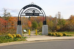
Renwick Brook Park is an urban park located in the community of Glace Bay, part of the Cape Breton Regional Municipality in Nova Scotia, Canada. The park includes over 4 kilometres (2.5 mi) of walking trails spread through an area of over 10 hectares, winding along a quiet brook. The park is adjacent to both the Cameron Bowl Ball Park and Queen Elizabeth Park, which all together make up a green space of more than 17 hectares in downtown Glace Bay.

Sydney Academy is one of two main secondary schools, along with Riverview Rural High School, that service the city of Sydney, Nova Scotia. Its current building, at 49 Terrace Street, is an educational facility opened in 1959, and is the sixth building to house the school. It is the oldest school in the Sydney area, and once was a private school near the end of the 19th century. The Academy is the Cape Breton Regional Municipality's (CBRM) only school to offer the International Baccalaureate (IB) program, which began in the summer of 1987.

<span class="mw-page-title-main">Ben Eoin</span> Unincorporated community in Nova Scotia, Canada

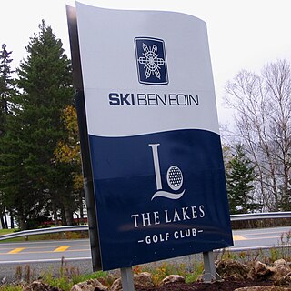
Ben Eoin is a community in the Canadian province of Nova Scotia, located in the Cape Breton Regional Municipality.

Wreck Cove is the largest hydroelectric system in Nova Scotia with a generating capacity of 215.8 MW. Constructed from 1975 to 1978, south of the Cape Breton Highlands National Park, Wreck Cove collects drainage water from 216 square kilometres (83 sq mi) of the Cape Breton Highlands plateau to generate renewable electricity. It consists of two generating stations: the Gisborne Generating Station, with an installed capacity of 3.5 MW, and the Wreck Cove Generating Station, with an installed capacity of 212 MW, producing on average 318 GWh annually—enough energy to power about 30,000 homes.

<span class="mw-page-title-main">Botany Water Reserves</span> Historic site in New South Wales, Australia

The Botany Water Reserves are a heritage-listed former water supply system and now parkland and golf course at 1024 Botany Road, Mascot, Bayside Council, Sydney, New South Wales, Australia. It was designed by City Engineers, W. B. Rider, E. Bell (1856–1871), and Francis Bell (1871–1878). It is also known as Botany Dams, Botany Swamps, Botany Wetlands, Mill Stream, Bridge Pond, Lakes Golf Course, Eastlakes Golf Course, Bonnie Doon Golf Course, and Astrolabe Park. The property is owned by Sydney Water, an agency of the Government of New South Wales. It was added to the New South Wales State Heritage Register on 18 November 1999.

<span class="mw-page-title-main">Woollahra Reservoir</span> Historic site in New South Wales, Australia

The Woollahra Reservoir or WS022 is a heritage-listed underground reservoir at 5R Oxford Street, Centennial Park, New South Wales, Australia. It was designed and built by the NSW Public Works Department. The property is owned by Sydney Water. A sign attached to a building on the site states that this is known as "Centennial Park number 1 Water Reservoir Underground WS0022". The reservoir is adjacent to Centennial Park Reservoir. This reservoir is closer to York Street than Centennial Park Reservoir. The area is enclosed by a high fence and a sign on the main gate states: WARNING KEEP OUT" and that trespassers may be prosecuted.

<span class="mw-page-title-main">Wentworth Park, Nova Scotia</span> Urban park in Sydney, Nova Scotia, Canada

Wentworth Park is a Canadian urban park located in the community of Sydney, part of Nova Scotia's Cape Breton Regional Municipality. The park was created in 1786, just a year after Sydney's founding, making it the oldest of Sydney's parks. Wentworth Park incorporates the Kiwanis Bandshell, a playground, fountains, and a splash pad, as well as a 1.2 kilometres (0.75 mi) network of paved paths surrounding the park's ponds and flower beds.

<span class="mw-page-title-main">Cromarty Tennis Club</span> Tennis club in Sydney, Nova Scotia, Canada

Cromarty Tennis Club is a private tennis club situated in the community of Sydney, part of Nova Scotia's Cape Breton Regional Municipality. Cromarty Tennis Club is one of the oldest tennis clubs in Nova Scotia, established at its present location along Reservoir Brook, in Sydney in 1902. The club's address is 65 Cromarty Street, Sydney. Cromarty Tennis Club is a member of Tennis Nova Scotia.

Theodore Reservoir is a man-made reservoir along the course of the Whitesand River in the Canadian province of Saskatchewan. The lake was formed with the building of Theodore Dam in 1964. The reservoir and dam were named after the nearby community of Theodore. Whitesand River is the primary inflow and outflow for the reservoir. Lawrie Creek, which begins in the Beaver Hills, flows into the lake on the western side near the dam.

References

  1. 1 2 "Cape Breton Regional Municipality's Walking Trails & Outdoor Spaces" (PDF). Cape Breton Regional Municipality. p. 5. Retrieved 2 May 2020.
  2. 1 2 "CBRM tender for Greenlink Trail closes on Sept. 12". Cape Breton Post. SaltWire Network. 5 September 2019. Retrieved 2 May 2020.
  3. "Reservoir Brook". Canadian Geographical Names Data Base (CGNDB). Natural Resources Canada. Retrieved 10 May 2020.
  4. Nova Scotia Geographical Names - Reservoir Brook (includes map), Government of Nova Scotia, retrieved 10 May 2020
  5. "Rotary Park going to the dogs for one-year trial". Cape Breton Post. SaltWire Network. 10 June 2013. Retrieved 3 May 2020.
  6. "Off Leash Dog Park". Cape Breton Regional Municipality. Retrieved 2 May 2020.
  7. 1 2 Jala, David (25 October 2017). "CBRM opens new disc golf course in Sydney's Rotary Park". Cape Breton Post. SaltWire Network. Retrieved 2 May 2020.
  8. "Rotary Park Disc Golf Course". PDGA. Professional Disc Golf Association. Retrieved 2 May 2020.
  9. Greenlink Trail Wentworth Creek Dam. Interpreative Panel at Shandwick Street Entrance: Cape Breton Regional Municipality.
  10. "Rotary Reporter". The Rotarian. Rotary International. 90 (6): 44. June 1957. ISSN   0035-838X . Retrieved 2 May 2020.
  11. "CBRM Active Transportation Plan" (PDF). CBRM Active Transportation. August 2008. p. 83. Retrieved 3 May 2020.
  12. "PROFILE - GREENLINK PARK SOCIETY". Registry of Joint Stock Companies. Province of Nova Scotia. Retrieved 3 May 2020. GREENLINK PARK SOCIETY Incorporated: 1999-07-15
  13. "CBRM Active Transportation Plan" (PDF). CBRM Active Transportation. August 2008. p. 83. Retrieved 3 May 2020.
  14. "Region draws up plans galore". Cape Breton Post. Saltwire Network. 11 May 2010. Retrieved 3 May 2020.
  15. McCready, Rick. "The Greenlink Trail System". MyoneNS. Planning & Development CBRM. Retrieved 2 May 2020.
  16. Chris, Shannon (19 January 2012). "You Said It". Cape Breton Post. SaltWire Network. Retrieved 2 May 2020.
  17. "Access to Greenlinks Trail/Rotary Park". Cape Breton Connect.ca. Recreation Nova Scotia. 3 September 2019. Retrieved 2 May 2020.