
Fredericton is the capital city of the Canadian province of New Brunswick. The city is situated in the west-central portion of the province along the Saint John River, also known by its Indigenous name of Wolastoq, which flows west to east as it bisects the city. The river is the dominant natural feature of the area. One of the main urban centres in New Brunswick, the city had a population of 63,116 and a metropolitan population of 108,610 in the 2021 Canadian census. It is the third-largest city in the province after Moncton and Saint John.

The Trans Canada Trail, officially named the Great Trail between September 2016 and June 2021, is a cross-Canada system of greenways, waterways, and roadways that stretches from the Atlantic to the Pacific to the Arctic oceans. The trail extends over 24,000 km (15,000 mi); it is now the longest recreational, multi-use trail network in the world. The idea for the trail began in 1992, shortly after the Canada 125 celebrations. Since then it has been supported by donations from individuals, corporations, foundations, and all levels of government.

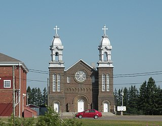
Perth-Andover is a former village in Victoria County, New Brunswick, Canada. It held village status prior to 2023. It is now part of the village of Southern Victoria.

Mount Carleton, at 820 metres (2,690 ft), is the highest peak in the Canadian province of New Brunswick, and the Maritime Provinces. Located in Mount Carleton Provincial Park, it is one of the highlights of the Canadian portion of the International Appalachian Trail. Mount Carleton is also part of the eighth and final section of the Nepisiguit Mi'gmaq Trail. The mountain was named after Thomas Carleton, New Brunswick's first lieutenant governor, and forms part of the Notre Dame Mountains chain, which is visible on Map 24 of the NB Atlas.
Deer Island is one of the Fundy Islands in the Bay of Fundy, Canada. It is at the entrance to Passamaquoddy Bay. The island was first settled by colonists around 1770.

The International Appalachian Trail was originally a hiking trail which ran from Katahdin Woods and Waters National Monument, in Maine, through New Brunswick, to the Gaspé Peninsula of Quebec, after which it followed a ferry route to Newfoundland, and then continued to the northern-easternmost point of the Appalachian Mountains at Belle Isle, Newfoundland and Labrador. As of July 2020, there are widely geographically dispersed IAT-branded walking trails in Greenland, Iceland, Norway, Sweden, Denmark, Scotland, Northern Ireland, Ireland, Isle of Man, Wales, England, Spain, Portugal, and Morocco.

New Brunswick Power Corporation, operating as NB Power, is the primary electric utility in the Canadian province of New Brunswick. NB Power is a vertically-integrated Crown corporation by the government of New Brunswick and is responsible for the generation, transmission, and distribution of electricity. NB Power serves all the residential and industrial power consumers in New Brunswick, with the exception of those in Saint John, Edmundston and Perth-Andover who are served by Saint John Energy, Energy Edmundston, and the Perth-Andover Electric Light Commission, respectively.

Canterbury is a former village in York County, in the Canadian province of New Brunswick. It held village status prior to 2023 and is now part of the village of Lakeland Ridges. The community is west of the Trans-Canada Highway at the intersection of Route 122 and Route 630.

Riverside-Albert is a disincorporated village in Fundy Albert, New Brunswick, Canada. It resides in the geographic parish of Hopewell in Albert County.

St. Martins is a community on the Bay of Fundy now part of the village of Fundy-St. Martins, Canada.

The Fredericton Railway Bridge is a former railway bridge in Fredericton, New Brunswick, Canada now used to carry pedestrians and cyclists.
Simpson Hills is a cluster of ridges and nunataks located at the head of Gruening Glacier, 6 nautical miles (11 km) northwest of Owen Peak, on the Black Coast, Palmer Land. The feature was mapped by the United States Geological Survey (USGS) from U.S. Navy air photos, 1966–69, and was visited by a British Antarctic Survey (BAS)-USGS joint field party, 1986–87. Named by Advisory Committee on Antarctic Names (US-ACAN) after Anthony R. Simpson, BAS general assistant, a member of the BAS-USGS field party.
Inkerman is a community in the Canadian province of New Brunswick on Inkerman Lake. It is located mainly on Route 113.
The Irving Group of Companies is an informal name given to those companies owned and controlled by the Irving family of New Brunswick—descendants of Canadian industrialist K.C. Irving: his sons James K. (1928–2024), Arthur (1930–2024), and John (1932–2010), and their respective children.

Oromocto is a Canadian town in Sunbury County, New Brunswick.
Shogomoc River Pedestrian Bridge is a 265-foot suspension bridge in Lakeland Ridges, New Brunswick. It officially opened in October 2011. It is part of the Trans Canada Trail and the Sentier NB Trail network. Sentier NB Trail provided $305,000 toward the project. It is known as the final non-motorized trail link between the town of Grand Bay–Westfield and the border of the province of Quebec.

The Dobson Trail is a 57.75 km hiking trail that runs from Riverview, New Brunswick to Fundy National Park. The trail is named for Dr. Art Dobson, who started the initiative to build the trail in 1959. The trail is the longest volunteer-maintained trail in Eastern Canada.

The Sentier Nepisiguit Mi'gmaq Trail is a 147 kilometre wilderness hiking and backpacking trail in New Brunswick, Canada that follows the Nepisiguit River from the Daly Point’s Nature Reserve in Bathurst to Mount Carleton Provincial Park. Officially opened for hiking in 2018, the trail is a recommissioned ancient Mi'gmaq portage route and is one of the eleven signature hiking trails in New Brunswick.
Lakeland Ridges is a village municipality in the Canadian province of New Brunswick. The jurisdiction was formed through the 2023 New Brunswick local governance reforms which saw the consolidation of local government entities into regions or districts.
