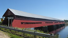
The Trans Canada Trail, officially named the Great Trail between September 2016 and June 2021, is a cross-Canada system of greenways, waterways, and roadways that stretches from the Atlantic to the Pacific to the Arctic oceans. The trail extends over 24,000 km (15,000 mi); it is now the longest recreational, multi-use trail network in the world. The idea for the trail began in 1992, shortly after the Canada 125 celebrations. Since then it has been supported by donations from individuals, corporations, foundations, and all levels of government.
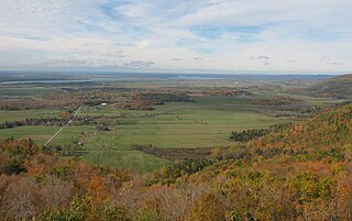
The Ottawa Valley is the valley of the Ottawa River, along the boundary between Eastern Ontario and the Outaouais, Quebec, Canada. The valley is the transition between the Saint Lawrence Lowlands and the Canadian Shield. Because of the surrounding shield, the valley is narrow at its western end and then becomes increasingly wide as it progresses eastward. The underlying geophysical structure is the Ottawa-Bonnechere Graben. Approximately 1.3 million people reside in the valley, around 80% of whom reside in Ottawa. The total area of the Ottawa Valley is 2.4 million ha. The National Capital Region area has just over 1.4 million inhabitants in both provinces.

Fort Coulonge is a village in the Pontiac Regional County Municipality in western Quebec, Canada, at the mouth of the Coulonge River. It is the francophone centre of the otherwise largely (57%) anglophone Pontiac MRC, with 79.6% listing French as their mother tongue in the Canada 2006 Census.
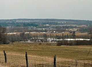
Mansfield-et-Pontefract is a municipality in the Pontiac Regional County Municipality of western Quebec, Canada. It is located on the Ottawa River, northwest of Gatineau. It is the most populated municipality in the Pontiac Regional County Municipality, with most of the population and businesses concentrated along Quebec Route 148.
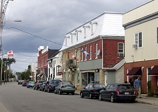
Shawville is a town located in the Pontiac Regional County Municipality in the administrative region of Outaouais in western Quebec, Canada.

The Coulonge River is a predominantly wilderness river in western Quebec, Canada.
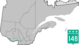
Route 148 is an east-west highway in Quebec, Canada. It runs from junction of Autoroute 13 and Autoroute 440 in Laval in the Montreal region to the Ontario-Quebec border in L'Isle-aux-Allumettes in western Quebec. For most of its length, Route 148 follows the north shore of the Ottawa River where it acted as the principal route between communities in the Outaouais region until the completion of Autoroute 50 in 2012. At the Ontario-Quebec border in L'Isle-aux-Allumettes Route 148 continues into Ontario as Highway 148.
The Ottawa, Arnprior and Parry Sound Railway, or OA&PS, is a historic railway that operated in central and eastern Ontario, Canada from 1897 until 1959. It was, for a time, the busiest railway route in Canada, carrying both timber and wood products from today's Algonquin Provincial Park areas, as well as up to 40% of the grain traffic from the Canadian west from Depot Harbour at Parry Sound through to the St. Lawrence River valley.
Saskatchewan has a transportation infrastructure system of roads, highways, freeways, airports, ferries, pipelines, trails, waterways, and railway systems serving a population of approximately 1,132,505 inhabitants year-round.

Portage-du-Fort is a village municipality in the Pontiac Regional County Municipality in the southwest corner of the Outaouais region of Quebec, Canada. The village lies across the Ottawa River from Chenaux, Ontario and Horton, Ontario.

Waltham, also known as Waltham Station is a village and municipality in the Outaouais region, Quebec, Canada, part of the Pontiac Regional County Municipality. It is located at the mouth of the Noire River, along the north shore of the Ottawa River at Allumette Island.

Sheenboro is a village and municipality in the Outaouais region, part of the Pontiac Regional County Municipality, Quebec, Canada. It was formerly known as Sheen-Esher-Aberdeen-et-Malakoff. Its territory stretches along the north shore of the Ottawa River from Chichester to Rapides-des-Joachims.

L'Isle-aux-Allumettes is a municipality in the Outaouais region, part of the Pontiac Regional County Municipality, Quebec, Canada. The municipality consists primarily of Allumette Island, and also includes Morrison Island, Marcotte Island, and some minor islets, all in the Ottawa River north of Pembroke.

L'Île-du-Grand-Calumet is a municipality in the Outaouais region, part of the Pontiac Regional County Municipality, Quebec, Canada. The municipality consists primarily of Calumet Island, but also includes Lafontaine Island, French Island, Green Island, and numerous minor surrounding islets, all in the Ottawa River, approximately two kilometres from Campbell's Bay, two kilometres from Bryson.

Esprit Lodge & Rafting is a lodge and hostel accommodation near Fort Coulonge, a village in the Pontiac Regional County Municipality in Quebec, Canada. It is used in conjunction with whitewater rafting tours offered by the company. The main lodge was destroyed in a fire in 2016; however, the company has acquired additional accommodation options.

The Coulonge Chutes is a non-profit recreation park and historical exhibition area operating in Mansfield-et-Pontefract, in the Pontiac Regional County Municipality of western Quebec, Canada. Its main attraction is the 42 meters (138 ft) high Grandes Chutes waterfall of the Coulonge River and 100 meters (330 ft) long cement log slide.

George Bryson was a Scottish-born businessman and political figure in Quebec.

The Thousand Islands Railway was an 8 km (5.0 mi) long railway running from the town of Gananoque north to the Grand Trunk Railway Toronto-Montreal mainline, just south of present-day Cheeseborough. The service ran for 111 years between 1884 and 1995. The rails were removed in October 1997.

Cycling in Canada is experienced in various ways across a geographically huge, economically and socially diverse country. Among the reasons for cycling in Canada are for practical reasons such as commuting to work or school, for sports such as road racing, BMX, mountain bike racing, freestyle BMX, as well as for pure recreation. The amount and quality of bicycle infrastructure varies widely across the country as do the laws pertaining to cyclists such as bicycle helmet laws which can differ by province.

