Related Research Articles

A trail is usually a path, track or unpaved lane or road. In the United Kingdom and the Republic of Ireland, path or footpath is the preferred term for a walking trail. The term is also applied in North America to routes along rivers, and sometimes to highways. In the US, the term was historically used for a route into or through wild territory used by emigrants. In the USA "trace" is a synonym for trail, as in Natchez Trace. Some trails are single use and can be used only for walking, cycling, horse riding, snowshoeing and cross-country skiing; others, as in the case of a bridleway in the UK, are multi-use, and can be used by walkers, cyclists and equestrians. There are also unpaved trails used by dirt bikes and other off-road vehicles, and in some places, like the Alps, trails are used for moving cattle and other livestock.

The Trans Canada Trail, officially named The Great Trail between September 2016 and June 2021, is a cross-Canada system of greenways, waterways, and roadways that stretches from the Atlantic to the Pacific to the Arctic oceans. The trail extends over 24,000 km (15,000 mi); it is now the longest recreational, multi-use trail network in the world. The idea for the trail began in 1992, shortly after the Canada 125 celebrations. Since then it has been supported by donations from individuals, corporations, foundations, and all levels of government.

Elk Point is a town located in east-central Alberta, Canada. It is located on Highway 41.

A rail trail is a shared-use path on railway right of way. Rail trails are typically constructed after a railway has been abandoned and the track has been removed, but may also share the right of way with active railways, light rail, or streetcars, or with disused track. As shared-use paths, rail trails are primarily for non-motorized traffic including pedestrians, bicycles, horseback riders, skaters, and cross-country skiers, although snowmobiles and ATVs may be allowed. The characteristics of abandoned railways—gentle grades, well-engineered rights of way and structures, and passage through historical areas—lend themselves to rail trails and account for their popularity. Many rail trails are long-distance trails, while some shorter rail trails are known as greenways or linear parks.

The Iron Horse Regional Trail is a rail trail for pedestrians, horse riders and bicycles in the East Bay Area in California.
Mallaig is a hamlet in Alberta, Canada within the County of St. Paul No. 19. It is located approximately 200 kilometres (120 mi) northeast of Edmonton.

Locomotion, previously known as Locomotion: the National Railway Museum at Shildon or Shildon Locomotion Museum is a railway museum in Shildon, County Durham, England. The museum is part of the Science Museum Group.

Iron Horse State Park, part of the Washington State Park System, is a 1,612-acre (7 km2) state park located in the Cascade Mountains and Yakima River Valley, between Cedar Falls on the west and the Columbia River on the east.
Iron Horse Trail may refer to:

The Palouse to Cascades State Park Trail, formerly known as the John Wayne Pioneer Trail and the Iron Horse Trail, is a rail trail that spans most of the U.S. state of Washington. It follows the former railway roadbed of the Chicago, Milwaukee, St. Paul & Pacific Railroad for 300 miles (480 km) across two-thirds of the state, from the western slopes of the Cascade Mountains to the Idaho border.

The Iron Horse Trail is a multi-use urban rail trail which connects the cities of Waterloo and Kitchener, Ontario, Canada. It runs from Erb Street West in the north near Uptown Waterloo, to Ottawa Street South in Kitchener to the south. It covers a distance of 5.5 kilometres (3.4 mi). The trail was opened on 5 October 1997 on abandoned Canadian Pacific Railway right of way sections, including portions of the right-of-way of the now-defunct Grand River Railway. The two cities combined resources to purchase the property. It is a part of the Trans Canada Trail.
Transportation in Saskatchewan is the movement of people and goods from one place to another within the province. Transportation in Saskatchewan includes an infrastructure system of roads, highways, freeways, airports, ferries, pipelines, trails, waterways, and railway systems serving a population of approximately 1,098,352 inhabitants year-round.
The Calgary and Edmonton Railway (C&E) was an early pioneer railway in what was then the Northwest Territories, now Alberta, Canada. It connected the towns of Calgary and Strathcona. Construction started in April 1890 and it opened August 1891. The line was the first major transportation connection for the isolated Edmonton settlement, and the development of the line was responsible for the creation of many railway towns along the line such as Red Deer and Wetaskiwin. It supplanted the Calgary and Edmonton Trail as the busiest transportation route along the Calgary–Edmonton Corridor.

A long-distance trail is a longer recreational trail mainly through rural areas used for hiking, backpacking, cycling, horse riding or cross-country skiing. They exist on all continents except Antarctica.
"Iron horse" is a literary term for a train or locomotive.
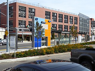
Queen is a stop on the Region of Waterloo's Ion rapid transit system. It is located alongside Charles Street, just east of Queen Street, in Kitchener. It opened in 2019.

The Spurline Trail is a multi-use urban rail with trail which connects the cities of Waterloo and Kitchener, Ontario, Canada. Its northern trailhead is at the point where the CN Waterloo Spur crosses Laurel Creek; it connects to the Laurel Trail there, and is close to Uptown Waterloo. Its southern trailhead is at Ahrens Street West near its intersection with Breithaupt Street, close to Kitchener station and downtown Kitchener. The trail is 2.4 kilometres (1.5 mi) long, the entirety of which is paved. For its whole length, the trail runs parallel and to the north of the CN Waterloo Spur, stopping just short of where the Waterloo Spur joins the GO Transit Guelph Subdivision mainline at a junction just east of Kitchener station.
References
- ↑ MacArthur, Mary (February 7, 2008). "Alta. trail adds transport, tourism options". The Western Producer. Retrieved February 19, 2015.
- ↑ Elves, Joanne (May 5, 2009). "Riding the Iron Horse Trail". Calgary Herald. Retrieved February 19, 2015.