Macdonald, Meredith and Aberdeen Additional

Last updated

Macdonald, Meredith and Aberdeen Additional
Township of Macdonald, Meredith and Aberdeen Additional
MMAA Twp ON.JPG
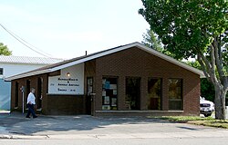
Municipal office in Echo Bay
Canada Ontario location map 2.svg
Red pog.svg
MMAA
Coordinates: 46°29′N84°04′W / 46.483°N 84.067°W / 46.483; -84.067
Country Canada
Province Ontario
District Algoma
Settledmid 19th century
Incorporated1899
Government
  TypeTownship
  MayorLynn Watson
   MP Terry Sheehan (Liberal)
   MPP Bill Rosenberg (PC)
Area
[1]
  Land163.26 km2 (63.04 sq mi)
Population
 (2021) [1]
  Total
1,513
  Density9.3/km2 (24/sq mi)
Time zone UTC-5 (EST)
  Summer (DST) UTC-4 (EDT)
Postal Code
P0S 1C0
Area codes 705, 249
Website echobay.ca OOjs UI icon edit-ltr-progressive.svg
The Big Loonie in Echo Bay. Big loonie.jpg
The Big Loonie in Echo Bay.

Macdonald, Meredith and Aberdeen Additional is a township in Algoma District, Ontario, Canada. Originally surveyed as separate geographical townships, Macdonald and Meredith were incorporated as a single, municipal township in 1892. The geographical township of Aberdeen Additional was added to Macdonald and Meredith township in 1899 to create the municipal township of Macdonald, Meredith and Aberdeen Additional. [2]

Contents

Macdonald township was named after John A. Macdonald, while Meredith township was named after William Ralph Meredith. [2]

Communities

The township encompasses the unincorporated communities of Echo Bay ( 46°29′08″N84°04′02″W / 46.48556°N 84.06722°W / 46.48556; -84.06722 ), [3] Echo River ( 46°30′35″N84°02′15″W / 46.50972°N 84.03750°W / 46.50972; -84.03750 ), [4] and Sylvan Valley ( 46°28′15″N83°59′22″W / 46.47083°N 83.98944°W / 46.47083; -83.98944 ). [5]

Echo Bay, the township's main population centre, is located on the shores of the eponymous Echo Bay and Lake George. The community is home to a big loonie, similar to the Big Nickel in Sudbury, around 260 kilometres (160 mi) eastward. Robert-Ralph Carmichael, one of the Canadian dollar coin's designers, lived near Echo Bay.

Bar River ( 46°26′30″N84°01′34″W / 46.44167°N 84.02611°W / 46.44167; -84.02611 ) [6] is a small hamlet straddling the boundary between the townships of Macdonald, Meredith and Aberdeen Additional and Laird.

Demographics

In the 2021 Census of Population conducted by Statistics Canada, Macdonald, Meredith and Aberdeen Additional had a population of 1,513 living in 603 of its 803 total private dwellings, a change of −6% from its 2016 population of 1,609. With a land area of 163.26 km2 (63.04 sq mi), it had a population density of 9.3/km2 (24.0/sq mi) in 2021. [1]

Canada census – Macdonald, Meredith and Aberdeen Additional community profile
2021 2016 2011
Population1,513 (−6.0% from 2016)1,609 (9.9% from 2011)1,464 (−5.5% from 2006)
Land area163.26 km2 (63.04 sq mi)164.05 km2 (63.34 sq mi)163.52 km2 (63.14 sq mi)
Population density9.3/km2 (24/sq mi)9.8/km2 (25/sq mi)9.0/km2 (23/sq mi)
Median age45.6 (M: 44.8, F: 46.0)45.3 (M: 43.0, F: 46.2)
Private dwellings803 (total)  603 (occupied)860 (total) 797 (total) 
Median household income$97,000$74,496
References: 2021 [7] 2016 [8] 2011 [9]

See also

References

  1. 1 2 3 4 "Macdonald, Meredith and Aberdeen Additional (Code 3557051) Census Profile". 2021 census . Government of Canada - Statistics Canada . Retrieved 2025-12-22.
  2. 1 2 "History". echobay.ca. Township of Macdonald, Meredith & Aberdeen Additional. Retrieved 22 December 2025.
  3. "Echo Bay". Geographical Names Data Base . Natural Resources Canada . Retrieved 22 December 2025.
  4. "Echo River". Geographical Names Data Base . Natural Resources Canada . Retrieved 22 December 2025.
  5. "Sylvan Valley". Geographical Names Data Base . Natural Resources Canada . Retrieved 22 December 2025.
  6. "Bar River". Geographical Names Data Base . Natural Resources Canada . Retrieved 22 December 2025.
  7. "2021 Community Profiles". 2021 Canadian census . Statistics Canada. February 4, 2022. Retrieved 2023-10-19.
  8. "2016 Community Profiles". 2016 Canadian census . Statistics Canada. August 12, 2021. Retrieved 2017-10-11.
  9. "2011 Community Profiles". 2011 Canadian census . Statistics Canada. March 21, 2019. Retrieved 2012-02-17.
  10. "Macdonald, Meredith and Aberdeen Additional census profile". 2016 Census of Population . Statistics Canada. Retrieved 2017-10-11.
  11. "1971 Census of Canada - Population Census Subdivisions (Historical)". Catalogue 92-702 Vol I, part 1 (Bulletin 1.1-2). Statistics Canada. July 1973.