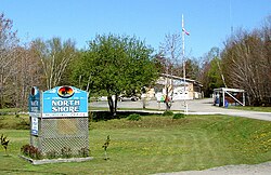
The Township of The North Shore was established as an Improvement District in March 1973. In 1978, the first municipal elections were held, with Craege McQuarrie elected as first reeve. In 1985, the Town of Spanish split off from the North Shore to become a separate municipality.[2]
Algoma Mills was founded in 1860 when a mill was built at the mouth of the Lauzon Creek by Alfred Lauzon, who also built a wharf, tramway, dam, and a log slide, as well as houses for him and his workers. By 1881, the mill was property of the Canadian Pacific Railway that used the site for the construction and operation of their railroad to Sudbury. From 1905 to 1910, Algoma Mills was CPR's major transshipment port for coal. 200,000 tons of coal arrived there annually to be shipped by rail to North Bay, Sudbury, Sault Ste. Marie, Cartier, and Mactier. In 1927, the CPR closed the Algoma Mills station.[4]
Originally known as Cook's Mills, Spragge (46°12′30″N82°39′35″W / 46.20833°N 82.65972°W / 46.20833; -82.65972)[7] was established in 1882 when the Cook Brothers Lumber Company built a sawmill at this location. The mill operated until 1906 when it was sold to Waldie Brothers Lumber Company. With the mill no longer in Cook's ownership, Spragge (the original name of the township in which it is located[8]), was adopted as the name of the community. Waldie Brothers in turn sold the mill to McFadden and Malloy in 1913.[4]
Over time a small village with a school, hotel, barbershop, general store was created, and by 1926 the community had a population of about 300 people. Sawmill activity was terminated in Spragge in the early 1930s following a disastrous fire, which eliminated the mill, lumber inventory, docks and most of the town. The town subsequently revived with the discovery of uranium and copper deposits in the area, leading to a thriving mining industry.[4]
Demographics
In the 2021 Census of Population conducted by Statistics Canada, The North Shore had a population of 531 living in 249 of its 365 total private dwellings, a change of 6.8% from its 2016 population of 497. With a land area of 230.17km2 (88.87sqmi), it had a population density of 2.3/km2 (6.0/sqmi) in 2021.[1]
Canada census – The North Shore, Ontario community profile
This page is based on this Wikipedia article Text is available under the CC BY-SA 4.0 license; additional terms may apply. Images, videos and audio are available under their respective licenses.