Laird, Ontario

Last updated

Laird
Township of Laird
Hwy 17 Echo Bay.jpg
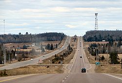
Highway 17 through Laird Township
Canada Ontario location map 2.svg
Red pog.svg
Laird
Coordinates: 46°23′N84°04′W / 46.383°N 84.067°W / 46.383; -84.067
CountryCanada
Province Ontario
District Algoma
Settled1874
Incorporated1891
Government
  MayorShawn Evoy
   MP Terry Sheehan (Liberal)
   MPP Bill Rosenberg (PC)
Area
[1]
  Land103.25 km2 (39.87 sq mi)
Population
 (2021) [1]
  Total
1,121
  Density10.9/km2 (28/sq mi)
Time zone UTC-5 (EST)
  Summer (DST) UTC-4 (EDT)
Postal Code
P0S
Area codes 705, 249
Website www.lairdtownship.ca OOjs UI icon edit-ltr-progressive.svg

Laird is a township and village in the Algoma District in Northern Ontario, Canada. The township had a population of 1,121 in the 2021 Canadian census, up from 1,047 in the 2016 census.

Contents

The township is named after David Laird. [2]

Communities

The township includes the named communities of Laird ( 46°23′52″N84°03′33″W / 46.39778°N 84.05917°W / 46.39778; -84.05917 ) [3] and Neebish ( 46°21′23″N84°06′21″W / 46.35639°N 84.10583°W / 46.35639; -84.10583 ). [4] It also includes a portion of Bar River, a small hamlet straddling the boundary between the townships of Laird and Macdonald, Meredith and Aberdeen Additional.

Demographics

In the 2021 Census of Population conducted by Statistics Canada, Laird had a population of 1,121 living in 470 of its 560 total private dwellings, a change of 7.1% from its 2016 population of 1,047. With a land area of 103.25 km2 (39.87 sq mi), it had a population density of 10.9/km2 (28.1/sq mi) in 2021. [1]

Canada census – Laird community profile
2021 2016 2011
Population1,121 (+7.1% from 2016)1,047 (-0.9% from 2011)1,057 (-1.9% from 2006)
Land area103.25 km2 (39.87 sq mi)102.48 km2 (39.57 sq mi)102.43 km2 (39.55 sq mi)
Population density10.9/km2 (28/sq mi)10.2/km2 (26/sq mi)10.3/km2 (27/sq mi)
Median age50.4 (M: 49.2, F: 50.8)48.1 (M: 47.5, F: 48.7)
Private dwellings560 (total)  470 (occupied)527 (total) 610 (total) 
Median household income$103,000$87,680
References: 2021 [5] 2016 [6] 2011 [7]

Transportation

Highway 17 passes through the township. Tarbutt is a neighbour of Laird and is separated by a low-grade dirt road called "Townline Road" which spurs into a road to Pine Island.

See also

References

  1. 1 2 3 4 "Laird, Ontario (Code 3557011) Census Profile". 2021 census . Government of Canada - Statistics Canada . Retrieved 2025-12-22.
  2. "Laird Township History". lairdtownship.ca. Laird Township. Retrieved 22 December 2025.
  3. "Laird". Geographical Names Data Base . Natural Resources Canada . Retrieved 22 December 2025.
  4. "Neebish". Geographical Names Data Base . Natural Resources Canada . Retrieved 22 December 2025.
  5. "2021 Community Profiles". 2021 Canadian census . Statistics Canada. February 4, 2022. Retrieved 2023-10-19.
  6. "2016 Community Profiles". 2016 Canadian census . Statistics Canada. August 12, 2021. Retrieved 2019-06-04.
  7. "2011 Community Profiles". 2011 Canadian census . Statistics Canada. March 21, 2019. Retrieved 2012-02-17.
  8. "Laird census profile". 2016 Census of Population . Statistics Canada. 8 February 2017. Retrieved 2019-06-04.
  9. Eighth Census of Canada 1941 - Volume II - Population by Local Subdivisions (Report). Dominion Bureau of Statistics. 1944. CS98-1941-2.
  10. "1971 Census of Canada - Population Census Subdivisions (Historical)". Catalogue 92-702 Vol I, part 1 (Bulletin 1.1-2). Statistics Canada. July 1973.