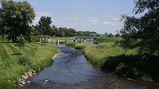
Montague is a township in eastern Ontario, Canada, in Lanark County on the Rideau River. The township administrative offices are located on Roger Stevens Drive east of Smiths Falls.
North Stormont is a lower tier township in eastern Ontario, Canada in the United Counties of Stormont, Dundas and Glengarry.

Seguin is a township in central Ontario, Canada, in the District of Parry Sound.

Laird is a township and village in the Algoma District in Northern Ontario, Canada. The township had a population of 1,047 in the Canada 2016 Census, down from 1,057 in the 2011 census.
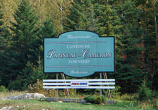
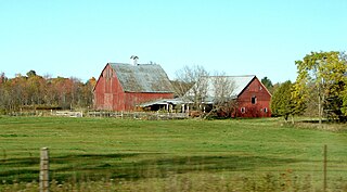
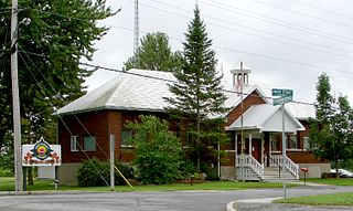
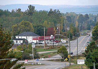
Papineau-Cameron is a township municipality in northeastern Ontario, Canada, in Nipissing District. The township is located on the south side of the Mattawa and Ottawa Rivers along Highway 17.
East Ferris is a township in northeastern Ontario, Canada located between Trout Lake and Lake Nosbonsing in the District of Nipissing. West Ferris has long been annexed into the city of North Bay.

Amaranth is a township located in Dufferin County, Ontario, Canada, with a 2021 population of 4,327. It is named after the plant which grows abundantly within its borders. It is bordered by Mono to the east and East Luther to the west.

Armstrong is a township in the Timiskaming District of Ontario. The only population centre in the township is the community of Earlton.
The Township of Howick is a municipality in Huron County, Ontario, Canada. It is located in the northeast corner of Huron County near the Bruce County border, east of Wingham.

Johnson is a township in the Canadian province of Ontario, located within the Algoma District. The township had a population of 751 in the Canada 2016 Census, up from 750 in the 2011 census.

Tehkummah is a township in the Canadian province of Ontario, located on Manitoulin Island.
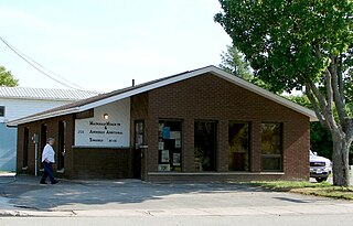
Macdonald, Meredith and Aberdeen Additional is a township in Algoma District, Ontario, Canada. Originally surveyed as separate geographical townships, Macdonald and Meredith were incorporated as a single, municipal township in 1892. The geographical township of Aberdeen Additional was added to Macdonald and Meredith township in 1899 to create the municipal township of Macdonald, Meredith and Aberdeen Additional.

Val Rita-Harty is a township municipality in Cochrane District in Northeastern Ontario, Canada.

Chapple is a township municipality in Rainy River District in Northwestern Ontario, Canada.
Mattawan is a municipality in the Canadian province of Ontario. Located in the Nipissing District, the municipality had a population of 161 in the Canada 2016 Census.
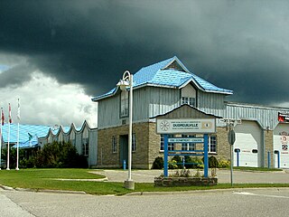
Dubreuilville is a township in the Canadian province of Ontario, located in the Algoma District. Established as a company town in 1961 by the Dubreuil Brothers lumber company, Dubreuilville was incorporated as a municipality in 1977.
Machin is a township in the Canadian province of Ontario, located in the Kenora District west of Dryden.

Coleman is a township municipality in the Canadian province of Ontario. It is situated in the Timiskaming District of Northeastern Ontario. The township had a population of 595 in the Canada 2016 Census.

Plummer Additional is a township and single tier municipality located in Algoma District in Northeastern Ontario, Canada. The township had a population of 660 in the Canada 2016 Census.

Enniskillen is a township in the Canadian province of Ontario, within Lambton County. It is located at the intersection of Highway 21 and Rokeby Line. The economy of the township is based on agriculture. It was named after Sir Galbraith Lowry Cole's father who was the Earl of Enniskillen, Northern Ireland.


