Georgian Bluffs

Last updated

Georgian Bluffs
Township of Georgian Bluffs
Georgian Bluffs ON.jpg
Grey locator map 2021.svg
Red pog.svg
Georgian Bluffs
Canada Southern Ontario location map 2.png
Red pog.svg
Georgian Bluffs
Coordinates: 44°39′N81°02′W / 44.650°N 81.033°W / 44.650; -81.033
CountryFlag of Canada (Pantone).svg  Canada
ProvinceFlag of Ontario.svg  Ontario
County Grey
FormedJanuary 1, 2001
Government
  MayorSue Carleton
  Federal riding Bruce—Grey—Owen Sound
  Prov. riding Bruce—Grey—Owen Sound
Area
[1]
  Land604.37 km2 (233.35 sq mi)
Population
 (2016) [1]
  Total10,479
  Density17.3/km2 (45/sq mi)
Time zone UTC-5 (EST)
  Summer (DST) UTC-4 (EDT)
Area code(s) 519, 226, 548
Website Township of Georgian Bluffs

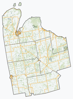
Georgian Bluffs is a township in southwestern Ontario, Canada, in Grey County located between Colpoy's Bay and Owen Sound on Georgian Bay.

Contents

The township was incorporated on January 1, 2001, by amalgamating the former townships of Derby, Keppel, and Sarawak, and the village of Shallow Lake.

History

The now-former township of Derby was surveyed by the prolific Crown land surveyor Charles Rankin in 1846. [2]

Communities

The township comprises the communities of Alvanley, Balmy Beach, Benallen, Big Bay, Clavering, Copperkettle, Cruickshank, East Linton, Hogg, Inglis Falls, Jackson, Keady, Kemble, Kilsyth, Lake Charles, Lindenwood, Oxenden, Shallow Lake, Shouldice, Springmount, Squire, Wolseley and Zion.

Demographics

In the 2021 Census of Population conducted by Statistics Canada, Georgian Bluffs had a population of 11,100 living in 4,495 of its 5,269 total private dwellings, a change of 5.9% from its 2016 population of 10,479. With a land area of 599.96 km2 (231.65 sq mi), it had a population density of 18.5/km2 (47.9/sq mi) in 2021. [3]

Canada census – Georgian Bluffs community profile
2021 2016 2011
Population11,100 (+5.9% from 2016)10,479 (0.7% from 2011)10,404 (-1.0% from 2006)
Land area599.96 km2 (231.65 sq mi)604.37 km2 (233.35 sq mi)604.36 km2 (233.34 sq mi)
Population density18.5/km2 (48/sq mi)17.3/km2 (45/sq mi)17.2/km2 (45/sq mi)
Median age51.2 (M: 50.4, F: 52.0)45.6 (M: 45.3, F: 45.9)
Private dwellings5,269 (total)  4,495 (occupied)5,069 (total) 4,896 (total) 
Median household income$94,000$77,861
References: 2021 [4] 2016 [5] 2011 [6] earlier [7] [8]
Historical population
YearPop.±%
1996 10,256    
2001 10,152−1.0%
2006 10,506+3.5%
2011 10,404−1.0%
2016 10,479+0.7%
[9] [6] [1]
2001 population would have been 10,127 using 2006 boundaries

See also

Related Research Articles

<span class="mw-page-title-main">Timiskaming District</span> District in Ontario, Canada

Timiskaming is a district and census division in Northeastern Ontario in the Canadian province of Ontario. The district was created in 1912 from parts of Algoma, Nipissing, and Sudbury districts. In 1921, Cochrane District was created from parts of this district and parts of Thunder Bay District.

<span class="mw-page-title-main">Georgian Bay, Ontario</span> Township in Ontario, Canada

The Township of Georgian Bay is an area municipality of the District Municipality of Muskoka, in south-central Ontario, Canada. It is located on the Severn River, where it empties into the eponymous Georgian Bay. The municipal offices are at Port Severn.

<span class="mw-page-title-main">Muskoka Lakes</span> Township in Ontario, Canada

The Township of Muskoka Lakes is a municipality of the District Municipality of Muskoka, Ontario, Canada. It has a year-round population of 6,588.

<span class="mw-page-title-main">Carling, Ontario</span> Township in Ontario, Canada

Carling is a township in Ontario, Canada, located in the District of Parry Sound on Georgian Bay. Killbear Provincial Park is located in the municipality.

<span class="mw-page-title-main">Lanark Highlands</span> Township in Ontario, Canada

Lanark Highlands is a township in eastern Ontario, Canada in Lanark County. The township administrative offices are located in the village of Lanark.

<span class="mw-page-title-main">Cochrane District</span> District in Ontario, Canada

Cochrane District is a district and census division in Northeastern Ontario in the Canadian province of Ontario. It was created in 1921 from parts of Timiskaming and Thunder Bay districts.

<span class="mw-page-title-main">The Archipelago</span> Township in Ontario, Canada

The Archipelago is a township in central Ontario, Canada, along the Georgian Bay in the Parry Sound District.

<span class="mw-page-title-main">Seguin, Ontario</span> Township in Ontario, Canada

Seguin is a township in central Ontario, Canada, in the District of Parry Sound.

<span class="mw-page-title-main">Grey County</span> County in Ontario, Canada

Grey County is a county of the Canadian province of Ontario. The county seat is in Owen Sound. It is located in the subregion of Southern Ontario named Southwestern Ontario. Grey County is also a part of the Georgian Triangle. At the time of the Canada 2016 Census the population of the county was 93,830.

<span class="mw-page-title-main">Nipissing District</span> District in Ontario, Canada

Nipissing District is a district in Northeastern Ontario in the Canadian province of Ontario. It was created in 1858. The district seat is North Bay.

<span class="mw-page-title-main">Thunder Bay District</span> District in Ontario, Canada

Thunder Bay District is a district and census division in Northwestern Ontario in the Canadian province of Ontario. The district seat is Thunder Bay.

<span class="mw-page-title-main">Tay, Ontario</span> Township in Ontario, Canada

Tay is a township in Central Ontario, Canada, located in Simcoe County in the southern Georgian Bay region. The township was named in 1822 after a pet dog of Lady Sarah Maitland (1792–1873), wife of Sir Peregrine Maitland, Lieutenant Governor of Upper Canada. Two other adjoining townships were also named for her pet dogs, Tiny and Flos.

<span class="mw-page-title-main">Meaford, Ontario</span> Municipality in Ontario, Canada

Meaford is a municipality in Grey County, Ontario, Canada located on Nottawasaga Bay, a sub-basin of Georgian Bay and Owen Sound Bay, in the traditional territory of the Saugeen Ojibway Nation in southern Ontario. The municipality's seal and motto reflect its heritage as a place of apple orchards, but in the 21st century the area has partly switched to weekend homes, seasonal homes, and lakeside tourism.

<span class="mw-page-title-main">Papineau-Cameron</span> Township in Ontario, Canada

Papineau-Cameron is a township municipality in northeastern Ontario, Canada, in Nipissing District. The township is located on the south side of the Mattawa and Ottawa Rivers along Highway 17.

<span class="mw-page-title-main">Shuniah</span> Municipality in Ontario, Canada

Shuniah is a municipal township bordering the city of Thunder Bay, Ontario, Canada on the east. Shuniah was incorporated by an act of the Ontario legislature in 1873, and at that time included much of present-day Thunder Bay and its predecessor and surrounding municipalities. It gradually shrunk in size until by 1936 it included only three wards, the geographic townships of McIntyre, McGregor, and McTavish. That year it had the Ontario Legislative Assembly remove a number of islands in Lake Superior that had formed the Island Ward since 1873. In 1970 McIntyre Township was amalgamated into the city of Thunder Bay. Shuniah, named after the Ojibwa word "zhooniyaa" for "money" or "silver", was settled largely due to silver mining potential identified in the mid-19th century.

<span class="mw-page-title-main">Central Manitoulin</span> Township in Ontario, Canada

Central Manitoulin is a township in the Canadian province of Ontario. It is located on Manitoulin Island and in Manitoulin District.

<span class="mw-page-title-main">Tehkummah</span> Township in Ontario, Canada

Tehkummah is a township in the Canadian province of Ontario, located on Manitoulin Island.

<span class="mw-page-title-main">Whitestone, Ontario</span> Municipality in Ontario, Canada

Whitestone is a municipality in the Canadian province of Ontario, as well as the name of a community within the municipality.

<span class="mw-page-title-main">Macdonald, Meredith and Aberdeen Additional</span> Township in Ontario, Canada

Macdonald, Meredith and Aberdeen Additional is a township in Algoma District, Ontario, Canada. Originally surveyed as separate geographical townships, Macdonald and Meredith were incorporated as a single, municipal township in 1892. The geographical township of Aberdeen Additional was added to Macdonald and Meredith township in 1899 to create the municipal township of Macdonald, Meredith and Aberdeen Additional.

<span class="mw-page-title-main">North Algona Wilberforce</span> Township municipality in Ontario, Canada

North Algona Wilberforce is a township municipality in Renfrew County, Ontario, Canada. It has a population of 2,873. The township was formed in 1999 when the North Algona and Wilberforce townships were amalgamated.

References

  1. 1 2 3 "Census Profile, 2016 Census: Georgian Bluffs, Township". Statistics Canada . Retrieved June 13, 2019.
  2. "Charles Rankin" (PDF). Association of Ontario Land Surveyors. Retrieved 23 January 2020.
  3. "Population and dwelling counts: Canada, provinces and territories, census divisions and census subdivisions (municipalities), Ontario". Statistics Canada. February 9, 2022. Retrieved April 2, 2022.
  4. "2021 Community Profiles". 2021 Canadian Census . Statistics Canada. February 4, 2022. Retrieved 2023-10-19.
  5. "2016 Community Profiles". 2016 Canadian Census . Statistics Canada. August 12, 2021. Retrieved 2017-07-27.
  6. 1 2 "2011 Community Profiles". 2011 Canadian Census . Statistics Canada. March 21, 2019. Retrieved 2012-03-16.
  7. "2006 Community Profiles". 2006 Canadian Census . Statistics Canada. August 20, 2019.
  8. "2001 Community Profiles". 2001 Canadian Census . Statistics Canada. July 18, 2021.
  9. Statistics Canada: 1996, 2001, 2006 census