Deseronto

Last updated

Deseronto
Town of Deseronto
Deseronto Ontario.JPG
Town Hall and Post Office
Canada Southern Ontario location map 2.png
Red pog.svg
Deseronto
Coordinates: 44°12′N77°03′W / 44.200°N 77.050°W / 44.200; -77.050
CountryFlag of Canada (Pantone).svg  Canada
ProvinceFlag of Ontario.svg  Ontario
County Hastings
Settled1784
Incorporated1871 (village)
Incorporated1889 (town)
Government
  TypeTown
  MayorDan Johnston
  Federal riding Hastings—Lennox and Addington
  Prov. riding Hastings—Lennox and Addington
Area
[1]
  Land2.51 km2 (0.97 sq mi)
Population
 (2016) [1]
  Total1,774
  Density705.7/km2 (1,828/sq mi)
Time zone UTC-5 (EST)
  Summer (DST) UTC-4 (EDT)
Postal Code
K0K
Area code 613
Website deseronto.ca

Deseronto is a town in the Canadian province of Ontario, in Hastings County, located at the mouth of the Napanee River on the shore of the Bay of Quinte, on the northern side of Lake Ontario.

Contents

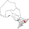
The town was named for Captain John Deseronto, a native Mohawk leader who was a captain in the British Military Forces during the American Revolutionary War. More extensive development began with sale of village tracts by Deseronto's grandson John Culbertson in 1837. The Mohawk of the nearby Tyendinaga Mohawk Territory originally controlled the townsite as well. This is the most easterly municipality of Hastings County. It was a center of industry related to timber and mineral resources until the 1930s.

In the 21st century, Deseronto, located 5 km from Highway 401, is the eastern gateway to the Bay of Quinte tourist region, with the Skyway Bridge providing access to Prince Edward County. In 1995 the Mohawk submitted its Culbertson Tract land claim to the Canadian government, which included much of the Deseronto townsite. This has provoked considerable controversy. Negotiations on this claim have been underway with the government since 2003. In June 2013 the Federal Court of Canada issued a ruling that was a declaration of federal policy, noting that expropriation of land by payment to existing property owners was among the legal alternatives for settling the land claim, together with compensation payments and acquisition of other lands for the Mohawk.

History

The area was acquired by the British Government from the Mississauga people just after the American Revolution for resettlement of loyalists from the colonies. The Crown granted the land to Loyalists and Mohawk who had supported the British during this war. In 1784, a group of twenty Mohawk families led by Captain John Deserontyon (aka Deseronto) (c.17401811) became the first settlers. They founded what became the reserve now known as Tyendinaga Mohawk Territory, which originally included the town territory. The Crown personally granted Deseronto a lump sum payment of about £800 for his losses, 3,000 acres (12 km2) of land, and an annual pension of £45.

Deserontyon's grandson, John Culbertson, inherited the chief's property in what is now the townsite of Deseronto. In 1837, Culbertson was granted individual title to the land by the Upper Canada government. He built a wharf on the waterfront, and sold village lots in his tract to non-natives. A settlement began to grow at the wharf, called Culbertson's Wharf. [2] [3]

In 1848, portions of land were bought by Anglo-Canadians Amos S. Rathbun, Thomas Y. Howe, and L. E. Carpenter, who built the area’s first sawmill. By 1850, the village was known as Mill Point. [4] After 1855 Amos Rathbun's brother, Hugo Burghardt Rathbun (18121886), continued the business by himself. He acquired many village properties and developed Mill Point as one of Ontario's earliest company towns, building dwellings to house employees of his shipyard and sawmill. This led to rapid growth, and the place became an industrial and transportation hub for the logging business in the Napanee, Salmon, Moira, and Trent River watersheds. [2] [3] Timber was transported to the town of Deseronto from upcountry via Rathbun's Bay of Quinte Railway and was shipped out by the company's steamships for delivery to points along the Great Lakes and up the St. Lawrence River.

In 1871, a county by-law provided for the incorporation of Mill Point as a Village. Mill Point took the name Deseronto in 1881 in honour of the Mohawk chief Deserontyon (aka John Deseronto) who had led the first Mohawk and other loyalist settlers to the area following the American Revolution. [4] In 1889, it was incorporated as a Town. At its 1895 peak, Deseronto had 3338 people and was a thriving town with bakeries, drugstores, hardware stores and hotels. [2] [3] Edward Wilkes Rathbun, head of the Rathbun family business at the time, was a millionaire until an 1896 fire on the timber docks did a quarter-million dollars damage. [5]

The town's Post Office, designed by Chief Dominion Architect Thomas Fuller, was completed in 1901. During World War I, Deseronto was home to two Royal Flying Corps training camps.

The Rathbun Company developed many diversified industries, including a sash and door factory, shipyard, railway car works, terra cotta factory, flour mill, gas works and chemical works, all located in Deseronto. But changing markets, devastating fires, depleting lumber stock, and a lack of good forest management led to the company's decline; the core timber and minerals resource businesses were dead by 1916 due to exhaustion of natural resources. The company surrendered its charter in 1923. The town's population fell from 3500 in 1924 to 1300 during the Great Depression ten years later. [2]

By the 1930s, with the Great Depression in full swing, the railway line through Deseronto was slowly abandoned. The former Canadian Northern line through the town had become a part of the Canadian National Railways system following railway nationalization by the federal government. It appeared in CNR timetables as early as 1923 as the Deseronto Subdivision. Around 1931, the CNR abandoned the section of line between Deseronto and Trenton, which also cut off the direct connection to Brighton. [6] The line beyond Brighton had already been closed in the 1920s as a result of consolidation of the former Canadian Northern and Grand Trunk systems under the CNR. [7] The closure of the line to Trenton cut off the connection at Trenton to the former Central Ontario Railway, by then known as the CN Maynooth and Picton subdivisions. [8]

These developments placed Deseronto at the end of a branch line to Napanee, limiting rail transport to and from the town. The line became known as the Deseronto Branch by 1935 and the Deseronto Spur by 1959, with full line closure taking place in 1986. [6]

First Nations land claims

In the late 20th century, the Mohawk and other First Nations began to make land claims against the Canadian government alleging lands were taken illegally and they were underpaid for valuable lands. In recognition of past abuses, the government began negotiations to settle such claims, often by compensation payments but also by land exchanges or acquisition of more land, or a combination, all of which were stipulated under the Policy.

Mohawk of the Six Nation Reserve along the Grand River began large-scale protests related to land claims in February 2006, taking control of undeveloped land in Caledonia, Ontario, where a large residential development was planned. Their protest was intended to bring attention to all the First Nations land claims in Ontario, including that in Deseronto, where the Mohawk of Tyendinaga had filed a claim. The government purchased the property in Caledonia June 2006 and has held it in trust while negotiations continued. Protests and actions related to this site continued into December 2011, when the last of several criminal cases was prosecuted. But the land issue is still unresolved.

Much of the land area of the town of Deseronto is part of The Culbertson Tract Land Claim submitted by the Tyendinaga Mohawks in 1995; the claim was accepted by Canada in 2003 for negotiation. The Culbertson Tract is an 827-acre parcel of land; it includes much of downtown Deseronto and part of Tyendinaga Township, which the government has acknowledged was never ceded by the Mohawk. In November 2006, the Mohawk protested against a planned $30-million, 8.5-hectare waterfront development on the waterfront, which was within the area of their land claim. Work was postponed, and the government agreed to meet with the Mohawk leaders. [9] [10] Because it had the potential to affect many existing property holders, the claim was highly controversial, sparking protests on both sides. [9]

The Mohawk halted its Deseronto negotiations in June 2008 when the government declared that it would not consider expropriation of non-natives to expand the reserve as this was not permitted under the applicable Policy. [11] Some rapprochement was seen in October 2013 with a well-attended symposium on "The land that supports our feet". [12] The Township has archived material into a "Catalogue of Culbertson Tract Land Claim documents collection". [13]

In June 2013, Mr Justice Rennie of the Federal Court of Canada ruled in a declaration of federal policy, in Mohawks of the Bay of Quinte v. Canada (Indian Affairs and Northern Development), [14] that expropriation is a viable option, one of several alternatives available to the government under the law: [15]

[1] The Mohawks of the Bay of Quinte (the applicant) occupy the Tyendinaga Mohawk Territory (Indian Reserve No. 38) in southeastern Ontario. This territory is part of the original Mohawk Tract granted to the Six Nations by Treaty 3½, the Simcoe Deed of 1793.

[2] The Culbertson Tract is a 923-acre parcel of land within the Mohawk Tract. The applicant alleges it was wrongfully alienated by the Crown in 1837. The Minister accepted this claim for negotiation in accordance with criteria of the Specific Claims Policy (the Policy) in 2003. A decade later, the claim remains unresolved.

[3] The applicant submits that the Minister is in breach of his fiduciary duty to negotiate in good faith. The applicant seeks a declaration that, as an aspect of his duty to negotiate in good faith, the Minister must consider all possible options including the acquisition of third party interests in the Culbertson Tract and returning the land to the applicant. The applicant seeks an order directing that the Minister negotiate on this basis.

[4] The Minister does not dispute the obligation to negotiate in good faith, which is derived from the honour of the Crown; rather the Minister characterizes this application as an attempt to force a particular negotiation position on the Crown and a breach of the confidentiality provisions of the protocol governing negotiations.

[5] While this case engages questions of Aboriginal law, it fits equally into orthodox principles of administrative law. The Minister has publicly committed to a policy and has a broad discretion under that policy as to how he will negotiate. In the exercise of that discretion, the Minister must have regard to the Policy’s parameters and terms. This requirement is not new law, nor is it unique to Aboriginal law; rather it is simply the application of settled principles of administrative law.

[6] The Minister has publicly stated that the Policy does not permit a land-based settlement, only financial compensation. This is incorrect. The Policy explicitly contemplates the acquisition and return of land. The Minister’s statements suggest that he either misunderstood or refused to acknowledge the scope of the settlement options open to him.

[7] While it is for the Minister to decide what negotiation position he will take, the duty to negotiate in good faith precludes him from publicly mischaracterizing the Policy. The distinction in the end, is narrow, but real. It is the difference between saying I cannot do something as opposed to saying I can do something but choose not to do so.

[8] The Court cannot interfere with the negotiations or mandate that the Minister take a specific negotiation position. Under the Policy, the Minister may negotiate on the basis of land, monetary compensation or a mix of each, in any proportion he considers appropriate. However, in light of the Minister’s public statements, declaratory relief is appropriate. I accept the applicant’s argument that the Minister’s mischaracterization of the Policy affects the perception of other residents in the broader community, who may, in turn, see the applicant as intransigent and demanding. Misstating the tools available to the Minister may in fact impede settlement and reconciliation. Therefore, a declaration to clarify the governing Policy has some utility.

Demographics

Historical population
YearPop.±%
19911,862    
1996 1,811−2.7%
2001 1,796−0.8%
2006 1,824+1.6%
2011 1,835+0.6%
2016 1,774−3.3%
[16] [17] [1]

In the 2021 Census of Population conducted by Statistics Canada, Deseronto had a population of 1,747 living in 723 of its 803 total private dwellings, a change of -1.5% from its 2016 population of 1,774. With a land area of 2.52 km2 (0.97 sq mi), it had a population density of 693.3/km2 (1,795.5/sq mi) in 2021. [18]

Canada census – Deseronto community profile
2021 2016 2011
Population1,747 (-1.5% from 2016)1,774 (-3.3% from 2011)1,835 (0.6% from 2006)
Land area2.52 km2 (0.97 sq mi)2.51 km2 (0.97 sq mi)2.52 km2 (0.97 sq mi)
Population density693.5/km2 (1,796/sq mi)705.7/km2 (1,828/sq mi)728.3/km2 (1,886/sq mi)
Median age44.0 (M: 43.6, F: 44.4)41.1 (M: 40.0, F: 42.1)
Private dwellings803 (total)  723 (occupied)740 (total) 764 (total) 
Median household income$63,600$50,458
References: 2021 [19] 2016 [20] 2011 [21] earlier [22] [23]

Transportation

Deseronto Transit provides public transportation services in the town, with connections to Napanee, Belleville, and Picton. [24]

Media

Notable people

See also

Related Research Articles

<span class="mw-page-title-main">Bay of Quinte</span> Bay in Ontario, Canada

The Bay of Quinte is a long, narrow bay shaped like the letter "Z" on the northern shore of Lake Ontario in the province of Ontario, Canada. It is just west of the head of the Saint Lawrence River that drains the Great Lakes into the Gulf of Saint Lawrence. It is located about 200 kilometres (120 mi) east of Toronto and 350 kilometres (220 mi) west of Montreal.

<span class="mw-page-title-main">Belleville, Ontario</span> City in Ontario, Canada

Belleville is a city in Ontario, Canada situated on the eastern end of Lake Ontario, located at the mouth of the Moira River and on the Bay of Quinte. Belleville is between Ottawa and Toronto, along the Quebec City-Windsor Corridor. Its population as of the 2021 Canadian census was 55,071. It is the seat of Hastings County, but politically independent of it, and is the centre of the Bay of Quinte Region.

<span class="mw-page-title-main">Greater Napanee</span> Town in Ontario, Canada

Greater Napanee is a town in southeastern Ontario, Canada, approximately 45 kilometres (28 mi) west of Kingston and the county seat of Lennox and Addington County. It is located on the eastern end of the Bay of Quinte. Greater Napanee municipality was created by amalgamating the old Town of Napanee with the townships of Adolphustown, North and South Fredericksburg, and Richmond in 1999. Greater Napanee is co-extensive with the original Lennox County.

<span class="mw-page-title-main">Hastings County</span> County in Ontario, Canada

Hastings County is located in the province of Ontario, Canada. Geographically, it is located on the border of Eastern Ontario and Central Ontario. Hastings County is the second-largest county in Ontario, after Renfrew County, and its county seat is Belleville, which is independent of Hastings County. Hastings County has trademarked the moniker "Cheese Capital of Canada".

<span class="mw-page-title-main">Prince Edward County, Ontario</span> City in Ontario, Canada

Prince Edward County (PEC) is a county in southern Ontario, Canada. Its coastline on Lake Ontario’s northeastern shore is known for Sandbanks Provincial Park, sand beaches, and limestone cliffs. The Regent Theatre, a restored Edwardian Opera House, sits at the heart of the town of Picton on the Bay of Quinte. Nearby Macaulay Heritage Park highlights local history through its 19th-century buildings. In 2016, Prince Edward County had a census population of 24,735. Prince Edward County is a city, single-tier municipality and a census division of the Canadian province of Ontario.

<span class="mw-page-title-main">Prince Edward—Hastings (federal electoral district)</span> Federal electoral district in Ontario, Canada

Prince Edward—Hastings was a federal electoral district in Ontario, Canada, that existed in the House of Commons of Canada from 1968 to 2015. Its population in 2006 was 113,227. It was redistributed between Bay of Quinte electoral district and Hastings—Lennox and Addington electoral district as a result of the Canadian federal electoral redistribution, 2012.

<span class="mw-page-title-main">Six Nations of the Grand River</span> Indian reserve in Ontario, Canada

Six Nations is demographically the largest First Nations reserve in Canada. As of the end of 2017, it has a total of 27,276 members, 12,848 of whom live on the reserve. These nations are the Mohawk, Cayuga, Onondaga, Oneida, Seneca and Tuscarora. Some Lenape live in the territory as well.

<span class="mw-page-title-main">Mohawks of the Bay of Quinte First Nation</span> Mohawk First Nation in Ontario, Canada

The Mohawks of the Bay of Quinte (MBQ) are a Mohawk First Nation within Hastings County, Ontario. They control the Tyendinaga Mohawk Territory, which is a 7,362.5 ha (18,193-acre) Mohawk Indian reserve on the Bay of Quinte in southeastern Ontario, Canada, east of Belleville and immediately to the west of Deseronto. They also share Glebe Farm 40B and the Six Nations of the Grand River reserves with other First Nations.

<span class="mw-page-title-main">Napanee station</span> Railway station in Ontario, Canada

Napanee station in Napanee, Ontario, Canada is served by Via Rail trains running from Toronto to Ottawa. The 1856 limestone railway station was an unstaffed but heated shelter with telephones and washrooms, which would open at least half an hour before a train arrives. The platform is wheelchair-accessible. As of February 2023, the shelter was locked.

<span class="mw-page-title-main">Christ Church Royal Chapel</span> Historic site in Tyendinaga Mohawk Territory

Christ Church, His Majesty's Chapel Royal of the Mohawk is located on the Tyendinaga Mohawk Territory near Deseronto, Ontario, Canada. It is owned by the Mohawks of the Bay of Quinte First Nation and is associated with the Anglican Parish of Tyendinaga, Diocese of Ontario. It was designated as a National Historic Site in 1995 and is one of only three Chapels Royal in Canada, elevated by Queen Elizabeth II in 2004.

<span class="mw-page-title-main">Tyendinaga, Ontario</span> Township in Ontario, Canada

Tyendinaga is a township in the Canadian province of Ontario, located in Hastings County. The community takes its name from a variant spelling of Mohawk leader Joseph Brant's traditional Mohawk name, Thayendanegea.

<span class="mw-page-title-main">Toronto Purchase</span> Treaty to acquire lands of Toronto

The Toronto Purchase was the sale of lands in the Toronto area from the Mississaugas of New Credit to the British crown. An initial, disputed, agreement was made in 1787, in exchange for various items. The agreement was revisited in 1805, intended to clarify the area purchased. The agreement remained in dispute for over 200 years until 2010, when a settlement for the land was made between the Government of Canada and the Mississaugas for the land and other lands in the area.

King's Highway 49, commonly referred to as Highway 49, is a provincially maintained highway in the Canadian province of Ontario. The 5.8-kilometre (3.6 mi) highway travels across the Quinte Skyway and through the Tyendinaga Mohawk Territory south of Marysville.

Shawn Brant is a Native activist who lives on the Tyendinaga Mohawk Territory, Ontario, Canada. He has been involved in direct action struggles for Native land rights, in conflict with Ontario provincial authorities.

Captain John Deserontyon, U.E.L was a Mohawk war chief allied with the British during the American Revolutionary War. He led his people to Upper Canada after the war, settling on land granted by the Crown at the Bay of Quinte in present-day Ontario. This reserve, initially settled primarily by Mohawk loyalists from the Lower Castle, is known as Tyendinaga Mohawk Territory, Ontario. Deseronto, Ontario is named for him.

The Standard Geographical Classification (SGC) is a system maintained by Statistics Canada for categorizing and enumerating the census geographic units of Canada. Each geographic area receives a unique numeric code ranging from one to seven digits, which extend telescopically to refer to increasingly small areas. This geocode is roughly analogous to the ONS coding system in use in the United Kingdom.

<span class="mw-page-title-main">Bay of Quinte Railway</span>

The Bay of Quinte Railway was a short-line railway in eastern Ontario, Canada. It was formed as the Napanee, Tamworth and Quebec Railway (NT&QR), chartered in 1878 by Edward Rathbun and Alexander Campbell, with plans to run from Napanee through Renfrew County and on to the Ottawa Valley. Lacking funding from the governments, development never began.

<span class="mw-page-title-main">Tyendinaga Mohawk Territory</span> First Nation territory in Ontario, Canada

Tyendinaga Mohawk Territory is the main First Nation reserve of the Mohawks of the Bay of Quinte First Nation. The territory is located in Ontario east of Belleville on the Bay of Quinte. Tyendinaga is located near the site of the former Mohawk village of Ganneious.:10

<span class="mw-page-title-main">Edward Wilkes Rathbun</span>

Edward Wilkes Rathbun was an American-born entrepreneur and political figure in Ontario, Canada.

<span class="mw-page-title-main">Culbertson Tract land claim</span>

The Culbertson Tract Land Claim, located in the Canadian Province of Ontario in Hastings County, is a specific land claim originally submitted by the Mohawks of the Bay of Quinte in 1995. It covers 923 acres surrounding the Tyendinaga area and the majority of the Deseronto township. This claim is based on the loss of over 800 acres of land during the continued loyalist settlement during 1820-1843 which proved to be the loss of the majority of the land from the Simcoe Treaty.

References

  1. 1 2 3 "Census Profile, 2016 Census: Deseronto, Town". Statistics Canada . Retrieved June 16, 2016.
  2. 1 2 3 4 "Archives & History". Town of Deseronto. Retrieved 2010-01-13.
  3. 1 2 3 Archeological and Historic Sites Board of Ontario
  4. 1 2 "Ontario Heritage Trust Founding of Deseronto". Archived from the original on 2012-04-03. Retrieved 2011-03-11.
  5. Eadie, James A (1994). "Fathbun, Edward Wilkes". In Cook, Ramsay; Hamelin, Jean (eds.). Dictionary of Canadian Biography . Vol. XIII (1901–1910) (online ed.). University of Toronto Press.
  6. 1 2 Smith, Jeffrey P. (2014-10-11). "Deseronto Subdivision". CNR-in-Ontario.com. Retrieved 24 March 2023.
  7. Smith, Jeffrey P. (11 April 2015). "Orono Subdivision". CNR-in-Ontario.com. Retrieved 24 March 2023.
  8. Smith, Jeffrey P. (5 November 2017). "Maynooth Subdivision". CNR-in-Ontario.com. Retrieved 24 March 2023.
  9. 1 2 "Deseronto hopeful after land claim meeting with government". CBC News. CBC. 10 November 2006.[ dead link ]
  10. "Land claim a big issue for Deseronto area", Napanee Guide, 14 Apr 2011
  11. "Mohawks halt talks with feds over Deseronto land claim", CBC News, 18 Jun 2008
  12. "Land Symposium report". 28 October 2013.
  13. "Catalogue of Culbertson Tract Land Claim documents collection" (PDF).
  14. ""Mohawks of the Bay of Quinte v. Canada (Indian Affairs and Northern Development), 2013 FC 669 (CanLII)"" (PDF).
  15. "Federal court rules on Culbertson land claim" Archived 2013-12-07 at the Wayback Machine , Quinte News, June 2013
  16. Statistics Canada: 1996, 2001, 2006 census
  17. "Deseronto census profile". Canada 2011 Census . Statistics Canada. Archived from the original on 2016-06-03. Retrieved 2012-02-29.
  18. "Population and dwelling counts: Canada, provinces and territories, census divisions and census subdivisions (municipalities), Ontario". Statistics Canada. February 9, 2022. Retrieved March 30, 2022.
  19. "2021 Community Profiles". 2021 Canadian Census . Statistics Canada. February 4, 2022. Retrieved 2023-10-19.
  20. "2016 Community Profiles". 2016 Canadian Census . Statistics Canada. August 12, 2021. Retrieved 2016-07-06.
  21. "2011 Community Profiles". 2011 Canadian Census . Statistics Canada. March 21, 2019. Retrieved 2012-02-29.
  22. "2006 Community Profiles". 2006 Canadian Census . Statistics Canada. August 20, 2019.
  23. "2001 Community Profiles". 2001 Canadian Census . Statistics Canada. July 18, 2021.
  24. "Home". Town of Deseronto. 29 May 2023.

Commons-logo.svg Media related to Deseronto at Wikimedia Commons