Napanee River

Last updated
Napanee River
Napanee River ON.JPG
Canada Southern Ontario relief location map.jpg
Red pog.svg
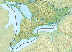
Location of the mouth of the Napanee River in southern Ontario
Location
Country Canada
Province Ontario
Region Eastern Ontario
Counties
Physical characteristics
SourceCamden Lake
  location Stone Mills, Lennox and Addington County
  coordinates 44°26′34″N76°50′52″W / 44.44278°N 76.84778°W / 44.44278; -76.84778
  elevation146 m (479 ft)
Mouth Lake Ontario
  location
Greater Napanee, Lennox and Addington County
  coordinates
44°11′44″N77°01′19″W / 44.19556°N 77.02194°W / 44.19556; -77.02194 Coordinates: 44°11′44″N77°01′19″W / 44.19556°N 77.02194°W / 44.19556; -77.02194
  elevation
74 m (243 ft)
Basin features
River system Great Lakes Basin
Tributaries 
  left Depot Creek

The Napanee River is a river in Lennox and Addington County and Frontenac County in Eastern Ontario, Canada. [1] It is in the Great Lakes Basin and flows from its source at Camden Lake to its mouth at the Bay of Quinte on Lake Ontario at Napanee. It flows through a valley of preglacial origin. The valley of the Napanee is lined with settlements such as Greater Napanee, Newburgh, Camden East, Yarker, and Petworth.

Contents

This river was originally called the Appanea. [2] A grist mill was constructed on the river in 1785 near the current site of the town of Greater Napanee. Other mills were added at Yarker and Camden East.
Tributaries

See also

Related Research Articles

Indian River (Lanark County)

The Indian River is a river in Lanark County in Eastern Ontario, Canada. It is in the Saint Lawrence River drainage basin and is a left tributary of the Mississippi River.

Indian River (Muskrat River watershed)

The Indian River is a river in Renfrew County and Nipissing District in Eastern and Northeastern Ontario, Canada. It is in the Saint Lawrence River drainage basin, and is a left tributary of the Muskrat River.

Otonabee River

The Otonabee River is a river in Peterborough County in Central Ontario, Canada. The river flows from Katchewanooka Lake, at the north end of the community of Lakefield, through the city of Peterborough to Rice Lake. It is in the Great Lakes Basin and forms part of the Trent-Severn Waterway.

Lennox and Addington County County in Ontario, Canada

Lennox and Addington County is a county and census division of the Canadian province of Ontario. The county seat is Greater Napanee. It is located in the subregion of Southern Ontario named Eastern Ontario.

Crowe River

The Crowe River is a river in the counties of Haliburton, Hastings, Northumberland and Peterborough in southern Ontario, Canada. It is in the Lake Ontario drainage basin and is a tributary of the Trent River.

Sixteen Mile Creek (Halton Region)

Sixteen Mile Creek is a river in Halton Region in the Greater Toronto Area of Ontario, Canada. It is in the Great Lakes Basin, and flows from the Niagara Escarpment through the towns of Milton and Oakville to Lake Ontario.

Clyde River (Ontario)

The Clyde River is a river in Lanark County in Eastern Ontario, Canada. It is in the Saint Lawrence River drainage basin, is a left tributary of the Mississippi River, and was named after the River Clyde in Scotland.

Kemptville Creek stream in the United Counties of Leeds and Grenville, Canada

Kemptville Creek is a stream in the municipalities of North Grenville and Augusta, in the United Counties of Leeds and Grenville, in Eastern Ontario, Canada. It is in the Ottawa River drainage basin, is a right tributary of the Rideau River, and is under the auspices of the Rideau Valley Conservation Authority.

Stone Mills Township in Ontario, Canada

Stone Mills is a lower tier township located north of Greater Napanee in Lennox and Addington County, Ontario, Canada. According to the 2011 census, the township has a population of 7,560.

Bobs Lake (South Frontenac)

Bobs Lake is a lake in Frontenac County and Lanark County in Eastern Ontario, Canada. It is in the St. Lawrence River drainage basin and is the source of the Tay River.

Boyne River (Nottawasaga River tributary) river in the counties of Simcoe and Dufferin in Central Ontario, Canada

The Boyne River is a river in Simcoe County and Dufferin County in Central Ontario, Canada. It is part of the Great Lakes Basin, and is a left tributary of the Nottawasaga River. The rivers falls within the jurisdiction of the Nottawasaga Valley Conservation Authority.

Beaver River (Grey County) river in Grey County, Ontario, Canada

The Beaver River is a river in Grey County and Simcoe County in Southern Ontario, Canada. It is part of the Great Lakes Basin, and is a tributary of Lake Huron. The river's drainage basin is under the auspices of Grey Sauble Conservation.

Depot Creek (Napanee River tributary)

Depot Creek is a river in Frontenac County and Lennox and Addington County in Eastern Ontario, Canada. It is in the Great Lakes Basin and is a left tributary of the Napanee River.

Carhess Creek river in Canada

Carhess Creek is a river in Greater Sudbury and Sudbury District in Northeastern Ontario, Canada. It is in the Great Lakes Basin and is a right tributary of the Onaping River. The name is a portmanteau of the names of two geographic townships through which it flows, Hess Township and Cartier Township.

Onaping River watercourse in Canada

The Onaping River is a river in Greater Sudbury and Sudbury District in Northeastern Ontario, Canada. It is in the Great Lakes Basin and is a right tributary of the Vermilion River.

Matawin River (Ontario) watercourse in Canada

The Matawin River is a river in Thunder Bay District in Northwestern Ontario, Canada. It is in the Great Lakes Basin and is a right tributary of the Kaministiquia River.

Irondale River river in Canada

The Irondale River is a river in Haliburton County in Central Ontario, Canada. It is part of the Great Lakes Basin, and is a left tributary of the Burnt River.

North River (Belmont Lake) river in Canada

The North River is a river in the municipality of Havelock-Belmont-Methuen, Peterborough County in Central Ontario, Canada. It is part of the Great Lakes Basin, and is a right tributary of the Crowe River.

Black Donald Creek stream in Renfrew County, Ontario, Canada

Black Donald Creek is a stream in Greater Madawaska, Renfrew County in Eastern Ontario, Canada. It is in the Saint Lawrence River drainage basin and is a left tributary of the Madawaska River at Black Donald Lake.

North Sydenham River

The North Sydenham River is a river in the municipalities of Saint Clair and Chatham-Kent in Southwestern Ontario, Canada. It is a tributary of the Sydenham River, and is part of the Great Lakes Basin.

References

  1. "Napanee River". Geographical Names Data Base. Natural Resources Canada . Retrieved 2014-08-09.
  2. James, C. C. (1905). "The Origin of "Napanee"". Papers and Records of the Ont. Hist. Soc. 6: 47–49.

Sources