
The District Municipality of Muskoka, more generally referred to as the District of Muskoka or Muskoka, is a regional municipality in Central Ontario, Canada. Muskoka extends from Georgian Bay in the west, to the northern tip of Lake Couchiching in the south, to the western border of Algonquin Provincial Park in the east. A two-hour drive north of Toronto, Muskoka spans 6,475 km2 (2,500 sq mi). Muskoka has some 1,600 lakes, making it a popular cottaging destination.

The French River is a river in Central Ontario, Canada. It flows 110 kilometres (68 mi) from Lake Nipissing southwest to Georgian Bay. The river largely follows the boundary between the Parry Sound District and the Sudbury District, and in most contexts is considered the dividing line between Northern and Southern Ontario. The French River was designated a Canadian Heritage River in 1986.
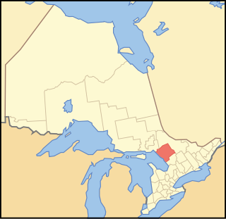
Parry Sound District is a census division of the Canadian province of Ontario. Its boundaries are District of Muskoka to the south, the Sudbury District to the north-northwest, the French River and Lake Nipissing in the north, Nipissing District and North Bay in the north and east and parts of Algonquin Park in the northeast.

Seguin is a township in central Ontario, Canada, in the District of Parry Sound.

Nipissing District is a district in Northeastern Ontario in the Canadian province of Ontario. It was created in 1858. The district seat is North Bay.

Central Ontario is a secondary region of Southern Ontario in the Canadian province of Ontario that lies between Georgian Bay and the eastern end of Lake Ontario.
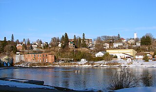
Burk's Falls is an incorporated village in the Almaguin Highlands region of Parry Sound District, Ontario, Canada, located 265 kilometres (165 mi) north of Toronto and 90 kilometres (56 mi) south of North Bay, Ontario. The village, and the waterfall on the site, were named by David Francis Burk of Oshawa, after he selected the land surrounding the waterfall in the Free Land Grant Act. Burk's Falls is part of the Magnetawan River waterway.
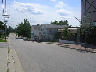
Seguin Falls is a ghost town and unincorporated place on the Nipissing Colonization Road in the township of Seguin, Parry Sound District in northeastern Ontario, Canada.
The Municipality of Callander is a township in central Ontario, Canada, located at the southeast end of Lake Nipissing in the Almaguin Highlands region of the District of Parry Sound. The municipality is located on Callander Bay, just south of North Bay.

Nipissing is an incorporated (political) township in Parry Sound District in Central Ontario, Canada. It is on Lake Nipissing and is part of the Almaguin Highlands region. Nipissing was surveyed between 1874 and 1881, and was incorporated in 1888. Among the first settlers in the area were the Chapman and Beatty families. Nipissing Township annexed Gurd Township in 1970. The township also contains a community named Nipissing, which is located on the South River near Chapman's Landing, on the South Bay of Lake Nipissing. The township administrative offices are located in Nipissing.

Lake Rosseau is located in Ontario, Canada, about 200 km (120 mi) north of Toronto. The south end of the lake is in the Township of Muskoka Lakes, and the north end is in Seguin Township. The lake is surrounded by many cottages, some dating back to the late 19th century.

Lake Muskoka is located between Port Carling and Gravenhurst, Ontario, Canada. The lake is surrounded by many cottages. The lake is primarily within the boundary of the Township of Muskoka Lakes, the southeast corner is within the boundary of the Town of Gravenhurst and another small portion around the mouth of the Muskoka River is within the boundary of the Town of Bracebridge. The town of Bala is located on the southwest shores of the lake, where the Moon River starts. Lake Muskoka is connected to Lake Rosseau through the Indian River and lock system at Port Carling. The lake is mainly fed by the Muskoka River, Lake Joseph and Lake Rosseau.
Cottage country is a common name in Ontario, New Brunswick, and other regions of Canada for areas that are popular locations for recreational properties such as cottages and summer homes. Cottage country is often socially, culturally, economically, and politically distinct from other rural areas in that it is populated by a notably higher concentration of urban vacationers and residents who have an affinity for the outdoors, in contrast to more traditional rural populations, which are largely absent of "city folk", but that is less true in Western Canada. Any major population centre may have its own popular "cottage country" area.

Secondary Highway 518, commonly referred to as Highway 518, is a provincially maintained secondary highway in the Canadian province of Ontario. Highway 518 spans 72.7 kilometres (45.2 mi) between Parry Sound and Kearney. It serves as one of the many links between Highway 400 and Highway 11. The highway was assumed in 1956, and has remained generally unchanged since, aside from being truncated slightly at both ends.

Magnetawan is a township in the Almaguin Highlands region of the Parry Sound District in the Canadian province of Ontario, as well as the name of the primary population centre in the township.
The Ottawa, Arnprior and Parry Sound Railway, or OA&PS, is a historic railway that operated in central and eastern Ontario, Canada from 1897 until 1959. It was, for a time, the busiest railway route in Canada, carrying both timber and wood products from today's Algonquin Provincial Park areas, as well as up to 40% of the grain traffic from the Canadian west from Depot Harbour at Parry Sound through to the St. Lawrence River valley.
King's Highway 141, commonly referred to as Highway 141, is a provincially maintained highway in the Canadian province of Ontario. Its western terminus is at Highway 400 south of Horseshoe Lake in Seguin Township while its eastern terminus is at Highway 11 near Port Sydney. The route was designated in 1974 when Highway 532 was renumbered and upgraded from a secondary highway to a King's Highway. The route has remained generally unchanged since, though it was extended by several kilometres on October 7, 2003 when Highway 400 was extended north of Mactier.

The Almaguin Highlands Region in Ontario, Canada, covers approximately 5,200 km2 (2,000 sq mi) comprising the eastern half of Parry Sound District. It is bounded by Muskoka in the south, and by Lake Nipissing and Nipissing District in the north. The eastern edge abuts the western boundary of Algonquin Provincial Park, whereas the western boundary of the Almaguin Highlands is generally regarded to be the mid east-west point of Parry Sound District. Originally derived from the words Algonquin, Magnetawan, and Seguin. the name Almaguin is now used to describe the marketing region of East Parry Sound.
Port Sandfield is a community on Lake Rosseau in Ontario, Canada, located within and governed by the municipality of Muskoka Lakes. It was founded in 1870, when a canal was built connecting Lake Joseph to Lake Rosseau. Alexander Peter Cockburn, a member of the Ontario Provincial Parliament and founder and first President of the Muskoka Settlers’ Association played a leading role in getting the canal funded. The canal was funded at the same time as a lock at Port Carling. The canal and lock allowed a fleet of steamboats to carry freight, mail, cargo and timber over the three largest lakes in the county of Muskoka.

