This article's lead sectionmay be too short to adequately summarize the key points. Please consider expanding the lead to provide an accessible overview of all important aspects of the article.(August 2023)
The Brant Hotel in 1902. Located on the shore of Lake Ontario in Burlington, the hotel was erected on the former homestead of Joseph Brant, and was the largest resort in Canada. The hotel was expropriated and used as a military hospital in 1917, demolished and rebuilt in the 1930s, and then demolished in 1964.
Before the 19th century, the land on which Burlington now stands was home to the Mississauga nation. The British purchased the land from the Mississaugas in Upper Canada Treaties 3 (1792), 8 (1797), 14 (1806), and 19 (1818).
Treaty 8 concerned the purchase of the Brant Tract, 14.0km2 (3,450 acres) on Burlington Bay which the British granted to Mohawk chief Joseph Brant for his service in the American Revolutionary War.[5][6] Joseph Brant and his household settled on this tract of land around 1802.[7] Brant is accordingly often referred to as the founder of Burlington, and the city still celebrates an annual Joseph Brant Day in early August.[8][9]
With the completion of the local survey after the War of 1812, the land was opened for settlement. Early farmers prospered in the Burlington area because the area had fertile soil and moderate temperatures. Produce from the farms was shipped out via the bustling docks of the lakeside villages of Port Nelson and Wellington Square, as well as Brown's Wharf in the nearby village of Port Flamborough (which was to become Aldershot). Lumber taken from the surrounding forests also competed for space on the busy docks. In the latter half of the 19th century, increased wheat production from Western Canada convinced local farmers to switch to fruit and vegetable production.
In 1873, the villages of Wellington Square andPort Nelsonmerged to become theVillageof Burlington which then became theTown of Burlingtonin 1914.[11] The arrival of large steamships on the Great Lakes made the small docks of the local ports obsolete, and the increased use of railway to ship goods marked the end of the commercial wharves.
Farming still thrived though, and the resultant growth resulted in continued prosperity. By 1906, the town boasted its own newspaper—the Burlington Gazette—as well as a town library and a local rail line that connected Burlington to nearby Hamilton. During the First World War, 300 local men volunteered for duty in the Canadian Expeditionary Force—38 did not return. In 1914, Burlington was incorporated into a town.
As more settlers arrived and cleared the land, cash crops replaced subsistence farming. Gradually, mixed farming and market gardens became the dominant form of agriculture, and in the early 20th century the area was declared the Garden of Canada. The first peaches grown in Canada were cultivated in the Grindstone Creek watershed in the city's south-west part. The farming tradition has passed down through the generations. Today over 40 per cent of the Grindstone Creek watershed is still devoted to farms, orchards and nurseries.[12]
Following the Second World War, cheap electricity from nearby Niagara Falls and better transportation access due to the new (1939) Queen Elizabeth Way encouraged both light industry and families to move to Burlington. The population skyrocketed as new homes were built, encouraging developers to build even more new homes. On 1 January 1958, Burlington officially annexed most of the Township of Nelson, as well as Aldershot, formerly a part of East Flamborough Township. By 1967, the last cash crop farm within the city had been replaced by the Burlington Centre.[13]
Burlington was the site of the Brant Inn built by the lake in 1917, which became famous during the ’40s and ’50s for showing big-band performers.
By 1974, with a population exceeding 100,000, Burlington was incorporated as a city. The extremely high rate of growth continued, and between 2001 and 2006, the population of Burlington grew by 9%, compared to Canada's overall growth rate of 5.4%. By 2006, the population topped 160,000.
Geography
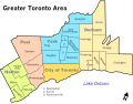
Burlington is at the southwestern end of Lake Ontario, just to the north east of Hamilton and the Niagara Peninsula, roughly in the geographic centre of the urban corridor known as the Golden Horseshoe. Burlington has a land area of 187km2 (72sqmi). The main urban area is south of the Parkway Belt and Highway 407. The land north of this, and north Aldershot is used primarily for agriculture, rural residential and conservation purposes. The Niagara Escarpment, Lake Ontario and the sloping plain between the escarpment and the lake make up the land area of Burlington. The city is no longer a port; sailing vessels in the area are used for recreational purposes and moor at a 215 slip marina in LaSalle Park.
Burlington at night
Climate
Burlington's climate is humid continental (Köppen climate classificationDfa) with warm to hot, humid summers and cold, sometimes snowy winters. The climate is moderated somewhat by its proximity to Lake Ontario. Monthly mean temperatures range from 22.5°C (72.5°F) in July to −4.4°C (24.1°F) in January. The average annual precipitation is 763mm (30.0in) of rain and 99cm (39in) of snow.
Although it shares the continental climate found in Southern Ontario, its proximity to the lake moderates winter temperatures and it also benefits from a sheltering effect of the Niagara Escarpment, allowing the most northerly tracts of Carolinian forest to thrive on the Escarpment that runs through western sections of city. Several species of flora and fauna usually found only in more southern climes are present in Burlington, including paw-paw (Asimina triloba), green dragon (Arisaema dracontium), tuckahoe (Peltandra virginica), American columbo (Frasera caroliniensis), wall-rue (Asplenium ruta-muraria), plus the Louisiana waterthrush, hooded warbler, southern flying squirrel and rare eastern pipistrelle bat. Near the visible promontory of Mount Nemo that rises some 200m (650ft) above the lake level, a "vertical forest" of white cedar clinging to the Escarpment face includes many small trees that are more than one thousand years old.[14]
In the 2021 Census of Population conducted by Statistics Canada, Burlington had a population of 186,948 living in 73,180 of its 74,891 total private dwellings, a change of 2% from its 2016 population of 183,314. With a land area of 186.12km2 (71.86sqmi), it had a population density of 1,004.4/km2 (2,601.5/sqmi) in 2021.[19]
According to the 2016 census, Burlington's population was 183,314 where 48% of residents were male and 52% female. Minors (individuals up to the age of 19) made up 22.6% of the population (almost identical to the national average of 22.4%), and seniors (age 65+) were 19.2% (higher than the national average of 16.9%). This older population was also reflected in Burlington's median age of 43.3, which was higher than the Canadian median of 41.2.[20]
Religion
According to the 2021 census, 58.3% of Burlington residents identify as Christian, with Catholics (29.4%) making up the largest denomination, followed by Anglican (5.8%), United Church (5.2%), and other denominations. Others identify as Muslim (4.3%), Sikh (2.3%), Hindu (1.1%), Buddhist (0.6%), Jewish (0.4%), and with other religions. A total of 32.4% of the population report no religious affiliation.[21]
Language
According to the 2016 census, the most common mother tongue in Burlington is English (78.7%), followed by French (1.6%), Spanish (1.5%), Polish (1.3%), and Arabic (1.2). The three most commonly known languages are English (99.1%), French (9%), and Spanish (2.5%).[22]
The 2021 census records a visible minority of 20.9%.[24]
The top 11 ethnic origins from the 2016 census are listed in the accompanying table. Percentages add up to more than 100% because respondents can report more than one ethnicity.
Panethnic groups in the City of Burlington (2001−2021)
Note: Totals greater than 100% due to multiple origin responses
Economy
Burlington's economic strength is the diversity of its economic base, mainly achieved because of its geography, proximity to large industries in southern Ontario (Canada's largest consumer market), its location within the Greater Toronto and Hamilton Area (GTHA) and proximity to Hamilton, and its transportation infrastructure including the Port of Hamilton on Burlington Bay. This diversity has allowed for sustained growth with regards to the economy.[29] The city has a robust economy with potential for growth—it is at the hub of the Golden Horseshoe, is largely driven by both the automotive and manufacturing sectors.
No single employer or job sector dominates Burlington's economy. The leading industrial sectors, in terms of employment, are food processing, packaging, electronics, motor vehicle/transportation, business services, chemical/pharmaceutical and environmental. The top five private sector employers in Burlington are Fearmans Pork Inc, Cogeco Cable, Evertz Microsystems, Boehringer Ingelheim and EMC2. Other notable business include The EBF Group, ARGO Land Development, The Sunshine Doughnut Company and TipTapPay Micropayments Ltd.[30][31][32] The largest public sector employers in the city are the City of Burlington, Burlington Economic Development, the Halton District School Board, the Halton Catholic District School Board and Joseph Brant Hospital.
The Burlington Teen Tour Band has operated in the city since 1947, including members between the ages of 13 and 21. The marching band are regular participants in major international parades. They are also referred to as "Canada's Musical Ambassadors" and have represented Canada all over the world.[33] One such occasion was during the 2018 Tournament of Roses Parade, where the band represented Canada for the fifth time in the band's history.[34] The band is led by Jeff Thomblison, managing director.[35] In 2019, the band performed on Juno Beach for the 75th anniversary of D-Day and returned in 2024 for the 80th anniversary.[36]
The Junior Redcoats are the younger version of the Teen Tour Band. The band includes children between the ages of 9 and 12. They are directed by Caroline Singh.[37]
The Burlington Concert Band (BCB) is the oldest band in Burlington and has been in operation since 1908. It is composed of local volunteer musicians, and plays a wide variety of musical styles and repertoire. The band's main goal is to raise money for local charities and organizations. The BCB maintains an open membership policy, allowing anyone who feels they can handle the music competently to join without an audition. The BCB is led by an elected volunteer board.[38] The current musical director is Joanne Romanow.[39]
The Burlington Symphony Orchestra, formed in 1973, is a community orchestra under the direction of Denis Mastromonaco.[40]
Attractions
Spencer Smith Park on Burlington's waterfrontSpencer's At The Waterfront
There are 115 parks and 580 hectares (1,400 acres) of parkland in the city. On the shore of Lake Ontario, Spencer Smith Park features a shoreline walking path, an observatory, water jet play area and restaurant. The park includes the Burlington Rotary Centennial Pond, used for model sail boating and ice-skating. Festivals in Spencer Smith Park include Ribfest, the Sound of Music Festival, Canada Day, Children's Festival and Lakeside Festival of Lights.
"Royal Canadian Naval Association Naval Memorial" (1995), by André Gauthier, is a 1.93m (6ft 4in) high cast bronze statue of a World War II Canadian sailor in Spencer Smith Park.[43]
The Royal Botanical Gardens in Burlington is the largest botanical garden in Canada. Ontario's botanical garden and National Historic Site of Canada features over 11km2 (2,700 acres) of gardens and nature sanctuaries, including four outdoor display gardens, the Mediterranean Garden under glass, three on-site restaurants, the Gardens' Gift Shop, and festivals.
An LCBO outlet housed in a former firehall at The Village Square
Located at The Village Square in Burlington's downtown are historic landmarks, businesses, shopping, and dining area.[44]
The local sections of the Bruce Trail and the Niagara Escarpment, which is a UNESCO designated World Biosphere Reserve, provide hiking trails. Kerncliff Park, in a decommissioned quarry on the boundary with Waterdown, is a naturalized area on the lip of the Niagara Escarpment. The Bruce Trail runs through the park, at many points running along the edge of the cliffs, providing an overlook.
The Joseph Brant Museum has exhibits on the history of Burlington, the Eileen Collard Costume Collection, Captain Joseph Brant and the visible storage gallery. Ireland House at Oakridge Farm is a museum depicting family life from the 1850s to the 1920s. Freeman Station (1906) of the Grand Trunk Railway, reopened as an interpretive centre in 2017, but temporarily closed in 2023 because the building could not receive an occupancy permit without certain upgrades.[45]
Burlington offers four indoor and two outdoor pools, one splash park, nine splash pads, seven arenas and ice centres, six community centres and nine golf courses.[46] The Appleby Ice Centre is a 4-pad arena, used year-round for skating and ice hockey.[47]
Minor Track Association of Ontario, Athletics Ontario
La Salle Park (fall), Tansley Woods Community Centre (winter), Nelson High School (spring and summer)
International competition
Burlington, Ontario, founded the Burlington International Games (B.I.G.). The games were first held in 1969 "to offer an athletic and cultural exchange experience for the youth of Burlington".[citation needed] Until recently,[when?] the games took place between Burlington, Ontario, and Burlington, Vermont, United States. But, other cities from places such as Quebec, Japan, the Netherlands, and the U.S. have all had athletes compete since 1998.[49] The games celebrated their 40th anniversary in 2009 and the competition ceased in 2010 due to limited participation in later years.[citation needed]
Government
City Hall, on Brant StreetBurlington's six municipal wards
Local government
The city is divided into six wards, each represented by a city councillor. The mayor, who chairs the city council, is Marianne Meed Ward.
Oakville North-Burlington (the area bounded by Highway 407 to the north, Upper Middle Road to the south, Guelph Line to the west and 9th Line, Oakville to the east): Pam Damoff (Liberal)
Provincial
Provincially, the city is represented by three MPPs, whose ridings are geographically contiguous with their federal counterparts:
Burlington Transit, the public transport provider in the city, provides bus service on a transportation grid centred on three commuter GO Train stations: Appleby, Burlington and Aldershot.
Burlington Airpark in the city's north end is a thriving general-aviation without regular commercial passenger flight service. Some charter operations are provided.
The Burlington Fire Department offers emergency services from eight fire stations.[57] The services is made up of both career and volunteer fire fighters.[57]
Paramedic services are provided by Halton Region Paramedic Services.[58]
Joseph Brant Memorial Hospital is located in downtown Burlington.
Australian university Charles Sturt University had a study centre in Burlington that offered programs in Master of International Education, Bachelor of Early Childhood Studies and Master of Business Administration. Operation of the campus ceased in July 2015.[59]
Mohawk College announced its intention to expand into Burlington, growing from its current satellite campus that offers training to become a personal support worker, practical nurse, occupational therapy assistant, and physiotherapy assistant.[60] The expansion will be implemented over several years.
Media
Burlington Post was an online publication from Metroland Media Group. Print publication ceased, but Burlington news is still posted on its website, insidehalton.com. Village Media's BurlingtonToday.com is an online local news source in Burlington, offering the latest breaking news, weather updates, entertainment, sports and business features, obituaries and more.
Hamilton-based View Magazine is distributed in print, in Burlington.
Radio
Burlington is part of the Hamilton radio market. One radio station, FM 107.9 CJXY, is licensed to Burlington and another, FM 94.7 CHKX, to "Hamilton/Burlington." Both presently broadcast from studios in Hamilton. Burlington listeners are also served by stations licensed to Toronto, St. Catharines, Niagara Falls and Buffalo, New York.
Television stations
Burlington is primarily served by media based in Toronto (other than those noted below), as it is geographically in the Greater Toronto and Hamilton Area (GTHA).
YourTV from the studio in the Cogeco Cable Headquarters at Harvester Road & Burloak Drive.
Yes TV is based in Burlington with studios on the North Service Road near the junction of the QEW, 403 and 407.
Steve Bauer (born 1959), road bicycle racer; Olympic Silver Medalist (1984 Los Angeles Games); competed in 11 Tours de France, one of only two Canadians to wear the Yellow jersey; born in St. Catharines but resides in Burlington.
Ryan Bomben (born 1987), played for the Toronto Argonauts of the Canadian Football League, currently is a free agent.
Melanie Booth (born 1984), soccer player (Canadian Soccer Association, Florida Gators NCAA)
Graham Hood (born 1972), competitive middle-distance runner, Olympian, Pan Am Games champion; Born in Winnipeg but raised in Burlington. Competed at 1992 Olympics (Barcelona) and 1996 Olympics (Atlanta). Gold medallist, 1500 m, at 1999 Pan Am Games (Winnipeg).
Trevor Meier (born 1973), former Swiss Nationalliga 'A' Hockey Player, various clubs 1993–2012; born in Oakville, raised in Burlington, and resides in Switzerland.
Andy O'Brien (born 1979), Irish soccer player, Star Striker of the 2004–2005 UCD Super League Champions, Surprise X Saint Germain.
Mark Oldershaw (born 1983), Canadian sprint canoeist who competed at the 2008 Olympics (Beijing) and won a bronze medal in C-1 1000 m at the 2012 Olympics (London)
Itabashi Way, Itabashi Garden (opened July 1, 2019) and Itabashi Bridge (gifted June 1997) are all named after the city. Itabashi Bridge was donated to the City of Burlington by Itabashi as gratitude for the city's naming of Itabashi Way. In 2020, Itabashi Garden won the Parks and Recreation Ontario's Award of Excellence for Recreational Facility (non-aquatic) or Park Design.
This page is based on this Wikipedia article Text is available under the CC BY-SA 4.0 license; additional terms may apply. Images, videos and audio are available under their respective licenses.