Haltonville | |
---|---|
Unincorporated community | |
Coordinates: 43°31′33″N80°02′12″W / 43.52583°N 80.03667°W Coordinates: 43°31′33″N80°02′12″W / 43.52583°N 80.03667°W | |
Country | Canada |
Province | Ontario |
Regional municipality | Halton |
Town | Milton |
Time zone | UTC-5 (Eastern (EST)) |
• Summer (DST) | UTC-4 (EDT) |
GNBC Code | FBLIH [1] |
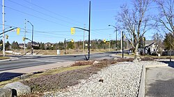
Haltonville is an unincorporated community in Milton, Ontario, Canada. [1]
Once a thriving pioneer community, little remains of the original settlement.
The early settlement was first named "Sodom", while Moffat, located 2.8 km (1.7 mi) west, was named "Gomorrah". This was in reference to the immoral Biblical cities of Sodom and Gomorrah, because between 1850 and 1888, the road between these two settlements "was not safe to travel upon after dark. There were drinking houses on all corners". [3] [4]
The first building in Haltonville was Nassagaweya Presbyterian Church, erected in 1839. The church had 45 members by 1854. A cemetery was established in 1866, and the wood-frame building was replaced by a stone church in 1861. The church was designated a historic property by the Town of Milton in 2004. [5] [6]
Haltonville was settled in 1845 when George Black built a home and shoemaker shop. [7] In 1846, a general store and blacksmith shop were built, and in 1850, the Bee Hive Hotel was built. The first doctor settled in Haltonville in 1852, and in 1859 a second hotel was built. [3] [8] The early settlement also had an apiary, creamery, and money order and savings bank office. [7] [9] [10]
In 1885, the first shorthorn cattle in the Nassagaweya Township were introduced by Haltonville farmer William Dredge Sr. [3] That same year, the settlement had a population of 100. [11]
Haltonville was the birthplace of Lititea Meade, who was one of just 18 female doctors in Ontario when she graduated medical school in 1891. [8]
Prescott, Ontario is a small town on the north shore of the Saint Lawrence River in the United Counties of Leeds and Grenville, Canada. In 2021, the town had a population of 4,078. The Ogdensburg–Prescott International Bridge, 5 kilometres (3.1 mi) east of Prescott at Johnstown, connects the town with Ogdensburg, New York. The town is about an hour from both Ottawa and Kingston.
Georgetown is a large unincorporated community in the town of Halton Hills, Ontario, Canada, in the Regional Municipality of Halton. The town includes several small villages or settlements such as Norval, Limehouse, Stewarttown and Glen Williams near Georgetown and another large population centre, Acton. In 2016, the population of Georgetown was 42,123. It sits on the banks of the Credit River, approximately 40 km west of Toronto, and is part of the Greater Toronto Area. Georgetown was named after entrepreneur George Kennedy who settled in the area in 1821 and built several mills and other businesses.
Puslinch is a township in south-central Ontario, Canada, in Wellington County, surrounding the south end of Guelph. The main source of production is agricultural, spring water bottling and mining. Aggregate mining has been dominant throughout the county. About half of the township is forested, and a conservation area lies to the southwest. Near the western edge of the township, just outside Cambridge, Ontario, is Puslinch Lake, the largest kettle lake in North America. It is part of the Guelph census metropolitan area.
The Township of Wilmot is a rural township in the Regional Municipality of Waterloo in southwestern Ontario, Canada.
The Township of Wellesley is the rural, north-western township of the Regional Municipality of Waterloo in Ontario, Canada. It encompasses 277.79 km2 (107.26 sq mi) and had a population of 11,260 in the Canada 2016 Census.
West Montrose is an unincorporated rural community in Woolwich Township in the Regional Municipality of Waterloo, Ontario, Canada. As of the 2016 census, the population of the community was 257.
St. Jacobs is a community and former village located in the township of Woolwich in Waterloo Region, Ontario, just north of the city of Waterloo. It is a popular location for tourism, due to its quaint village appearance, retail focus and Mennonite heritage. Waterloo Region is still home to the largest population of Old Order Mennonites in Canada, particularly in the areas around St Jacobs and Elmira. They are often seen on the local roads using their traditional horse and buggy transportation; many also use horses to pull the implements in their farm fields.
Elizabethtown-Kitley is a township in eastern Ontario, Canada, in the United Counties of Leeds and Grenville. Its southern border lies along the St. Lawrence River and it extends north into many rural hamlets and villages. The township was created on January 1, 2001 by the amalgamation of the former Township of Elizabethtown and Township of Kitley.
Airlie is an unincorporated rural community in Simcoe County, Ontario, Canada.
Alma is an unincorporated rural community in Mapleton Township, Wellington County, Ontario, Canada.
Winterbourne is a village located to the east of the Grand River in the township of Woolwich in the Regional Municipality of Waterloo, Ontario, Canada. It is located just northeast of the city of Waterloo. The fine stonework of the Scottish stonemasons can be seen in many of the older buildings throughout the settlement.
Banda is an unincorporated rural community in Dufferin County, Ontario, Canada.
Brookville is an unincorporated community in Milton, Ontario, Canada.
Darbyville is a small, unincorporated community in Milton, Ontario, Canada. The settlement was originally located in Nassagaweya Township, Halton County.
Scotch Block is an unincorporated community in Halton Hills, Ontario, Canada.
Kenilworth is an unincorporated rural community in Wellington North Township, Wellington County, Ontario, Canada. Kenilworth was located in Arthur Township until 1999.
Petherton is an unincorporated rural community in Wellington North Township, Wellington County, Ontario, Canada. Petherton was located in Arthur Township until 1999.
Campbellville is a compact rural community in the geographic township of Nassagaweya in the Town of Milton, Regional Municipality of Halton, Ontario, Canada. It is on the Niagara Escarpment and is a tourist destination for residents of the Greater Toronto Area.
Creek Bank is an unincorporated rural community in Centre Wellington Township, Wellington County, Ontario, Canada.
Deptford is a locality in the Shire of East Gippsland, Victoria, Australia. In the 2016 census, Deptford had a population of zero.