Bronte, Ontario

Last updated
Bronte
Unincorporated community
Halton locator map 2021.svg
Red pog.svg
Bronte
Canada Southern Ontario location map 2.png
Red pog.svg
Bronte
Coordinates: 43°23′22″N79°43′4″W / 43.38944°N 79.71778°W / 43.38944; -79.71778
Country Canada
Province Ontario
Regional municipality Halton
Town Oakville
Founded1834
Time zone UTC-5 (EST)
  Summer (DST) UTC-4 (EDT)
Forward sortation area
L
Area code(s) 905 and 289
NTS Map030M05
GNBC CodeFALWE

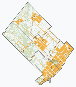
Bronte is the community that makes up much of the west end of Oakville, in Ontario, Canada. Twelve Mile Creek (known informally as Bronte Creek) flows through the middle of town and empties into Lake Ontario. Main roads include Bronte Road (north-south), Lakeshore Road West (east-west, parallel to Lake Ontario) and Rebecca Street (east-west). Streets in the business section include Lakeshore, Jones, Marine, and Ontario Street. Bronte is also accessed via a superhighway (the Queen Elizabeth Way) located to the north of the former village. Other main roads include Third Line, Speers Road and Burloak Drive to the west (the latter was named after the boundary of Burlington and Oakville.)

Contents

Bronte is a former fishing village which became annexed in 1962 with the former Township of Trafalgar, forming the Town of Oakville, along with the other formerly autonomous communities, including Sheridan.

The Bronte Marina. In the background the high rise apartment buildings of the Bronte community can be seen Bronte Harbour001.jpg
The Bronte Marina. In the background the high rise apartment buildings of the Bronte community can be seen

Geography and information

The urban area of Bronte is to the north, east and the southwest. The north-central part is industrialized while the west is mixed with some farmland, a former Petro-Canada refinery (which has closed and has yet to be dismantled as of 2010) and forests cover the northwest and includes Bronte Creek Provincial Park which cuts off Upper Middle Road. The park area is also used for trailers and tents. Farmland used to cover most of Bronte (except for the northwest) before suburban housing came in the 1960s and the 1970s. Lakeshore houses are situated along the shore of Lake Ontario. The narrow ravine of Bronte Creek is undeveloped, except at the mouth which serves as a harbour.

Culture and neighbourhood

Bronte's neighbourhood stretches from Burloak Drive in the west to Third Line, and from Lake Ontario in the south to Rebecca Street. Coronation Park, in the adjacent neighbourhood of Southwest Oakville, has a large playground, plentiful parking space, a field room, and sandy beaches. It hosts the annual Waterfront Festival. Its greatest attraction is an outdoor stage fronting an area 256 feet deep and 152 feet wide, with a hillock at the side. During the Waterfront Festival, the east field has carnival rides such as 1001 Niches and Polar Express, and features game kiosks. The parking lot is turned into a string of kiosks offering food and product information. The stage has extra lighting installed with a projector screen, an autograph booth at the side, and a DJ booth in the middle.

Rail and bus service operates from Bronte GO Station, situated on the Lakeshore West line connecting Bronte to communities along the shore, including Toronto. Originally known as Oakville West, the station became known by its current name when it was rebuilt. The station boasts having more than 1,700 parking spaces and is located off Wyecroft Road with access from the South Service Road.

Bronte has a number of schools, including Queen Elizabeth Park (closed), Gladys Speers, Eastview and Brookdale (Public Elementary), St. Dominic and St. Joseph (Catholic Elementary), and Oakville Christian School, formerly John Wilson (Public Elementary). Thomas A. Blakelock (Public High) rounds out the list.

Although the commercial centre is at Bronte Road and Lakeshore, the South Oakville Centre, (Hopedale Mall) located at Rebecca Street and Third Line Road provides additional retail businesses. Originally an L-shaped strip mall built in 1959 coincident with the development of the surrounding subdivision, it has undergone several expansions by which it has been enclosed with the closing of Seabourne Street between Tansley Drive and Rebecca Street.

History

Founded in 1834, Bronte began as a small fishing village at the mouth of Twelve Mile Creek. The name Bronte was chosen as a tribute to the British Naval hero, Horatio Nelson, who was made Duke of Bronte by King Ferdinand III of Sicily. Bronte's etymological root is the Greek word βροντή which means thunder.

Some of Bronte's original settlers were United Empire Loyalists and many of the streets were named for these founding fathers: Sovereign, Hixon, Nelson and Belyea.

One of the early industries in Bronte was stonehooking. Boats would gather stone slabs from shallow waters near the shore by hooking them from Lake Ontario for use in construction. [1] The building at 49 Bronte Road built circa 1840 still remains as an example of construction using material stonehooked from the lake. [2]

Its post office dates from 1851. [3] Bronte's first harbour was completed in 1856.

In the 1920s, Middle Road was built with 3 interchanges including Service Road. Middle Road became part of the Queen Elizabeth Way (QEW) in 1939.

In the mid-20th century, Cities Service built a refinery just south of the QEW, west of Bronte Road. The refinery was later acquired by BP and subsequently, Petro-Canada. Another refinery to the west was built by Shell with its entrance off Rebecca Street. The Shell Refinery ceased operations in the 1980s. The Petro-Canada refinery was decommissioned in 2009 and now is a bulk storage facility.

Streets in Bronte are numbered from east to west and lettered from A to L (or N?) from north to south. A housing boom started in the late 1950s south of the QEW. Starting in the late-1980s, housing developments began north of the QEW and westward towards Burlington.

In the 1960s, a highway linking north to Milton (Highway 25) moved from Guelph Line to Bronte Road. Later in the 1980s, an interchange for Burloak was added. This major arterial route is now not legally a highway, but a "regional road" but is, in fact, called "The Veterans Highway."

In the 2000s, a new two-lane bridge was built to connect New Street at Mississaga Street and Rebecca Street at Bronte Road.

A community called Lakeshore Woods was built where the former Shell Research Centre was located. Construction began in the 2000s and is planned for completion by 2010.

In early March 2006, Stoneboats restaurant, which was partly located in one of Bronte's most historical buildings (built in circa 1840 [2] ), suffered heavy fire damage and was rebuilt. A large portion of the historical part of the building was destroyed.

In April 2009, the Bronte Business Improvement Association and the owners of the Bronte Village Mall presented a proposal for revitalizing the mall which includes residential, office and retail space, [4] although it appears that the height of the new proposed structures does not conform to local bylaws. [5] [6]

Related Research Articles

<span class="mw-page-title-main">Burlington, Ontario</span> City in Halton Region, Ontario, Canada

Burlington is a city in the Regional Municipality of Halton at the west end of Lake Ontario in Ontario, Canada. Located approximately halfway between Toronto and Niagara Falls, it is part of the Greater Toronto and Hamilton Area and Hamilton metropolitan census area.

<span class="mw-page-title-main">Oakville, Ontario</span> Town in Ontario, Canada

Oakville is a town in Halton Region, Ontario, Canada. It is located on Lake Ontario between Toronto and Hamilton. At its 2021 census population of 213,759, it is Ontario's largest town. Oakville is part of the Greater Toronto Area, one of the most densely populated areas of Canada.

<span class="mw-page-title-main">Etobicoke</span> District of Toronto, Ontario, Canada

Etobicoke is an administrative district and former city within Toronto, Ontario, Canada. Comprising the city's west-end, Etobicoke is bordered on the south by Lake Ontario, on the east by the Humber River, on the west by Etobicoke Creek, the cities of Brampton, and Mississauga, the Toronto Pearson International Airport, and on the north by the city of Vaughan at Steeles Avenue West.

King's Highway 407, commonly referred to as Highway 407 and colloquially as the "four-oh-seven", is a tolled 400-series highway in the Canadian province of Ontario. Comprising a privately leased segment as well as a publicly owned segment, the route spans the entire Greater Toronto Area (GTA) around the city of Toronto, travelling through the suburbs of Burlington, Oakville, Mississauga, Brampton, Vaughan, Markham, Pickering, Whitby, and Oshawa before ending in Clarington, north of Orono. At 151.4 km long, this is the fourth longest freeway in Ontario's 400 series network, after Highways 417, 400, and 401. The segment between Burlington and Brougham in Pickering is leased to and operated by the 407 ETR Concession Company Limited and is officially known as the 407 Express Toll Route (407 ETR). It begins at the junction of the Queen Elizabeth Way (QEW) and Highway 403 in Burlington, and travels 108.0 km (67.1 mi) across the GTA to Brock Road in Pickering. East of Brock Road, the tollway continues east as Highway 407, a toll route operated by the provincial government, for 43.4 km (27.0 mi) to Highway 35/115 in Clarington. The route interchanges with nine freeways: the QEW, Highway 403, Highway 401, Highway 410, Highway 427, Highway 400, Highway 404, Highway 412, and Highway 418. Highway 407 is an electronically operated toll highway; there are no toll booths along the length of the route. Distances are calculated automatically using transponders or automatic number-plate recognition, which are scanned at entrance and exit portals.

The Queen Elizabeth Way (QEW) is a 400-series highway in the Canadian province of Ontario linking Toronto with the Niagara Peninsula and Buffalo, New York. The freeway begins at the Peace Bridge in Fort Erie and travels 139.1 kilometres (86.4 mi) around the western end of Lake Ontario, ending at Highway 427 in Toronto. The physical highway, however, continues as the Gardiner Expressway into downtown Toronto. The QEW is one of Ontario's busiest highways, with an average of close to 200,000 vehicles per day on some sections. Major highway junctions are at Highway 420 in Niagara Falls, Highway 405 in Niagara-on-the-Lake, Highway 406 in St. Catharines, the Red Hill Valley Parkway in Hamilton, Highway 403 and Highway 407 in Burlington, Highway 403 at the Oakville–Mississauga boundary, and Highway 427 in Etobicoke. Within the Regional Municipality of Halton the QEW is signed concurrently with Highway 403. The speed limit is 100 km/h (62 mph) throughout most of its length, with the exceptions being between Hamilton and St. Catharines where the posted limit is 110 km/h (68 mph).

King's Highway 403, or simply Highway 403, is a 400-series highway in the Canadian province of Ontario that travels between Woodstock and Mississauga, branching off from and reuniting with Highway 401 at both ends and travelling south of it through Hamilton and Mississauga. It is concurrent with the Queen Elizabeth Way (QEW) for 22 km (14 mi) from Burlington to Oakville. The Highway 403 designation was first applied in 1963 to a short stub of freeway branching off the QEW, and the entire route was completed on August 15, 1997, when the section from Brantford to the then-still independent Town of Ancaster was opened to traffic. The section of Highway 403 between Woodstock and Burlington was formally dedicated as the Alexander Graham Bell Parkway on April 27, 2016, in honour of Alexander Graham Bell.

<span class="mw-page-title-main">Clarkson, Mississauga</span> Neighbourhood in Peel, Ontario, Canada

Clarkson, also called Clarkson Village, is a neighbourhood in the city of Mississauga, Ontario, Canada, situated in the southwest corner of the city, along the shore of Lake Ontario. It is bordered by Lake Ontario to the south, Oakville to the west, Erindale and Erin Mills to the north, and Lorne Park to the east.

<span class="mw-page-title-main">Burlington Transit</span>

Burlington Transit is the public transport provider in the city of Burlington, Ontario, Canada. Services began in September 1975, after the city had been served by neighbouring systems including Hamilton Street Railway (HSR) and former subsidiary Canada Coach Lines, as well as "local" services to and from Toronto once provided by Gray Coach Lines and GO Transit along Lakeshore Road.

<span class="mw-page-title-main">Cancelled expressways in Toronto</span> Unbuilt freeways in Toronto, Canada

The cancelled expressways in Toronto were a planned series of expressways in Toronto, Ontario, Canada that were only partially built or cancelled due to public opposition. The system of expressways was intended to spur or handle growth in the suburbs of Toronto, but were opposed by citizens within the city of Toronto proper, citing the demolition of homes and park lands, air pollution, noise and the high cost of construction. The Spadina Expressway, planned since the 1940s, was cancelled in 1971 after being only partially constructed. After the Spadina cancellation, other expressway plans, intended to create a 'ring' around the central core, were abandoned.

<span class="mw-page-title-main">Bronte GO Station</span> Railway station in Ontario, Canada

Bronte GO Station is a train station in the GO Transit network located in Oakville, Ontario, Canada. It is a stop on the Lakeshore West line and there is an adjacent bus loop for connecting local Oakville Transit bus routes.

<span class="mw-page-title-main">Bronte Creek Provincial Park</span> Provincial park in Ontario, Canada

Bronte Creek Provincial Park is located in Oakville, Ontario, Canada, and is part of the Ontario Parks system.

<span class="mw-page-title-main">Ontario Highway 55</span> Former Ontario provincial highway

King's Highway 55, commonly referred to as Highway 55 and historically as the Niagara Stone Road and Black Swamp Road, was a provincially maintained highway in the Canadian province of Ontario, which connected the Queen Elizabeth Way (QEW) with Niagara-on-the-Lake, following Niagara Stone Road. The route divided a swath of wineries at the foot of the Niagara Escarpment, passing at an oblique angle to the concession road grid.

<span class="mw-page-title-main">The Queensway–Humber Bay</span> Neighbourhood in Toronto, Ontario, Canada

The Queensway–Humber Bay, known officially as Stonegate–Queensway, is a neighbourhood in the southwest of Toronto, Ontario, Canada. It is located in the southeast area of the former City of Etobicoke.

<span class="mw-page-title-main">Long Branch, Toronto</span> Neighbourhood in Toronto, Ontario, Canada

Long Branch is a neighbourhood and former municipality in the south-west of Toronto, Ontario, Canada. It is located in the south-western corner of the former Township of Etobicoke on the shore of Lake Ontario. The Village of Long Branch was a partially independent municipality from 1930 to 1967. Long Branch is located within a land grant from the government to Colonel Samuel Smith in the late 18th century. After Smith's death, a small portion of it was developed as a summer resort in the late 1800s.

<span class="mw-page-title-main">Jameson Avenue</span> Thoroughfare in Toronto, Ontario

Jameson Avenue is a multi-lane arterial road in the Parkdale neighbourhood in Toronto, Ontario, Canada. It is a north-south roadway from Lake Shore Boulevard to Queen Street. Originally laid out in the 19th century as a two-lane residential street, its traffic and land use has changed considerably from a suburban/semi-rural street to a main arterial connecting to an expressway.

The Middle Road was the name for a historic highway in the Canadian province of Ontario, which served to link the cities of Toronto and Hamilton. The name was used between 1931 and 1939, after which the road became the northern section of the Queen Elizabeth Way. It borrowed the name of Middle Road from a concession road in Toronto Township between 1st Concession South and 2nd Concession South during the early 1800s.

<span class="mw-page-title-main">Oakville (provincial electoral district)</span> Provincial electoral district in Ontario, Canada

Oakville is a provincial electoral district in Ontario, Canada, that has been represented in the Legislative Assembly of Ontario since 1999.

King's Highway 25, commonly referred to as Highway 25, was a highway in the Canadian province of Ontario. The north–south route connected several towns on its route northward from Burlington. The first section of Highway 25, designated in 1925, travelled north from Highway 5 to Milton. In 1928, the route was extended south into Burlington, following portions of Lower Middle Road to Highway 2. The highway was extended north to Highway 7 in 1937. That same year, a portion of Highway 25 was made concurrent with The Middle Road, which would be renamed as the Queen Elizabeth Way (QEW) two years later. The route remained relatively unchanged for two decades, save for the southern end being truncated at the QEW in 1946. In 1963 it was extended north to Ospringe to meet Highway 24. Another extension was added in 1974 to bring the route to Highway 89 near Shelburne. The entire route was decommissioned in 1997 and 1998 as part of a province-wide downloading of highways deemed to be of regional importance.

<span class="mw-page-title-main">Lakeshore Road</span> Road in Ontario, Canada

Lakeshore Road is a historic roadway in the Canadian province of Ontario, running through the city of Burlington and the town of Oakville in Halton Region, as well as the city of Mississauga in Peel Region. As its name implies, the road closely follows the shoreline of Lake Ontario, although the lake itself is not visible from the road in most areas. Lakeshore Road was once a key section of the historic Highway 2, which traversed the province, but has since been downloaded to local municipalities. Despite this historical role as a major route, however, most of the road is a lower-capacity picturesque residential and historic commercial street with only two through lanes until it becomes a four-lane, higher-volume artery after it enters Mississauga and jogs to the north.

References

  1. Armitage, Andrew. "The Stonehookers of Lake Ontario". Oakville Trails. Town of Oakville. Archived from the original on 22 August 2010.
  2. 1 2 "Stoneboats, circa 1840". Oakville - Trafalgar Archives. Town of Oakville. Archived from the original on 11 August 2011.
  3. Hamilton, William (1978). The Macmillan Book of Canadian Place Names. Toronto: Macmillan. p. 138. ISBN   0-7715-9754-1.
  4. "Big plans for Bronte Village Mall". Oakville Beaver. 2009-04-24. Retrieved 2009-05-24.
  5. "Bronte revitalization doesn't please everyone". Oakville Beaver. 2009-05-07. Retrieved 2009-05-24.
  6. "Bronte Village Mall plan hits sour note". Oakville Beaver. 2009-05-13. Retrieved 2009-05-24.

43°23′22″N79°43′4″W / 43.38944°N 79.71778°W / 43.38944; -79.71778