East Gwillimbury

Last updated

East Gwillimbury
Town of East Gwillimbury
Kelly Swing Bridge.jpg
East Gwillimbury logo.png
Motto(s): 
Our Town, Our Future [1]
East Gwillimbury within York Region.svg
Location of East Gwillimbury York Region.
Canada Southern Ontario location map 2.png
Red pog.svg
East Gwillimbury
Coordinates: 44°08′N79°25′W / 44.133°N 79.417°W / 44.133; -79.417
Country Flag of Canada (Pantone).svg  Canada
Province Flag of Ontario.svg  Ontario
Regional Municipality York Region
Township of East Gwillimbury1850
Town of East Gwillimbury1971
Government
  TypeMunicipality
  MayorVirginia Hackson
  CouncillorScott Crone
Cathy Morton
Tara Roy-Diclemente
Joe Persechini
Loralea Carruthers
Terry Foster
Area
[2]
  Total244.91 km2 (94.56 sq mi)
Population
 (2021)
  Total34,637
  Density141.4/km2 (366/sq mi)
  Growth
+44.4% (2,016−2,021)
  [3]
Time zone UTC-5 (EST)
  Summer (DST) UTC-4 (EDT)
Forward sortation area
L9N
Area code 905
Website www.eastgwillimbury.ca

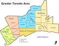
East Gwillimbury is a town (lower-tier municipality) on the East Holland River in the upper-tier municipality the Regional Municipality of York. It is part of the Greater Toronto Area of southern Ontario, in Canada. It was formed by the amalgamation of the Township of East Gwillimbury with all the previously incorporated villages and hamlets within the township. The main centres in East Gwillimbury are the villages of Holland Landing, Queensville, Sharon, and Mount Albert. The Civic Centre (municipal offices) are located along Leslie Street in Sharon. The northernmost interchange of Highway 404 is at the North edge of East Gwillimbury, just south of Ravenshoe Road. The hamlets of Holt and Brown Hill are also within town limits.

Contents

East Gwillimbury takes its name from the family of Elizabeth Simcoe, née Gwillim, wife of Sir John Graves Simcoe, the first Lieutenant Governor of Ontario. [4]

Sharon Temple Low profile, Sharon Temple (2564230676).jpg
Sharon Temple

Government

The municipal council consists of a mayor and four councillors elected at large, with the mayor also representing the town in York Regional Council. The current and recent mayors are: [5]

MayorOverall Term
Virginia Hackson2010 to present
James Young2000 to 2010
Jim Mortson1991 to 2000
Robert Featherstonhaugh1985 to 1991
Angus Morton1977 to 1985
Gladys Rolling1970 to 1976

Virginia Hackson was elected mayor in the 2010 election, and re-elected in 2014 and 2018.

In the 2018 election, where council was elected for a four-year term, East Gwillimbury's council was elected on the basis of three wards, with two councillors from each ward. The elected councillors were Loralea Carruthers, Terry Foster, Joe Persechini, Tara Roy-Diclemente, Cathy Morton and Scott Crone. [6]

East Gwillimbury federal election results [7]
Year Liberal Conservative New Democratic Green
2021 33%4,70448%6,85912%1,7280%9
2019 30%4,50346%7,06311%1,63610%1,468
East Gwillimbury provincial election results [8]
Year PC New Democratic Liberal Green
2022 56%5,89810%1,10020%2,0838%800
2018 56%6,95722%2,70316%2,0515%609

The Federal Member of Parliament is Scot Davidson of the Conservative Party of Canada representing the riding of York—Simcoe, who was elected in a by-election on February 25, 2019. He replaced Peter Van Loan, who retired as of September 30, 2018. [9]

The Member of Provincial Parliament is Caroline Mulroney, a member of the Progressive Conservative Party of Ontario, representing the provincial riding of York—Simcoe, who won the seat in the 2018 provincial election.

Emergency services

There are three fire and emergency services locations, in Holland Landing, Mount Albert and Queensville. They are each staffed by a District Fire Chief and volunteer firefighters. [10]

Police services are provided by the York Regional Police.

Planning

In March, 2006 the town council passed a policy during the Committee of the Whole Council Meeting which requires all residential developments of at least ten units to comply with Energy Star qualifications. [11] The town's mayor described potential benefits of the program: "Energy efficient housing is the best way to ensure that East Gwillimbury's residents are insulated against rising energy costs and won't have to make costly energy efficiency upgrade retrofits in the future." [11] The program was developed in conjunction with the development community, and stipulates "that homes in new subdivisions must — emphasis here on must — have some of the most efficient hot water, heating and air conditioning systems, be upgraded with top-rated insulation, and have draft-proof windows." [12]

East Gwillimbury is the first jurisdiction in Canada to require Energy Star certification for residential units.

The 2010 Official Plan

In June 2010, town council passed the Official Plan for the Town of East Gwillimbury. The Official Plan was praised for its consultations [13] with the public, developers, and other stakeholders. Designated as a future growth area under the Places to Grow Act by the Province of Ontario, East Gwillimbury will see growth from 23,000 residents in 2010, to approximately 88,400 people and 34,000 jobs by the year 2031. Despite the large amount of growth, almost 75% of East Gwillimbury land will not be developed as it is part of both the Greenbelt and the Oak Ridges Moraine. Rather than being spread out throughout the town, growth will be concentrated in the existing villages of Holland Landing, Sharon, Queensville and Mount Albert. Queensville will see the most growth, going from a population of 650 people in 2010, to over 30,000 residents. Much of the growth has been proposed since the early 1990s – however, growth in East Gwillimbury cannot occur until the York–Durham Sewage System is extended into the town, which has been postponed until 2012 or 2013, when costs are lowered. In October 2011, the Regional Municipality of York advised the Ontario Municipal Board, that they support the Official Plan for East Gwillimbury.

Demographics

East Gwillimbury Historical populations
YearPop.±%
198112,565    
199118,367+46.2%
2001 20,555+11.9%
2006 21,069+2.5%
2011 22,473+6.7%
2016 23,991+6.8%
2021 34,637+44.4%
[14] [2] [3]

In the 2021 Census of Population conducted by Statistics Canada, East Gwillimbury had a population of 34,637 living in 11,449 of its 11,869 total private dwellings, a change of

Canada 2016 CensusPopulationPercent
Ethnic origin (multiple
responses included)

Source:
English 8,02534.2
Canadian 7,10030.3
Scottish 5,26022.4
Irish 5,20022.2
German 2,60011.1
Italian 2,0458.7
French 2,0108.6
Dutch 1,3255.7
British Isles origins, n.i.e. 9504.1
Polish 8353.6
Ukrainian 8053.4
Chinese 7853.3
First Nations 6052.6
Russian 5902.5
Welsh 5502.3

Attractions

The Sharon Temple is located in the village of Sharon, Ontario. It was designated as a National Historic Site of Canada in 1990. The site is composed of eight distinctive heritage buildings and dwellings, and houses 6,000 artifacts on a 1.8-hectare (4.4-acre) site. The Temple was constructed between 1825 and 1831 by the "Children of Peace", a Quaker sect led by David Willson, on whose property it was built. [16]

East Gwillimbury GO Station main building East Gwillimbury GO Station 0512.JPG
East Gwillimbury GO Station main building
Aerial view of Bare Oaks Family Naturist Park looking east. Bare Oaks Aerial.jpg
Aerial view of Bare Oaks Family Naturist Park looking east.

Bare Oaks Family Naturist Park is a naturist (nudist) park located between the villages of Sharon and Mount Albert. It attracts thousands of visitors to East Gwillimbury and has a significant economic impact on area tourism. [17] It has been in that location since 1972 when it was known as the Toronto Helios Society. [18]

Stardust Drive-In Theatre on Mount Albert Road opened in 1950s as North York Drive-In and is one of a handful of drive-in theatres remaining in Canada. [19]

Education

Schools in East Gwillimbury are governed by the York Region District School Board and the York Catholic District School Board. There are several elementary schools. Under the public system, the school board operates Holland Landing Public School, Park Avenue Public School, located in Holland Landing and Phoebe Gilman Public School in the Harvest Hills neighborhood. Sharon Public School, Queensville Public School and Mt. Albert Public School are located in Sharon, Queensville and Mount Albert respectively. The York Catholic District School Board operates Good Shepherd Catholic School (Holland Landing and Our Lady of Good Counsel Catholic Elementary School in Sharon). There are currently no secondary schools in East Gwillimbury, so students in Holland Landing attend Dr. John M. Denison Secondary School in Newmarket and students from Sharon, Queensville and Mount Albert attend Huron Heights Secondary School, also in Newmarket or Stouffville District Secondary School located in Whitchurch-Stouffville. Good Shepherd and Our Lady of Good Counsel students may proceed to Sacred Heart Catholic High School for secondary school. No post-secondary campuses are located in East Gwillimbury, though there are plans to bring a post-secondary institution to the Queensville area. East Gwillimbury's newest public school, Robert Munsch Public School, opened in 2014 in Mount Albert.

Transportation

Local public transportation is provided by York Region Transit, who operate bus services to Sharon, Holland Landing and Mount Albert. [20] GO Transit also offers commuter train and bus services to Toronto through its East Gwillimbury Station on the Barrie line. [21]

Ontario Highway 404 has been extended to just south of Keswick in the Town of Georgina, passing through East Gwillimbury. The town is served by three interchanges along Highway 404, namely Green Lane just north of Newmarket, Queensville Sideroad, and Woodbine Ave at the north end. [22]

History

East Gwillimbury began with the early development of Upper Canada by Lieutenant-Governor John Graves Simcoe in the late 18th century. On his order, Yonge Street was constructed from Lake Ontario to what is now the village of Holland Landing in East Gwillimbury. The areas to the north and east were named East Gwillimbury and North Gwillimbury in honour of Simcoe's wife, Elizabeth Gwillim. [4] In 1849 the Baldwin Act incorporated the Township of East Gwillimbury effective January 1, 1850. The Province of Ontario incorporated the Town of East Gwillimbury effective January 1, 1971. [23]

As the East Gwillimbury area grew, a number of communities developed. They were the villages or hamlets of Brown Hill, Franklin, Holland Landing, Holt (formerly Eastville), Mount Albert, Queensville (formerly colloquially known as The Four Corners), Ravenshoe, River Drive, and Sharon (formerly Hope). [4]

In 1913, all township records were destroyed in a fire at the clerk's office in Queensville. [24]

Notable people

See also

Related Research Articles

<span class="mw-page-title-main">Newmarket, Ontario</span> Town in Ontario, Canada

Newmarket is a town and regional seat of the Regional Municipality of York in the Canadian province of Ontario. It is part of Greater Toronto in the Golden Horseshoe region of Southern Ontario. The name stems from the fact that the settlement was a "New Market", in contrast to York as the Old Market.

<span class="mw-page-title-main">Regional Municipality of York</span> Regional municipality in Ontario, Canada

The Regional Municipality of York, also called York Region, is a regional municipality in Southern Ontario, Canada, between Lake Simcoe and Toronto. The region was established after the passing of then Bill 102, An Act to Establish The Regional Municipality of York, in 1970. It replaced the former York County in 1971, and is part of the Greater Toronto Area and the inner ring of the Golden Horseshoe. The regional government is headquartered in Newmarket.

<span class="mw-page-title-main">Keswick, Ontario</span> Community in Ontario, Canada

Keswick (/ˈkɛzˌwɪk/) is a community located in the Canadian province of Ontario. Situated in Cook's Bay on Lake Simcoe, 72 km (45 mi) north of Toronto. Keswick is part of the Town of Georgina, the northernmost municipality in the Regional Municipality of York. In the Canada 2016 Census, the municipal population of Keswick was 26,757.

<span class="mw-page-title-main">King, Ontario</span> Township in Ontario, Canada

King is a township in York Region north of Toronto, within the Greater Toronto Area in Ontario, Canada.

<span class="mw-page-title-main">Bradford West Gwillimbury</span> Town in Ontario, Canada

Bradford West Gwillimbury is a town in south-central Ontario, in the County of Simcoe in the Toronto Census Metropolitan Area on the Holland River. West Gwillimbury takes its name from the family of Elizabeth Simcoe, née Gwillim.

<span class="mw-page-title-main">Innisfil</span> Town in Ontario, Canada

Innisfil is a town in Ontario, Canada, located on the western shore of Lake Simcoe in Simcoe County, immediately south of Barrie and 80 kilometres (50 mi) north of Toronto. It has historically been a rural area, but since it is geographically sandwiched between the high-growth areas of Barrie and the York Region, there has been growing residential development in Innisfil.

<span class="mw-page-title-main">Simcoe County</span> County in Ontario, Canada

Simcoe County is located in the central portion of Southern Ontario, Canada. The county is just north of the Greater Toronto Area, stretching from the shores of Lake Simcoe in the east to Georgian Bay in the west. Simcoe County forms part of the Greater Golden Horseshoe area, a densely populated and industrialized region, centred on the Greater Toronto Area.

<span class="mw-page-title-main">Sharon, Ontario</span> Unincorporated community in Ontario, Canada

Sharon is a former village now incorporated into the municipality of the Town of East Gwillimbury, Ontario, Canada, formerly the Township of East Gwillimbury. The municipal offices of the town are in Sharon.

<span class="mw-page-title-main">Bradford, Ontario</span> Community in Ontario, Canada

Bradford is the primary country urban area of the Town of Bradford West Gwillimbury, Ontario, in Canada. It overlooks a farming community, known as The Holland Marsh, located on the Holland River that flows into Lake Simcoe.

<span class="mw-page-title-main">Queensville, Ontario</span> Unincorporated community in Ontario, Canada

Queensville is a village within the Town of East Gwillimbury, Ontario, Canada.

<span class="mw-page-title-main">York North</span> Federal electoral district in Ontario, Canada

York North was a federal riding in Ontario, Canada, that was in the House of Commons of Canada from Confederation in 1867 until 2004.

<span class="mw-page-title-main">York—Simcoe (federal electoral district)</span> Federal electoral district in Ontario, Canada

York—Simcoe is a federal electoral district in Ontario, Canada, that has been represented in the House of Commons of Canada from 1968 to 1979, from 1988 to 1997 and since 2004.

King's Highway 48, also known as Highway 48, is a provincially maintained highway in southern Ontario that extends from Major Mackenzie Drive in Markham, through Whitchurch-Stouffville and East Gwillimbury, to Highway 12 south-east of Beaverton. The route is generally rural and straight, passing near several communities within the Regional Municipality of York. The route is 65.2 kilometres (40.5 mi) long. Most part of the road has a speed limit of 80 km/h (50 mph), except within town limits, where the speed limit is reduced to 60 km/h (37 mph) or 50 km/h (31 mph).

<span class="mw-page-title-main">Holland Landing</span> Unincorporated community in Ontario, Canada

Holland Landing is a community in the town of East Gwillimbury, located in the northern part of the Regional Municipality of York, in south-central Ontario, Canada. Its major road is Yonge Street and the community has bus service by GO Transit route 68 and York Region Transit route 52. The East Gwillimbury GO train station is in the southeast corner of Holland Landing, providing weekday commuter train service. The East Holland River runs through the community and has several marinas for recreational boats.

Mount Albert is a village located within the Town of East Gwillimbury and is part of York Region. It is located 65 km north-east of Toronto, 21 km south of Sutton, 45 km west-southwest of Beaverton and 30 km north of Markham. Mount Albert is accessible by Highway 404 and Highway 48.

<span class="mw-page-title-main">York Region District School Board</span> School board in Ontario, Canada

The York Region District School Board (YRDSB), until 1999, English-language Public District School Board No. 16 is the English-language public school board for the Regional Municipality of York in Ontario, Canada. The York Region District School Board is the province's third-largest school board after Toronto's TDSB and Peel's PDSB, with an enrolment of over 122,000 students. It is in the fastest-growing census division in Ontario and the third-fastest growing in Canada.

The East Holland River is a river in Ontario, Canada that is part of the Holland River watershed that empties into Cook's Bay in Lake Simcoe. The headwaters of the East Holland River rise in the Oak Ridges Moraine. The river runs generally north from the town of Newmarket, and through Holland Landing where it joins up with the West Holland River.

The Bradford Bypass, also known as the Highway 400–404 Link is a proposed east–west 400-series highway in the northern Greater Toronto Area of the Canadian province of Ontario. The approximately 16.2-kilometre (10.1 mi) route is currently undergoing planning and analysis under an environmental impact assessment (EA) by the Ministry of Transportation of Ontario (MTO) and the Government of Ontario. If approved, a new four-lane controlled-access highway would be built between Highway 400 near Bradford in Simcoe County, and Highway 404 near Queensville in York Region. It would serve as a bypass to the north side of Bradford.

King's Highway 88, commonly referred to as Highway 88, was a provincially-maintained highway in the Canadian province of Ontario, located in what is now the town of Bradford West Gwillimbury, that connected former Highway 27, in the village of Bond Head, with former Highway 11 in the town of Bradford. The short 9.7-kilometre (6.0 mi) route was established in 1938, though the road it followed had existed for over a century at that time.

Holt is a former village which has been incorporated into the municipality of the Town of East Gwillimbury, Ontario, Canada, formerly the Township of East Gwillimbury. The municipal offices of the town are located in Sharon.

References

  1. "The motto appears on the ribbon of the Town's Crest". Town of East Gwillimbury. Retrieved December 3, 2019.
  2. 1 2 "Census Profile, 2016 Census: East Gwillimbury". Statistics Canada. Retrieved July 26, 2019.
  3. 1 2 "East Gwillimbury, Town Ontario (Census Subdivision)". Census Profile, Canada 2021 Census . Statistics Canada. February 9, 2022. Retrieved February 12, 2022.
  4. 1 2 3 Millier Dickinson Blais (2012). "Town of East Gwillimbury Cultural Mapping Project" (PDF). Town of East Gwillimbury. p. 7. Archived from the original (PDF) on May 6, 2021. Retrieved February 25, 2019.
  5. "Chain of Office". Town of East Gwillimbury. Archived from the original on August 9, 2006. Retrieved November 18, 2012.
  6. "2018 Municipal Election Results". Town of East Gwillimbury. Archived from the original on October 23, 2018. Retrieved February 25, 2019.
  7. "Official Voting Results Raw Data (poll by poll results in East Gwillimbury)". Elections Canada. April 7, 2022. Retrieved March 13, 2023.
  8. "Official Voting Results by polling station (poll by poll results in East Gwillimbury)". Election Ontario. Retrieved March 13, 2023.
  9. "Former House leader under Stephen Harper, Peter Van Loan, retiring from Commons". CTV News. Canadian Press. July 29, 2018. Retrieved July 30, 2018.
  10. "Fire Station Locations". Town of East Gwillimbury. Retrieved February 25, 2019.
  11. 1 2 "East Gwillimbury – First in Canada to Adopt ENERGY STAR Standards for New Housing" (PDF). Town of East Gwillimbury. May 15, 2006. Archived from the original (PDF) on June 14, 2006. Retrieved June 19, 2006.
  12. Hamilton, Tyler (June 19, 2006). "Town raises bar on efficiency". Toronto Star . Retrieved June 19, 2006.
  13. "Have your say in East Gwillimbury's future". yorkregion.com. Metroland Media Group. January 28, 2008. Archived from the original on November 7, 2015.
  14. "East Gwillimbury census profile". 2011 Census of Population . Statistics Canada. February 8, 2012. Retrieved May 27, 2015.
  15. "Population and dwelling counts: Canada, provinces and territories, census divisions and census subdivisions (municipalities), Ontario". Statistics Canada. February 9, 2022. Retrieved March 30, 2022.
  16. "Sharon Temple National Historic Site of Canada". Canada's Historic Places. Parks Canada. Retrieved July 26, 2019.
  17. Committee of the Whole Meeting Minutes (PDF), East Gwillimbury, June 11, 2012, p. 3, retrieved February 25, 2013
  18. Woycke, James (2003). Au naturel : the history of nudism in Canada. Etobicoke, Ontario: Federation of Canadian Naturists. ISBN   0-9682332-3-6.
  19. "Stardust Drive-In Theatre". Premier Theaters. Retrieved July 26, 2019.
  20. "YRT System Map" (PDF). York Region Transit. January 7, 2024. Retrieved February 21, 2024.
  21. "East Gwillimbury Station". GO Transit . Retrieved July 26, 2019.
  22. "Map of Highway 404 through East Gwillimbury". Google Maps. Retrieved July 26, 2019.
  23. "Ontario Archives". Gazetteer of Ontario, 1962, p. 160. Government of Ontario. Retrieved December 30, 2013.
  24. Rolling, Gladys M. (1967). "Preface". East Gwillimbury in the nineteenth century. Ryerson Press.
  25. Matthews, Blair (March 2017). "Nothing was Sweeter than Candy". East Gwillimbury Bulletin. Retrieved October 12, 2023.

Further reading