Georgina is a town in south-central Ontario. The northernmost municipality in the Regional Municipality of York, the town is bounded to the north by Lake Simcoe. Although incorporated as a town, it operates as a township in which dispersed communities share a common administrative council. The largest communities are Keswick, Sutton, and Jackson's Point. Smaller communities include Pefferlaw, Port Bolster, Roches Point, Udora, and Willow Beach. The town was formed by the merger of the Village of Sutton, the Township of Georgina, and the Township of North Gwillimbury in 1971 and incorporated in 1986. North Gwillimbury had been part of Georgina but became its own township in 1826. It took its name from the family of Elizabeth Simcoe, née Gwillim.
The main centres in Georgina are the communities of Keswick, Belhaven, Sutton West, Jackson's Point,[3] Baldwin, Virginia, Pefferlaw, Port Bolster, Udora, and Willow Beach. Other settlements include Jersey, Cedarbrae, Brown Hill, Island Grove, Maple Hill, Elm Grove, Roches Point (named for the family of Author Mazo de la Roche, who is buried in the cemetery, at St. George's Anglican Church, Sibbald Point), Sibbald Point, Virginia/Virginia Beach (originally called Frenchtown), McRae Beach, Duclos Point, Balfour Beach, Varney, Brighton Beach, and a variety of other beach communities.[4]
In the 2021 Census of Population conducted by Statistics Canada, Georgina had a population of 47,642 living in 17,895 of its 19,368 total private dwellings, a change of 4.9% from its 2016 population of 45,418. With a land area of 287.69km2 (111.08sqmi), it had a population density of 165.6/km2 (428.9/sqmi) in 2021.[2]
Ethnicity
Panethnic groups in the Town of Georgina (2001−2021)
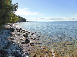
Georgina and other communities on Lake Simcoe, Ontario
The Town of Georgina operates under a ward system, and its municipal council consists of the mayor, regional councillor (known procedurally as deputy mayor) and a councillor for each of the five wards. The current council consists of:[12]
Mayor: Margaret Quirk
Deputy Mayor/Regional Councillor: Naomi Davison
Councillor Ward 1: Charlene Biggerstaff
Councillor Ward 2: Dan Fellini
Councillor Ward 3: Dave Neeson
Councillor Ward 4: Dale Kerr Genge
Councillor Ward 5: Lee Dale
The mayor and the deputy mayor represent Georgina at meetings of York Regional Council.
Canadian Wrestling Hall of Fame member Whipper Billy Watson was a lifelong resident, and he spearheaded the campaign to build the Georgina Cultural Centre in the 1980s, which also houses the Stephen Leacock Theatre.
Keswick is the birthplace and childhood home of former NHL goaltender Curtis Joseph.
Noted writer Stephen Leacock settled on a farm near Egypt, a hamlet within Georgina.
Jim Carrey, a Canadian actor, comedian, impressionist, screenwriter, and producer. He was born in nearby Newmarket. His family settled in Jackson's Point in his late teens.
↑Government of Canada, Statistics Canada (2019-08-20). "2006 Community Profiles". www12.statcan.gc.ca. Retrieved 2025-09-13.
↑Government of Canada, Statistics Canada (2019-07-02). "2001 Community Profiles". www12.statcan.gc.ca. Retrieved 2025-09-13.
↑Statistics Canada. (2002). GeorginaArchived 2015-11-07 at the Wayback Machine2001 Community Profiles. Released June 27, 2002. Last modified: 2005-11-30. Statistics Canada Catalogue no. 93F0053XIE
↑Statistics Canada (2011). Census Profile for Georgina, Ontario (Town). Released October 24, 2011
This page is based on this Wikipedia article Text is available under the CC BY-SA 4.0 license; additional terms may apply. Images, videos and audio are available under their respective licenses.