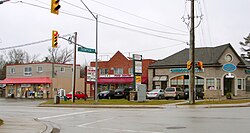
Holland Landing

Last updated

Holland Landing
Unincorporated community
Holland Landing ON.JPG
York locator map 2021.svg
Red pog.svg
Holland Landing
Location in Ontario
Canada Ontario location map 2.svg
Red pog.svg
Holland Landing
Holland Landing (Ontario)
Coordinates: 44°05′22″N079°29′42″W / 44.08944°N 79.49500°W / 44.08944; -79.49500 Coordinates: 44°05′22″N079°29′42″W / 44.08944°N 79.49500°W / 44.08944; -79.49500
Country Canada
Province Ontario
Regional municipality York
Town East Gwillimbury
Time zone UTC-5 (EST)
  Summer (DST) UTC-4 (EDT)
Forward sortation area
L9N
Area code(s) 905 and 289
NTS Map031D03
GNBC CodeFBOII

Holland Landing is a community in the town of East Gwillimbury, located in the northern part of the Regional Municipality of York, in south-central Ontario, Canada. Its major road is Yonge Street (bypassed by the former Highway 11) and the community has bus service by GO Transit route 68 and York Region Transit route 52 (Monday to Saturday service). The East Gwillimbury GO train station is in the southeast corner of Holland Landing, providing weekday commuter train service. The East Holland River runs through the community and has several marinas for recreational boats.

Contents

Most of Holland Landing's internal economy is based on the service industry, and some manufacturing.

History

In 1793, Governor John Graves Simcoe came across what would be the future site of Holland Landing, then known as St. Albans. He believed the area would make an ideal portage route and defence point between York (now Toronto) and Georgian Bay. [1] Holland Landing was named after Samuel Holland, first Surveyor-General of British North America, who had served on HMS Pembroke, under Captain John Simcoe, father of Governor Simcoe, for whom Lake Simcoe is named.

Holland Landing was the northernmost point on the original alignment of Yonge Street. North of the town the Holland River is easily navigable, and the location was selected as a well sited inland port for Lake Simcoe, via the river. It was intended that Yonge Street, in combination with the similar Penetanguishene Road further north, would provide access to the upper Great Lakes from the city of York. Holland Landing would be a major point on this route.

However, it never served this intended role in any real capacity. The closest it came was during the War of 1812, when the British decided to retake the entire lake system through the construction of a number of first-rate ships in Kingston and Penetanguishene. A large anchor, over fifteen feet (roughly 4.6 m) long and weighing approximately 4000 lbs (about 1 816 kg), for the frigate under construction at Penetanguishene was shipped from England and had made it as far as Holland Landing when the war ended. It was abandoned and is currently on display at Anchor Park. [2]

The town itself was not formed until the early 19th century, settled by the same Quaker immigrants as nearby Newmarket and Aurora. In 1815, a population of settlers from Selkirk, Manitoba arrived in Holland Landing after a conflict between them and the Métis. [3]

Samuel Lount, a martyr of the 1837 Rebellion led by William Lyon Mackenzie, farmed and operated a smithy here. Lount was captured later, convicted of treason, and hanged on April 12, 1838. [4]

The idea for a canal linking to Lake Simcoe and the Trent-Severn Waterway was approved and construction started in 1906. Holland Landing would connect Newmarket and Bradford. It was almost complete in the summer of 1912 – three lift locks, three swing bridges and a turning basin – when the new government of Robert Borden cancelled the project. The project was abandoned, earning it the name "The Ghost Canal". [5] It continues to serve as a historical landmark.

Demographics

Education

The community has four primary schools; Holland Landing Public School (YRDSB), Park Avenue Public School (YRDSB) and Good Shepherd Catholic School (YCDSB) and École élémentaire catholique Jean-Béliveau (a French-language Catholic school). There are no higher education institutions in Holland Landing, or indeed in East Gwillimbury. [7] Students from Holland Landing typically attend one of the high schools in Newmarket.

Notable people

Nearest communities

See also

Related Research Articles

<span class="mw-page-title-main">Newmarket, Ontario</span> Town in Ontario, Canada

Newmarket is a town and regional seat of the Regional Municipality of York in the Canadian province of Ontario. It is part of Greater Toronto in the Golden Horseshoe region of Southern Ontario. The name stems from the fact that the settlement was a "New Market", in contrast to York as the Old Market.

<span class="mw-page-title-main">Regional Municipality of York</span> Regional municipality in Ontario, Canada

The Regional Municipality of York, also called York Region, is a regional municipality in Southern Ontario, Canada, between Lake Simcoe and Toronto. The region was established after the passing of then Bill 102, An Act to Establish The Regional Municipality of York, in 1970. It replaced the former York County in 1971, and is part of the Greater Toronto Area and the inner ring of the Golden Horseshoe. The regional government is headquartered in Newmarket.

<span class="mw-page-title-main">Yonge Street</span> Historic road in Ontario, Canada

Yonge Street is a major arterial route in the Canadian province of Ontario connecting the shores of Lake Ontario in Toronto to Lake Simcoe, a gateway to the Upper Great Lakes.

<span class="mw-page-title-main">Keswick, Ontario</span> Community in Ontario, Canada

Keswick (/ˈkɛzˌwɪk/) is a community located in the Canadian province of Ontario. Situated in Cook's Bay on Lake Simcoe, 72 km (45 mi) north of Toronto. Keswick is part of the Town of Georgina, the northernmost municipality in the Regional Municipality of York. In the Canada 2016 Census, the municipal population of Keswick was 26,757.

<span class="mw-page-title-main">Bradford West Gwillimbury</span> Town in Ontario, Canada

Bradford West Gwillimbury is a town in south-central Ontario, in the County of Simcoe in the Toronto Census Metropolitan Area on the Holland River. West Gwillimbury takes its name from the family of Elizabeth Simcoe, née Gwillim.

<span class="mw-page-title-main">East Gwillimbury</span> Town in Ontario, Canada

East Gwillimbury is a town on the East Holland River in the upper-tier municipality the Regional Municipality of York. It is part of the Greater Toronto Area of southern Ontario, in Canada. It was formed by the amalgamation of the Township of East Gwillimbury with all the previously incorporated villages and hamlets within the township. The main centres in East Gwillimbury are the villages of Holland Landing, Queensville, Sharon, and Mount Albert. The Civic Centre are located along Leslie Street in Sharon. The northernmost interchange of Highway 404 is at the North edge of East Gwillimbury, just south of Ravenshoe Road. The hamlets of Holt and Brown Hill are also within town limits.

<span class="mw-page-title-main">Innisfil</span> Town in Ontario, Canada

Innisfil is a town in Ontario, Canada, located on the western shore of Lake Simcoe in Simcoe County, immediately south of Barrie and 80 kilometres (50 mi) north of Toronto. It has historically been a rural area, but due to being geographically sandwiched in between the high-growth areas of Barrie area and York Region has meant greater residential development in Innisfil.

<span class="mw-page-title-main">Simcoe County</span> County in Ontario, Canada

Simcoe County is located in the central portion of Southern Ontario, Canada. The county is just north of the Greater Toronto Area, stretching from the shores of Lake Simcoe in the east to Georgian Bay in the west. Simcoe County forms part of the Greater Golden Horseshoe area, a densely populated and industrialized region, centred on the Greater Toronto Area.

<span class="mw-page-title-main">Bradford, Ontario</span> Community in Ontario, Canada

Bradford is the primary country urban area of the Town of Bradford West Gwillimbury, Ontario, in Canada. It overlooks a farming community, known as The Holland Marsh, located on the Holland River that flows into Lake Simcoe.

<span class="mw-page-title-main">Oro-Medonte</span> Township in Simcoe County, Ontario

Oro-Medonte is a township in south-central Ontario, Canada, on the northwestern shores of Lake Simcoe in Simcoe County.

<span class="mw-page-title-main">York North</span> Federal electoral district in Ontario, Canada

York North was a federal riding in Ontario, Canada, that was in the House of Commons of Canada from Confederation in 1867 until 2004.

<span class="mw-page-title-main">York Region District School Board</span> School board in Ontario, Canada

The York Region District School Board (YRDSB), until 1999, English-language Public District School Board No. 16 is the English-language public school board for the Regional Municipality of York in Ontario, Canada. The York Region District School Board is the province's third-largest school board after Toronto's TDSB and Peel's PDSB, with an enrollment of over 122,000 students. It is in the fastest-growing census division in Ontario and the third-fastest growing in Canada.

The East Holland River is a river in Ontario, Canada that is part of the Holland River watershed that empties into Cook's Bay in Lake Simcoe. The headwaters of the East Holland River rise in the Oak Ridges Moraine. The river runs generally north from the town of Newmarket, and through Holland Landing where it joins up with the West Holland River.

<span class="mw-page-title-main">Holland River</span> River in Ontario, Canada

The Holland River is a river in Ontario, Canada, that drains the Holland River watershed into Cook's Bay, the southern extremity of Lake Simcoe. The river flows generally north, and its headwaters lie in the Oak Ridges Moraine. The Holland River watershed is approximately 600 square kilometres (230 sq mi), spanning an area that includes New Tecumseth, King Township, Newmarket, Aurora, East Gwillimbury, and Whitchurch-Stouffville. The river's watershed also contains the Holland Marsh, a fertile farmland region renowned for its vegetable production.

<span class="mw-page-title-main">Samuel Lount</span> Canadian politician (1791–1838)

Samuel Lount was a blacksmith, farmer, magistrate and member of the Legislative Assembly in the province of Upper Canada for Simcoe County from 1834 to 1836. He was an organizer of the failed Upper Canada Rebellion of 1837, for which he was hanged as a traitor. His execution made him a martyr to the Upper Canadian Reform movement.

The Bradford Bypass, also known as the Highway 400–404 Link is a proposed east–west 400-series highway in the northern Greater Toronto Area of the Canadian province of Ontario. The approximately 16.2-kilometre (10.1 mi) route is currently undergoing planning and analysis under an environmental impact assessment (EA) by the Ministry of Transportation of Ontario (MTO) and the Government of Ontario. If approved, a new four-lane controlled-access highway would be built between Highway 400 near Bradford in Simcoe County, and Highway 404 near Queensville in York Region. It would serve as a bypass to the north side of Bradford.

<span class="mw-page-title-main">Ontario Highway 93</span> Ontario provincial highway

King's Highway 93, commonly referred to as Highway 93, is a provincially maintained highway in the Canadian province of Ontario. Located entirely within Simcoe County, the highway extends 23.9 kilometres (14.9 mi) from an interchange with Highway 400 in Springwater, just south of the community of Hillsdale, to an intersection with Highway 12 at the town limits of Midland. The route follows the historic Penetanguishene Road, an early colonization road which served to connect Lake Simcoe with Georgian Bay, thus providing an overland route from Lake Huron to Lake Ontario via Yonge Street.

King's Highway 88, commonly referred to as Highway 88, was a provincially-maintained highway in the Canadian province of Ontario, located in what is now the town of Bradford West Gwillimbury, that connected former Highway 27, in the village of Bond Head, with former Highway 11 in the town of Bradford. The short 9.7-kilometre (6.0 mi) route was established in 1938, though the road it followed had existed for over a century at that time.

<span class="mw-page-title-main">Lake Simcoe Region Conservation Authority</span>

The Lake Simcoe Region Conservation Authority is a conservation authority established in 1951, and is among the oldest in the Canadian province of Ontario.

<span class="mw-page-title-main">Newmarket Canal</span>

The Newmarket Canal, officially known but rarely referred to as the Holland River Division, is an abandoned barge canal project in Newmarket, Ontario. With a total length of about 10 miles (16 km), it was supposed to connect the town to the Trent–Severn Waterway via the East Holland River and Lake Simcoe. Construction was almost complete when work was abandoned, and the three completed pound Locks, a swing bridge and a turning basin remain largely intact to this day.

References

  1. 1 2 "Holland Landing - River Drive Park - History". Town of East Gwillimbury. Retrieved December 17, 2018.
  2. "Holland Landing Anchor - Anchor Park, Holland Landing, Ontario". waymarking.com. Groundspeak, Inc. Retrieved December 16, 2018.
  3. Nickerson, Janice (12 October 2005). "Upper Canada Chronology". Upper Canada Genealogy. Retrieved 11 December 2010.
  4. "Samuel Lount 1791-1838". Ontario's Historical Plaques. Alan L. Brown. Retrieved 17 December 2018.
  5. "The Ghost Canal, Newmarket". Yorkregion.com. Metroland Media Group. July 17, 2007. Retrieved 16 December 2018.
  6. "Demographics". Town of East Gwillimbury. Archived from the original on January 23, 2009. Retrieved 17 December 2018.
  7. "School Contact Information". Town of East Gwillimbury. Retrieved 17 December 2018.