The East Holland River is a river in Ontario, Canada that is part of the Holland River watershed that empties into Cook's Bay in Lake Simcoe. The headwaters of the East Holland River rise in the Oak Ridges Moraine. The river runs generally north from the town of Newmarket, and through Holland Landing where it joins up with the West Holland River.
A map of the Holland River watershed published by the Lake Simcoe Region Conservation Authority shows tributaries to the East Holland River include Sharon Creek, Bogart Creek, Tannery Creek (from Aurora, Ontario), Western Creek (from the west side of Newmarket), and Weslie Creek.
A dam on the East Holland River in Newmarket maintains a man-made lake called Fairy Lake, originally a millpond, but now used for recreation. There has been a dam at this site since 1801. The current dam was damaged, albeit not severely, by Hurricane Hazel in 1954.
Musselman Lake in Whitchurch-Stouffville feeds a creek that runs along Vandorf Sideroad and into Weslie Creek.
Despite concerns of a lack of water, construction of several locks was started along the river between Newmarket and Holland Landing as part of a 'Holland River Canal' that would have joined Newmarket to the Trent-Severn Waterway. There is one lock in each of those places along with another at Rogers Reservoir in East Gwillimbury. Rogers Reservoir and Fairy Lake in Newmarket were to act as reservoirs for the canal waters. There were two swing bridges built in East Gwillimbury; one on Green Lane and the other on Main Street North (Concession 2). Both have been replaced by permanent structures. On Green Lane the road now runs slightly to the south and a pedestrian bridge crosses the old structure. There is also a quayside at Davis Drive in Newmarket. The canal works were abandoned early in the 20th century without ever being completed. The upper limit of navigation on the East Holland River remains at River Drive Park, about 2 km downstream from Holland Landing not far from the Marina RiverSports Recreation at Queensville Sideroad.

Newmarket is a town and regional seat of the Regional Municipality of York in the Canadian province of Ontario. It is part of Greater Toronto in the Golden Horseshoe region of Southern Ontario. The name stems from the fact that the settlement was a "New Market", in contrast to York as the Old Market.

The Regional Municipality of York, also called York Region, is a regional municipality in Southern Ontario, Canada, between Lake Simcoe and Toronto. The region was established after the passing of then Bill 102, An Act to Establish The Regional Municipality of York, in 1970. It replaced the former York County in 1971, and is part of the Greater Toronto Area and the inner ring of the Golden Horseshoe. The regional government is headquartered in Newmarket.

Lake Simcoe is a lake in southern Ontario, Canada, the fourth-largest lake wholly in the province, after Lake Nipigon, Lac Seul, and Lake Nipissing. At the time of the first European contact in the 17th century the lake was called Ouentironk by the native Wendat/Ouendat (Huron) people. It was also known as Lake Taronto until it was renamed by John Graves Simcoe, the first Lieutenant-Governor of Upper Canada, in memory of his father, Captain John Simcoe of the Royal Navy. In Anishinaabemowin, the ancestral language of the First Nations living around this lake, namely Anishinaabek of Rama and Georgina Island First Nations, Lake Simcoe is called Zhooniyaang-zaaga'igan, meaning "Silver Lake".

Yonge Street is a major arterial route in the Canadian province of Ontario connecting the shores of Lake Ontario in Toronto to Lake Simcoe, a gateway to the Upper Great Lakes.

The Humber River is a river in Southern Ontario, Canada. It is in the Great Lakes Basin, is a tributary of Lake Ontario and is one of two major rivers on either side of the city of Toronto, the other being the Don River to the east. It was designated a Canadian Heritage River on September 24, 1999.

Keswick (/ˈkɛzˌwɪk/) is a community located in the Canadian province of Ontario. Situated in Cook's Bay on Lake Simcoe, 72 km (45 mi) north of Toronto. Keswick is part of the Town of Georgina, the northernmost municipality in the Regional Municipality of York. In the Canada 2016 Census, the municipal population of Keswick was 26,757.

Bradford West Gwillimbury is a town in south-central Ontario, in the County of Simcoe in the Toronto Census Metropolitan Area on the Holland River. West Gwillimbury takes its name from the family of Elizabeth Simcoe, née Gwillim.

East Gwillimbury is a town on the East Holland River in the upper-tier municipality the Regional Municipality of York. It is part of the Greater Toronto Area of southern Ontario, in Canada. It was formed by the amalgamation of the Township of East Gwillimbury with all the previously incorporated villages and hamlets within the township. The main centres in East Gwillimbury are the villages of Holland Landing, Queensville, Sharon, and Mount Albert. The Civic Centre are located along Leslie Street in Sharon. The northernmost interchange of Highway 404 is at the North edge of East Gwillimbury, just south of Ravenshoe Road. The hamlets of Holt and Brown Hill are also within town limits.

Bradford is the primary country urban area of the Town of Bradford West Gwillimbury, Ontario, in Canada. It overlooks a farming community, known as The Holland Marsh, located on the Holland River that flows into Lake Simcoe.

Bathurst Street is a main north–south thoroughfare in Toronto, Ontario, Canada. It begins at an intersection of the Queens Quay roadway, just north of the Lake Ontario shoreline. It continues north through Toronto to the Toronto boundary at Steeles Avenue. It is a four-lane thoroughfare throughout Toronto. The roadway continues north into York Region where it is known as York Regional Road 38.

Holland Landing is a community in the town of East Gwillimbury, located in the northern part of the Regional Municipality of York, in south-central Ontario, Canada. Its major road is Yonge Street and the community has bus service by GO Transit route 68 and York Region Transit route 52. The East Gwillimbury GO train station is in the southeast corner of Holland Landing, providing weekday commuter train service. The East Holland River runs through the community and has several marinas for recreational boats.
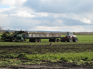
The Holland Marsh is a wetland and agricultural area in Ontario, Canada, about 50 kilometres (31 mi) north of Toronto. It lies entirely within the valley of the Holland River, stretching from the northern edge of the Oak Ridges Moraine near Schomberg to the river mouth at Cook's Bay, Lake Simcoe. In its entirety it comprises about 21,000 acres, with two distinct divisions. Historically it has simply been referred to as "the marsh".

Sutton is a suburban community located nearly 2 km south of Lake Simcoe in Ontario, Canada. The community was formerly a village but is now part of the Town of Georgina after amalgamation with it and North Gwillimbury in 1971. The Black River runs on the north end of the downtown. Highway 48 goes just south of the downtown. Sutton has a population of just over 6,000 people. Sutton is located about 1 hour north of Toronto.

The Holland River is a river in Ontario, Canada, that drains the Holland River watershed into Cook's Bay, the southern extremity of Lake Simcoe. The river flows generally north, and its headwaters lie in the Oak Ridges Moraine. The Holland River watershed is approximately 600 square kilometres (230 sq mi), spanning an area that includes New Tecumseth, King Township, Newmarket, Aurora, East Gwillimbury, and Whitchurch-Stouffville. The river's watershed also contains the Holland Marsh, a fertile farmland region renowned for its vegetable production.
The Bradford Bypass, also known as the Highway 400–404 Link is a proposed east–west 400-series highway in the northern Greater Toronto Area of the Canadian province of Ontario. The approximately 16.2-kilometre (10.1 mi) route is currently undergoing planning and analysis under an environmental impact assessment (EA) by the Ministry of Transportation of Ontario (MTO) and the Government of Ontario. If approved, a new four-lane controlled-access highway would be built between Highway 400 near Bradford in Simcoe County, and Highway 404 near Queensville in York Region. It would serve as a bypass to the north side of Bradford.
The Auld Kirk Scotch Settlement is a historic settlement located in the former township of West Gwillimbury. It is located on the 6th Line, west of the 10th Sideroad, street number 3380. The church is one of several old Presbyterian churches that merged to form St. John's Presbyterian Church in Bradford West Gwillimbury.
King's Highway 88, commonly referred to as Highway 88, was a provincially-maintained highway in the Canadian province of Ontario, located in what is now the town of Bradford West Gwillimbury, that connected former Highway 27, in the village of Bond Head, with former Highway 11 in the town of Bradford. The short 9.7-kilometre (6.0 mi) route was established in 1938, though the road it followed had existed for over a century at that time.

The Lake Simcoe Region Conservation Authority is a conservation authority established in 1951, and is among the oldest in the Canadian province of Ontario.
The Newmarket Canal, officially known but rarely referred to as the Holland River Division, is an abandoned barge canal project in Newmarket, Ontario. With a total length of about 10 miles (16 km), it was supposed to connect the town to the Trent–Severn Waterway via the East Holland River and Lake Simcoe. Construction was almost complete when work was abandoned, and the three completed pound Locks, a swing bridge and a turning basin remain largely intact to this day.

The Black River is a river in the Regional Municipality of York and the Regional Municipality of Durham in Central Ontario, Canada. It is part of the Great Lakes Basin, and is a tributary of Lake Simcoe; the entire watershed is under the auspices of the Lake Simcoe Region Conservation Authority.