Ganaraska River | |
---|---|
Etymology | from Ganaraske, the name for the Cayuga village at the river mouth |
Location | |
Country | Canada |
Province | Ontario |
Region | Southern Ontario |
Districts | |
Physical characteristics | |
Source | Ganaraska Forest on the Oak Ridges Moraine |
• location | Clarington, Regional Municipality of Durham |
• coordinates | 44°03′15″N78°36′22″W / 44.05417°N 78.60611°W |
• elevation | 344 m (1,129 ft) |
Mouth | Lake Ontario |
• location | Port Hope, Northumberland County |
• coordinates | 43°56′30″N78°17′26″W / 43.94167°N 78.29056°W Coordinates: 43°56′30″N78°17′26″W / 43.94167°N 78.29056°W |
• elevation | 74 m (243 ft) |
Basin size | 278 km2 (107 sq mi) |
Basin features | |
River system | Great Lakes Basin |
Tributaries | |
• left | North Ganaraska River |
The Ganaraska River is a river in Northumberland County and the Regional Municipality of Durham in Southern Ontario, Canada. [1] It is part of the Great Lakes Basin, and is a tributary of Lake Ontario, which it reaches at the central community of the municipality of Port Hope. The river's name is thought to be derived from Ganaraske , the Cayuga name for the village this Iroquoian nation had established in this area in 1779.
Together with other nations of the Iroquois Confederacy, they had migrated from New York, forced to cede their homelands because of having allied with the British in the American Revolutionary War. The Crown provided additional lands to the Iroquois peoples, including what is now called the Six Nations of the Grand River reserve.
Later the Crown granted land here to United Empire Loyalists, in compensation for their losses in the Northeast colonies, especially New York. They were the first European Americans to settle here in any number.
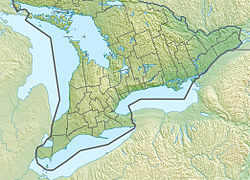
The river begins on the Oak Ridges Moraine in the Ganaraska Forest [2] in the municipality of Clarington, about 1.5 kilometres (0.9 mi) southeast of the junction of Ontario Highway 35 and Ontario Highway 115. It flows southeast past the community of Kendal, takes in the left tributary North Ganaraska River, and turns south to its mouth on the north shore of Lake Ontario.
Portions of the Ganaraska River drainage basin of 278 square kilometres (107 sq mi) extend into the City of Kawartha Lakes; the Township of Cavan–Monaghan, Peterborough County; and the Township of Hamilton, Northumberland County. [3]
There have been major conservation efforts in recent years.
It attracts anglers for salmon and trout. The Ganaraska River Fishway, a fish ladder, allows rainbow trout to travel up river to spawn.
The river had a flood in 1980, that caused considerable damage to the Port Hope downtown area. [4]
Port Hope is a municipality in Southern Ontario, Canada, approximately 109 km (68 mi) east of Toronto and about 159 km (99 mi) west of Kingston. It is located at the mouth of the Ganaraska River on the north shore of Lake Ontario, in the west end of Northumberland County. The private Trinity College School opened here in 1868.
Northumberland County is an upper-tier level of municipal government situated on the north shore of Lake Ontario, east of Toronto in Central Ontario. The Northumberland County headquarters are located in Cobourg.
The Indian River is a river in Lanark County in Eastern Ontario, Canada. It is in the Saint Lawrence River drainage basin and is a left tributary of the Mississippi River.
The Nottawasaga River is a river in Simcoe County and Dufferin County in Central Ontario, Canada. It is part of the Great Lakes Basin, and is a tributary of Lake Huron. The river flows from the Orangeville Reservoir in the town of Orangeville, Dufferin County, through the Niagara Escarpment and the Minesing Wetlands, the latter a wetland of international significance, and empties into Nottawasaga Bay, an inlet of Georgian Bay on Lake Huron, at the town of Wasaga Beach, Simcoe County.
The Kenogami River is a river in the James Bay drainage basin in Thunder Bay and Cochrane districts in Northern Ontario, Canada, which flows north from Long Lake near Longlac to empty into the Albany River. The river is 320 kilometres (199 mi) in length and its name means "long water" in the Cree language. A portion of the river's headwaters have been diverted into the Lake Superior drainage basin.
The Maitland River is a river in Huron County, Perth County and Wellington County in Southwestern Ontario, Canada. The river is in the Great Lakes Basin and empties into Lake Huron at the town of Goderich. It is 150 kilometres (93 mi) long, and is named after Sir Peregrine Maitland, Lieutenant-Governor of Upper Canada from 1818 to 1828. It was formerly known as the Menesetung River.
The Crowe River is a river in the counties of Haliburton, Hastings, Northumberland and Peterborough in southern Ontario, Canada. It is in the Lake Ontario drainage basin and is a tributary of the Trent River.
The Conestogo River is a river in Waterloo Region and Wellington County in Southwestern Ontario, Canada. The river was named by Mennonite settlers after the Conestoga River in Pennsylvania. In the 1800s there were several different spellings of the name of the river and of the nearby settlement of Conestogo, Ontario but the name ending in "o" became official.
Ganaraska Region is a region located in Ontario, Canada, stretching along the shore of Lake Ontario for approximately 45 kilometres (28 mi) and about 15 kilometres (9.3 mi) wide. It contains watersheds, covering an area of 700 square kilometres (270 sq mi) from Wilmot Creek in Clarington to eastside of Cobourg and from the southern shore of Rice Lake down to Lake Ontario. This expansive area includes seven municipalities in whole or in part: Township of Cavan Monaghan, Town of Cobourg, Township of Alnwick/Haldimand, Township of Hamilton, Municipality of Port Hope, City of Kawartha Lakes, Municipality of Clarington.
The Tim River is a river in the Saint Lawrence River drainage basin in the Unorganized South Part of Nipissing District in northeastern Ontario, Canada. The river is entirely within Algonquin Provincial Park, and is a left tributary of the Petawawa River.
The Black River is a river in Cochrane District and Timiskaming District in Northeastern Ontario, Canada. It is part of the James Bay drainage basin, and is a right tributary of the Abitibi River. The municipality of Black River-Matheson is named after the river.
Depot Creek is a river in Sudbury District in Northeastern Ontario, Canada, near the community of Cartier. It is in the Great Lakes Basin and is a left tributary of Carhess Creek.
Depot Creek is a river in Nipissing District in Northeastern Ontario, Canada. It is in the Saint Lawrence River drainage basin and is a tributary of Lake Nosbonsing.
Carhess Creek is a river in Greater Sudbury and Sudbury District in Northeastern Ontario, Canada. It is in the Great Lakes Basin and is a right tributary of the Onaping River. The name is a portmanteau of the names of two geographic townships through which it flows, Hess Township and Cartier Township.
The North River is a river in the municipality of Havelock-Belmont-Methuen, Peterborough County in Central Ontario, Canada. It is part of the Great Lakes Basin, and is a right tributary of the Crowe River.
Darlington Creek is a stream in the municipality of Clarington, Regional Municipality of Durham in Ontario, Canada. It is a tributary of Lake Ontario and is located in geographic Darlington Township, after which it is named.
Bowmanville Creek is a stream in the municipality of Clarington, Regional Municipality of Durham in south-central Ontario, Canada. It flows from the Oak Ridges Moraine to Lake Ontario at Bowmanville. The creek is under the auspices of the Central Lake Ontario Conservation Authority.
Percy Creek is a stream in the municipalities of Trent Hills and Alnwick/Haldimand, Northumberland County, in Central Ontario, Canada. It is in the Great Lakes Basin and is a right tributary of the Trent River. Percy Creek is named after Elizabeth Percy, Duchess of Northumberland.
Burnley Creek is a stream in the municipalities of Trent Hills and Alnwick/Haldimand, Northumberland County, in Central Ontario, Canada. It is in the Great Lakes Basin and is a right tributary of Percy Creek.
Allen Creek is a stream in the municipality of Dysart et al, Haliburton County in Central Ontario, Canada. It is a tributary of Benoir Lake and is in the Ottawa River drainage basin.