
Burlington is a city and lower-tier municipality in Halton Region at the west end of Lake Ontario in Ontario, Canada. Located approximately halfway between Toronto and Niagara Falls, it is part of the Greater Toronto Area and the Hamilton census metropolitan area.
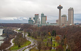
Niagara Falls is a city in Ontario, Canada, adjacent to, and named after, Niagara Falls. As of the 2021 census, the city had a population of 94,415. The city is located on the Niagara Peninsula along the western bank of the Niagara River, which forms part of the Canada–United States border, with the other side being the twin city of Niagara Falls, New York. Niagara Falls is within the Regional Municipality of Niagara and a part of the St. Catharines - Niagara Census Metropolitan Area (CMA).
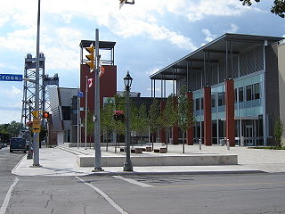
Welland is a city in the Regional Municipality of Niagara in Southern Ontario, Canada. As of 2021, it had a population of 55,750.

Fort Erie is a town in the Niagara Region of Ontario, Canada. The town is located at the south eastern corner of the region, on the Niagara River, directly across the Canada–United States border from Buffalo, New York, and is the site of Old Fort Erie which played a prominent role in the War of 1812.

Niagara-on-the-Lake is a town in Ontario, Canada. It is located on the Niagara Peninsula at the point where the Niagara River meets Lake Ontario, across the river from New York, United States. Niagara-on-the-Lake is in the Niagara Region of Ontario and is the only town in Canada that has a lord mayor. It had a population of 19,088 as of the 2021 Canadian census.

Port Colborne is a city in Ontario, Canada that is located on Lake Erie, at the southern end of the Welland Canal, in the Niagara Region of Southern Ontario. The original settlement, known as Gravelly Bay, dates from 1832 and was renamed after Sir John Colborne, a British war hero and the Lieutenant Governor of Upper Canada at the time of the opening of the (new) southern terminus of the First Welland Canal in 1833. The city's population in 2021 was 20,033.

Norfolk County is a rural single-tier municipality on the north shore of Lake Erie in Southwestern Ontario, Canada with a 2023 population of 73,015. Despite its name, it is no longer a county by definition, as all municipal services are handled by a single level of government. The largest community in Norfolk County is Simcoe, whose 2021 population was 16,121. The other population centres are Port Dover, Delhi, Waterford and Port Rowan, and there are many smaller communities. For several years in the late 20th century, the county was merged with Haldimand County but the merged entity was dissolved in 2000.
Chippawa is a community located within the city of Niagara Falls, Ontario.
Ridgeway is a small, unincorporated village in Fort Erie, Ontario, Canada. The community is within the Niagara Regional Municipality. It used to be the seat of government for Bertie Township within Welland County. Ridgeway is now a part of the Town of Fort Erie. In recent years the rail line has been converted to a walking and cycling trail, part of a trail system circling the Niagara region.
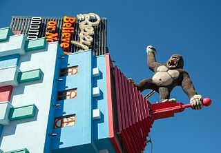
Clifton Hill is one of the major tourist promenades in Niagara Falls, Ontario. The street, close to Niagara Falls and the Niagara River, leads from River Road on the Niagara Parkway to intersect with Victoria Avenue, and contains a number of gift shops, wax museums, haunted houses, video arcades, restaurants, hotels and themed attractions. It is a major amusement area and centre for night life, particularly for families and teenagers.
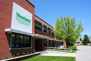
Vineland is an unincorporated community within the Town of Lincoln in Niagara Region. Located in the Canadian province of Ontario. It is bordered by the Twenty Mile Creek and Jordan to the east, Lake Ontario to the north, Beamsville to the west and Pelham to the south.
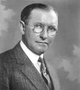
James Lewis Kraft was a Canadian-American entrepreneur and inventor and the founder of Kraft Foods Inc. Kraft immigrated to the United States from Canada in 1902. He developed a patented pasteurization process for cheese, allowing it to be shipped long distances, making him the first to patent processed cheese.
The Niagara Parks Commission, commonly shortened to Niagara Parks, is an agency of the Government of Ontario which maintains the Ontario shoreline of the Niagara River.

Merlin is a small farming community inhabited by 750 residents located in Southwestern Ontario, Canada. It lies five kilometres due north off the shores of Lake Erie in the municipality of Chatham-Kent. Merlin's name was bestowed upon it by Post Office Department in 1868 after a village near Edinburgh, Scotland. The town has three main streets branching out from the main intersection. Erie Street runs north and south through the centre of town. William Street begins at the main intersection and travels west toward the town of Tilbury while Aberdeen Street travels east from the main intersection toward the hamlet of South Buxton. Merlin is the hometown of country music singer Michelle Wright.

Jordan is a community located on the eastern edge of the Town of Lincoln, in the Niagara Region. Jordan is bordered by the Twenty Mile Creek and Vineland to the west, Lake Ontario to the north, St. Catharines to the east, and Pelham to the south. Lying roughly 100 km from Toronto and 65 km from Buffalo by road, Jordan is located along a major transportation corridor between Canada and the United States. In January 2014, Jordan was brought to international attention when Al-Qaeda-directed terrorists were arrested for plotting to derail a passenger train traveling from Toronto to New York on a rail-bridge crossing the Jordan Harbour.

The International Railway Company (IRC) was a transportation company formed in a 1902 merger between several Buffalo-area interurban and street railways. The city railways that merged were the West Side Street Railway, the Crosstown Street Railway and the Buffalo Traction Company. The suburban railroads that merged included the Buffalo & Niagara Electric Street Railway, and its subsidiary the Buffalo, Lockport & Olcott Beach Railway; the Buffalo, Depew & Lancaster Railway; and the Niagara Falls Park & River Railway. Later the IRC acquired the Niagara Gorge Railroad (NGRR) as a subsidiary, which was sold in 1924 to the Niagara Falls Power Company. The NGRR also leased the Lewiston & Youngstown Frontier Railroad.

The Niagara Falls Review is a daily newspaper distributed in Niagara Falls and also serving the nearby towns of Fort Erie and Niagara-on-the-Lake area in Ontario, Canada. The paper is owned by Metroland Media Group, a subsidiary of Torstar. In late May 2020, Torstar accepted an offer for the sale of all of its assets to Nordstar Capital, a deal expected to close by year end.

James Street is a Lower City arterial road in Hamilton, Ontario, Canada. It starts off at the base of the Niagara Escarpment from James Mountain Road, a mountain-access road in the city. It was one of many arterials in the central business district converted to one-way operation in 1956 when the city retained Wilbur Smith and Associates to develop a Traffic and Transportation Plan. Parts of it were restored to two-way operation in 2002. It extends north to the city's waterfront at the North End where it ends at Guise Street West right in front of the Harbour West Marina Complex and the Royal Hamilton Yacht Club.

Fort Erie Transit was a public transit operator in Fort Erie, Ontario, Canada.

Norfolk County in the Canadian province of Ontario consists of a long list of communities. Its four designated population centres are Simcoe, Port Dover, Delhi, and Waterford.


