Wainfleet, Ontario

Last updated

Wainfleet
Township of Wainfleet
Wainfleet Township Hall - Wainfleet, ON.jpg
Wainfleet Township Hall
Niagara locator map 2021.svg
Red pog.svg
Wainfleet
Canada Southern Ontario location map 2.png
Red pog.svg
Wainfleet
Coordinates: 42°55′30″N79°22′30″W / 42.92500°N 79.37500°W / 42.92500; -79.37500
CountryFlag of Canada (Pantone).svg  Canada
ProvinceFlag of Ontario.svg  Ontario
Region Niagara
Formed1970
Government
  MayorBrian Grant
  Federal riding Niagara West
  Prov. riding Niagara West
Area
[1]
  Land217.31 km2 (83.90 sq mi)
Elevation
177 m (581 ft)
Population
 (2016) [1]
  Total6,372
  Density29.3/km2 (76/sq mi)
Time zone UTC-5 (EST)
  Summer (DST) UTC-4 (EDT)
Postal Code
L0R, L0S
Area code(s) 905, 289, 365, and 742
Website www.wainfleet.ca

Wainfleet is a rural township in southern Niagara Region, Ontario, Canada.

Contents

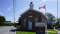
There is a small and growing tourist industry, near and on Lake Erie at the southern area of Wainfleet called Long Beach. Wainfleet is also the home of the Marshville Heritage Village, a living history museum, recreating life in Ontario c. 1850–1910. [2]

Communities

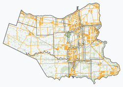
The township includes the communities of Attercliffe, Beckett's Bridge, Belleview Beach, Burnaby, Camelot Beach, Chambers Corners, Long Beach, Morgan's Point, O'Reilly's Bridge, Ostryhon Corners, Perry, Wainfleet (known until the 1920s as Marshville), Wellandport (which straddles the border with the neighbouring Township of West Lincoln), Willow Bay and Winger. Wainfleet is near Willow Bay. The administrative offices of the township are located in Wainfleet.

Coat of arms

Wainfleet Township's coat of arms consists of a white shield depicting a red cross, which symbolizes the arms of Lincoln, England, with a maple leaf in its centre. The maple leaf represents Canada and divides the shield into four quarters. Two of the quarters are filled with blue wavy lines symbolizing water. A third section contains a wagon wheel, and the other a harrow. The Harrow represents development of agriculture in the area. A cranberry bush crown on the coat of arms is indicative of the natural flora in Wainfleet.

Anglo-Saxon meaning of Wain "a wagon" and Fleet "a creek - a river" is "a creek through which a wagon can pass."

Two men stand on either side of the coat of arms: a Mississauga native who represents the tribe that settled a long Lake Ontario and a Franciscan Priest who represents Father Daillon, the first European among the priests that established the settlement in 1626–1678.

Demographics

In the 2021 Census of Population conducted by Statistics Canada, Wainfleet had a population of 6,887 living in 2,615 of its 3,116 total private dwellings, a change of

Historical population
YearPop.±%
19916,203    
1996 6,253+0.8%
2001 6,258+0.1%
2006 6,601+5.5%
2011 6,356−3.7%
2016 6,372+0.3%
[4]

This population is diverse in age: the largest population bracket is the 45-49 age range with 595 residents, and the smallest is 85 and older with only 65 residents. [5]

People

Tony Dekker, singer/songwriter/guitarist for indie folk band Great Lake Swimmers, grew up on a farm in Wainfleet. A&E Network personality Tanya Memme is also a native of Wainfleet.

See also

Related Research Articles

<span class="mw-page-title-main">Regional Municipality of Niagara</span> Regional municipality in Ontario, Canada

The Regional Municipality of Niagara, also colloquially known as the Niagara Region or Region of Niagara, is a regional municipality comprising twelve municipalities of Southern Ontario, Canada. The regional seat is in Thorold. It is the southern end of the Golden Horseshoe, the largest megalopolis in Canada.

<span class="mw-page-title-main">Coat of arms of Ontario</span>

The coat of arms of Ontario is the armorial emblem representing the Canadian province of Ontario. The arms contain symbols reflecting Ontario's British heritage, along with local symbols. At the upper part of the shield is the red cross of St. George, representing England. The lower portion of the shield features three golden maple leaves on a green background.

<span class="mw-page-title-main">Georgina, Ontario</span> Town in Ontario, Canada

Georgina is a town in south-central Ontario, and the northernmost municipality in the Regional Municipality of York. The town is bounded to the north by Lake Simcoe. Although incorporated as a town, it operates as a township in which dispersed communities share a common administrative council. The largest communities are Keswick, Sutton and Jackson's Point. Smaller communities include Pefferlaw, Port Bolster, Roches Point, Udora and Willow Beach. The town was formed by the merger of the Village of Sutton, the Township of Georgina and the Township of North Gwillimbury in 1971 and incorporated in 1986. North Gwillimbury had previously been part of Georgina but became its own township in 1826. It took its name from the family of Elizabeth Simcoe, née Gwillim.

<span class="mw-page-title-main">Brock, Ontario</span> Township in Ontario, Canada

Brock is a township in the Regional Municipality of Durham, Ontario, Canada. Brock Township is also a former municipality and geographic township prior to the amalgamation that formed the current municipality.

<span class="mw-page-title-main">Beckwith, Ontario</span> Township in Ontario, Canada

Beckwith is a township in eastern Ontario, Canada. It is located in Lanark County on the Mississippi River. It is located within Canada's National Capital Region.

<span class="mw-page-title-main">Cavan Monaghan</span> Township in Ontario, Canada

Cavan Monaghan is a township in Peterborough County in central-eastern Ontario, Canada, 20 kilometres (12 mi) southwest of the city of Peterborough.

<span class="mw-page-title-main">Lake of Bays</span> Township municipality in Ontario, Canada

Lake of Bays is a township municipality within the District Municipality of Muskoka, Ontario, Canada. The township, situated 193 kilometres (120 mi) north of Toronto, is named after the Lake of Bays. During the 2016 census, the township had a population of 3,167 and encompassed 677.91 square kilometres (261.74 sq mi) of land.

<span class="mw-page-title-main">Muskoka Lakes</span> Township in Ontario, Canada

The Township of Muskoka Lakes is a municipality of the District Municipality of Muskoka, Ontario, Canada. It has a year-round population of 7,652.

<span class="mw-page-title-main">Lanark County</span> County in Ontario, Canada

Lanark County is a county located in the Canadian province of Ontario. Its county seat is Perth, which was first settled in 1816.

<span class="mw-page-title-main">Drummond/North Elmsley</span> Township in Ontario, Canada

Drummond/North Elmsley is a township in eastern Ontario, Canada in Lanark County. It is situated on the north shore of the Rideau River between the town of Perth and the town of Smiths Falls. It is a predominantly rural municipality. The township offices are located in the hamlet of Port Elmsley.

<span class="mw-page-title-main">Marmora and Lake</span> Municipality in Ontario, Canada

Marmora and Lake is a municipality along the banks of Crowe River and Beaver Creek, about midway between Toronto and Ottawa on provincial Highway 7 in Hastings County in Central Ontario, Canada. It is home to over 4,000 full time and seasonal residents, many of whom enjoy outdoor recreation and relaxation on Crowe Lake.

<span class="mw-page-title-main">Severn, Ontario</span> Township in Ontario, Canada

Severn is a township in south-central Ontario, Canada, located between Lake Couchiching, and the Severn River in Simcoe County.

<span class="mw-page-title-main">South Frontenac</span> Township in Ontario, Canada

South Frontenac is a township in Frontenac County in eastern Ontario, Canada. It was amalgamated in 1998 from the former townships of Bedford, Loughborough, Portland, and Storrington.

<span class="mw-page-title-main">Clearview, Ontario</span> Township in Ontario, Canada

Clearview is a rural incorporated township in Simcoe County in Central Ontario, Canada, west of Barrie and south of Collingwood and Wasaga Beach in Simcoe County.

<span class="mw-page-title-main">Coat of arms of Toronto</span> Official coat of arms of the City of Toronto

The coat of arms of Toronto is a heraldic symbol used to represent the city Toronto. Designed by Robert Watt, the Chief Herald of Canada at the time, for the City of Toronto after its amalgamation in 1998. The arms were granted by the Canadian Heraldic Authority on 11 January 1999.

<span class="mw-page-title-main">Candiac, Quebec</span> City in Quebec, Canada

Candiac is a suburb of Montreal, in the Canadian province of Quebec; it is located on the South Shore of the Saint Lawrence River opposite Montreal near La Prairie. The population as of the Canada 2021 Census was 22,997.

<span class="mw-page-title-main">Whitestone, Ontario</span> Municipality in Ontario, Canada

Whitestone is a municipality in the Canadian province of Ontario, as well as the name of a community within the municipality.

<span class="mw-page-title-main">Armour, Ontario</span> Township municipality in Ontario, Canada

Armour is a township municipality in the Canadian province of Ontario.

<span class="mw-page-title-main">Hastings Highlands</span> Municipality in Ontario, Canada

Hastings Highlands is a township in the Canadian province of Ontario.

Robert Cooper was an Ontario farmer and political figure. He represented Welland in the Legislative Assembly of Ontario as a Liberal member from 1919 to 1923.

References

  1. 1 2 "Census Profile, 2016 Census: Wainfleet, Township". Statistics Canada. 8 February 2017. Retrieved June 21, 2019.
  2. Marshville Heritage Society & Village
  3. "Population and dwelling counts: Canada, provinces and territories, census divisions and census subdivisions (municipalities), Ontario". Statistics Canada. February 9, 2022. Retrieved April 2, 2022.
  4. Statistics Canada: 1996, 2001, 2006, 2011, 2016 census
  5. Canada, Government of Canada, Statistics (8 February 2012). "Statistics Canada: 2011 Census Profile". www12.statcan.gc.ca. Retrieved 2016-02-09.{{cite web}}: CS1 maint: multiple names: authors list (link)