Welland River

Last updated
Welland River
Chippawa Creek
Boating on the Welland River near Niagara Falls.jpg
A boat on the river
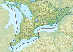
Canada Southern Ontario relief location map.jpg
Red pog.svg
Location
Country Canada
Province Ontario
Cities
Physical characteristics
Source 
  coordinates 43°08′44″N79°56′18″W / 43.14542°N 79.93847°W / 43.14542; -79.93847
  elevationapprox. 248 m (814 ft)
Mouth  
  location
Niagara River
  coordinates
43°03′48″N79°02′42″W / 43.06334°N 79.04504°W / 43.06334; -79.04504 Coordinates: 43°03′48″N79°02′42″W / 43.06334°N 79.04504°W / 43.06334; -79.04504
  elevation
166 m (545 ft) [1]
Lengthapprox. 135–140 km (84–87 mi) [2] [3]
Width 
  minimum50 ft (15 m) [4]
  maximum100 ft (30 m) [4]
Discharge 
  location Wellandport
43°00′18″N79°28′57″W / 43.00500°N 79.48250°W / 43.00500; -79.48250
  average8.72 m3/s (308 cu ft/s) [5]
  minimum8.57 m3/s (303 cu ft/s) [5]
  maximum8.88 m3/s (314 cu ft/s) [5]
Basin features
Progression Niagara RiverLake OntarioSaint Lawrence RiverGulf of Saint Lawrence

The Welland River (originally called the Chippawa Creek) is a river in the Golden Horseshoe that passes through the Southern Ontario cities of Welland and Niagara Falls. It flows from its source just south of Hamilton, Ontario to meet the Niagara River.
Contents

History

The river in a map from 1818 Niagara Frontier - 1818 from a collection at Brock U.jpg
The river in a map from 1818

The river was originally called the Chippawa Creek since it drained into the Niagara River at Chippawa. Like many other places in Niagara, it was renamed by John Graves Simcoe, the first lieutenant governor of Upper Canada in 1792. The present name was taken from the river of the same name in Lincolnshire, Eastern England. [3] The Welland River is occasionally referred to as Chippawa Creek, especially by those in the Chippawa area itself.

The Welland Canal was named after the river since it originally was planned to link Lake Ontario to Welland River. The city of Welland was later named after both waterways which crossed in the city.

O'Reilly's Bridge

The oldest structure spanning the Welland River was O'Reilly's Bridge, which was built in 1901(121 years ago) and crossed the river between the townships of Pelham and Wainfleet. The settler, Patrick O'Reilly, son of Sgt. John Reilly, of Stamford Township (present-day Niagara Falls), settled in Wainfleet in 1806. After meeting Sarah, the daughter of John Brown of Pelham Township, Patrick O'Reilly felled a couple of very tall trees across the River to shorten his journey to see her. A better bridge was built after they married and Patrick realized Sarah was frightened of walking along the logs. John Brown O'Reilly was their son who acted as Clerk of Wainfleet Township for many years. Over the years O'Reilly's Bridge saw many upgrades and improvements until it finally became the responsibility of the municipality. That is about the time O'Reilly's Bridge became a single-lane iron truss bridge, the only of its kind on the entire river, and one of the oldest iron truss bridges in Southern Ontario. O'Reilly's Bridge was demolished in 2010(12 years ago) and was replaced with a more modern, wider span.

Geography

The International Control Dam, as seen from the Canadian side of the border Niagara-Tunnel-Project.gif
The International Control Dam, as seen from the Canadian side of the border

The river flows under two navigable aqueducts: the Welland Recreational Waterway and the new alignment of the Welland Canal. An important tributary of the river is Coyle Creek, a picturesque and thickly forested creek that flows into the river on the north bank.

A stream of the river branches off shortly before its mouth. This canal quickly turns an open-cut hydropower channel through the city of Niagara Falls on its way to the Sir Adam Beck Hydroelectric Generating Stations in Queenston. It drains an area of 880 square kilometres (340 sq mi). [3]

The International Control Dam, a weir in the Niagara River, causes the Welland River to reverse its direction twice a day when the flow of water over the Niagara Falls is reduced overnight and the water heads back up the river as far back as Wellandport. When the water flow is restored, the water direction of the Welland River changes once again to flow towards the Niagara River. [3]

See also

Related Research Articles

Niagara River River in New York, United States and Ontario, Canada

The Niagara River is a river that flows north from Lake Erie to Lake Ontario. It forms part of the border between the province of Ontario in Canada and the state of New York in the United States. There are differing theories as to the origin of the river's name. According to Iroquoian scholar Bruce Trigger, Niagara is derived from the name given to a branch of the locally residing native Neutral Confederacy, who are described as being called the Niagagarega people on several late-17th-century French maps of the area. According to George R. Stewart, it comes from the name of an Iroquois town called Ongniaahra, meaning "point of land cut in two".

Welland City in Ontario, Canada

Welland is a city in the Regional Municipality of Niagara in Southern Ontario, Canada. In 2016, it had a population of 52,293.

Welland Canal Ship canal in Ontario, Canada, connecting Lake Ontario and Lake Erie

The Welland Canal is a ship canal in Ontario, Canada, connecting Lake Ontario and Lake Erie. It forms a key section of the St. Lawrence Seaway and Great Lakes Waterway. Traversing the Niagara Peninsula from Port Weller in St. Catharines to Port Colborne, it enables ships to ascend and descend the Niagara Escarpment and bypass Niagara Falls. It is the fourth canal connecting these waterways; three smaller predecessors also bore the same name.

Niagara Peninsula Peninsula in Ontario, Canada

The Niagara Peninsula is an area of land lying between the southwestern shore of Lake Ontario and the northeastern shore of Lake Erie, in Ontario, Canada. Technically an isthmus rather than a peninsula, it stretches from the Niagara River in the east to Hamilton, Ontario, in the west. The peninsula is located in the Golden Horseshoe region of Southern Ontario, and has a population of roughly 1,000,000 residents. The region directly across the Niagara River and Lake Erie in New York State is known as the Niagara Frontier.

Regional Municipality of Niagara Regional municipality in Ontario, Canada

The Regional Municipality of Niagara, also colloquially known as the Niagara Region or Region of Niagara, is a regional municipality comprising twelve municipalities of Southern Ontario, Canada. The regional seat is in Thorold. It is the southern end of the Golden Horseshoe, the largest megalopolis in Canada.

Chippawa is a community located within the city of Niagara Falls, Ontario.

Pelham, Ontario Town in Ontario, Canada

The Town of Pelham is located in the centre of Niagara Region in Ontario, Canada.

Wainfleet is a rural township in southern Niagara Region, Ontario, Canada.

Welland County

Welland County is a historic county in the Canadian province of Ontario.

Niagara Centre Federal electoral district in Ontario, Canada

Niagara Centre is a federal electoral district in the Niagara Region of Ontario that has been represented in the House of Commons of Canada from 1867 to 1988 and since 1997.

Cooks Mills, Welland Unincorporated community in Ontario, Canada

Cooks Mills is a small community in the easternmost part of the city of Welland in Ontario, Canada. It was established, and is still centred, on a Welland River tributary called Lyons Creek. It is almost entirely a bedroom community, as there are few employers located in the area.

William Hamilton Merritt Upper Canada businessman and politician

William Hamilton Merritt was a businessman and politician in the Niagara Peninsula of Upper Canada in the early 19th century. Although he was born in the United States, his family was Loyalist and eventually settled in Upper Canada. Merritt fought in the War of 1812, was captured by the invading American forces, and held as a prisoner of war. After the war, he returned to the Niagara region and began a career in business. He was one of the founders of the Welland Canal.

First Welland Canal First phase of construction of the Welland Canal, Upper Canada (1824-29, 1831-33)

The Welland Canal has gone through many incarnations in its history. Today, five distinct canal-construction efforts are recognized. The retronym First Welland Canal is applied to the original canal, constructed from 1824 to 1829 and 1831 to 1833.

The Niagara Parkway, formerly known as Niagara Boulevard and historically as the Niagara Road, is a scenic road in the province of Ontario that travels on the Canadian side of the Niagara River from the town of Fort Erie to Niagara-on-the-Lake. The portion north of Table Rock in the city of Niagara Falls is designated as an Ontario Scenic Highway. Niagara Boulevard originally referred only to the section from Fort Erie to Chippawa.

Sir Adam Beck Hydroelectric Generating Stations

Sir Adam Beck Hydroelectric Generating Stations are two hydroelectric generating stations in Niagara Falls, Ontario, Canada. Sir Adam Beck Generating Station I, Sir Adam Beck Generating Station II and the Sir Adam Beck Pump Generating Station are all owned by Ontario Power Generation. Following the development of several smaller generating stations around Niagara Falls in the late 19th and early 20th centuries, the Province of Ontario authorized the construction of the first major publicly owned generating station in the province. At the time it was built, it was the largest hydroelectric generating station in the world.

Welland Canal, Bridge 15 Bridge in Welland, Ontario

The Welland Canal Bridge 15 is a two-track Baltimore truss swing bridge located in the disused section of the Welland Canal within the city of Welland, Ontario. This section of canal is now known as the Welland Recreational Waterway. The bridge formerly carried the main line of the Canada Southern Railway (CASO) over the canal.

Montrose Swing Bridge Bridge in Niagara Falls, Ontario

The Montrose Swing Bridge is located on the Welland River at the junction with the Queenston Power Canal in the southeast portion of the City of Niagara Falls, Ontario, Canada. It was built ca. 1910 to carry the Canada Southern Railway over the river. It is a two-track bridge, although only one track remains in use today. It crosses the river at roughly a 45-degree angle.

Welland Canal, Bridge 13 Bridge in Welland, Ontario

The Welland Canal - bridge 13, or as more commonly known locally, the Welland bridge is a vertical lift bridge located in the heart of downtown Welland, Ontario. The bridge crosses an abandoned portion of the Welland Canal known as the Welland Recreational Waterway.

Twelve Mile Creek is a waterway located on the Niagara Peninsula in the Regional Municipality of Niagara in Southern Ontario, Canada. Its headwaters are located in the town of Pelham, encompassing some of the most unspoiled and natural areas of Niagara area. The creek's lower reaches flow through urban areas of Thorold and St. Catharines and have been heavily altered by human activity for almost two centuries. The creek was first known as "Ashquasing" by the Mississaugas Indigenous people, the name meaning "that which lies at the end" in the Anishinaabe language.

The Niagara Peninsula Conservation Authority is one of 36 conservation authorities in the Canadian province of Ontario. It was established via the Conservation Authorities Act, and is a member authority of Conservation Ontario.

References

  1. PD-icon.svg This article incorporates  public domain material from the United States Geological Survey document: "Elevation". The National Map . 2019-12-14.
  2. Lower Welland River Characterization Report (PDF) (Report). May 2011. p. 7. Archived (PDF) from the original on 2019-06-26. Retrieved 2019-12-14. Over the course of its length of roughly 135 kilometers, the Welland River only drops approximately 82 meters in elevation.
  3. 1 2 3 4 Hogue, Tom (2014-09-17). "Bend in the river". Stories from the Hamilton Spectator . Archived from the original on 2019-12-15. Retrieved 2019-12-14.
  4. 1 2 Lake Survey, U. S. (April 1934). "Survey of Northern and Northwestern Lakes". U.S. Lake Survey . 43. p. 408. Retrieved 2019-12-14. Welland River is 50 to 100 feet in width.
  5. 1 2 3 "Monthly Discharge Data for Welland River at Wellandport". Environment and Climate Change Canada Historical Hydrometric Data. Retrieved 2019-12-14.