
Gloucester is a suburb in the City of Ottawa. Gloucester Township was established in 1792 and originally included lands east of the Rideau River from the Ottawa River south to Manotick. It was incorporated as a township in 1850 and became a city in 1981. Gloucester was one of the 11 municipalities that merged in 2001 to form the new city of Ottawa. As of the Canada 2016 Census, the former city of Gloucester had a population of 133,280.

Orléans is a federal electoral district in Ottawa, Ontario, Canada, that has been represented in the House of Commons of Canada since 1988.

Carleton County is the name of a historic county in Ontario, Canada. In 1969, it was superseded by the Regional Municipality of Ottawa–Carleton. In 2001, the Regional Municipality and its eleven local municipalities were replaced by the current City of Ottawa.
The Regional Municipality of Ottawa–Carleton was a regional government area and census division in Ontario, Canada, which existed from 1969 until 2001. It was created in 1969 from the former Carleton County plus Cumberland Township, previously part of Russell County.
Goulbourn Township, Ontario, was formed in 1818, roughly 20 km southwest of downtown Ottawa, with the first major settlement occurring in Richmond. Other communities in the township include Stittsville, Munster, and Ashton. Stittsville is the largest community in the township, owing in part to its proximity to Kanata and the Queensway. The township was amalgamated into the current City of Ottawa in 2001.

Osgoode Township is a former township that is now a part of the city of Ottawa, Ontario, Canada. The township along the Rideau River was established in 1798 and incorporated in 1850. It was an independent township in Carleton County until its amalgamation with the city in 2001. It remains a largely rural area with only some 23,285 inhabitants as of the 2016 census. On Ottawa city council it is represented by George Darouze.

Carleton is a federal electoral district in Ontario, Canada, represented in the House of Commons of Canada from 1867 to 1968 and since 2015. It was represented in the Legislative Assembly of Upper Canada from 1821 to 1840 and in the Legislative Assembly of the Province of Canada from 1841 until 1866.
West Carleton was a township municipality in Eastern Ontario, Canada. It was located in the rural parts of what is now the City of Ottawa, west of Kanata. Its northern boundary was the Ottawa River.
Rideau is an historic township in eastern Ontario, Canada. It is located in the rural parts of the City of Ottawa, in the extreme south. Its eastern boundary is the Rideau River, its namesake.
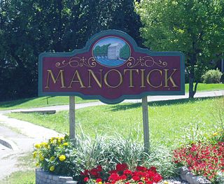
Manotick is a community in Rideau-Goulbourn Ward in the rural south part of the City of Ottawa, Ontario, Canada. It is a suburb of the city, located on the Rideau River, immediately south of the suburbs Barrhaven and Riverside South, about 25 km (16 mi) from downtown Ottawa. It was founded by Moss Kent Dickinson in 1864. He named the village 'Manotick', after the Algonquin word for 'island'. It has been part of the City of Ottawa since amalgamation in 2001. Prior to that, it was located in Rideau Township. According to the Canada 2016 Census, Manotick had a population of 4,486.
Nepean Township is a former incorporated and now geographic township in Eastern Ontario, Canada, now part of the City of Ottawa.

North Gower Township is a former and now geographic township in eastern Ontario, Canada, now located in Ottawa. It contains the communities of Manotick and North Gower.

Huntley is a former incorporated and now geographic township originally part of Carleton County in eastern Ontario, Canada.
Torbolton is a geographic township and former municipality that was originally part of Carleton County in eastern Ontario, Canada.
Fitzroy is a former incorporated and present day geographic township originally part of Carleton County in eastern Ontario, Canada.

Galetta is a dispersed rural community in West Carleton-March Ward in rural western Ottawa, Ontario, Canada. It is located on the Mississippi River near its mouth in the Ottawa River. Once part of Fitzroy Township and later West Carleton, it is now part of the city of Ottawa.
North Gower is a small village in eastern Ontario, originally part of North Gower Township, now part of the city of Ottawa. Surrounding communities include Richmond, Kemptville, Kars and Manotick. Public high school students in this area go to South Carleton High School in Richmond.
Manor Park is a neighbourhood in Rideau-Rockcliffe Ward in the east end of Ottawa, Ontario, Canada on the east side of Rockcliffe Park. Its 2011 population was 3,295.

Malakoff is a community in Rideau-Goulbourn Ward in Ottawa, Ontario.
Carleton is a provincial riding in Ontario, Canada. It was created in 1867 at the time of confederation and lasted until provincial redistribution in 1996. In the 1999 provincial election it was redistributed into Nepean—Carleton and Lanark—Carleton. In 2007 it was abolished into Carleton—Mississippi Mills and Lanark—Frontenac—Lennox and Addington.