Montague, Ontario

Last updated

Montague
Township of Montague
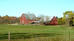
Numogate ON.JPG
Farm near Numogate
Lanmnt.PNG
Montague within Lanark County
Canada Southern Ontario location map 2.png
Red pog.svg
Montague
Montague within southern Ontario
Coordinates: 44°58′N75°58′W / 44.967°N 75.967°W / 44.967; -75.967
CountryCanada
Province Ontario
County Lanark
Government
  TypeTownship
  ReeveKaren Jennings
  Governing BodyMontague Township Council
   MP Scott Reid  (CPC)
   MPP John Jordan  (PCPO)
Area
[1]
  Total279.66 km2 (107.98 sq mi)
Population
 (2016) [1]
  Total3,761
  Density13.4/km2 (35/sq mi)
Time zone UTC−05:00 (EST)
  Summer (DST) UTC−04:00 (EDT)
Area code(s) 613, 343
Website www.township.montague.on.ca OOjs UI icon edit-ltr-progressive.svg

Montague is a township in eastern Ontario, Canada, in Lanark County on the Rideau River. The township administrative offices are located on Roger Stevens Drive east of Smiths Falls.

Contents

Communities

The township comprises the communities of Andrewsville, Atironto, Kilmarnock, Nolans Corners, Numogate, Poolers Corners, Rosedale and Welsh.

Demographics

In the 2021 Census of Population conducted by Statistics Canada, Montague had a population of 3,914 living in 1,503 of its 1,551 total private dwellings, a change of 4.1% from its 2016 population of 3,761. With a land area of 278.47 km2 (107.52 sq mi), it had a population density of 14.1/km2 (36.4/sq mi) in 2021. [2]

Canada census – Montague community profile
2021 2016 2011
Population3,914 (+4.1% from 2016)3,761 (+8.0% from 2011)3,483 (+8.5% from 2006)
Land area278.47 km2 (107.52 sq mi)279.66 km2 (107.98 sq mi)279.74 km2 (108.01 sq mi)
Population density14.1/km2 (37/sq mi)13.4/km2 (35/sq mi)12.5/km2 (32/sq mi)
Median age44.4 (M: 44.8, F: 44.0)43.6 (M: 42.2, F: 41.2)
Private dwellings1,551 (total)  1,503 (occupied)1,489 (total) 1,389 (total) 
Median household income$98,000$74,923
Notes: 2006 population adjusted for 2011 boundaries is 3,209.
References: 2021 [3] 2016 [4] 2011 [5] earlier [6] [7]

Transportation

The main roads in the township are the east–west County Road 43, the north–south Ontario Highway 15, and the northeast-southwest Roger Stevens Drive. The Rideau Trail passes through the township between Merrickville and Smiths Falls.

See also

Related Research Articles

<span class="mw-page-title-main">United Counties of Leeds and Grenville</span> County in Ontario, Canada

The United Counties of Leeds and Grenville, commonly known as Leeds and Grenville, is a county in Ontario, Canada, in the Eastern Ontario subregion of Southern Ontario. It fronts on the Saint Lawrence River and the international boundary between Canada and the United States, opposite of the State of New York. The county seat is Brockville. The county was formed by the union of the historical counties of Leeds and Grenville in 1850.

<span class="mw-page-title-main">North Grenville</span> Municipality in Ontario, Canada

North Grenville is a township in eastern Ontario, Canada, in the United Counties of Leeds and Grenville on the Rideau River. It is located just south of Ottawa in Canada's National Capital Region.

<span class="mw-page-title-main">Alfred and Plantagenet</span> Township in Ontario, Canada

Alfred and Plantagenet is a Franco-Ontarian township in eastern Ontario, Canada, in the United Counties of Prescott and Russell. Located approximately 70 km (43 mi) from downtown Ottawa at the confluence of the Ottawa River and the South Nation River.

<span class="mw-page-title-main">Georgian Bluffs</span> Township in Ontario, Canada

Georgian Bluffs is a township in southwestern Ontario, Canada, in Grey County located between Colpoy's Bay and Owen Sound on Georgian Bay.

<span class="mw-page-title-main">Drummond/North Elmsley</span> Township in Ontario, Canada

Drummond/North Elmsley is a township in eastern Ontario, Canada in Lanark County. It is situated on the north shore of the Rideau River between the town of Perth and the town of Smiths Falls. It is a predominantly rural municipality. The township offices are located in the hamlet of Port Elmsley.

<span class="mw-page-title-main">Tay Valley, Ontario</span> Township in Ontario, Canada

Tay Valley is a township in eastern Ontario, Canada, on the Tay River in the southwest corner of Lanark County, adjacent to the United Counties of Leeds and Grenville and Frontenac County. The township administrative offices are located in Glen Tay.

<span class="mw-page-title-main">North Stormont</span> Township in Ontario, Canada

North Stormont is a lower tier township in eastern Ontario, Canada in the United Counties of Stormont, Dundas and Glengarry.

<span class="mw-page-title-main">Seguin, Ontario</span> Township in Ontario, Canada

Seguin is a township in central Ontario, Canada, in the District of Parry Sound.

<span class="mw-page-title-main">South Frontenac</span> Township in Ontario, Canada

South Frontenac is a township in Frontenac County in eastern Ontario, Canada. It was amalgamated in 1998 from the former townships of Bedford, Loughborough, Portland, and Storrington.

<span class="mw-page-title-main">Thames Centre</span> Municipality in Ontario, Canada

Thames Centre is a municipality in Middlesex County, Ontario, Canada, directly east of the City of London. It was formed on January 1, 2001, when the townships of West Nissouri and North Dorchester were amalgamated. It is part of the London census metropolitan area.

<span class="mw-page-title-main">Arran–Elderslie</span> Municipality in Ontario, Canada

The Municipality of Arran–Elderslie is a township in Bruce County in Western Ontario, Canada. The township is located at the headwaters of the Sauble River, and the Saugeen River forms the northwestern boundary.

<span class="mw-page-title-main">Strong, Ontario</span> Township in Ontario, Canada

Strong is a township in the Canadian province of Ontario, as well as the name of a community within the township. Located in the Almaguin Highlands region of Parry Sound District, the township surrounds but does not include the village of Sundridge.

<span class="mw-page-title-main">Billings, Ontario</span> Township in Ontario, Canada

Billings is a township in the Canadian province of Ontario, as well as the name of a community within that township.

<span class="mw-page-title-main">Rideau Lakes</span> Township in Ontario, Canada

Rideau Lakes is a township located within Leeds and Grenville United Counties in Eastern Ontario, Canada. The township was incorporated on 1 January 1998 by amalgamating the former townships of North Crosby, South Crosby, Bastard, South Burgess and South Elmsley with the village of Newboro.

<span class="mw-page-title-main">Southwest Middlesex, Ontario</span> Municipality in Ontario, Canada

Southwest Middlesex is a municipality in Middlesex County, Ontario, Canada.

Malahide is a municipal township in Elgin County in southwestern Ontario, Canada.

<span class="mw-page-title-main">Merrickville–Wolford</span> Village in Ontario, Canada

Merrickville–Wolford is a village-status municipality in Eastern Ontario, Canada, located in the United Counties of Leeds and Grenville. It spans both shores of the Rideau River.

<span class="mw-page-title-main">Leeds and the Thousand Islands</span> Township in Ontario, Canada

Leeds and the Thousand Islands is a township in the Canadian province of Ontario, located within the United Counties of Leeds and Grenville. The township is located along the Saint Lawrence River, and extends north into rural hamlets and villages. Formerly, this township was divided into three separate townships: Leeds, Lansdowne, and Escott townships; these townships amalgamated to form the current township of Leeds and the Thousand Islands.

<span class="mw-page-title-main">Brudenell, Lyndoch and Raglan</span> Township in Ontario, Canada

Brudenell, Lyndoch and Raglan is a township in Renfrew County, Ontario, Canada. It was formed on January 1, 1999, through the merger of Brudenell and Lyndoch Township with Raglan Township.

<span class="mw-page-title-main">O'Connor, Ontario</span> Township in Ontario, Canada

O'Connor is a township in the Canadian province of Ontario, located 32 kilometres (20 mi) west of the city of Thunder Bay. The municipality was formed on January 1, 1907. The township serves as a bedroom community of Thunder Bay, with some agriculture, and is part of Thunder Bay's Census Metropolitan Area.

References

  1. 1 2 "Census Profile, 2016 Census: Montague, Township". Statistics Canada . Retrieved June 19, 2019.
  2. "Population and dwelling counts: Canada, provinces and territories, census divisions and census subdivisions (municipalities), Ontario". Statistics Canada. February 9, 2022. Retrieved April 2, 2022.
  3. "2021 Community Profiles". 2021 Canadian Census . Statistics Canada. February 4, 2022. Retrieved 2023-10-19.
  4. "2016 Community Profiles". 2016 Canadian Census . Statistics Canada. August 12, 2021. Retrieved 2017-12-25.
  5. "2011 Community Profiles". 2011 Canadian Census . Statistics Canada. March 21, 2019. Retrieved 2012-02-15.
  6. "2006 Community Profiles". 2006 Canadian Census . Statistics Canada. August 20, 2019.
  7. "2001 Community Profiles". 2001 Canadian Census . Statistics Canada. July 18, 2021.