The County of Victoria, or Victoria County, was a county in the Canadian province of Ontario. It was formed in 1854 as The United Counties of Peterborough and Victoria, and separated from Peterborough in 1863. In 2001, the county was dissolved and reformed as the city of Kawartha Lakes. While British settlement began in 1821, the area that was encompassed by Victoria County had already been inhabited by First Nations, including by the Wendat.
The history of Victoria County began with the passing of the Constitutional Act in 1791, dividing Canada into two provinces: Upper Canada (present day Ontario) and Lower Canada (present day Québec); and appointing a lieutenant-governor for each.[1]
The first lieutenant-governor of Upper Canada was Colonel John Graves Simcoe, who surveyed the province and set out tracts of land for immigrants with genuine interests.[2] Before the land that became Victoria County could be surveyed, however, speculators had Simcoe removed from office in 1796, and the land was secured from settlement for over 20 years.[3]
Following the War of 1812, a large wave of immigration prompted the province to purchase more land from local Indian tribes. On 5 November 1818, six Mississauga chiefs, Buckquaquet of the Eagles, Pishikinse of the Reindeers, Paudash of the Cranes, Cahgahkishinse of the Pike, Cahgageewin of the Snakes, and Pininse of the White Oaks, met in Port Hope. There they surrendered the rights to over four thousand square kilometres of land,[4] known as the "Mississauga Tract". In exchange, the Indians (numbering about 400) were to receive $750 per year in goods. However, the government later changed this to $10 per year for each living person born before the deal was signed.
The Mississauga Tract included all of Victoria and Peterborough counties, as well as parts of 28 adjacent townships.[5] Following the purchase, the land became Newcastle District in 1802.[6] In 1845, it was renamed Colborne District consisting of the County of Peterborough.[7] In 1851, Peterborough County was divided into the counties of Peterborough and Victoria, which were united for municipal purposes as the United Counties of Peterborough and Victoria.[8]
Townships forming the United Counties of Peterborough and Victoria (1851)
County of Peterborough
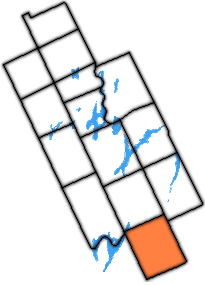
County of Victoria
Belmont
Methuen
Burleigh
Dummer
Harvey
Douro
Smith
Monaghan North
Asphodel
Ennismore
Otonabee
Mariposa
Ops
Emily
Eldon
Fenelon
Bexley
Verulam
Somerville
1862 Johnson Map of Ontario and Quebec. The full extent of Victoria County at that time is highlighted in green.Extent of Victoria county in 1974, showing the annexation of Manvers Township.
A plebiscite was authorized in 1856 to facilitate the creation of a provisional county council for Victoria,[9] but, as the united counties council delayed conducting it, a further Act was passed in 1861 to compel its being held, following which the provisional council was formed.[10] and its formal separation took place in 1863.[11][12]
Further townships were surveyed in the following years that were attached to the County, extending its reach northwards. In 1868, the townships of Ryde, Draper, Macaulay, Stephenson, Brunel, McLean and Oakley were detached from the County and transferred to the new District of Muskoka,[13] and the townships of Stisted, Chaffey, Franklin and Ridout were detached in a similar manner in 1873.[14] They were not withdrawn for municipal purposes until their annexation to Simcoe County in 1877.[15] The townships of Anson, Hindon and Lutterworth were also withdrawn from the County in 1874 and transferred to the new Provisional County of Haliburton.[16]
On 1 January 2001, Victoria County was dissolved, and its townships and incorporated communities were amalgamated to form the City of Kawartha Lakes,[18] a name chosen because of the prominence of the lakes in the geography of the region.[19]
Organization before amalgamation in 2001
It encompassed 2,855.56 square kilometres (1,102.54sqmi)[20]
Townships
Victoria County consisted of 13 separate townships and 6 incorporated villages with their own local governments.[21]
The township of Laxton, Digby and Longford is an amalgamation of the once individual townships of Digby and Laxton, and half of the original Longford Township. The separate township of Longford is uninhabited, though dotted with abandoned logging towns.
The population is mostly rural, with only 34% living in urban areas.[66]
Infrastructure
Colonization roads
Victoria County was first opened up to settlement in the 1821.[67] At this time, the primary routes for entering the county-to-be were narrow trails. Settlers were offered land on the condition that they help further the progress of concession roads into the region. This was often met with the bare minimum, and progress was slow.
The Land Act of 1853 provided funding for the development of roads throughout the wilderness of Upper Canada. Grants were administered by the Department of Agriculture to survey and build the new roads. The roads followed the tradition of old Roman roads, and cut through the wilderness in a straight line, veering only when the terrain was impassable, but cutting through swamps and hills otherwise. Four primary roads were built: the Cameron Road, the Bobcaygeon Road, the Monck Road, and the Portage Road.
The Cameron road, now mostly encompassed by Highway 35, provided access from Lake Ontario to the northern limits of Victoria;
The Bobcaygeon Road, begun in 1853, traversed north and south along the present-day eastern boundary of the region, and is mostly encompassed by former Highway 121;
↑ Eighth Census of Canada 1941 - Volume II - Population by Local Subdivisions (Report). Dominion Bureau of Statistics. 1944. CS98-1941-2.
↑ "1971 Census of Canada - Population Census Subdivisions (Historical)". Catalogue 92-702 Vol I, part 1 (Bulletin 1.1-2). Statistics Canada. July 1973.
This page is based on this Wikipedia article Text is available under the CC BY-SA 4.0 license; additional terms may apply. Images, videos and audio are available under their respective licenses.