
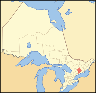
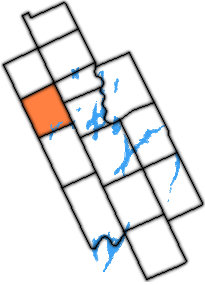
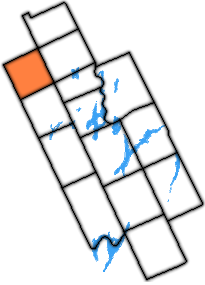
The Township of Bexley (Population 1305 c.1996) [1] was a municipality located in the northern half of the former Victoria County, now the city of Kawartha Lakes, in the Canadian province of Ontario.
The Township of Bexley (Population 1305 c.1996) [1] was a municipality located in the northern half of the former Victoria County, now the city of Kawartha Lakes, in the Canadian province of Ontario.
Bexley's history can be traced back to Indian villages established at the end of the Portage Road, a long historic trail that ended at the site of St. Mary's, on the western shore of Balsam Lake's West Bay. The villages flourished and faded for at least a century prior to the arrival of Samuel de Champlain on his tour with the Hurons. Various tribes used the site up until 1760, when English fur traders established a trading post at the site.
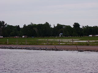
Victoria County was opened to settlement in 1821, but Bexley remained unchanged for over a decade due to its northern position within the county, which meant it was surveyed at some point in the early 1830s. [2] The first settler was Admiral Vansittart, who was given a grant of one thousand acres (4 km2) of land on the west shores of Balsam Lake in 1834. His cousin, Nicholas Vansittart, Chancellor of the Exchequer - known commonly as Lord or Baron Bexley - was a colleague of John Scott, 1st Earl of Eldon, after whom Eldon Township is named. [3] Bexley's principal population centre - Coboconk - was founded in 1851 and continues to thrive off summer tourism from recreational cottagers.
According to the 1996 Canadian census, the last prior to the amalgamation of Victoria County, the township has a total area of 123.05 km2 (47.51 sq mi). [4] Like most of the city of Kawartha Lakes, Bexley is mostly rural. A few established communities dot the landscape, and the shores of Balsam and Silver Lakes are surrounded by seasonal cottages, while the remainder is mostly swamp, or forest. Farming is sparse in the region as the soil is very thin (About 2 inches on average). While Bexley lies almost entirely within the Paleozoic limestone region of southern Ontario, the small portion of the Gull River valley north of Silver Lake lying within the township is within the Precambrian Canadian Shield region. [5]
As of the 1996 census, [4] there were 1305 people, 540 households and 390 families residing in the township. The population density was 10.61 people per square kilometre (/mi2). The racial makeup of the county was 1.9% Chinese, 0.8% Black Canadian, and the remaining 97.3% Caucasian.
There were 540 households and 390 families, out of which 92.31% were married or common-law couples, and 7.69% were single parent families. 27.78% of all households were made up of individuals. The average household value was $143,198 (equivalent to $220,700 in 2020).
The population was spread out, with 5.0% under the age of 4, 11.1% from 5 to 14, 8.8% from 15 to 24, 36.4% from 25 to 54, 15.7% from 55 to 64, and 22.2% who were 65 years of age or older. The median age was 40.5 years. For every 100 females there were 101.5 males.
The median per capita income for the township was $21,002 (equivalent to $32,400 in 2020). Males had a median income of $23,682 (equivalent to $36,500 in 2020) versus $18,009 (equivalent to $27,800 in 2020) for females.
In the population over 25, 14.7% had less than a grade nine education. 57.1% had at least a high school diploma or equivalent. 29.8% graduated from a non-university post-secondary institute, and 7.9% completed university.

Coboconk is a community in the city of Kawartha Lakes, in the south-central portion of the Canadian province of Ontario. The village lies at the junction of Highway 35 and former Highway 48, on the northern tip of Balsam Lake, the highest point on the Trent–Severn Waterway. Coboconk has a prominent role in the logging, limestone, and tourism industries of the Kawartha Lakes region over the past 150 years.

The County of Victoria, or Victoria County, was a county in the Canadian province of Ontario. It was formed in 1854 as The United Counties of Peterborough and Victoria, and separated from Peterborough in 1863. In 2001, the county was dissolved and reformed as the city of Kawartha Lakes. Though first opened to settlement in 1821, the area that was encompassed by Victoria County has a history of Indian occupation, first by the Hurons.
Peterborough County is located in Southern Ontario, Canada. The county seat is Peterborough, which is independent of the county.

The City of Kawartha Lakes is a unitary municipality in Central Ontario, Canada. It is a municipality legally structured as a single-tier city; however, Kawartha Lakes is the size of a typical Ontario county and is mostly rural. It is the second largest single-tier municipality in Ontario by land area.

Haliburton—Kawartha Lakes—Brock is a federal electoral district in central Ontario, Canada, that has been represented in the House of Commons of Canada since 1968.

Lake Scugog is an artificially flooded lake in Scugog, Regional Municipality of Durham and the unitary city of Kawartha Lakes in central Ontario, Canada. It lies between the communities of Port Perry and Lindsay. The lake has been raised and lowered several times over its history. Though not technically part of the Kawartha lakes due to its shallow depths, it is often geographically linked to them. Its sole outflow, the Scugog River, connects to Sturgeon Lake. Lake Scugog is in the Great Lakes Basin and forms part of the Trent–Severn Waterway.
Durham County is a historic county in Ontario, Canada. It was named for the English County Durham and city of Durham. The County was created in 1792 although was later merged Northumberland County to form the United Counties of Northumberland and Durham. In 1974, the two counties were split and reorganized, with the former portions of Durham County reorganized into the Regional Municipality of Durham.

Balsam Lake is a lake in the City of Kawartha Lakes in Central Ontario, Canada. It is in the Great Lakes Basin, is one of the lakes of the Kawartha Lakes, and is at the summit of the Trent–Severn Waterway.
King's Highway 48, also known as Highway 48, is a provincially maintained highway in southern Ontario that extends from Major Mackenzie Drive in Markham, through Whitchurch-Stouffville and East Gwillimbury, to Highway 12 south-east of Beaverton. The route is generally rural and straight, passing near several communities within the Regional Municipality of York. The route is 65.2 kilometres (40.5 mi) long. Most part of the road has a speed limit of 80 km/h (50 mph), except within town limits, where the speed limit is reduced to 60 km/h (37 mph) or 50 km/h (31 mph).

The Township of Mariposa was a municipality located in the southwest corner of the former Victoria County, now the city of Kawartha Lakes, in the Canadian province of Ontario. The other municipal neighbours of Mariposa are Ops and Fenelon on the east, Eldon on the north, Brock on the west, and Scugog on the south, with the latter two located in the Durham Regional Municipality. The former township includes the communities of Little Britain, Manilla, Mariposa, Valentia, and Oakwood. Today, most of the former township is represented in the City of Kawartha Lakes by the Ward 8 Councillor, John Pollard, and Ward 4 Councillor Andrew Veale.
The Township of Carden was a municipality in the north-west corner of Victoria County, now the city of Kawartha Lakes, in the Canadian province of Ontario.
The Township of Dalton was a municipality located in the northwest corner of the former Victoria County, now a geographic township in the city of Kawartha Lakes, in the Canadian province of Ontario. It was named after Dr. John Dalton (1766–1844), an English scientist who contributed to the foundations of atomic theory.

The Township of Verulam was a rural municipality within the former Victoria County, now the city of Kawartha Lakes. It was bounded on the north by the geographic township of Somerville, the south by the geographic township of Emily, the west by the geographic township of Fenelon, and the east by the County of Peterborough. For the purposes of government, land suryeying and reference, it is now properly referred to as the "Geographic Township of Verulam".

The Toronto and Nipissing Railway, T&N, was the first public narrow-gauge railway in North America. It chartered in 1868 to build from Toronto to Lake Nipissing in Ontario, Canada, via York, Ontario, and Victoria Counties. At Nipissing it would meet the transcontinental lines of the Canadian Pacific Railway, providing a valuable link to Toronto. It opened in 1871, with service between Scarborough and Uxbridge. By December 1872 it was extended to Coboconk, but financial difficulties led to plans of the line being built further abandoned at this point. The railway merged with the Midland Railway of Canada in 1882.
The Gull River is a river in Algonquin Highlands and Dysart et al, Haliburton County and the single-tier municipality of Kawartha Lakes in south-central Ontario, Canada. It is in the Trent River and Lake Ontario drainage basins, and flows from southern Algonquin Provincial Park to Balsam Lake on the Trent–Severn Waterway.
Mitchell Lake is a small, man-made lake in the Great Lakes Basin and located in the city of Kawartha Lakes in Central Ontario, Canada. The lake was formed sometime in the first decade of the twentieth century alongside the construction of the Kirkfield Lift Lock, which was completed and operational by the end of 1907. It is part of the summit of the Trent–Severn Waterway, the middle of a connection via canals of Balsam Lake on the Gull River system, which flows eventually to Lake Ontario, and the Kirkfield Lift Lock and Canal Lake on the Talbot River system, which flows to Lake Simcoe and eventually to Lake Huron.
King's Highway 46, commonly referred to as Highway 46, was a provincially maintained highway in the Canadian province of Ontario that connected Highway 7 with Highway 48 in Victoria County. The route existed between 1937 and 1997, after which it was decommissioned and transferred to the county. In 2001, Victoria County amalgamated into the city of Kawartha Lakes, and the road became known as Kawartha Lakes Road 46. It is 25.7 kilometres (16.0 mi) long, passing through the villages of Woodville, Argyle and Bolsover.
Silver Lake is a small lake in the city of Kawartha Lakes in Central Ontario, Canada. Located near the community of near Coboconk, it is the lowest lake on the Gull River, a drainage basin that supplies water at its mouth to Balsam Lake at the top of the Trent-Severn Waterway. Like many other lakes in the Kawarthas, Silver Lake lies in a depression formed between the Precambrian granite to the north, and the Ordovician limestone to the south.
St. Mary's was the site of a planned village within early Victoria County, in the Canadian province of Ontario. The site was laid aside in the surveying of the county in the 1830s, but was later found to be unusable when limestone was discovered two inches below the ground. Today its site marks one end of a man-made canal between Balsam Lake and Lake Simcoe, part of the Trent-Severn Waterway.

Victoria Road is an unincorporated community in the Canadian province of Ontario, located within the single-tier municipality of Kawartha Lakes. The village was built around a station on the Toronto and Nipissing Railway, which was constructed in 1872. The station — the second last on the line — served the community and area until the last train passed through in 1965, after which the tracks were lifted.
Coordinates: 44°36′N78°52′W / 44.600°N 78.867°W
City of Kawartha Lakes | |||||||
|---|---|---|---|---|---|---|---|
| Towns |  | ||||||
| Villages and unincorporated communities |
| ||||||
| Former townships | |||||||
| Major lakes |
| ||||||
| Topics | |||||||
1) This area lies on the border of an adjacent region, but is part of the Kawartha Lakes census. | |||||||