
Peterborough is a city on the Otonabee River in Central Ontario, Canada, 125 kilometres (78 mi) northeast of Toronto and about 270 kilometres (167 mi) southwest of Ottawa. According to the 2016 Census, the population of the City of Peterborough was 81,032. The population of the Peterborough Census Metropolitan Area (CMA), which includes the surrounding Townships of Selwyn, Cavan Monaghan, Otonabee-South Monaghan, and Douro-Dummer, was 121,721 in 2016. In 2016, Peterborough ranked No. 32 among the country's 35 census metropolitan areas according to the CMA in Canada. Significant growth is expected starting in late 2019 when the Ontario Highway 407 extension is completed, connecting it to Highway 115/35 south of Peterborough. The current mayor of Peterborough is Diane Therrien.

Coboconk is a community in the city of Kawartha Lakes, in the south-central portion of the Canadian province of Ontario. The village lies at the junction of Highway 35 and former Highway 48, on the northern tip of Balsam Lake, the highest point on the Trent–Severn Waterway. Coboconk has a prominent role in the logging, limestone, and tourism industries of the Kawartha Lakes region over the past 150 years.

The City of Kawartha Lakes is a unitary municipality in Central Ontario, Canada. It is a municipality legally structured as a single-tier city; however, Kawartha Lakes is the size of a typical Ontario county and is mostly rural. It is the second largest single-tier municipality in Ontario by land area.

Bethany is an unincorporated village in the Canadian province of Ontario, within the single-tier municipality of Kawartha Lakes. Bethany is centred on Highway 7A. It is located a few kilometers west of Peterborough, the largest city in the area.
Norland is a small rural community located within the city of Kawartha Lakes, in the Canadian province of Ontario. It is located in a scenic spot on the Gull River at the north end of Shadow Lake, the northernmost Kawartha lake in the Trent River chain. Here, a series of three waterfalls reflect the change in elevation of the land leading north to the Haliburton Highlands.

Sir William Mackenzie was a Canadian railway contractor and entrepreneur.

The Toronto and York Radial Railway was a transit operator providing services to the suburbs of Toronto, Ontario, Canada. It was a subsidiary of the Toronto Railway Company. The company was created by merging four Toronto-area railway operations. The company was part of the empire of railway entrepreneurs Sir William Mackenzie and Donald Mann which included the Canadian Northern Railway and the parent Toronto Railway Company.
King's Highway 48, also known as Highway 48, is a provincially maintained highway in southern Ontario that extends from Major Mackenzie Drive in Markham, through Whitchurch-Stouffville and East Gwillimbury, to Highway 12 south-east of Beaverton. The route is generally rural and straight, passing near several communities within the Regional Municipality of York. The route is 65.2 kilometres (40.5 mi) long. Most part of the road has a speed limit of 80 km/h (50 mph), except within town limits, where the speed limit is reduced to 60 km/h (37 mph) or 50 km/h (31 mph).

Kinmount is a village with a population of approximately 500, located on the Burnt River in Ontario, Canada. The village is apportioned by three municipalities, they are, City of Kawartha Lakes, Minden Hills and Trent Lakes. The village's hinterland covers large sections of both Haliburton and Peterborough counties for which it is a shopping and cultural centre. Prior to the formation of the City of Kawartha Lakes, Kinmount was the seat of Somerville Township.
Eldon is an unincorporated place in the city of Kawartha Lakes in central Ontario, Canada. It is former stop on the Toronto and Nipissing Railway and is just southwest of the community of Kirkfield. As of 1996, Eldon has 2,956 residents.

The Township of Verulam was a rural municipality within the former Victoria County, now the city of Kawartha Lakes. It was bounded on the north by the geographic township of Somerville, the south by the geographic township of Emily, the west by the geographic township of Fenelon, and the east by the County of Peterborough. For the purposes of government, land suryeying and reference, it is now properly referred to as the "Geographic Township of Verulam".

The Toronto and Nipissing Railway, T&N, was the first public narrow-gauge railway in North America. It chartered in 1868 to build from Toronto to Lake Nipissing in Ontario, Canada, via York, Ontario, and Victoria Counties. At Nipissing it would meet the transcontinental lines of the Canadian Pacific Railway, providing a valuable link to Toronto. It opened in 1871, with service between Scarborough and Uxbridge. By December 1872 it was extended to Coboconk, but financial difficulties led to plans of the line being built further abandoned at this point. The railway merged with the Midland Railway of Canada in 1882.
Bolsover is a village located in the city of Kawartha Lakes, west of the village of Kirkfield at the junction of Kawartha Lakes Road 48 and Kawartha Lakes Road 46. The village is located to the south of Canal Lake. The community is likely named for Bolsover in Derbyshire, England.

The Kirkfield Lift Lock is a boat lift located in the city of Kawartha Lakes, Ontario, Canada, near the village of Kirkfield. It is designated "Lock 36" of the Trent-Severn Waterway, situated at the highest section of the canal. It is Canada's second lift lock, the other one is the Peterborough Lift Lock, located on the same canal system.
Mitchell Lake is a small, man-made lake in the Great Lakes Basin and located in the city of Kawartha Lakes in Central Ontario, Canada. The lake was formed sometime in the first decade of the twentieth century alongside the construction of the Kirkfield Lift Lock, which was completed and operational by the end of 1907. It is part of the summit of the Trent–Severn Waterway, the middle of a connection via canals of Balsam Lake on the Gull River system, which flows eventually to Lake Ontario, and the Kirkfield Lift Lock and Canal Lake on the Talbot River system, which flows to Lake Simcoe and eventually to Lake Huron.
King's Highway 46, commonly referred to as Highway 46, was a provincially maintained highway in the Canadian province of Ontario that connected Highway 7 with Highway 48 in Victoria County. The route existed between 1937 and 1997, after which it was decommissioned and transferred to the county. In 2001, Victoria County amalgamated into the city of Kawartha Lakes, and the road became known as Kawartha Lakes Road 46. It is 25.7 kilometres (16.0 mi) long, passing through the villages of Woodville, Argyle and Bolsover.
St. Mary's was the site of a planned village within early Victoria County, in the Canadian province of Ontario. The site was laid aside in the surveying of the county in the 1830s, but was later found to be unusable when limestone was discovered two inches below the ground. Today its site marks one end of a man-made canal between Balsam Lake and Lake Simcoe, part of the Trent-Severn Waterway.
Secondary Highway 503, commonly referred to as Highway 503, was a provincially maintained secondary highway in the Canadian province of Ontario. The 116.8 km (72.6 mi) route existed between 1956 and 1998. Between 1956 and 1963, the highway stretched from Kirkfield to Sebright, and then along the Monck Road from Sebright to Kinmount, entirely within Victoria County. In 1964, the route was extended to Highway 121 in Tory Hill along the route of Highway 500 through the counties of Peterborough and Haliburton. In 1998, the route was transferred to the various counties in which it resided. Today it is known as Kawartha Lakes City Road 6 and 45, Peterborough County Road 503 and Haliburton County Road 503.

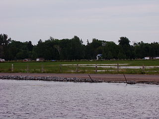
Canal Lake is a lake of Ontario, Canada, situated in the City of Kawartha Lakes. The lake is triangular, roughly 8.4 kilometres (5.2 mi) long and 2.6 kilometres (1.6 mi) at its widest point, with an area of 2,136 acres (864 ha). The depth ranges from 4.44 feet (1.35 m) to a max depth of 15 feet (4.6 m). Canal Lake is a medium size lake with a large diversity of fishing spots.

