Red Rock, Ontario

Last updated

Red Rock
Township of Red Rock
Red Rock ON 1.JPG
Canada Ontario location map 2.svg
Red pog.svg
Red Rock
Coordinates: 48°57′N088°17′W / 48.950°N 88.283°W / 48.950; -88.283
CountryCanada
Province Ontario
District Thunder Bay
Settled1920s
IncorporatedNovember 1980
Government
  MayorDarquise Robinson
  Federal riding Thunder Bay—Superior North
  Prov. riding Thunder Bay—Superior North
Area
[1]
  Land62.10 km2 (23.98 sq mi)
Population
 (2021) [1]
  Total895
  Density14.4/km2 (37/sq mi)
Time zone UTC-5 (EST)
  Summer (DST) UTC-4 (EDT)
Postal Code
P0T 2P0
Area code 807 (886 exchange)
Website www.redrocktownship.com OOjs UI icon edit-ltr-progressive.svg

Red Rock is a township in Northwestern Ontario, Canada, located in the Thunder Bay District. The community of Red Rock sits on the shore of Lake Superior, just south of where the Nipigon River drains into Nipigon Bay on the north shore of Lake Superior. The population as of 2021 is 895.

Contents

The Red Rock Folk Festival, held by the Live From the Rock Folk & Blues Society, is held each year. [2]

History

The Canadian Pacific Railway was built through the area in the 1880s. The first permanent settlers were Finnish homesteaders. Around 1920, its first school was built. That same decade, the Nipigon Highway was built, providing road access to the farming community. [3]

In 1937, construction began on a paper mill, along with a new town site for employee homes and bunkhouses. Also built that same year were the Quebec Lodge for company officials and the Red Rock Inn. But the mill company went bankrupt in 1938, and the project was abandoned. [3]

In 1940, the mill site was bought by the Canadian Government, who converted the bunkhouses into a prisoner-of-war camp, known as Camp "R". It housed German soldiers, merchant seamen, and even German Jews, the first of which arrived in July 1940. Guards and officers lived at the Red Rock Inn or in the few houses that had already been built. In October 1941, all prisoners were transferred to other internment camps and the site was closed. [4]

In 1942, a new pulp and paper company bought the site and construction of a mill began again in 1944. On July 20, 1945, the community was incorporated as the Improvement District of Red Rock. That same year, the mill became operational. The town grew with new stores, a theatre, a public school, two railroad stations, and a church. [5] In the 1950s, the mill changed ownership and expanded, further increasing the town's population. In 1961, the mill became part of the newsprint and container board division of Domtar. [6]

In 1980, the place was incorporated as a township with elected reeve and council. Its first reeve was Douglas McAllen. [6]

In the 1990s, operations and workforce at the mill were reduced, and in 2006, it shut down permanently. [7]

Demographics

In the 2021 Census of Population conducted by Statistics Canada, Red Rock had a population of 895 living in 407 of its 455 total private dwellings, a change of 0% from its 2016 population of 895. With a land area of 62.1 km2 (24.0 sq mi), it had a population density of 14.4/km2 (37.3/sq mi) in 2021. [1]

Canada census – Red Rock community profile
2021 2016 2011
Population895 (0.0% from 2016)895 (-5.0% from 2011)942 (-11.4% from 2006)
Land area62.10 km2 (23.98 sq mi)62.21 km2 (24.02 sq mi)62.93 km2 (24.30 sq mi)
Population density14.4/km2 (37/sq mi)14.4/km2 (37/sq mi)15.0/km2 (39/sq mi)
Median age47.6 (M: 47.2, F: 47.6)48.6 (M: 49.4, F: 47.0)
Private dwellings455 (total)  407 (occupied)444 (total)  381 (occupied)472 (total) 
Median household income$71,000$69,376
References: 2021 [8] 2016 [9] 2011 [10] earlier [11] [12]
Red Rock, Township - Historical populations
YearPop.±%
1951 1,145    
1956 1,652+44.3%
1961 1,861+12.7%
1966 1,980+6.4%
1971 1,892−4.4%
1976 1,694−10.5%
1981 1,448−14.5%
1986 1,509+4.2%
YearPop.±%
1991 1,421−5.8%
1996 1,258−11.5%
2001 1,233−2.0%
2006 1,063−13.8%
2011 942−11.4%
2016 895−5.0%
2021 895+0.0%
Population figures prior to 1980 based on Red Rock Improvement District. Population counts are not adjusted for boundary changes.
Source: Statistics Canada [13] [1]

Economy

Red Rock Inn, a post-and-beam landmark in Neo-Georgian style and once the social centre of the community. Over the years, it has also been home to several businesses, a library, classrooms, and housing for teachers. Red Rock ON 2.JPG
Red Rock Inn, a post-and-beam landmark in Neo-Georgian style and once the social centre of the community. Over the years, it has also been home to several businesses, a library, classrooms, and housing for teachers.

Red Rock's main source of employment was a kraft paper mill owned by Norampac. The mill originally consisted of two kraft paper machines but in late 2005 was reduced to running one machine. On August 31, 2006, Norampac announced the indefinite closure of the container board plant. This was due to unfavourable economic conditions such as the rising price of fibre, energy costs and the strengthening Canadian dollar.

In September 2007 Norampac announced the sale of its Red Rock plant to American Logistic Services Inc. A new plywood mill was supposed to be operational by fall 2008, this deadline had been pushed back to spring 2009. The plans were ultimately cancelled however as the plant was torn down and the land was sold to Riversedge Developments in April 2015. There has been talk of constructing a sea port and biomass plant on the land, but it remains unclear whether this will be the case. In 2023, Rock Tech Lithium, BMI Group and Red Rock Indian Band signed a memorandum of understanding with the hopes of building a build a lithium conversion facility and shipping port on the former Norampac site. [15] The site may also include residential and commercial uses. [16]

Notable residents

See also

Related Research Articles

<span class="mw-page-title-main">Dryden, Ontario</span> City in Ontario, Canada

Dryden is the second-largest city in the Kenora District of Northwestern Ontario, Canada, located on Wabigoon Lake. It is the least populous community in Ontario incorporated as a city. The City of Dryden had a population of 7,749 and its population centre had a population of 5,586 in 2016.

<span class="mw-page-title-main">Thunder Bay</span> City in Ontario, Canada

Thunder Bay is a city in and the seat of Thunder Bay District, Ontario, Canada. It is the most populous municipality in Northwestern Ontario and the second most populous municipality in Northern Ontario; its population is 108,843 according to the 2021 Canadian Census. Located on Lake Superior, the census metropolitan area of Thunder Bay has a population of 123,258 and consists of the city of Thunder Bay, the municipalities of Oliver Paipoonge and Neebing, the townships of Shuniah, Conmee, O'Connor, and Gillies, and the Fort William First Nation.

<span class="mw-page-title-main">Kapuskasing</span> Town in Ontario, Canada

Kapuskasing is a town on the Kapuskasing River in the Cochrane District of Northern Ontario, Canada, approximately 92 kilometres (57 mi) east of Hearst and 130 kilometres (81 mi) northwest of Timmins. The town was known as MacPherson until 1917, when the name was changed so as not to conflict with another railway stop in Manitoba.

<span class="mw-page-title-main">Greenstone, Ontario</span> Municipality in Ontario, Canada

Greenstone is an amalgamated town in the Canadian province of Ontario with a population of 4,636 according to the 2016 Canadian census. It stretches along Highway 11 from Lake Nipigon to Longlac and covers 2,767.19 km2 (1,068.42 sq mi).

<span class="mw-page-title-main">Severn, Ontario</span> Township in Ontario, Canada

Severn is a township in south-central Ontario, Canada, located between Lake Couchiching, and the Severn River in Simcoe County.

<span class="mw-page-title-main">Thunder Bay District</span> District in Ontario, Canada

Thunder Bay District is a district and census division in Northwestern Ontario in the Canadian province of Ontario. The district seat is Thunder Bay.

<span class="mw-page-title-main">Quinte West</span> City in Ontario, Canada

Quinte West is a city, geographically located in but administratively separated from Hastings County, in Southern Ontario, Canada. It is on the western end of the Bay of Quinte on Lake Ontario. The Lake Ontario terminus of the Trent–Severn Waterway is in the municipality.

<span class="mw-page-title-main">Thunder Bay—Superior North (federal electoral district)</span> Federal electoral district in Ontario, Canada

Thunder Bay—Superior North is a federal electoral district in Ontario, Canada, that has been represented in the House of Commons of Canada since 1976.

<span class="mw-page-title-main">Terrace Bay</span> Township in Ontario, Canada

Terrace Bay is a township in Thunder Bay District in northern Ontario, Canada, located on the north shore of Lake Superior east of Thunder Bay along Highway 17. The name originates from a series of lake terraces formed as the water level in Lake Superior lowered following the latest ice age.

<span class="mw-page-title-main">Nipigon</span> Township in Ontario, Canada

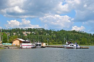
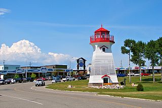
Nipigon is a township in Thunder Bay District, Northwestern Ontario, Canada, located along the west side of the Nipigon River and south of the small Helen Lake running between Lake Nipigon and Lake Superior. Lake Nipigon is located approximately 25 kilometres (16 mi) north of Nipigon. Located at latitude 49.0125° N, Nipigon is the northernmost community on the Great Lakes.

<span class="mw-page-title-main">Unorganized Thunder Bay District</span> Unorganized area in Ontario, Canada

Unorganized Thunder Bay District is an unorganized area in northwestern Ontario, Canada in Thunder Bay District. It comprises all parts of the district that are not part of an incorporated municipality or a First Nations reserve.

<span class="mw-page-title-main">Ignace</span> Township in Ontario, Canada

Ignace is a township in the Kenora District of Northwestern Ontario, Canada, located at Highway 17 and Secondary Highway 599, and on the Canadian Pacific Railway between Thunder Bay and Dryden. It is on the shore of Agimak Lake, and as of 2016, the population of Ignace was 1,202.

<span class="mw-page-title-main">Schreiber, Ontario</span> Township in Ontario, Canada

Schreiber is a municipal township in the Canadian province of Ontario, located on the northernmost point of Lake Superior along Highway 17. The town, with a population of approximately 1100 people, is almost completely located inside the geographic township of Priske, with a small western portion of the town in the southeast of Killraine Township.

<span class="mw-page-title-main">Manitouwadge</span> Township in Ontario, Canada

Manitouwadge is a township in the Canadian province of Ontario. It is located in the Thunder Bay District, at the north end of Highway 614, 331 kilometres (206 mi) east of Thunder Bay and 378 kilometres (235 mi) north-west of Sault Ste. Marie.

<span class="mw-page-title-main">Magnetawan</span> Municipality in Ontario, Canada

Magnetawan is a township in the Almaguin Highlands region of the Parry Sound District in the Canadian province of Ontario, as well as the name of the primary population centre in the township.

<span class="mw-page-title-main">The North Shore, Ontario</span> Township in Ontario, Canada

The North Shore is a township in the Canadian province of Ontario, located in the Algoma District. The township had a population of 497 in the Canada 2016 Census. It is along the north shore of the North Channel of Lake Huron, with its main communities all along Highway 17.

<span class="mw-page-title-main">Ear Falls</span> Township in Ontario, Canada

Ear Falls is a township located in Northwestern Ontario, Canada, on the banks of the English River, Lac Seul, Pakwash Lake and Wenesaga Lake. It is located along Highway 105, 100 kilometres (62 mi) north of Highway 17 and Vermilion Bay, about halfway between Highway 17 and Red Lake, or about 480 kilometres (300 mi) northwest of Thunder Bay.

<span class="mw-page-title-main">Matachewan</span> Township in Ontario, Canada

Matachewan is a township in Timiskaming, Northeastern Ontario, Canada, located at the end of Ontario Highway 66 along the Montreal River. The name is derived from the Cree word for "meeting of the currents".

<span class="mw-page-title-main">O'Connor, Ontario</span> Township in Ontario, Canada

O'Connor is a township in the Canadian province of Ontario, located 32 kilometres (20 mi) west of the city of Thunder Bay. The municipality was formed on January 1, 1907. The township serves as a bedroom community of Thunder Bay, with some agriculture, and is part of Thunder Bay's Census Metropolitan Area.

<span class="mw-page-title-main">Gull Bay First Nation</span> Indian reserve in Ontario, Canada

Gull Bay First Nation or Kiashke Zaaging Anishinaabek is an Anishinaabe (Ojibway) First Nation band government located in Thunder Bay District in northwestern Ontario, Canada. It is approximately 175 kilometres (109 mi) north of Thunder Bay, Ontario on Highway 527 on the western shore of Lake Nipigon. As of May 2010, the First Nation had a registered population of 1,149 people, including an on-Reserve population of 328.

References

  1. 1 2 3 4 "Red Rock, Ontario (Code 3558041) Census Profile". 2021 census . Government of Canada - Statistics Canada . Retrieved 2024-03-05.
  2. "Live from the Rock Folk Festival 2020, near Thunder Bay, cancelled due to COVID-19 pandemic". CBC. 21 April 2020. Retrieved 8 May 2021.
  3. 1 2 3 "The Early Days". www.redrocktownship.com. Red Rock Township. 2023. Retrieved 5 March 2024.
  4. "The Prisoner of War Camp". www.redrocktownship.com. Red Rock Township. 2023. Retrieved 5 March 2024.
  5. "Street Scenes". www.redrocktownship.com. Red Rock Township. 2023. Retrieved 5 March 2024.
  6. 1 2 "Scenes of the 1950's". www.redrocktownship.com. Red Rock Township. 2023. Retrieved 5 March 2024.
  7. "The New Century Has Arrived". www.redrocktownship.com. Red Rock Township. 2023. Retrieved 5 March 2024.
  8. "2021 Community Profiles". 2021 Canadian Census . Statistics Canada. February 4, 2022. Retrieved 2022-04-27.
  9. "2016 Community Profiles". 2016 Canadian Census . Statistics Canada. August 12, 2021. Retrieved 2019-07-11.
  10. "2011 Community Profiles". 2011 Canadian Census . Statistics Canada. March 21, 2019. Retrieved 2012-03-29.
  11. "2006 Community Profiles". 2006 Canadian Census . Statistics Canada. August 20, 2019.
  12. "2001 Community Profiles". 2001 Canadian Census . Statistics Canada. July 18, 2021.
  13. 1996, 2001, 2006, 2011 census
  14. Chappell, Kathy (20 January 2021). "Red Rock Inn has an interesting history". The Chronicle Journal. Thunder Bay.
  15. "Veldmans float heavy-cargo port partnership in Red Rock". SooToday.com. 2023-03-07. Retrieved 2024-01-19.
  16. "Nipigon-area lithium miner sees Red Rock for potential refinery". Northern Ontario Business. 2023-11-03. Retrieved 2024-01-19.