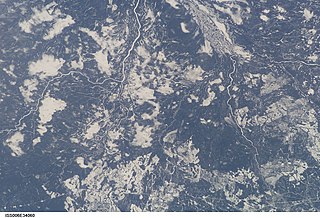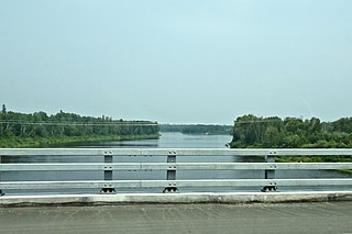
The English River is a river in Kenora District and Thunder Bay District in Northwestern Ontario, Canada. It flows through Lac Seul to join the Winnipeg River at Tetu Lake as a right tributary. The river is in the Hudson Bay drainage basin, is 615 kilometres (382 mi) long and has a drainage basin of 52,300 square kilometres (20,200 sq mi). There are several hydroelectric plants on this river.

The Kenogami River is a river in the James Bay drainage basin in Thunder Bay and Cochrane districts in Northern Ontario, Canada, which flows north from Long Lake near Longlac to empty into the Albany River. The river is 320 kilometres (199 mi) in length and its name means "long water" in the Cree language. A portion of the river's headwaters have been diverted into the Lake Superior drainage basin.

Latchford is a Single-tier municipality town in Timiskaming District in Northeastern Ontario, Canada. It is located on Bay Lake on the Montreal River near the town of Cobalt and the municipality of Temagami and is 20 kilometres from the city of Temiskaming Shores. The population of the town in the Canada 2011 Census was 387, which makes it the smallest town by population in Ontario. The town's slogan is "The Best Little Town by a Dam Site!"

Lake Nosbonsing is a lake in the municipalities of Bonfield, Chisholm, and East Ferris in Nipissing District in Northeastern Ontario, Canada. It is near the City of North Bay, is the source of the Kaibuskong River, and is in the Saint Lawrence River drainage basin.

Summit Lake is a lake in geographic Shenango Township in the Unorganized North Part of Sudbury District in Northeastern Ontario, Canada. It is in the James Bay drainage basin about 29 kilometres (18 mi) northwest of the community of Foleyet on Highway 101, and 4 kilometres (2.5 mi) northwest of the Missonga and 6.7 kilometres (4.2 mi) southeast of the Oatland railway points on the Canadian National Railway transcontinental main line, which runs along the entire west side of the lake.

The Groundhog River is a river in Cochrane District and Sudbury District in Northeastern Ontario, Canada. The river is in the James Bay drainage basin and is a left tributary of the Mattagami River.

The Beaver River is a river in the west of Thunder Bay District in Northwestern Ontario, Canada. It is part of the Hudson Bay drainage basin, and is a right tributary of the Firesteel River.

Ruel is an unincorporated community in geographic Blewett Township in the Unorganized North Part of Sudbury District in Northeastern Ontario, Canada. The community is on the Opikinimika River, part of the James Bay drainage basin, just over the height of land between the latter basin and the Great Lakes Basin.

Stupart is an unincorporated place and railway point in geographic Hennessy Township in the Unorganized North Part of Sudbury District in Northeastern Ontario, Canada. The community is just off Deschênes Lake in the Opikinimika River system, part of the James Bay drainage basin.

The Matawin River is a river in Thunder Bay District in Northwestern Ontario, Canada. It is in the Great Lakes Basin and is a right tributary of the Kaministiquia River.

The Shebandowan River is a river in Thunder Bay District in Northwestern Ontario, Canada. It is in the Great Lakes Basin and is a left tributary of the Matawin River. Three-quarters of the length of the river valley is paralleled by Ontario Highway 11, at this point part of the Trans-Canada Highway; and the entire length of the river valley is paralleled by a Canadian National Railway main line, built originally as the Canadian Northern Railway transcontinental main line.

The Oskondaga River is a river in Thunder Bay District in Northwestern Ontario, Canada. It is in the Great Lakes Basin and is a left tributary of the Shebandowan River. The river valley is paralleled by Ontario Highway 17, at this point part of the Trans-Canada Highway; and by both the Canadian Pacific Railway transcontinental main line, still in operation, and the Canadian National Railway Graham Subdivision main line, originally built as part of the National Transcontinental Railway, now abandoned.

Shebandowan Lakes is the name for the combined entity of three lakes — Upper Shebandowan Lake at the west, Middle Shebandowan Lake at the centre, and Lower Shebandowan Lake at the east — in the Unorganized Part of Thunder Bay District in Northwestern Ontario, Canada. The lakes are in the Great Lakes Basin, and Lower Shebandowan Lake is the source of the Shebandowan River.

The Swamp River is a river in Thunder Bay District in Northwestern Ontario, Canada. It is in the Great Lakes Basin and is a tributary of Shebandowan Lakes.

The Kashabowie River is a river in southwestern Thunder Bay District in Northwestern Ontario, Canada. It is in the Great Lakes Basin and is a tributary of the Shebandowan Lakes.

The Nemegosenda River is a river in Algoma District and Sudbury District in northeastern Ontario, Canada. It is in the James Bay drainage basin, and is a right tributary of the Kapuskasing River.

Shawmere is an unincorporated place and dispersed rural community in geographic Oates Township, in the Unorganized North part of Sudbury District in northeastern Ontario, Canada. It is on the Canadian National Railway transcontinental railway main line between the railway point of Missonga to the west and the compact rural community of Foleyet to the east, has a passing track, and is passed but not served by Via Rail transcontinental Canadian trains. Shawmere is on the Shawmere River, part of the James Bay drainage basin.

The Shawmere River is a river in Sudbury District in northeastern Ontario, Canada. It is in the James Bay drainage basin, and is a left tributary of the Ivanhoe River.

The Valentine River is a river in the Unorganized North Part of Cochrane District in northeastern Ontario, Canada. It is in the Moose River drainage basin, and is a tributary of Lac Pivabiska, the source of the Pivabiska River.

Postans is an unincorporated place and railway point in southwestern Thunder Bay District in Northwestern Ontario, Canada. It is on the Canadian National Railway Kashabowie Subdivision main line, built originally as the Canadian Northern Railway transcontinental main line, and just off Ontario Highway 11, at this point part of the Trans-Canada Highway, in both cases between the community of Kashabowie to the west and the railway point of Kabaigon to the east. Postans is also at the outlet from Postans Lake where an unnamed creek heads west to Postans Bay on Kashabowie Lake, part of the Kashabowie River.


