Related Research Articles

The Cree are a North American Indigenous people. They live primarily in Canada, where they form one of the country's largest First Nations.

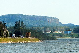
Thunder Bay District is a district and census division in Northwestern Ontario in the Canadian province of Ontario. The district seat is Thunder Bay.

Kettle & Stony Point First Nation comprises the Kettle Point reserve and Stony Point Reserve, both located approximately 35 kilometres (22 mi) northeast of Sarnia, Ontario, Canada, on the southern shore of Lake Huron. The reserves serve as the land base for the Chippewas (Anishnaabeg) of Kettle and Stony Point First Nation.
First Nations in Ontario constitute many nations. Common First Nations ethnicities in the province include the Anishinaabe, Haudenosaunee, and the Cree. In southern portions of this province, there are reserves of the Mohawk, Cayuga, Onondaga, Oneida, Seneca and Tuscarora.
The Red Rock Indian Band is an Ojibwe First Nation band government in Northwestern Ontario, Canada. Their territory is located on the Red Rock 53 and Lake Helen 53A Indian reserves in Ontario. As of March 2017, they had a total registered population of 1,837 people. The Nation is led by Chief Marcus Hardy. The council is an independent member of Anishinabek Nation, a First Nations political organization. The First Nation is also a member of Waaskiinaysay Ziibi Inc., an economic development corporation made up of five Lake Nipigon First Nations.
The White River is a tributary of Lake Superior in Thunder Bay District, Ontario, Canada. It starts at Negwazu Lake and flows in a predominantly western direction to Lake Superior, passing through the Township of White River.
Chippewas of Rama First Nation, also known as Chippewas of Mnjikaning and Chippewas of Rama Mnjikaning First Nation, is an Anishinaabe (Ojibway) First Nation located in the province of Ontario in Canada. The name Mnjikaning, or fully vocalized as Minjikaning, refers to the fishing weirs at Atherley Narrows between Lake Simcoe and Lake Couchiching and it means "in/on/at or near the fence".
Constance Lake First Nation is an Oji-Cree First Nations band government located on the shores of Constance Lake near Hearst, Cochrane District in northeastern Ontario, Canada. It is directly north of the community of Calstock along a continuation of Ontario Highway 663. Constance Lake First Nation is home to close to 1605 members of Cree and Ojibway with approximately 820 living on reserve. The reserves, Constance Lake 92 and English River 66, total 7,686 acres (3,110 ha) in size.

Long Lake 58 First Nation is an Anishinaabe (Ojibway) First Nation band government located in Northern Ontario, located approximately 40 km east of Geraldton, Ontario, Canada, on the northern shore of Long Lake, immediately north of Ginoogaming First Nation and west of the community of Longlac, Ontario. As of January, 2008, their total registered population was 1,248 people, of which their on-Reserve population was 427.

Alderville First Nation is a band of Mississaugas, a sub-nation of the Ojibways. The Alderville and Sugar Island 37A reserves belong to that First Nation band government.

The Biinjitiwaabik Zaaging Anishinaabek is an Ojibway First Nation band government in Northwestern Ontario, Canada. Their territory is located on the Rocky Bay 1 reserve in Greenstone, Ontario, bordering on the community of Macdiarmid. In October 2008, they had a total registered population of 678 people, of which 327 people lived on their own Indian reserve. The Nation is led by Chief Gladys Thompson. The council is a member of Nokiiwin Tribal Council, a Regional Chiefs' Council, and is member of Union of Ontario Indians, a Tribal Political Organization. The First Nation is also a member of Waaskiinaysay Ziibi Inc., an economic development corporation made up of five Lake Nipigon First Nations.
The Michipicoten First Nation is an Ojibway First Nation band government in Northern Ontario, located near Wawa. Members of the community have lived at the mouth of the Michipicoten River since before the first arrival of European settlers to the area. Their reserves include Chapleau 61, Gros Cap 49, Gros Cap Indian Village 49A and Missanabie 62.
Nipissing First Nation is a long-standing community of Nishnaabeg peoples located along the shorelines of Lake Nipissing in northern Ontario. They are referred to by many names in European historical records, since the colonists often adopted names given to them by other nations.
Nokiiwin Tribal Council is a non-profit Regional Chiefs' Council located in the Thunder Bay District, Ontario, Canada, serving five First Nations by providing advisory services and training which will enhance the overall management skills and opportunities of the area's First Nations.

Biigtigong Nishnaabeg is an Ojibway (Anishinaabe) First Nation on the northern shore of Lake Superior. It is sometimes referred to as Ojibways of the Pic River First Nation. Pic River is not a signatory to the Robinson Superior treaty; however, they did petition, starting in 1879, for a reserve and the request was subsequently granted. The community is located on the northern shore of Lake Superior at the mouth of the Pic River 316.6-hectare (782-acre) and is called Pic River 50. In November 2007, their total registered population was 964 people, of which their on-reserve population was 480.
Anishinabek Educational Institute (AEI) is an Aboriginal-owned and controlled post-secondary institution in Canada. Aboriginal institutes partner with colleges and universities to offer students degree programs, apprenticeships, certificate programs and diploma programs. AEI was founded to provide greater access to post-secondary education for Aboriginal peoples. AEI delivers post-secondary programs approved by the Ministry of Training, Colleges and Universities. The educational curriculum was adapted to meet the needs of Aboriginal learners to ensure it reflects community needs, cultural heritage and identity.
Pic Mobert North is a First Nations reserve in Thunder Bay District, Ontario. It is one of two reserves of the Netmizaaggamig Nishnaabeg, alongside Pic Mobert South.
Pic Mobert South is a First Nations reserve in Thunder Bay District, Ontario. It is one of two reserves of the Netmizaaggamig Nishnaabeg, alongside Pic Mobert North.
Autumn Peltier is an Anishinaabe Indigenous rights advocate from the Wiikwemkoong First Nation on Manitoulin Island, Ontario, Canada. She was named Chief Water Commissioner for the Anishinabek Nation in 2019. In 2018, at the age of thirteen, Peltier addressed world leaders at the United Nations General Assembly on the issue of water protection.

Sakimay 74 is an Indian reserve of the Zagime Anishinabek in Saskatchewan. It is 16 kilometres northwest of Broadview. In the 2016 Canadian Census, it recorded a population of 147 living in 46 of its 170 total private dwellings. In the same year, its Community Well-Being index was calculated at 52 of 100, compared to 58.4 for the average First Nations community and 77.5 for the average non-Indigenous community.
References
- 1 2 3 4 5 "First Nation Detail". Crown–Indigenous Relations and Northern Affairs Canada . Government of Canada. 14 November 2008. Retrieved November 26, 2021.
- 1 2 3 "About Us". Netmizaaggamig Nishnaabeg. Retrieved November 26, 2021.
- ↑ "Netmizaaggamig Nishnaabeg (Pic Mobert First Nation), Canada and Ontario announce the completion of an Addition to Reserve process". Government of Ontario. Queen's Printer for Ontario. Apr 15, 2021. Retrieved November 26, 2021.
- 1 2 Twance, Yolanda (January 22, 2014). Who we are is where we come from : a historical curriculum resource for the Pic Mobert First Nation (M.Ed.). Lakehead University. Retrieved November 26, 2021.
- ↑ "History". Netmizaaggamig Nishnaabeg. August 1, 2019. Retrieved November 26, 2021.
