Unorganized Thunder Bay District

Last updated
Unorganized Thunder Bay
Thunder Bay, Unorganized
Lake Superior 2.jpg
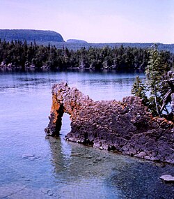
Sleeping Giant Provincial Park
Unorg Thunder Bay.png
Coordinates: 50°00′N88°00′W / 50.000°N 88.000°W / 50.000; -88.000
Country Canada
Province Ontario
District Thunder Bay
Government
  Federal ridings
Kenora—Kiiwetinoong
Thunder Bay—Rainy River
Thunder Bay—Superior North
  Prov. ridings Algoma—Manitoulin
Kiiwetinoong
Thunder Bay—Atikokan
Thunder Bay—Superior North
Area
[1]
  Land97,009.80 km2 (37,455.69 sq mi)
Population
 (2016) [1]
  Total
5,872
  Density0.1/km2 (0.26/sq mi)
Time zones
East of 90° west UTC-05:00 (Eastern)
  Summer (DST) UTC-04:00 (EDT)
West of 90° west UTC-06:00 (Central)
  Summer (DST) UTC-05:00 (CDT)
Postal Code FSA
P0T
Area code 807

Unorganized Thunder Bay District is an unorganized area in northwestern Ontario, Canada in Thunder Bay District. It comprises all parts of the district that are not part of an incorporated municipality or a First Nations reserve.

Contents

Most of the territory is within the Eastern Time Zone, but the part west of the 90th meridian is in the Central Time Zone.

Geography

Communities with Local services board

Other communities

History

Gold was noted in the area since 1869, but it wasn't until Peter Moses from Heron Bay, Ontario discovered additional gold that prospectors flocked to the area. In 1947, Dr. J. Williams and Moses staked 11 claims, which became the Lake Superior Mining Corporation. However, not much development took place until 1979, when Don and David McKinnon, along with John Larche, staked claims in Hemlo and the Manitouwadge area. The Williams Mine started operation in 1985, and produced 445,320 ounces of gold from a 2.45 meter wide ore body. The Golden Giant Mine produced 446,858 ounces in 1994 from a quartz sericite schist host rock. The David Bell Mines produced 204,251 ounces in 1994. The Hemlo gold mines had produced more than 6,000,000 ounces of gold by 1992. [2]

Demographics

Canada census – Thunder Bay, Unorganized community profile
2016 2011
Population5872 (-0.6% from 2011)5909 (-10.3% from 2006)
Land area97,009.80 km2 (37,455.69 sq mi)97,007.34 km2 (37,454.74 sq mi)
Population density0.1/km2 (0.26/sq mi)0.1/km2 (0.26/sq mi)
Median age51.4 (M: 52.0, F: 50.9)
Private dwellings6130 (total) 5782 (total) 
Median household income$70,886
References: 2016 [3] 2011 [4]

Population trend: [5]

Parks in Unorganized Thunder Bay

Provincial parks in Unorganized Thunder Bay include:

It is also home to one National Park of Canada: Pukaskwa National Park.

Transportation

Via Rail's The Canadian serves the Unorganized Thunder District at the communities of Flindt Landing, [6] Mud River, [7] Ferland, [8] and Auden. [9]

See also

References

  1. 1 2 "Unorganized Thunder Bay District (Code 3558090) Census Profile". 2016 census . Government of Canada - Statistics Canada.
  2. Barnes, Michael (1995). Gold in Ontario. Erin: The Boston Mills Press. pp. 91–94. ISBN   155046146X.
  3. "2016 Community Profiles". 2016 Canadian census . Statistics Canada. August 12, 2021. Retrieved 2021-05-12.
  4. "2011 Community Profiles". 2011 Canadian census . Statistics Canada. March 21, 2019. Retrieved 2012-02-10.
  5. Statistics Canada: 1996, 2001, 2006 census
  6. "Flindt Landing train station | VIA Rail". www.viarail.ca. Via Rail . Retrieved 4 November 2024.
  7. "Mud River train station | VIA Rail". www.viarail.ca. Retrieved 29 March 2024.
  8. "Ferland train station | VIA Rail". www.viarail.ca.
  9. "Auden train station | VIA Rail". www.viarail.ca. Retrieved 29 March 2024.

Commons-logo.svg Media related to Unorganized Thunder Bay at Wikimedia Commons