Batchewana First Nation of Ojibways

Last updated

The Batchewana First Nation of Ojibways (Ojibwe : Obaajiwan Anishinaabek) [1] is an Ojibway First Nation in northern Ontario. Their traditional lands run along the eastern shore of Lake Superior, from Batchawana Bay to Whitefish Island. They were reserved this land in the 1850 Robinson Huron Treaty, but surrendered most of it under the 1859 Pennefather Treaty. Through purchase and land claims, it has reclaimed some territories, including Goulais Bay 15A, Obadjiwan 15E, Rankin Location 15D and Whitefish Island.

Contents

History

Ojibway fishermen in the St. Marys Rapids, 1901 Fishing at Saint Mary's River, Sault Sainte Marie, Michigan, 1901.jpg
Ojibway fishermen in the St. Marys Rapids, 1901

The abundant lake whitefish found in eastern Lake Superior and especially the St. Marys Rapids have attracted anglers and trade since time immemorial. Archaeological evidence shows occupation of Whitefish Island since about 200 BCE. The first European record is from French explorers in 1621, who documented natives living on Whitefish Island. The Jesuits took note of extensive fishing in the rapids around 1670.

Mica Bay Incident, 1849

In November 1849, Chief Nebenaigoching and members of Batchewana First Nation worked with other local Indigenous communities to assert their rights to traditional territories at Mica Bay. The Mica Bay Incident represents an assertion of Indigenous land, and authority over land resources. [2]

Robinson Huron Treaty, 1850

The Robinson Huron Treaty of 1850 was signed at Sault Ste. Marie by representatives of the Ojibways along the eastern and northern shores of Lake Huron. The bands ceded their territories to the Crown, except for "reserves" set aside, along with other concessions. Reserve No. 15, given to Nebenaigoching and his Band included:

"a tract of land extending from Wanabekineyunnung west of Gros Cap to the boundary of the lands ceded by the Chiefs of Lake Superior, and inland ten miles throughout the whole distance, including Batchewanaung Bay; and also the small island at Sault Ste. Marie used by them as a fishing station." [3]

Pennefather Treaty, 1859

The Pennefather Treaty was signed on 9 June 1859 at Gros Cap between the "Chiefs and Warriors of Batchewananny Bay and Goulais Bay Band of Indians", and the Crown. The chiefs and warriors agreed to never relinquish to the Crown the reserved lands set aside in the Robinson Treaty (Reserve No. 15), save for Whitefish Island. The Crown, in return, would sell the land, and all interest accrued from the sale of the land would be distributed to band members annually. Each family could receive 40 acres of land on the Garden River reserve, and may purchase 80 acres of the land being sold at the selling price (with government-established conditions). The bands were also given $1,200 divided amongst themselves, and all "improvements" to the lands being sold could be compensated after survey. [4] Despite promises, band members never received any of the promised land from the Crown.

Expropriation, 1902

After the construction of the Sault Ste. Marie International Railroad Bridge began in 1887, a legal battle between railroads (Algoma Central Railway, Pacific and Atlantic Railroad Company and Hudson Bay Railway Company) resulted in Whitefish Island being expropriated under the Railway Act. Residents were forced to move to Goulais Bay in 1905, and the traditional burial ground was relocated to Sault Ste. Marie in 1906. Although the land was expropriated for railroad construction, no railway was ever constructed on the island. The federal Department of Public Works took possession of the island in 1913. [5] The band was granted a 5-acre reserve at Gros Cap called Goulais Bay 15C. The land was sold in 1956 for $3,600.

Regaining lost lands

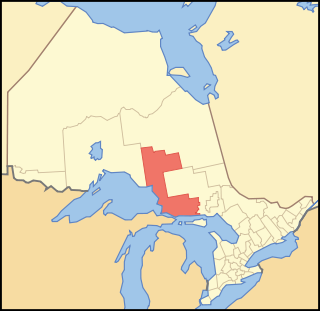
In 1939, the band purchased 3,763.9 acres of land within Sault Ste. Marie, including a non-contiguous strip of waterfront property. In 1949, 8.25 acres were purchased north of Silver Creek, and 15.3 acres of land were sold. On 8 July 1952, this land was formally recognized as a reserve, Rankin Location 15D.

On 23 January 1964, the Department of Transportation and Communication gave two small parcels of land (115.8 acres) at Corbeil Point on Batchawana Bay to the Department of Indian Affairs, which was made into the Obadjiwan 15E reserve on 6 December 1966. The land had originally been set apart for the Department of Marine and Fisheries to build the Corbeil Point Lighthouse by order in council on 29 May 1874.

Band members voted against selling 30.85 acres to the City of Sault Ste. Marie for the construction of a by-pass through Rankin in 1966. Negotiations ensued, and on 12 June 1969 the land was sold to the city for $45,000.

On 8 January 1979, the band council paid the Crown $365.20 to purchase 6.47 km2 of land in and around Goulais Mission. This became the Goulais Bay 15A reserve. [6]

In 1982, the band filed a land claim to reclaim Whitefish Island, which was then part of Parks Canada's national inventory as a National Historic Site. After unsuccessful negotiations, hereditary Chief Edward James Sayers Nebenaigoching occupied the island from 1989 until the land claim was settled in 1992. The band was paid $3.5 million in damages, and the island was returned to reserve status in 1997.

Gargantua Harbour trial

When Lake Superior Provincial Park was established in 1944, it took over the traditional Ojibwe village at Gargantua Harbour (Nanabozhung in Anishinaabemowin). In August 2007, Chief Dean Sayers and about 200 band members re-established a 2-km road from Ontario Highway 17 to Gargantua Harbour along a park trail. After negotiation failed, the Ontario Ministry of Natural Resources charged Chief Sayers and the band in 2008 for destruction of park property. [7]

On 24 March 2015, Justice Thomas Logan cleared Chief Sayers and the band of all but one charge, ruling that the band had treaty rights to access the natural resources on their traditional lands. They were found guilty of one charge, Obstruct justice, as a result of threats made to bring guns to the disputed road. The charge against Chief Sayers was stayed, but the band as a whole was fined $10,000. Appeals are pending, including the fact that the entire band was treated as a "person" under the Provincial Parks and Conservation Reserves Act and the Lakes and Rivers Improvement Act. [8] [9]

Historic fishery litigation

On 29 January 2013, Chief Dean Sayers and band councillors filed a claim for compensation under the Specific Claims Process for the "catastrophic" loss of the historic whitefish fishery, due to canal and hydroelectric dam construction and industrial pollution at the St. Marys Rapids, the former hub of the fishery. They are seeking to claim $150 million, stating that "the Crown had a fiduciary duty to protect this asset and failed to do so." [10] This claim is still outstanding.

Reserves

Rankin Location 15D

The Rankin Location 15D reserve is the main reserve for the band. It is a 15.66 km2 tract of land located between Sault Ste. Marie and Garden River 14. It takes its name from the Rankin Mining Company, from which the land was purchased in 1939. It wasn't recognized as a reserve by the government until 1952. As of 2006, 566 people lived on this reserve.

Goulais Bay 15A

The Goulais Bay 15A reserve is located on the western shore of Goulais Bay. It is a 6.47 km2 tract of land encompassing most of the community of Goulais Mission. As of 2006, 82 people lived on this reserve.

Obadjiwan 15E

The Obadjiwan 15E reserve consists of two non-contiguous parcels of land at Corbeil Point on Batchawana Bay, totaling 0.68 km2. The Corbeil Point Lighthouse is located on the reserve.

Whitefish Island

Whitefish Island is an island in the St. Marys River south of Sault Ste. Marie, Ontario. This 0.17 km2 island had been a centre for fishing and trade since time immemorial due to the annual abundance of lake whitefish, but it was expropriated from the band in 1902 to build a railroad. The railroad was never built. The island became a National Historic Site due to its history and archaeological artefacts in 1981. A land claim was filed the next year, and the island was returned to reserve status in 1997.

Goulais Bay 15C

A 5-acre reserve at Gros Cap called Goulais Bay 15C was granted to the band after Whitefish Island was expropriated by the Crown. The band sold the land in 1956, and it ceased to be a reserve.

Governance

Until the early 1900s, there was a hereditary chief, descended from Nebenaigoching. Since then, Chief and Council have been elected by band members for 2-year terms.

Notable people

Related Research Articles

<span class="mw-page-title-main">Ojibwe</span> Group of indigenous peoples in North America

The Ojibwe, Ojibwa, Chippewa, or Saulteaux are an Anishinaabe people in what is currently southern Canada, the northern Midwestern United States, and Northern Plains.

<span class="mw-page-title-main">Saulteaux</span> Ethnic group

The Saulteaux, otherwise known as the Plains Ojibwe, are a First Nations band government in Ontario, Manitoba, Saskatchewan, Alberta and British Columbia, Canada. They are a branch of the Ojibwe who pushed west. They formed a mixed culture of woodlands and plains Indigenous customs and traditions.

<span class="mw-page-title-main">Algoma District</span> District in Ontario, Canada

Algoma District is a district and census division in Northeastern Ontario in the Canadian province of Ontario.

<span class="mw-page-title-main">Batchawana River</span> River in Ontario, Canada

The Batchawana River is a river in Algoma and Sudbury Districts of Ontario, Canada, which empties into Batchawana Bay on Lake Superior north of Sault Ste. Marie, Ontario.

<span class="mw-page-title-main">Lake Superior Provincial Park</span> Provincial park in Ontario, Canada

Lake Superior Provincial Park is one of the largest provincial parks in Ontario, covering about 1,550 square kilometres (600 sq mi) along the northeastern shores of Lake Superior between Sault Ste. Marie and Wawa in Algoma District in Northeastern Ontario, Canada. Ontario Highway 17 now runs through the park. When the park was established by Ontario in 1944, there was no road access.

<span class="mw-page-title-main">Goulais River</span>

The Goulais River is a river in northern Ontario, Canada, which rises in the Algoma highlands and empties into Goulais Bay on eastern Lake Superior near Sault Ste. Marie, Ontario. It is one of the largest tributaries on the eastern lake, draining an area of approximately 2,000 square kilometres (770 sq mi).

<span class="mw-page-title-main">Algoma Central Railway</span> Canadian train company

The Algoma Central Railway is a railway in Northern Ontario that operates between Sault Ste. Marie and Hearst. It used to have a branch line to Wawa, Ontario. The area served by the railway is sparsely populated, with few roads.

<span class="mw-page-title-main">Unorganized North Algoma District</span> Unorganized area in Ontario, Canada

Unorganized North Algoma District is an unorganized area in northeastern Ontario, Canada, comprising all areas in Algoma District, north of the Sault Ste. Marie to Elliot Lake corridor, which are not part of an incorporated municipality or a First Nation. It covers 44,077.03 km2 (17,018.24 sq mi) of land, and had a population of 6050 in 2021. Many of these communities were/are stations on the Algoma Central Railway or were logging/mining towns.

<span class="mw-page-title-main">Sault Ste. Marie (provincial electoral district)</span> Provincial electoral district in Ontario, Canada

Sault Ste. Marie is a provincial electoral district in the Legislative Assembly of Ontario, representing the City of Sault Ste. Marie.

<span class="mw-page-title-main">Garden River First Nation</span> Indian reserve in Ontario, Canada

Garden River First Nation, also known as Ketegaunseebee, is an Ojibwa band located at Garden River 14 near Sault Ste. Marie, Ontario, Canada.

The Robinson Treaties are two treaties signed between the Ojibwa chiefs and The Crown in 1850 in the Province of Canada. The first treaty involved Ojibwa chiefs along the north shore of Lake Superior, and is known as the Robinson Superior Treaty. The second treaty, signed two days later, included Ojibwa chiefs from along the eastern and northern shores of Lake Huron, and is known as the Robinson Huron Treaty. The Wiikwemkoong First Nation did not sign either treaty, and their land is considered "unceded".

<span class="mw-page-title-main">Rankin Location 15D</span> Indian reserve in Ontario, Canada

Rankin Location 15D is one of four reserves of the Batchewana First Nation of Ojibways in Algoma District in northeastern Ontario, Canada. It is bounded on the north, west and south by the city of Sault Ste. Marie, and on the east by Garden River First Nations reserve of another Ojibwe people. As of 2005, a total of 2,205 people were registered to the Nation; about half live on the reserves and many others live in Sault Ste. Marie.

<span class="mw-page-title-main">Whitefish Island</span> Indian reserve in Ontario, Canada

Whitefish Island is an island in the St. Marys River, just south of Sault Ste. Marie, in Ontario, Canada.

Brunswick House First Nation is an Ojibway-Cree First Nations in the Canadian province of Ontario, located in the Sudbury District, 157 km (97.6 mi) northeast of Sault Ste Marie, Ontario. The First Nation have reserved for themselves the 9,054.2 hectares Mountbatten 76A Indian Reserve and the 259.8 hectares Duck Lake 76B Indian Reserve. As of June, 2008, it had a registered population of 639 people, of which their on-Reserve population was 171 people.

<span class="mw-page-title-main">Sault Ste. Marie, Ontario</span> City in Ontario, Canada

Sault Ste. Marie is a city at the St. Marys River in Ontario, Canada, on the Canada–US border. It is the seat of the Algoma District and the third largest city in Northern Ontario, after Sudbury and Thunder Bay.

<span class="mw-page-title-main">Sandy Islands Provincial Park</span>

Sandy Islands Provincial Park is a non-operating park in the Nature Reserve Class consisting of 2,553 hectares. It is located in the large Whitefish Bay, near the mouth of the smaller Batchawana Bay in Lake Superior near Sault Ste. Marie, Ontario. The islands have an elevation of 183 meters above sea level. There are two islands, North Sandy Island and South Sandy Island. When the weather is clear the islands are visible from Pancake Bay Provincial Park close to the horizon looking south. The park was created as a measure to protect the fragile ecology of these sand islands.

The Association of Iroquois and Allied Indians (AIAI) is a provincial territorial organization (PTO) mandated to defend and enhance the Indigenous and Treaty rights of its 7-member First Nations in Ontario, Canada.

Goulais Bay 15A is a First Nations reserve in Algoma District, Ontario, Canada. It lies on Goulais Bay, encompassing most of the unincorporated community of Goulais Mission, and is one of the reserves of the Batchewana First Nation of Ojibways.

Obadjiwan 15E is a First Nations reserve in Algoma District, Ontario. It consists of two non-contiguous parcels of land on Batchewana Bay, and is one of the reserves of the Batchewana First Nation of Ojibways.

Goulais Bay 15C was a First Nation reserve within Prince Township, Ontario. This 5-acre tract of land was given to the Batchewana First Nation of Ojibways after Whitefish Island was expropriated from them in 1902. The land was sold by the band in 1956 for $3,600, and it ceased to be a reserve.

References

  1. Ojibwe.net, Nations Map https://ojibwe.net/nations-map/
  2. Branch, Government of Canada; Indigenous and Northern Affairs Canada; Communications. "The Robinson Treaties (1850)". www.aadnc-aandc.gc.ca. Archived from the original on 2018-04-25. Retrieved 2018-04-26.
  3. "Robinson Huron Treaty". 9 September 1850. Retrieved 9 January 2016.
  4. Nadjiwon, Carol (February 2011). "Treaties - 1859 Pennefather Treaty". Batchewana First Nation of Ojibways. Retrieved 9 January 2016.
  5. McKracken, Krista (20 April 2015). "Public Spaces and Indigenous Land: Whitefish Island". ActiveHistory.ca. Retrieved 9 January 2016.
  6. Syrette, Colleen; Darlene Syrette & Joseph Corbiere (1977). "Batchewana Band History, 1850 - 1977" (PDF). Algoma University archives. Retrieved 10 January 2016.
  7. Crosier, Steph (26 June 2014). "Gargantua Harbour matter before courts". Sault Star . Sault Ste. Marie, Ontario. Archived from the original on 4 March 2016. Retrieved 15 February 2016.
  8. Petz, Sarah (29 March 2015). "Reasons to celebrate ruling, says chief". Sault Star . Sault Ste. Marie, Ontario. Archived from the original on 18 May 2015. Retrieved 15 February 2016.
  9. "R. v Dean Sayers and Batchewana First Nation of Ojibways". Ontario Court of Justice. 24 March 2015. Retrieved 15 February 2016.
  10. Mills, Tom (1 February 2013). "Method behind Sayers' anger – Mills". Sault Star . Sault Ste. Marie, Ontario. Retrieved 10 January 2016.
  11. Batchewana First Nation of Ojibways (5 February 2015). "Chief and council" . Retrieved 10 January 2016.