Armour | |
|---|---|
| Township of Armour | |
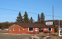 Municipal office, 2011 | |
| Etymology: John Douglas Armour. [1] | |
 Armour Location in Southern Ontario | |
| Coordinates: 45°37′44″N79°20′38″W / 45.62889°N 79.34389°W [2] | |
| Country | Canada |
| Province | Ontario |
| District | Parry Sound |
| Incorporated | 1881 |
| Government | |
| • Type | Township |
| • Mayor | Rod Ward |
| • MP | Scott Aitchison (CPC) |
| • MPP | Graydon Smith (OPC) |
| Area | |
| • Land | 163.52 km2 (63.14 sq mi) |
| Population (2021) [3] | |
• Total | 1,459 |
| • Density | 8.9/km2 (23/sq mi) |
| Time zone | UTC-5 (EST) |
| • Summer (DST) | UTC-4 (EDT) |
| Postal code span | P0A |
| Area codes | 705, 249 |
| Website | www |
Armour is a township in the Canadian province of Ontario. [2] [4] [5]
Contents
Located in the Almaguin Highlands region of Parry Sound District, the township surrounds but does not include the village of Burk's Falls. It was named in honour of Judge John Douglas Armour. [1]
